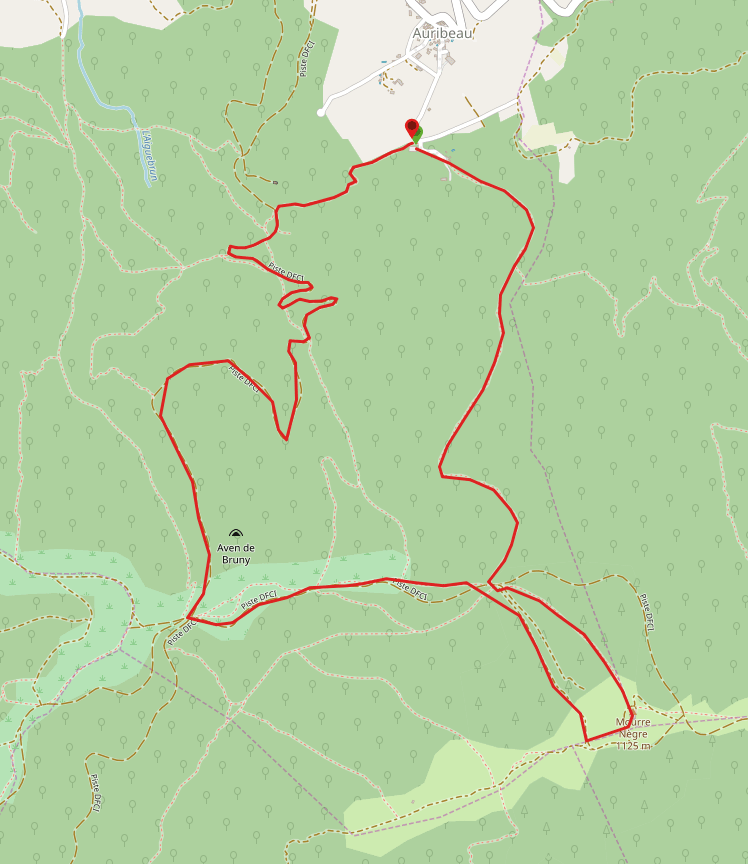
The Luberon Massif is an undulating ridge in the Vaucluse Dept of France that stretches for about thirty miles East to West, the Petit Luberon to the West and the Grand Luberon to the East, the two divided by a narrow canyon, the ‘Combe de Lourmarin‘. The highest point of the Luberon is the Mourre Nègre, height 1125 m (3690 ft). And this was my goal.
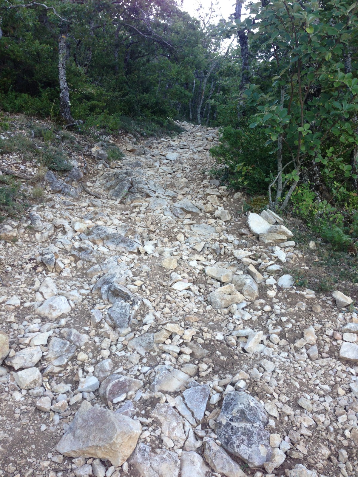
I started my 5 mile walk from the car park just to the South of the village of ‘Auribeau‘ and took the direct approach, straight up. I think this is one of the steepest paths I have ever walked (map below). It climbs more than 1,700 feet in about 1.5 miles as the crow flies. It was a real scramble. Subsequently I have found a great blog which describes the walk I would have liked to do and hope to in the future. I recommend it. It being August, I started at dawn in order to get the benefit of a cool morning while making my way up which was just as well. The path seemed more like a steep river bed than path proper but I have found this in France, some paths being almost impossible without scrambling to the point that I have had to turn back. But I laboured on until I disturbed a family of wild boar snuffling among the small oaks. I had no Idea what to do so I froze and waited until they moved off. Delightful to see but very large.
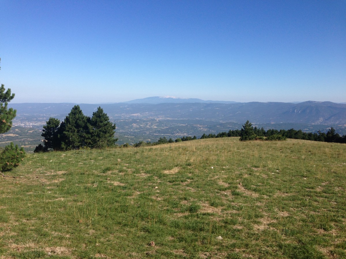
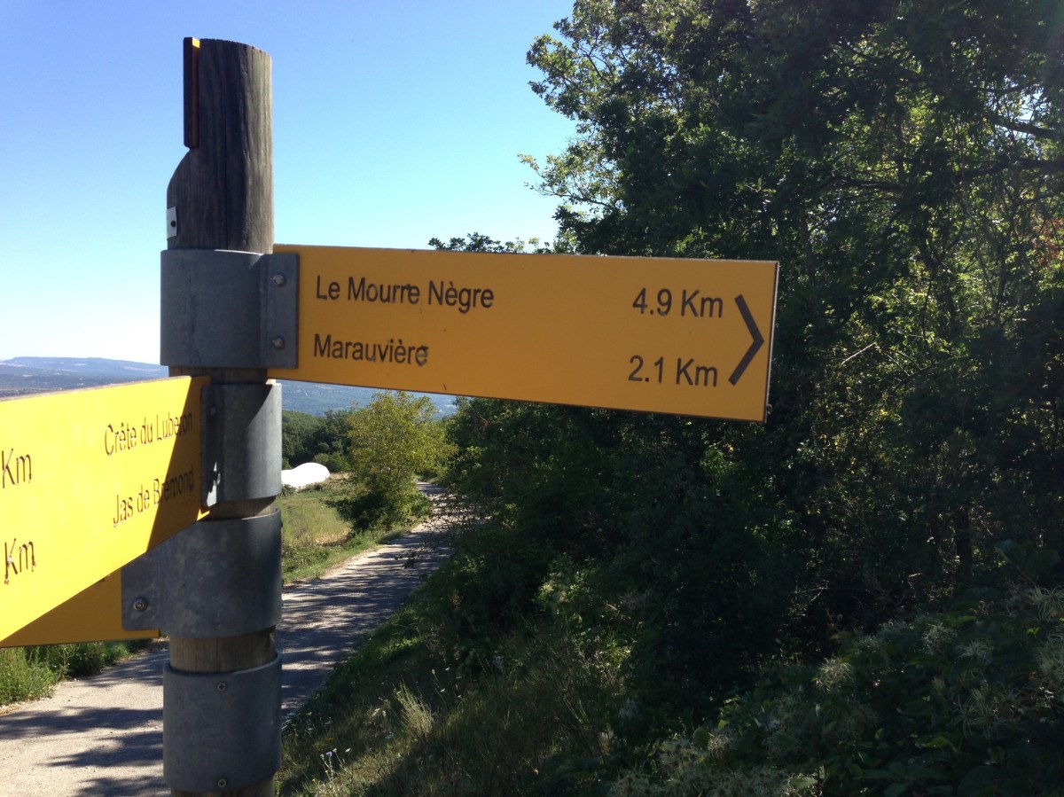
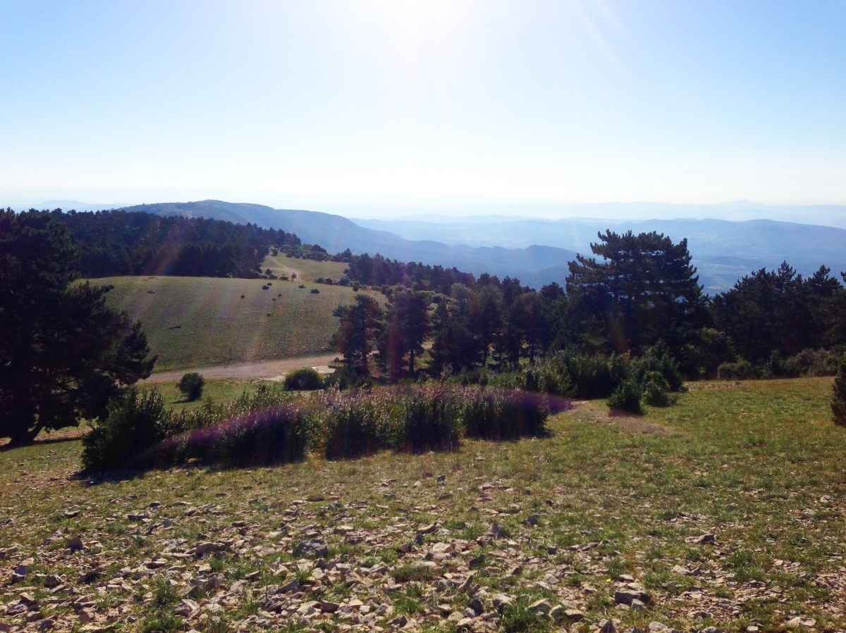
Having made it nearly to the ridge top I crossed an unmade access road into a fabulous, seemingly never ending alpine meadow interspersed with pine trees and fragrant flowers that stretched for miles into the morning sun to the East, the softer ground churned by the wild boar, the cool breeze providing relief after the hot path up. More Julie Andrews than Johnny Hallyday. The mountain is dominated by a massive radio tower but otherwise it is just a visual joy. The views are some of the best. The ridge is narrow so the country just opens up beneath your feet. And the clarity was amazing. I could make out Mont Ventoux to the North, about 25 miles away.
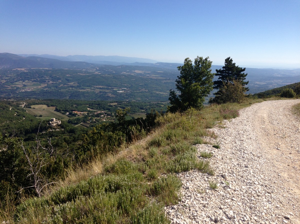
It was a special place to spend an hour or so soaking up the increasingly warmer sunshine. The ridge path disappeared to the undulating East and I so wanted to walk it all the way but could only walk a mile or so before having to turn back to take the longer track to Auribeau then back to do family holiday stuff. The long access road back down is easy if long. I just couldn’t face the descent on the same path I had taken up the mountain. My knees just aren’t that tough.
A fabulous walk but I wish I had researched the better approach. Take lots of water and poles, it’s a beast in the Summer. I wore decent trail shoes which were ideal for the terrain.