‘Penygadair/Cadair Idris’ – walk, Eryri/Snowdonia

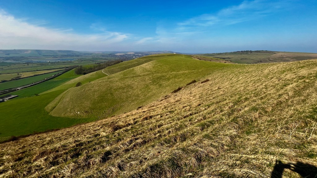
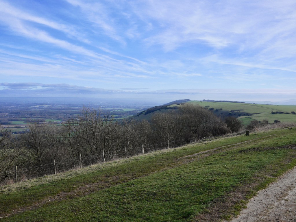
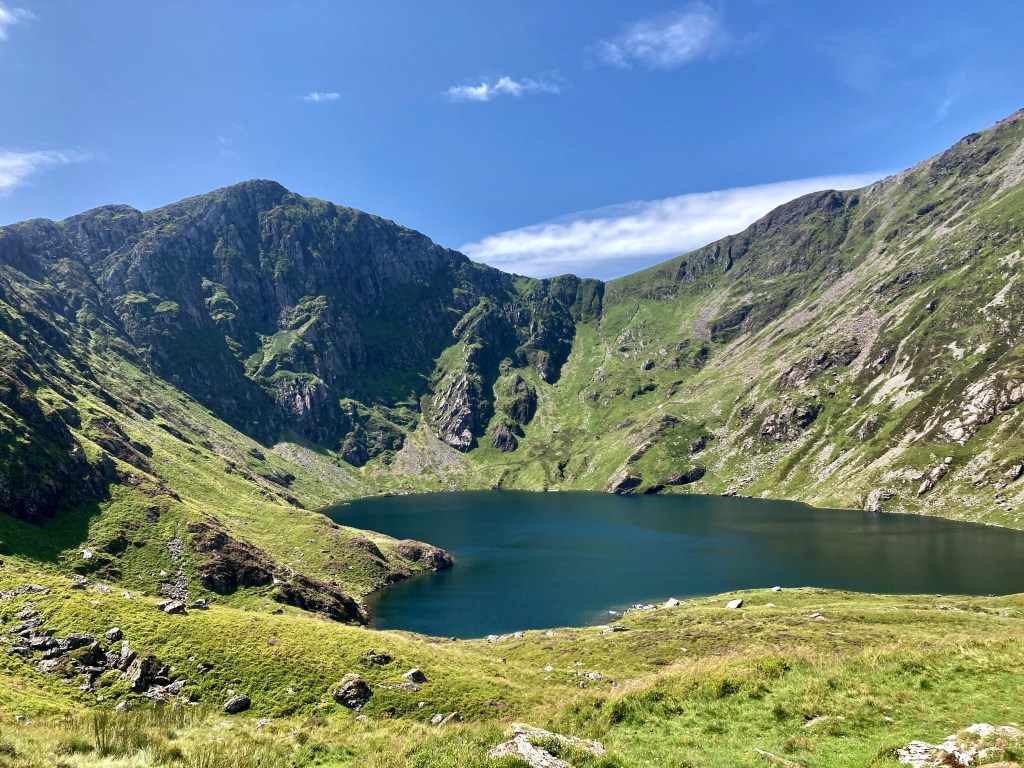
LLyn Cau as the path heads south and climbs around the corrie

My walking friends and I talked about climbing another big mountain having walked Pen y Fan some years ago. I’m less keen as I’m the oldest, least fit and as the one who has planned most of our trips across the relative gentility and safety of Dartmoor, the Black Mountains or South Downs, so the prospect of a major hill was a little daunting – particularly given the vagaries of UK weather. But the consensus was for a weekend in July for the best likelihood of a sunny, dry trip and Snowdonia in North Wales as our playground for the weekend, specifically with our sights on Cadair Idris/Penygadair as it’s quieter than Mount Snowdon. We based ourselves in the seaside town of Barmouth which has a great coastline, views of the looming mountains, pubs, supermarket and fish and chips. On arrival we had a late afternoon stroll in the Rhinogs, which gave us a taster of the wonderful walking in Snowdonia.

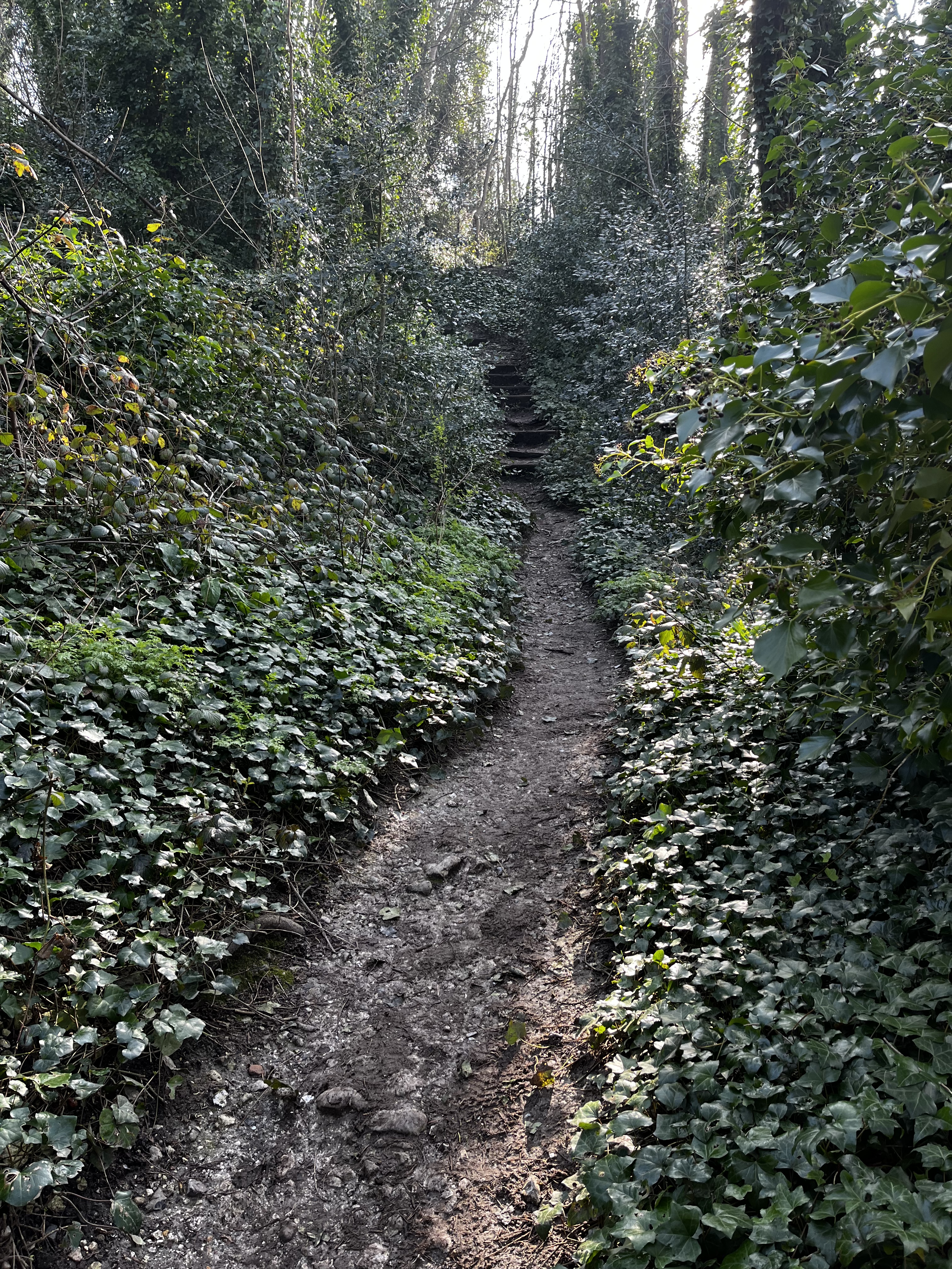
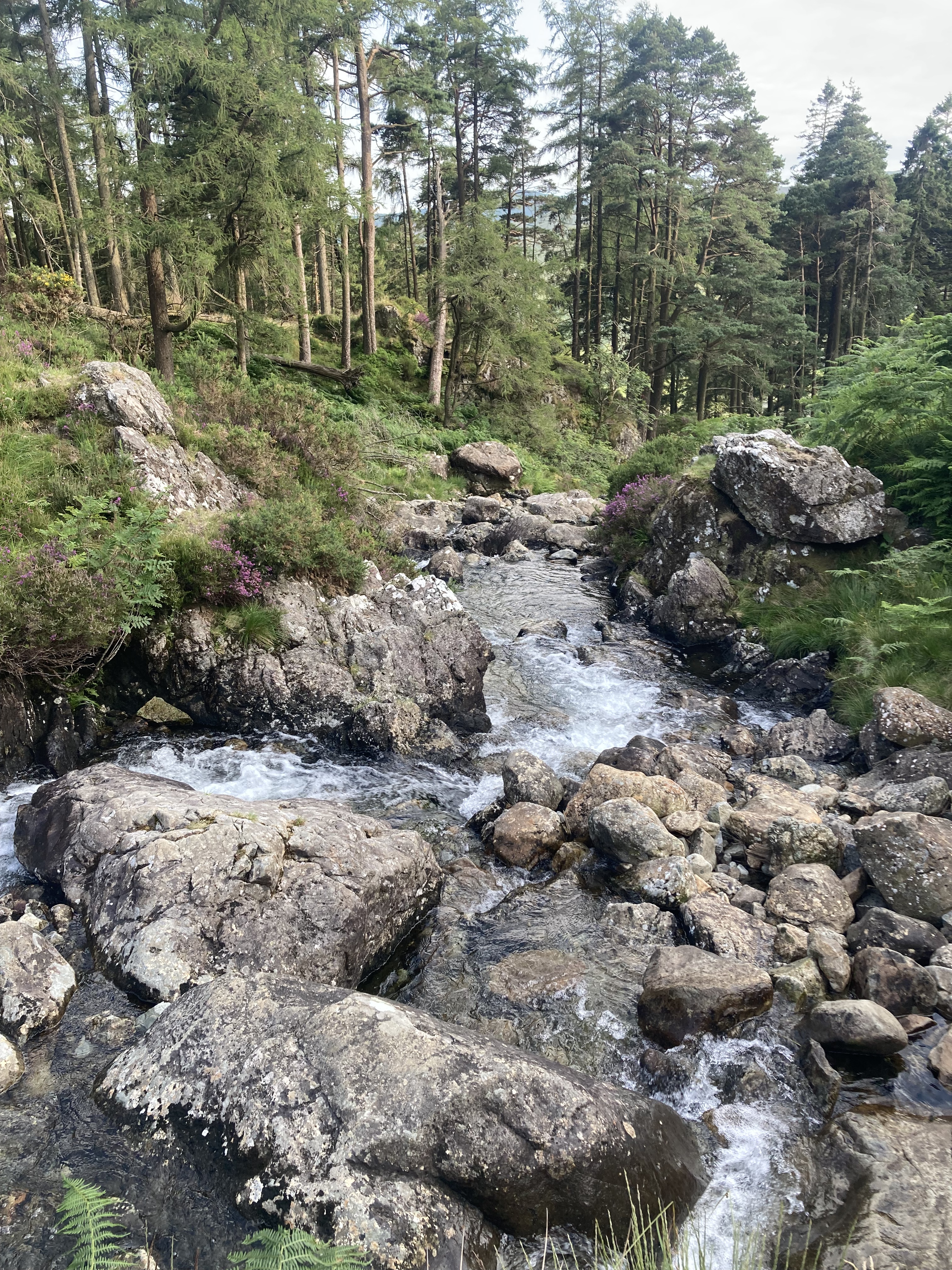
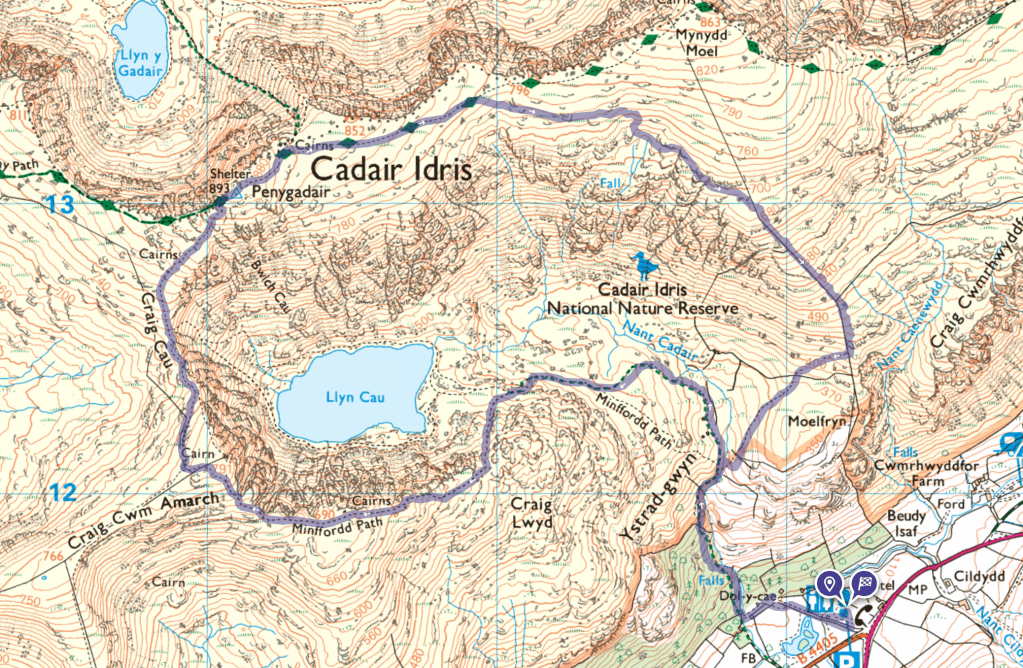
The forecast was for perfect weather as we left Barmouth after breakfast next day with packs as light as possible, intending to park in the Lay by east of the walk on the on the A487 but this was populated by a gaggle of oversized camper vans who saw this as their domain for a few days and together with early arrivals there was no parking, so we headed for the capacious Visitor Centre car park (with loos) at the foot of the mountain (map below) and revisited our route, on reflection, a good option as it is from here that the iconic Minffordd Path starts, which follows the course of a tumbling mountain stream through stunning pine woods up a great many steps before the open uplands below the summit.

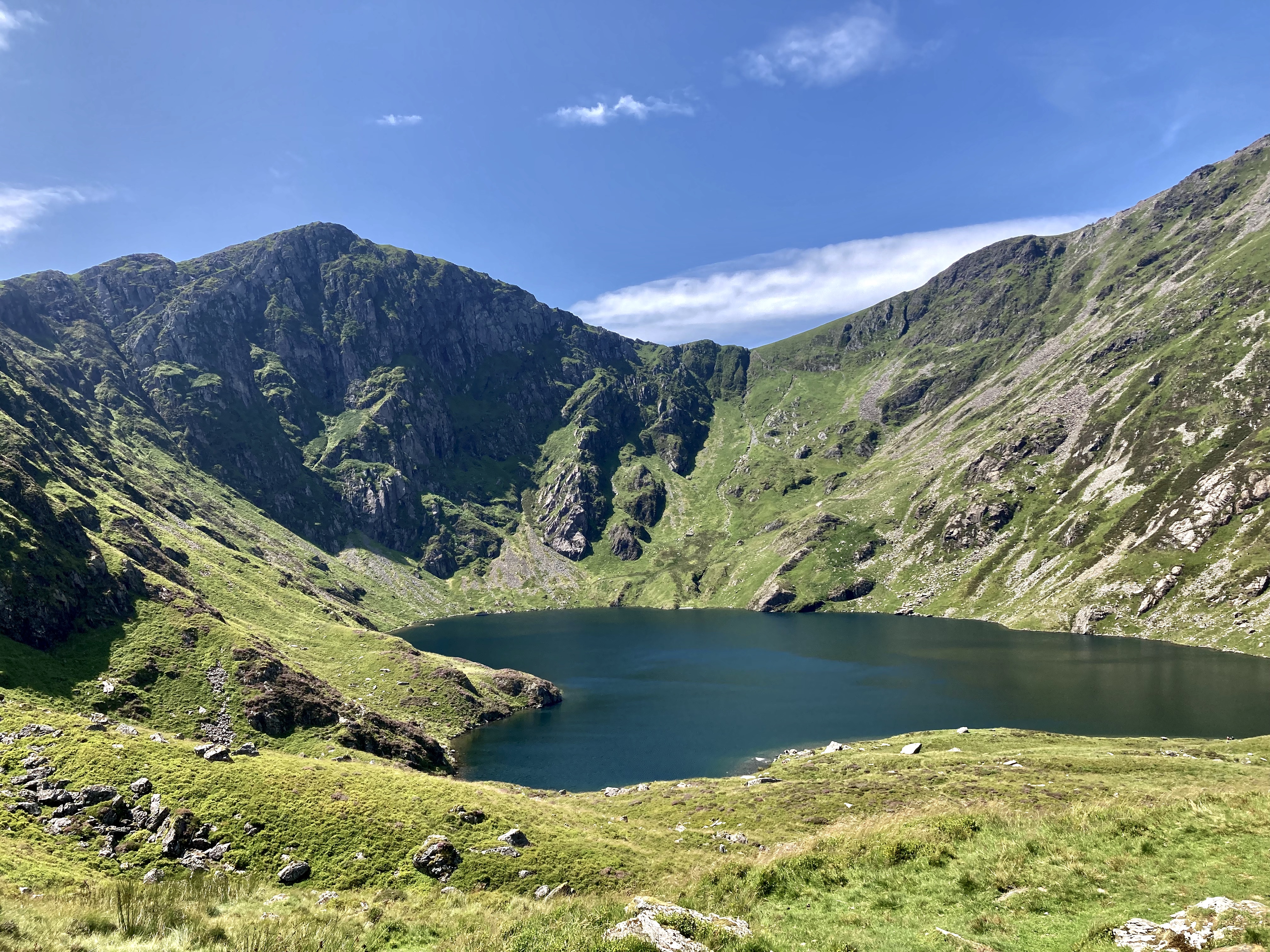
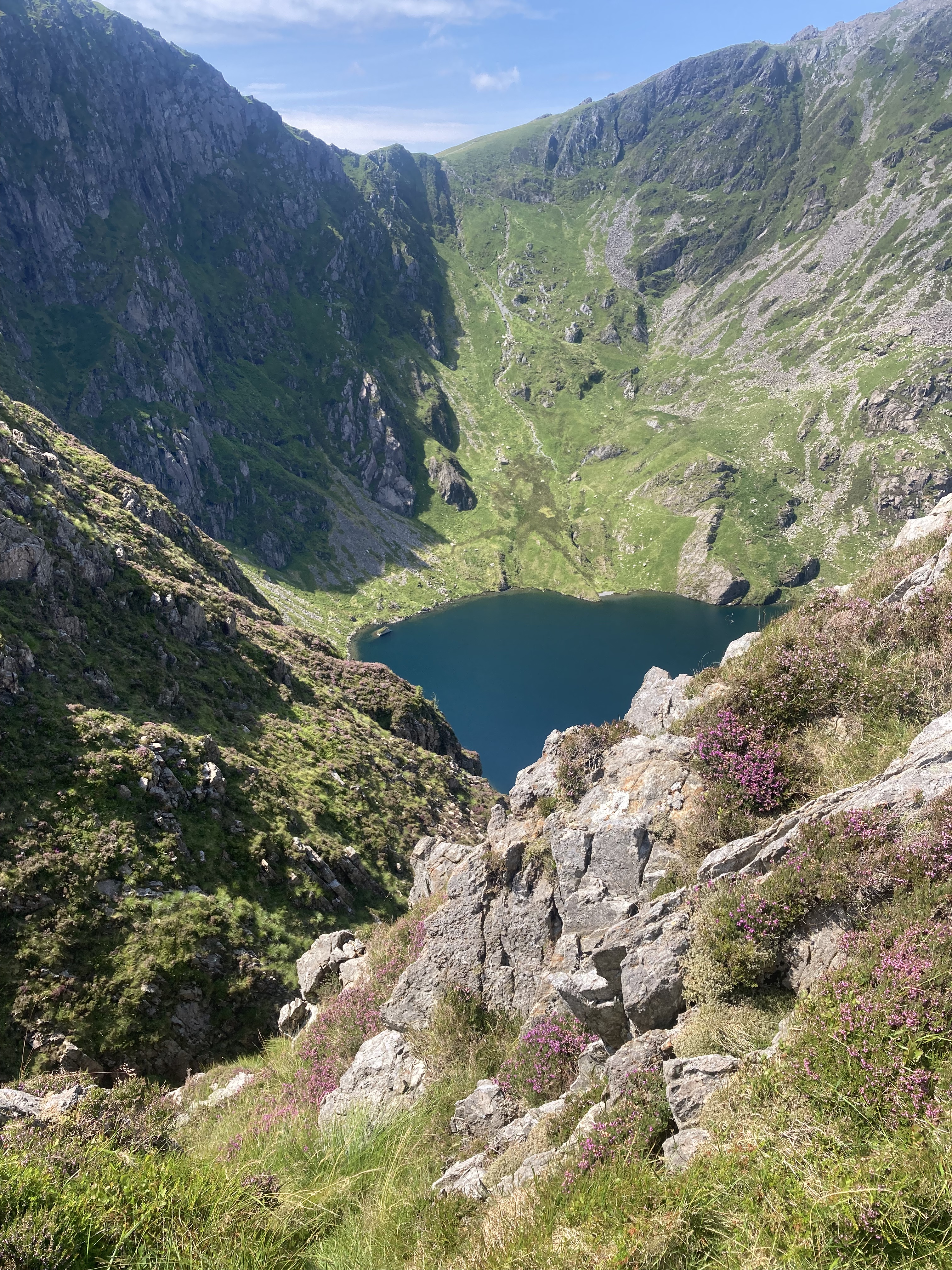
Clockwise from top left: Looking back down the stream. LLyn Cau as the path climbs to the south. Looking east from the grit path above LLyn Cau. The trig point at the summit with Barmouth Estuary in the background. LLyn Cau seen through gaps in the cliffs as you climb around the corrie.

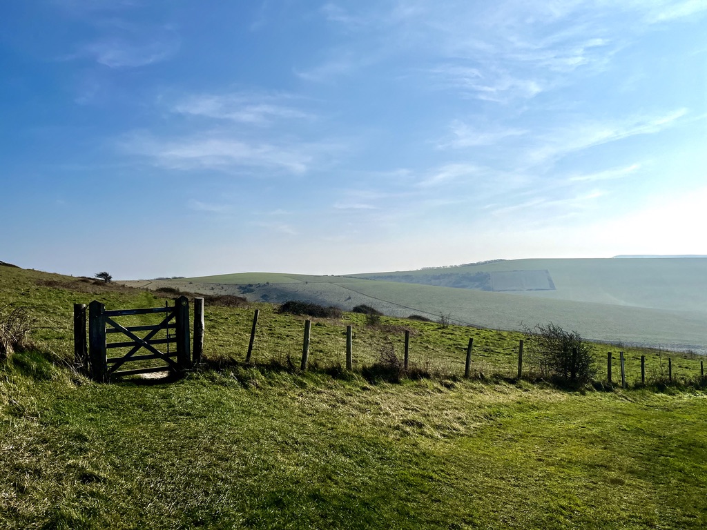
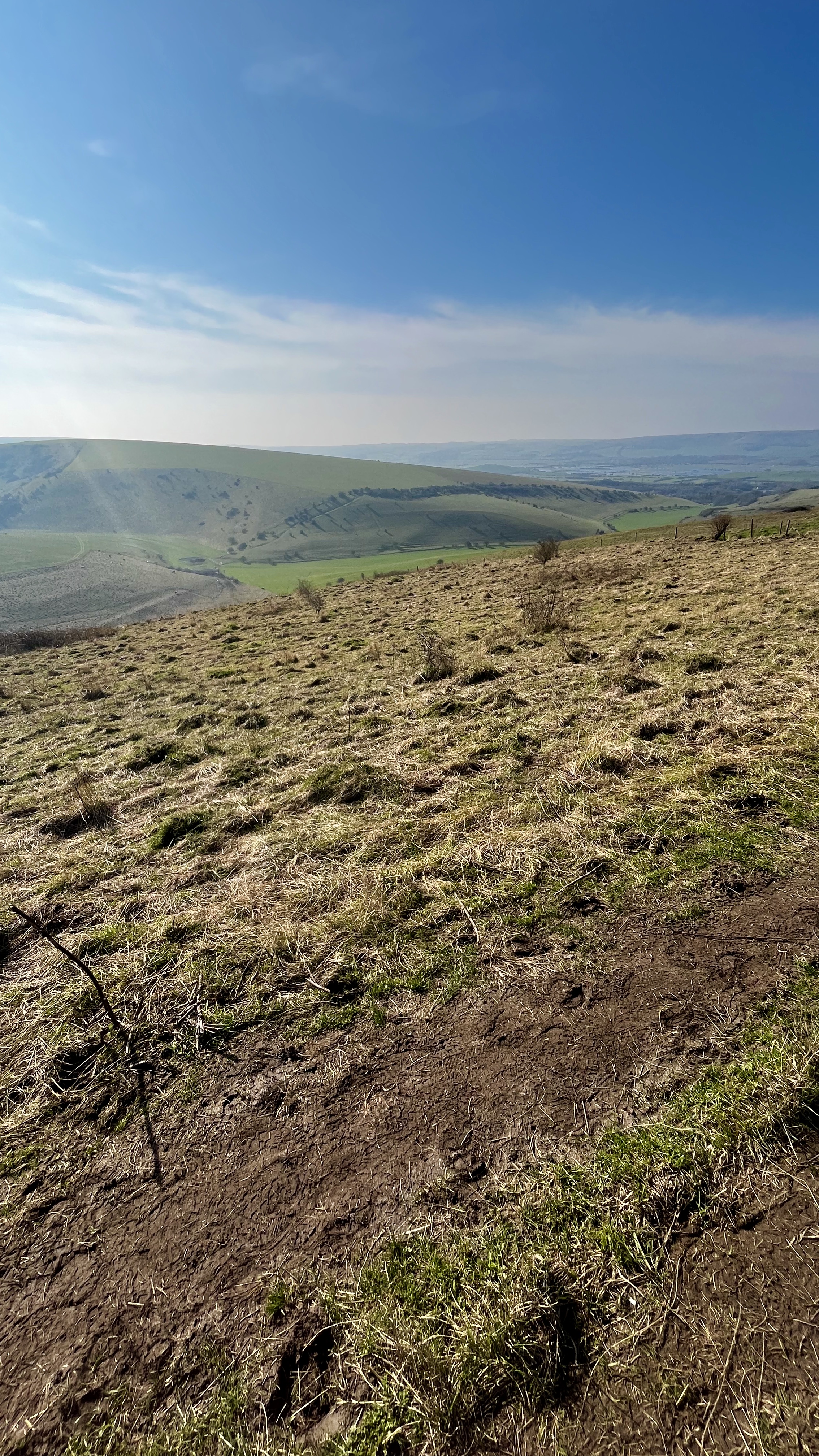
It’s a 700ft climb heading north before view opens up and the route leaves the stream, the path relatively easy grit/grass as you head west toward LLyn Cau, a water filled corrie under the looming flanks of the mountain’s peak. The path climbs to the south and up, then to the west, ever climbing at the same rate, round LLyn Cau as fabulous views to the south and east are revealed. We took a break here and had tea as, while we had only travelled about a mile and a half, we had climbed 1500 ft, half the overall height of the mountain. RAF jets cruised below us practicing their low-level skills through the valleys – amazing to see. Besides, we had all day and wanted to enjoy the views at leisure.

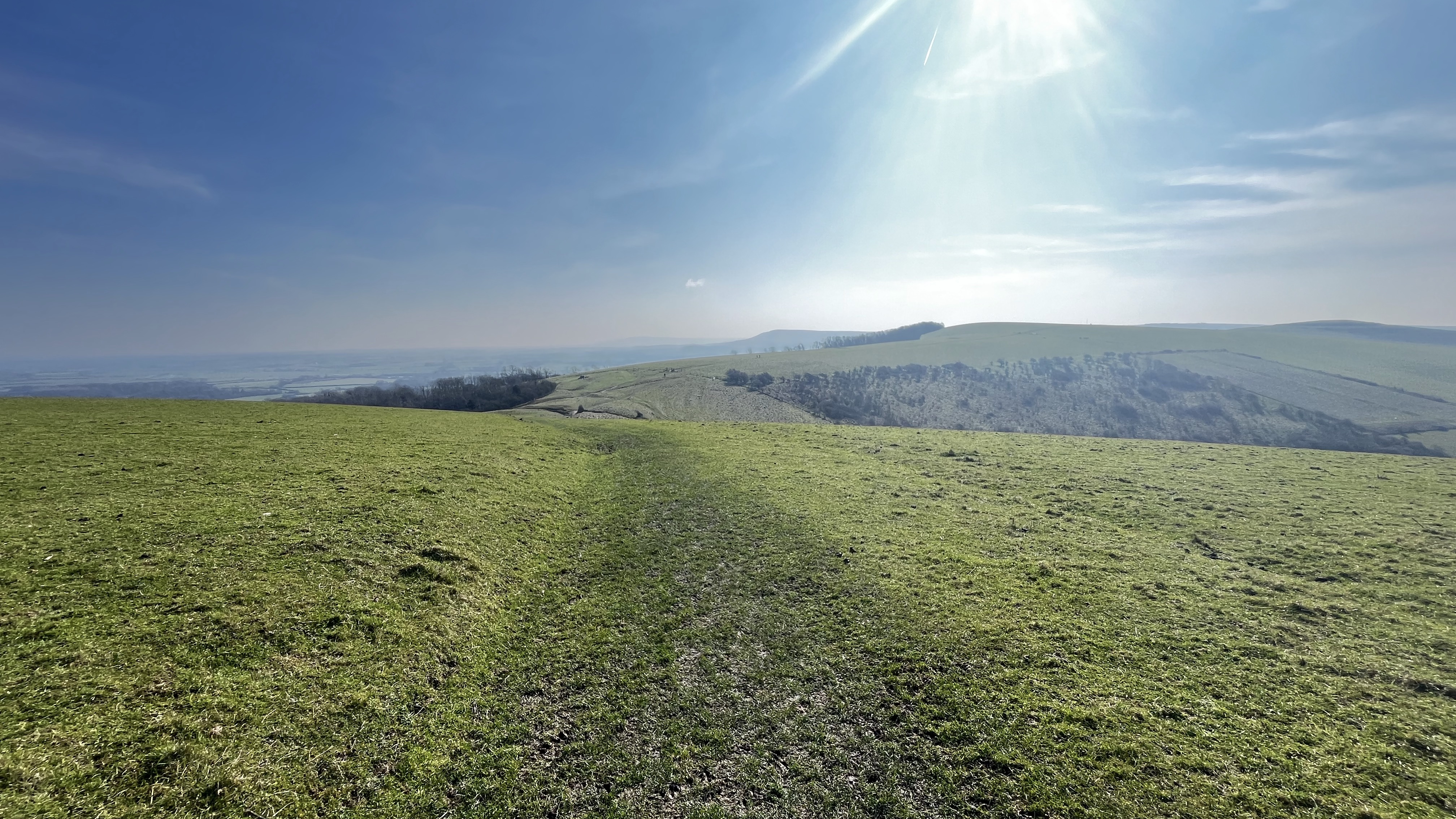
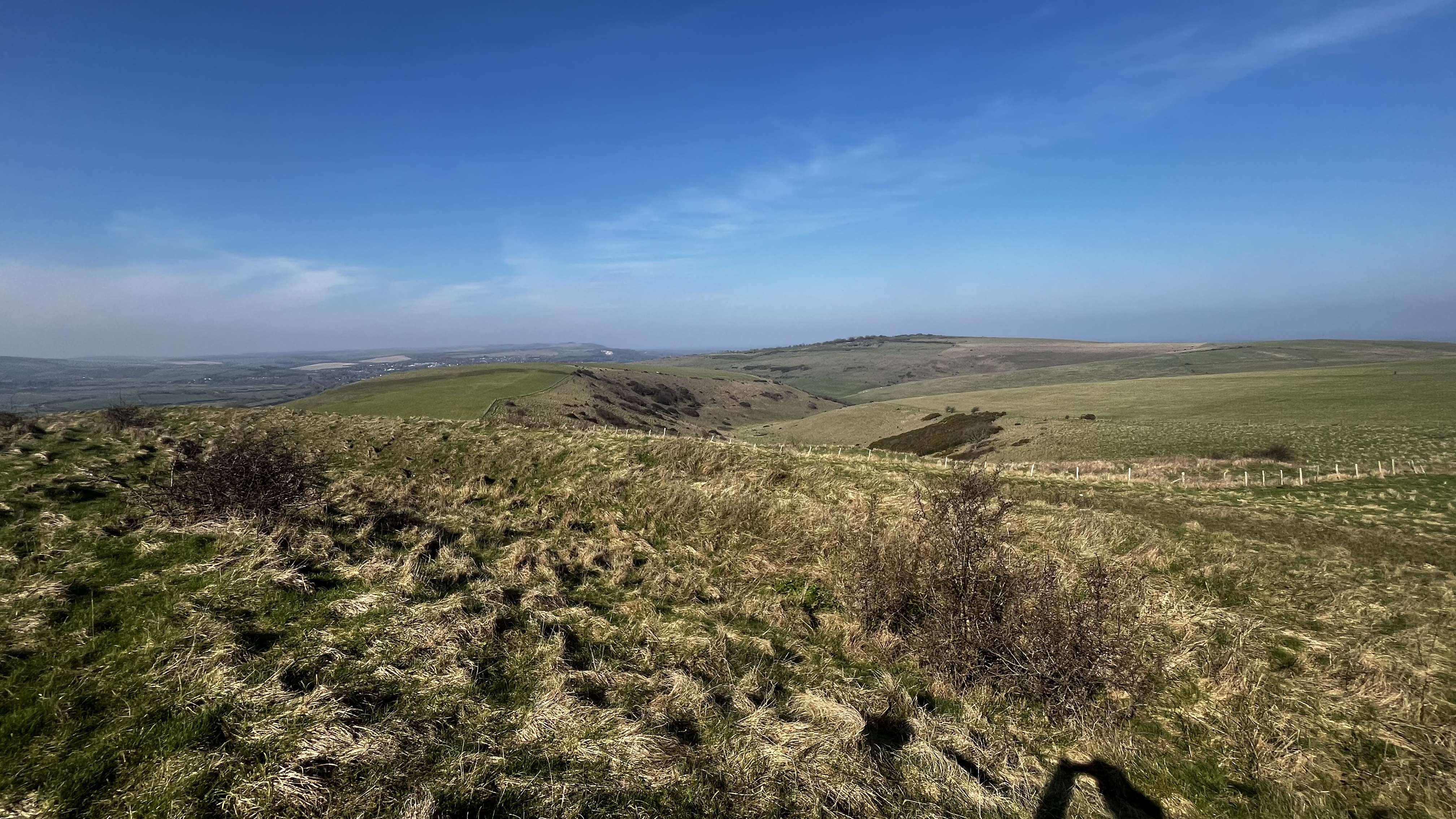
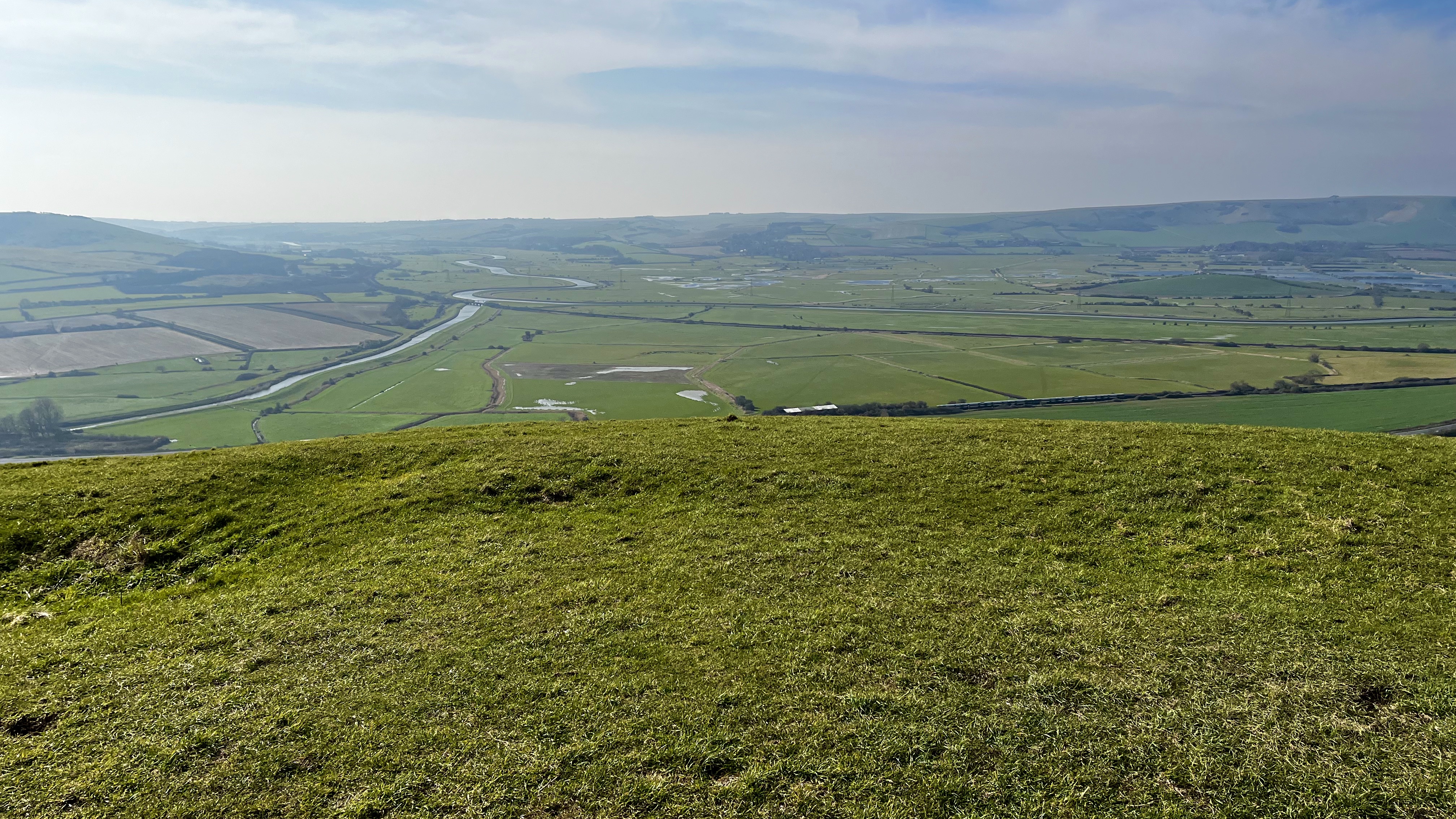
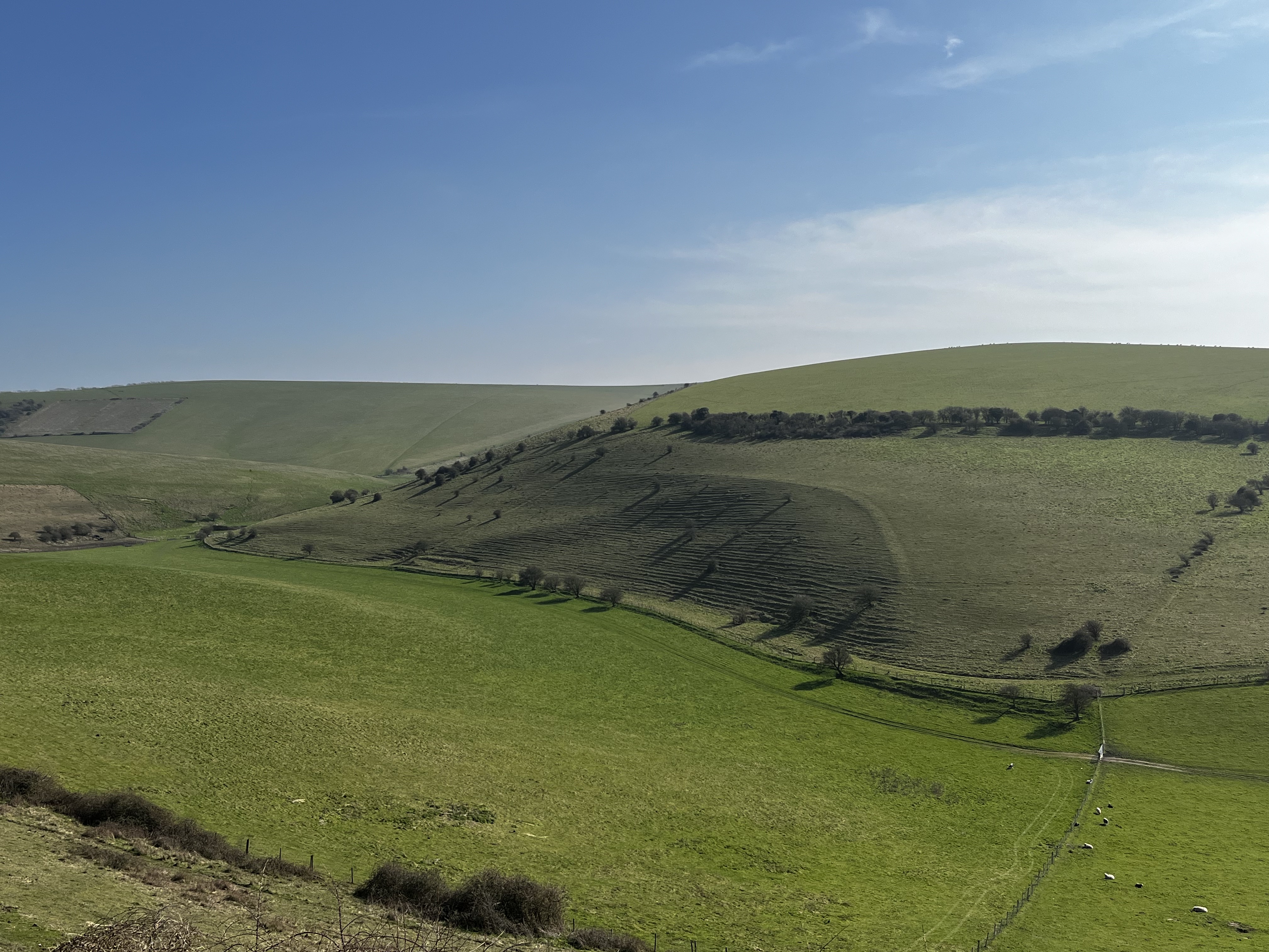
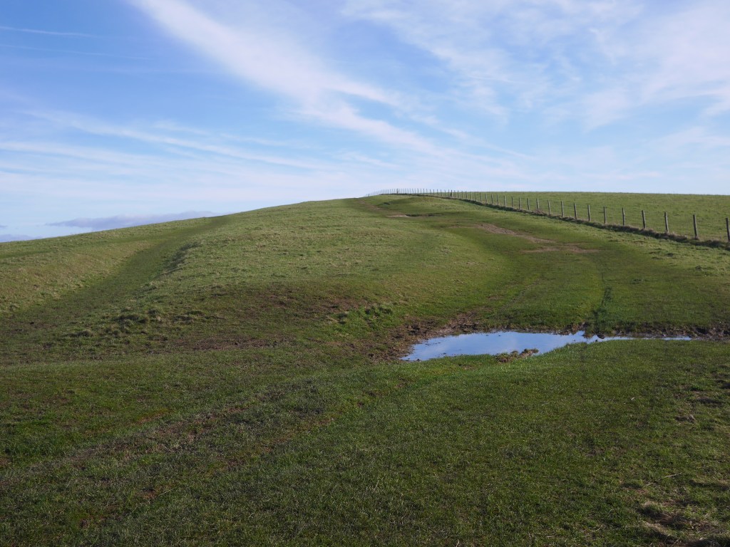
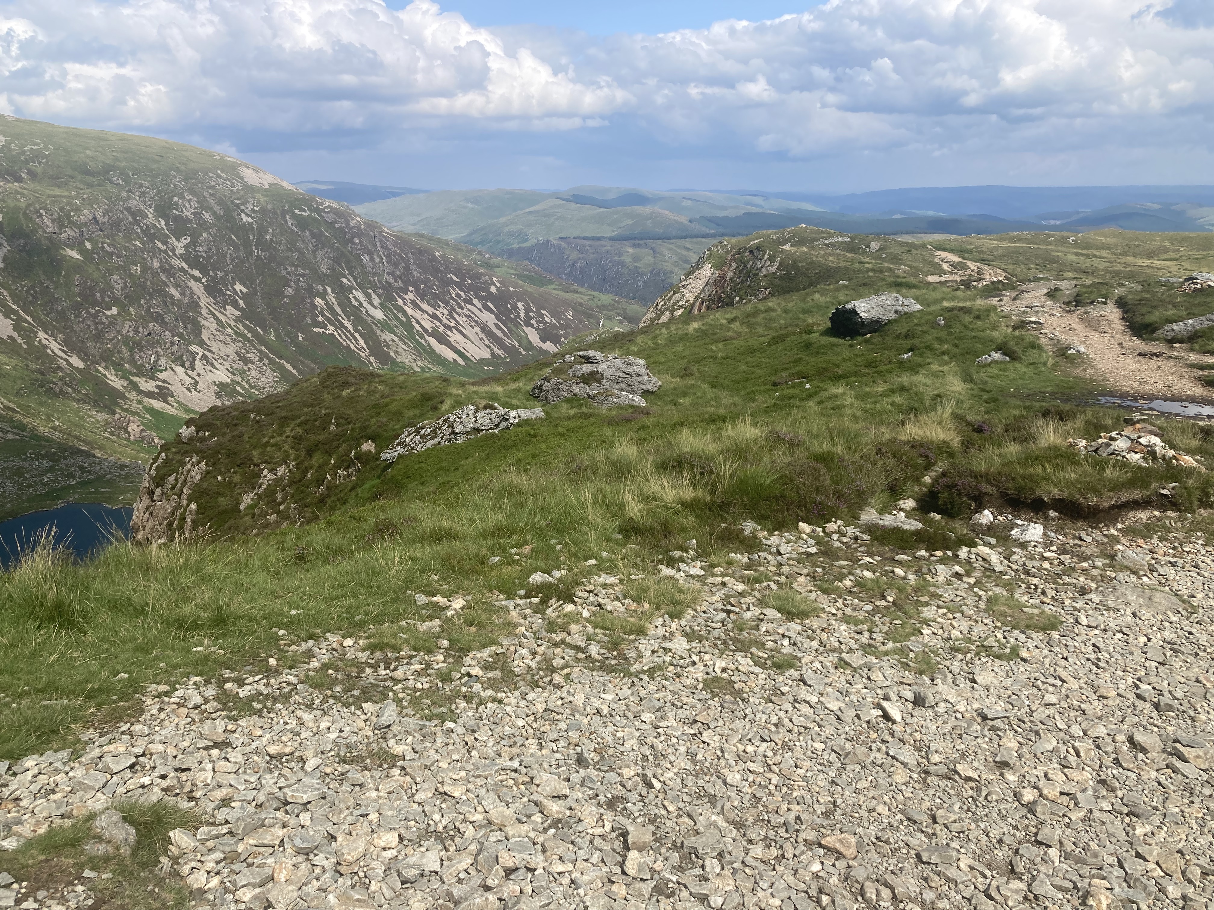
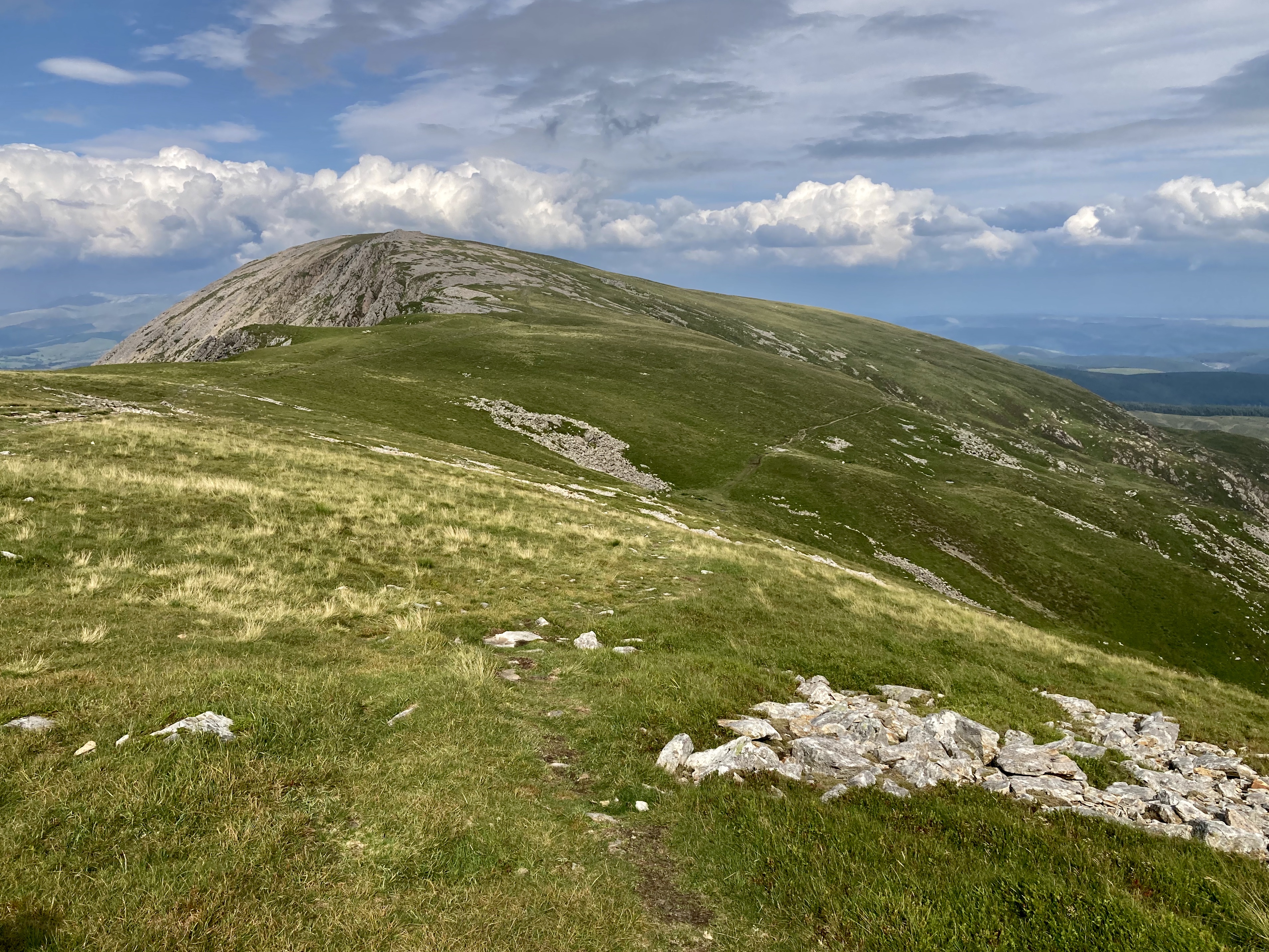
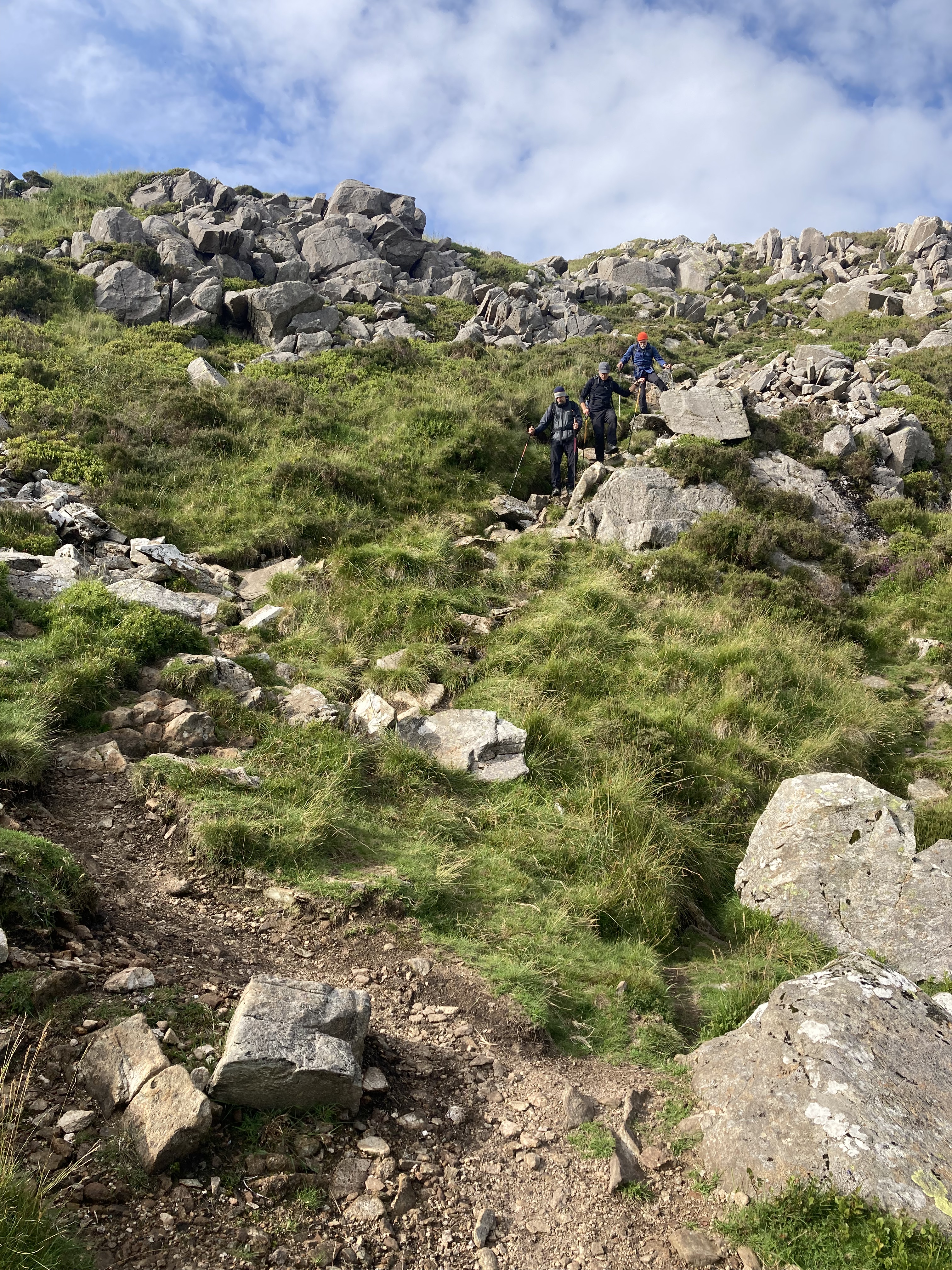
At Cwm Amarch the path climbs northward along the well defined route until the path becomes a lot rockier as you approach the summit. A last push and you reach the trig point from where the views are just pectacular. North you can sea the Barmouth estuary round to the tip of the LLeyn Peninsular, Snowdon and countless other peaks of mountains in the National Park. To the South all of Mid Wales is at your feet. There is a hut just below the summit which made for a pleasant break from the strong wind. We took in the sights, took photos, had lunch then headed east as we decided to make our route circular rather than retrace our steps. It was invigorating to be striding west across the level, grassy plateau, peak bagged, toward Mynydd Moel before bearing right along a small track heading south east which hugged the contours before descending a steep set of steps/path about a mile from the summit which was really hard going for about half a mile as you descend about a thousand feet. The path then takes a right south west along a fence/wall line heading back to the wooded stream and the steps back to the visitor centre and car park.

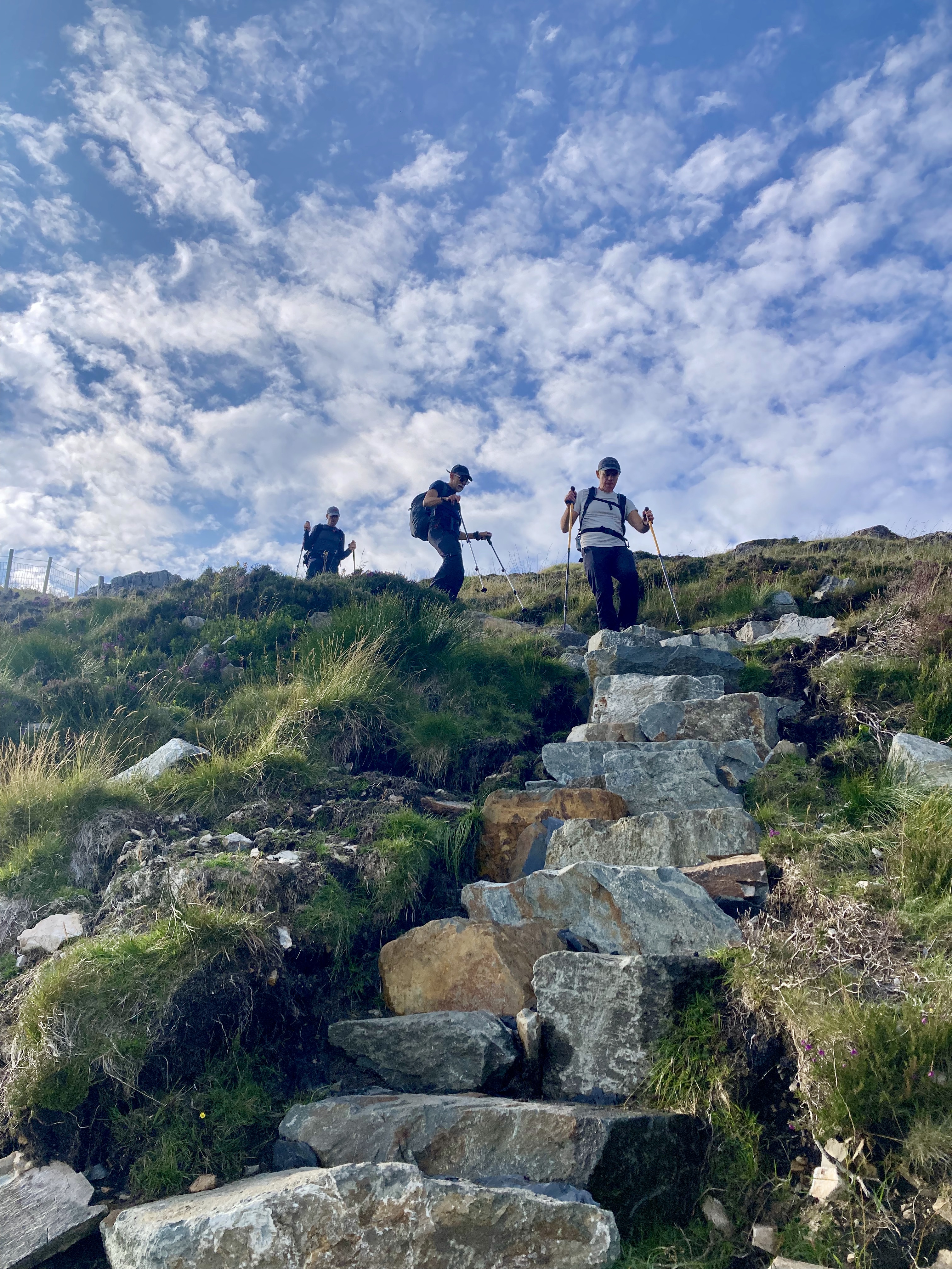
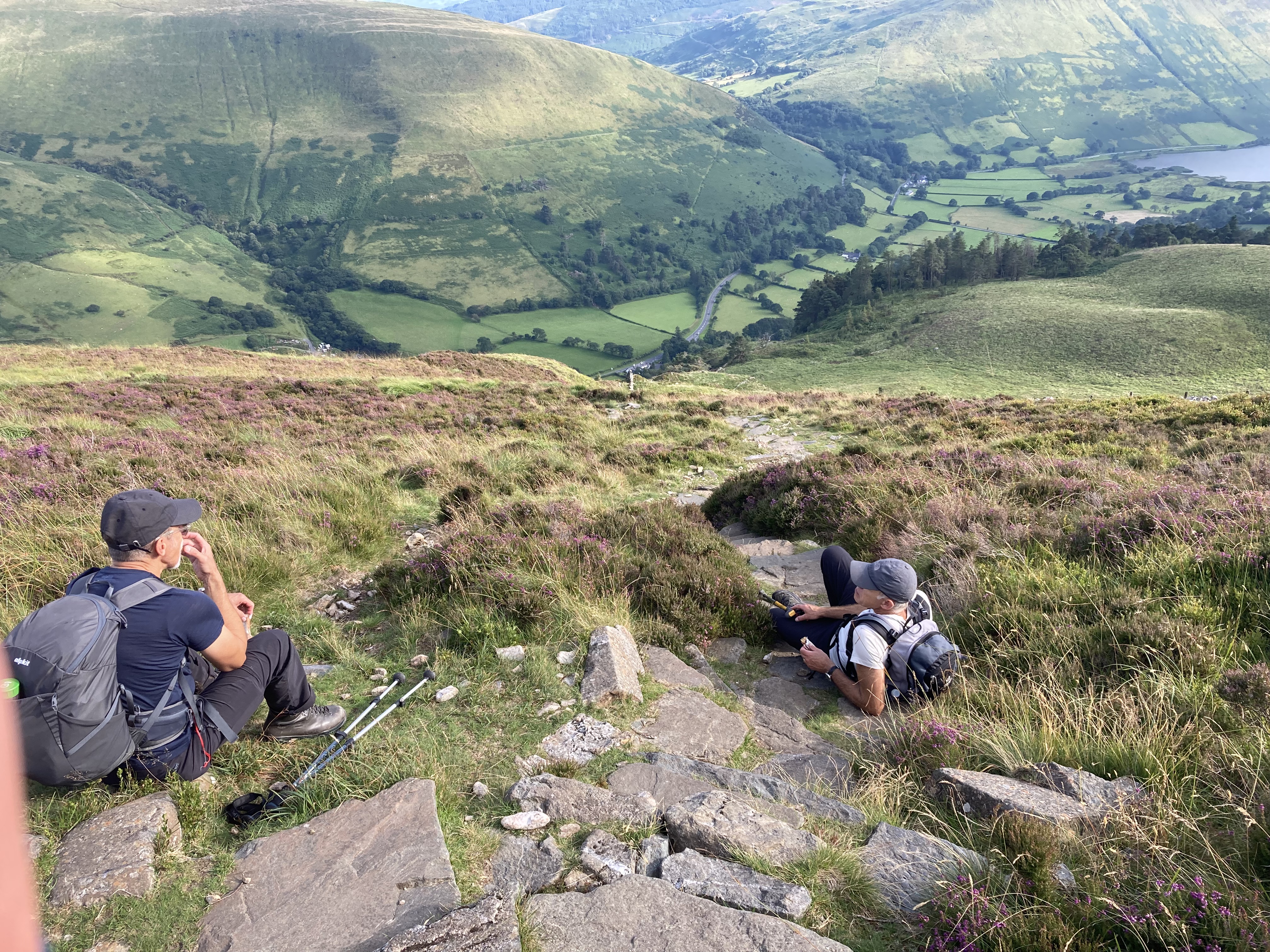
Clockwise from top left: The plateau looking east from the summit towards Mynydd Moel, our path bearing to the right. The steps on the descent which must have taken an immense effort to put in place. The steep track from the plateau to the steps. A break to absorb the views to the south before bearing right back into the valley, stream and steps. Looking back towards Cadair Idris from the descent.

Cadair Idris and a short walk in the the remote Rhinogs the day before made this one of our favourite trips. This is an iconic walk and we were really lucky to get the weather for the entire day. We were all kitted out but saw families making the climb with the bare minimum but even in July it was a hat and coat experience in the cool wind at the top. We agreed we wouldn’t consider attempting this in anything other than good dry, warm summer conditions with a long day key to the enjoyment, kit apart, particularly as the steep descent from the plateau as the steps/path would be treacherous in the wet. We would like to climb Cadair Idris again using the Pony Path to the North. All in all a fabulous day. Diolch/Thank you Cymru.

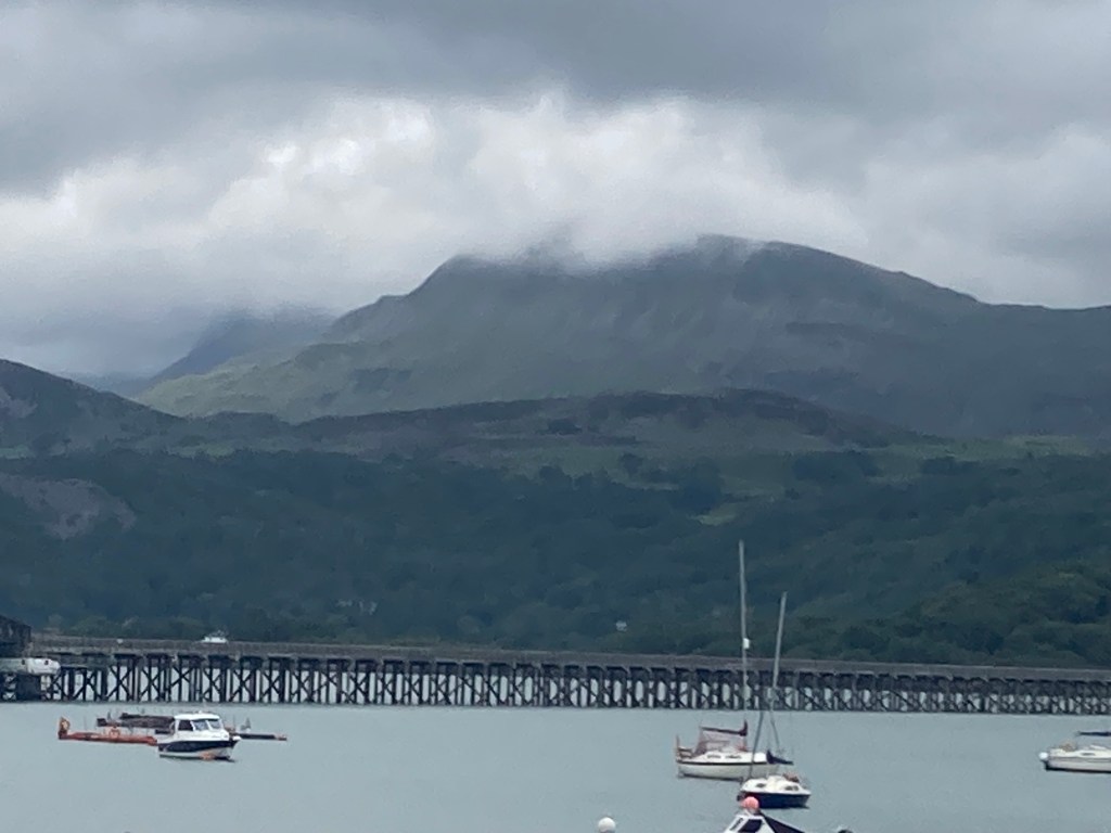
Cadair Idris from Barmouth the morning after our walk

‘Mount Caburn from Lewes’ – walk, Sussex Downs

Looking south west acroos the Lewes Downs from Mount Caburn

After the wettest February on record, early March promised something a little better with a few days without rain for the ground to dry out (February walking was a mud-fest) and the promise of a sunny Friday. So I decided on a trip to Lewes and a 5.5 mile circular walk from Lewes station town into the hills east of town. It takes in classic downs above a dry valley to the high point of Mount Caburn, the remains of an Iron Age hill fort, then back via the valley floor (map at end). I also wanted to spend some time in the vibrant town taking in the history and architecture for a couple of hours.

It isn’t a long walk, the first half mile via the town centre with, for me, a stop off on Station Street at ‘Carafe’ for a cup of tea. The route from the station is north up to High Street and from here you can see the downs you’ll be climbing, towering above the lower town. Walk east down high street and cross the bridge over the River Ouse by the Harveys brewery continuing on the level to the end of the street. Cross South Street and make your way up Chapel Hill, a steep, narrow road between beautiful cottages. At .75 miles take the small lane to the left, then through the gate onto a footpath and steps. This is the hardest part of the walk as it’s a short sharp climb to a golf course from which there are views of the town as a reward for the effort.

Clockwise from top left: Chapel Hill, view from High Street east to the downs, the downs as you leave the golf course, the path from Chapel Lane to the golf course, the view of the town from the golf course

Continue across the course roughly east between the tees. The walk continues to climb and is signposted in places. The views begin to become wider until at the 1.4 mile mark you leave the golf course and the path becomes a little wilder and level. At 2.4 miles there is a stile (or gate, can’t remember), then head south east towards the 135m high point and tumuli. The path descends a little, crosses some deep tracks then climbs up to another and stile. Head roughly south along the fence line to the highpoint at 148m as ‘The Caburn’ begins to take shape – follow your nose.

Views en route to the fort, the bottom two from Mount Caburn. The walk offers a pleasant mix of downland wildness and pasture.

The views from the fort are amazing, the steep scarp plunging into the sweep of the flooded Ouse valley, the views of the downs, Lewes and weald explain the fort’s important position in the landscape. Despite the strong sun, a brisk easterly wind made it a fresh day so the lee of the forts ramparts made a great place to sit and enjoy an early lunch in the sun out of the wind. I was in no great rush and the opportunity to simply sit on my warm, dry foam mat and take in the vast scene in the noonday sun was relaxing. It’s a good spot.

From the fort walk northwest towards the stile into the rough slope above Caburn Bottom, turn left and walk northwest keeping the fence line to your left (there is another stile into the field adjacent, ignore this) and follow the rough path as it tracks the dry valley below before veering to the right – northward and down to the bottom of the valley and a gate which takes you through the valley floor for a half mile or so heading northwest, past a dew pond and another gate before taking the path rising up the ridge flank to your right and heading west with great views of the valley until the path meets the top of Chapel lane by the golf course Clubhouse. Walk down the lane and you reach South Street at the 5 mile mark into town.

Pics of the town and its medieval architecture: dew pond in the dry valley and two of the town from the top of Chapel Lane as you come off the downs.

5.5 miles from the Lewes station and back, 850 ft of ascent.

‘Pyecombe to Southease’ – walk, South Downs Way

Looking E from Plumpton Plain towards the Ouse Valley and Downs beyond

The weather of early February 2020 has been so much better for getting out. It’s still quite gross underfoot in places but the ground has dried out enough to make a long walk less of an assault course. So with a weather forecast of sunshine, a light NE wind and single figures C, I wanted to get back to Sussex to complete another section of the South Downs Way (SDW), an accidental inspiration borne of having completed a couple of sections previously. The object is to use public transport where I can to get there and back (home in London) in a day and complete a decent walk in between. In this instance 15.5 miles from Pyecombe to Southease Station. From Clapham Junction I took the train to Hassocks Station then a quick 5 min walk to the A273 to catch a bus to Pyecombe. In just over an hour and I was at the foot of the Downs.

The walk (map below). You have to retrace back up the A273 for just over half a mile in order to pick up the SDW and the road is busy with no pavement so better to walk round through Pyecombe village and use the dedicated path to the W of the road until you cross E to start the walk. The first mile or so is steadily uphill through a manicured golf course before the path turns N through a stables then up to the scarp path where you can see the two ‘Clayton’ windmills. The path turns sharp right and continues E and opens up as do the magnificent views (weather permitting). There are Tumuli to the left and right and a couple of ‘dew ponds’ – man made pools, traditionally lined with straw, clay and Lime (to deter worms from perforating the lining) which date from medieval times, designed to harvest rainwater for livestock in an otherwise parched landscape.

Looking E when on the scarp path
Dew Pond near Ditchling Beacon
Gorse in flower

The path continues E towards Ditchling Beacon, one of the highest points of the Downs. Noticeable in the surroundings as an area of scrub which is being grazed back into chalk grassland. The Beacon was gifted to the National Trust by a local family in memory of their son, an RAF pilot lost in the English Channel during the Battle of Britain of 1940. I cycled (actually I pushed my bike) up here when taking part in the London to Brighton Bike Ride and remember it as the toughest part of the route before becoming a welcome downhill freewheel to the coast.

Looking East near Ditchling Beacon
The wide path

For a couple of miles beyond Ditchling Beacon the path retains a wide open feel, more ride than path and occasionally Skylarks can be heard as they hover above more hospitable areas of field stubble, in what incredibly has become an ever more unfriendly zone for them. Skylarks are on the Red List of threatened species, as changes in farming practices (including the use of herbicides to eliminate weeds which provided the Skylark with over-Wintering food) and the decline in habitat has led to a 90% decline in just 30 years. I find it incredible that we haven’t addressed this issue of erosion of habitat during an extended period of awareness of the problem. The British Trust for Ornithology has more information about the plight of the Skylark and has launched an appeal to help farmland birds. This helps explain why my memory of Skylark song as a constant backdrop when walking the Downs in the early 1970s isn’t fanciful nostalgia.

From Plumpton Plain views of the Ouse valley and coast, including the Seven Sisters cliffs, open up together with views of the Downs beyond the Ouse marching E towards Alfriston. The path soon turns right heading S away from the scarp slope into the rolling dip slope of the South Downs. The landscape becomes a patchwork of largely arable fields with some grazing and the path less busy as it heads away from the obvious route towards Lewes.

Wide open spaces looking SE on the Southern leg of the walk
Traveller’s Joy/Wild Clematis – indicative of a downland habitat

The path carries on roughly S before reaching the busy A27. There is free water by Housedean Farm (and a campsite) before the path crosses the bridge over the road then continues parallel to it, backtracking past a foot tunnel on the right before going under a second bridge/tunnel a few hundred yards further on. Thankfully once through this the sound of the road diminishes as you begin to climb past a stretch of wood to the left. The route emerges onto the edge of a large bowl, the edge of which you trace around – always climbing to nearly 600ft /190m. The views become expansive as you pass the Dew Pond at the top.

Free water by the A27
Looking NE rom Swanborough Hill – Lewes and the River Ouse

For the views alone this is a lovely and quiet stretch of the Downs as it heads SE but after a couple of turns the path becomes a mile long concrete road between ploughed fields running downhill and the going is tough on weary feet. Beyond this the path enters a field, then a short section of fenced path past houses* and enters another field above a farm, the path twists round the hill descending to join a farm track heading NE. *An option (though not following the SDW) would be to follow the sign to ‘the pub’ in Rodmell. Very tempting and you can follow the minor road from there and rejoin the SDW at Southease.

Big fields adjacent the concrete road
Near Fore Hill towards the end of the walk

After about half a mile the path leaves the scrappy track and climbs to the right, crossing a road entering Southease, a hamlet with a beautiful church with 12thc tower and small green with a couple of houses. From Southease the road heads E, crosses the River Ouse and reaches Southease Station from which you can get to Lewes in minutes or Brighton in under half an hour. Trains run every hour at about five past the hour until late evening. From here I caught the 16.05 to Lewes and was at Clapham junction in less than 90 minutes.

It’s a long walk with 1600 ft of ascent. I wore light boots (Salomon X Ultra 3 mids) which, paired with Darn Tough socks, perform brilliantly on fair paths. The weather was good and my Montane Power Up hoodie over a Lowe Dryflo base layer worked for most of the day until the afternoon when it cooled and I swapped the hoodie for a Marmot Alpha 60 jacket. As it wasn’t too cold I wore a pair of Bergans Torfinnstind softshell trousers which are surprisingly wind resistant for their light weight and have a close alpine cut at the ankle which stretches over the top of the boot. Outside of Winter these are an excellent, comfortable packable option which wick really well.