Another few days off with good friends and we chose the Black Mountains on the England Wales Border as the area we enjoyed last year and in which wanted to do some more exploring. Again we stayed in Hay-on-Wye which is just magical. Can’t think of anywhere better to spend an evening after a day on the hills.
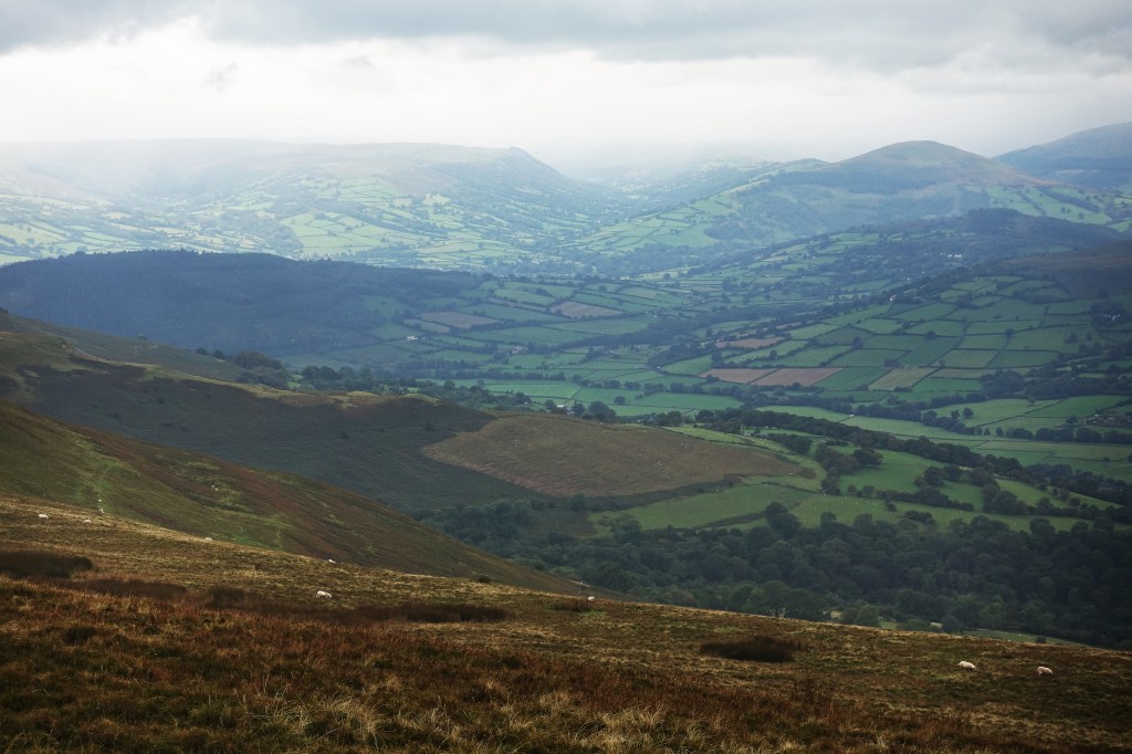
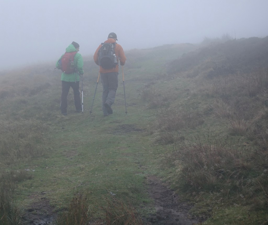
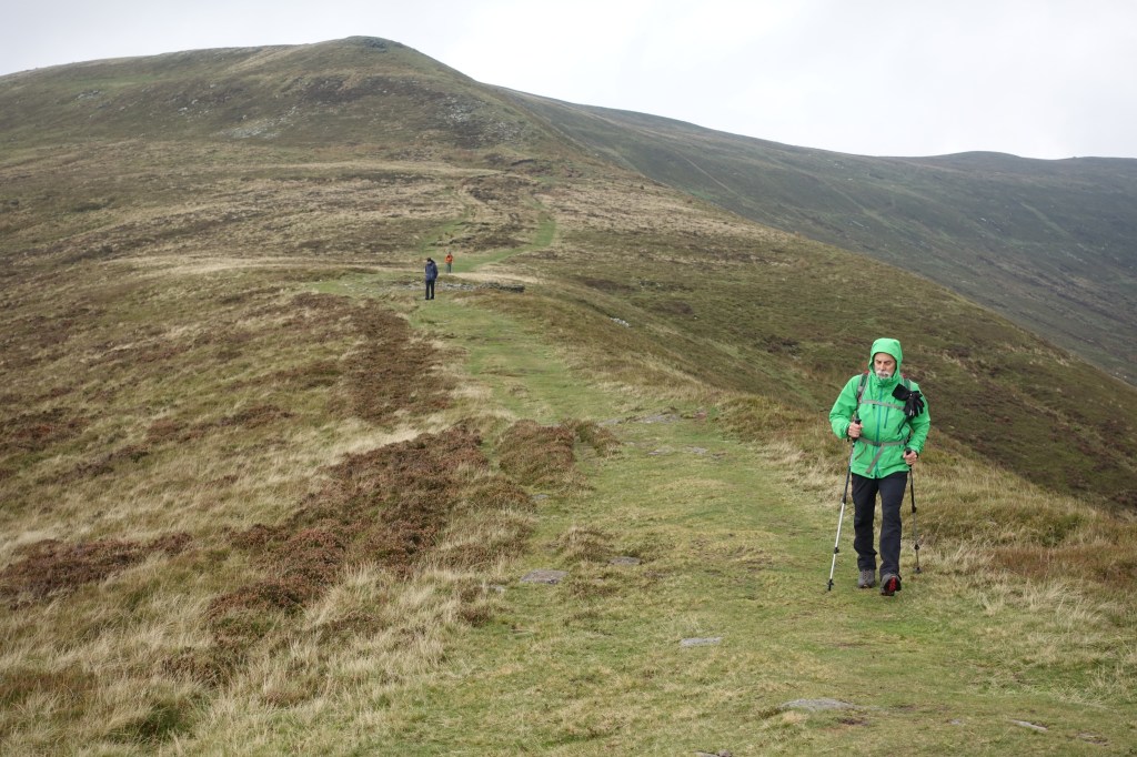
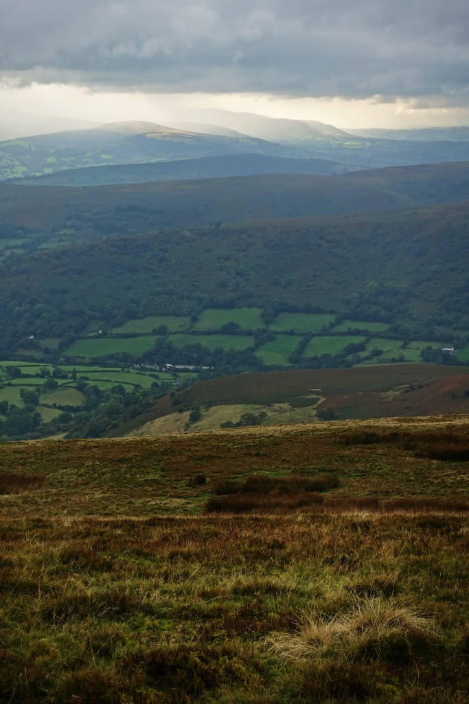
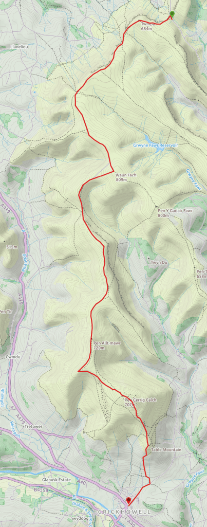
The walk we chose is a 14 mile ridge route starting at Gospel Pass a few miles S of Hay meandering S to the village of Crickhowell (map below). Having parked in the Car Park at the top of the pass we headed W uphill to ‘Twmpa’ aka ‘Lord Hereford’s Knob’, then headed SW along the fantastic ridge (I would like to say the views were great but they weren’t. We were in October fog from the get-go and only lifted briefly at lunchtime). The path flattened out on the scarp edge until we reached the three mile mark and our route turned roughly S – again following the ridge edge. A further two miles and we reached the highest point of the route at ‘Waun Fach‘ (2,600 ft). From here we turned right roughly W toward ‘Pen Trumeau‘. Some of the path is boggy but not too bad, particularly given we had a week of rain beforehand. Other parts of the path have been overhauled with a grit surface and drainage ditches, presumably to mitigate the impact of erosion. All in all this is pretty easy walking if wearing decent footwear. The fog briefly lifted and we were able to take in the really fabulous views. This place has grandeur. Then just as quickly we were again in the thick of it. We had map and compass but the paths are pretty obvious and the Viewranger app on iphone worked well throughout.
At six miles we reached a small saddle which offers decent paths off the hill both E and W. This would make a great spot for a breezy wild camp. At seven miles we reached the highest part of ‘Mynydd Llysiau’ and the path continued S bearing right past ‘Pen Twyn Glas’, and at 9 miles ‘Pen Allt Mawr’ after which we took in the spur to the W. At 11 miles ‘Pen Cerrig-galch’ marks the last climb up (on a nicer day a great place to perch for a while) before the path meanders roughly S to the W of Table Mountain downhill all the way then dog-legging into pasture and woods before hitting a B road off which a small residential road leads into Crickhowell.
We really were hoping for better weather rather than a yomp through a low cloud base but it made for a mini adventure. I will certainly be back to walk this breathtaking route again when the weather is a little more predictable and the incredible views revealed in full. A late afternoon start and a wild camp 6 miles in really appeals.

One thought on “‘Black Mountains’ walk – Welsh English border”