January has been really dry, a blessing for walkers. The usual clag and boginess of Winter walking can be a real pain. So it was with keen anticipation that I met up with an old friend to walk among the extraordinary landscape and features around Avebury.
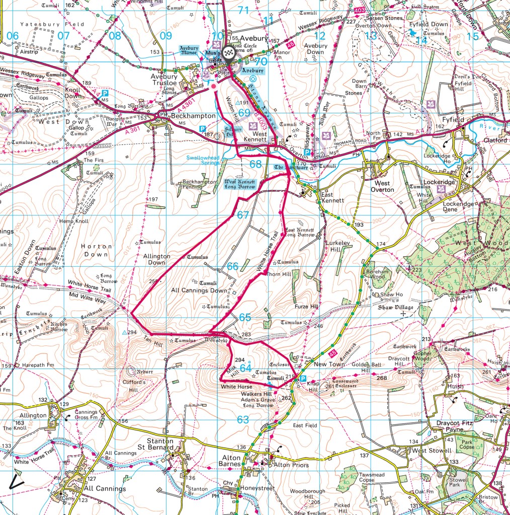
Storm Corrie made its blustery presence felt with a strong Northwesterly wind and a few spots of rain as we set off from the National Trust car park in the village of Avebury. Parking for a day is £7 unless you are a NT member. Our route was a 9.8 mile circuit (map below) starting low then heading gently up to the downs with a short ridge walk and views at nearly 1000 ft then back to Avebury taking in some of the historic features in this magical place.
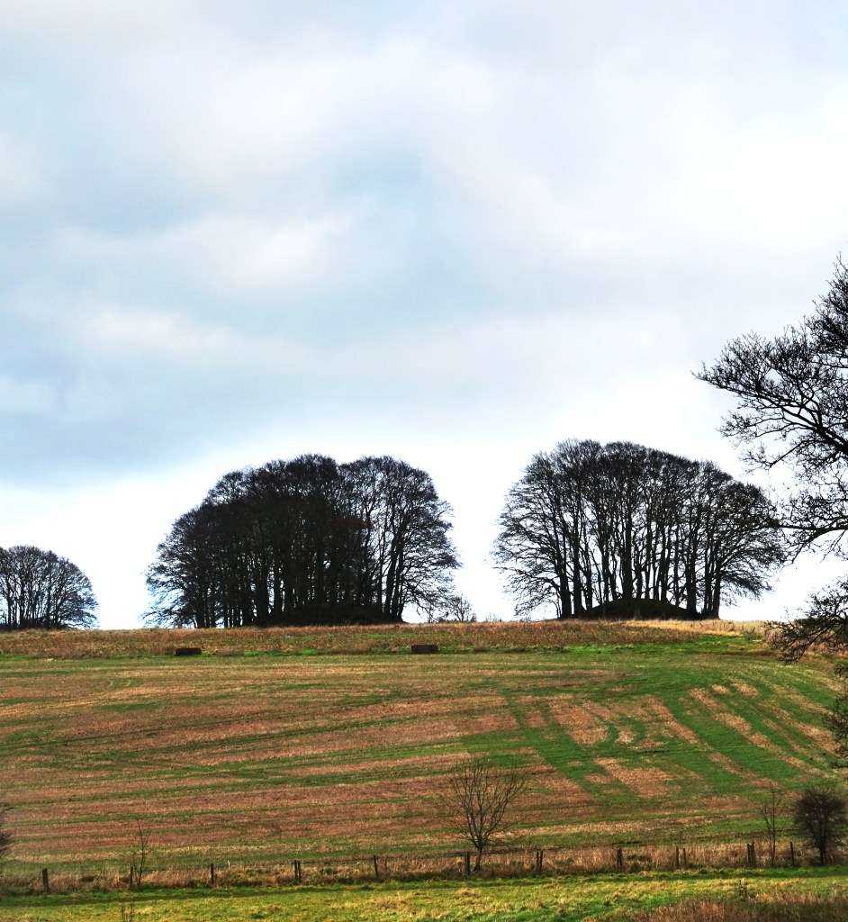
From the car park the route heads S, crossing the A4361, following a level footpath next to the infant River Kennet, a chalk stream, crystalline water running over the white chalk riverbed, before passing Silbury Hill on the right, the largest artificial prehistoric mound in Europe at 30m in height and some 4,500 year in age.
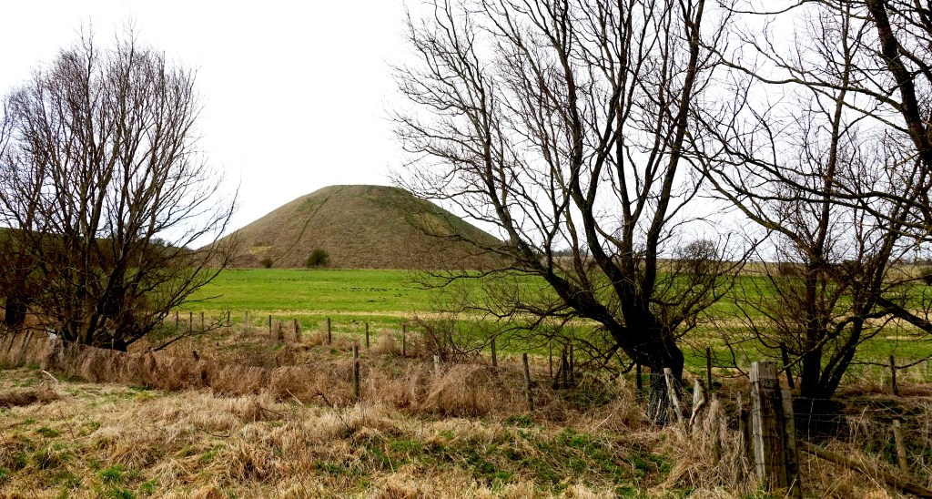
Top: Silbury Hill. Bottom: Looking back towards Avebury
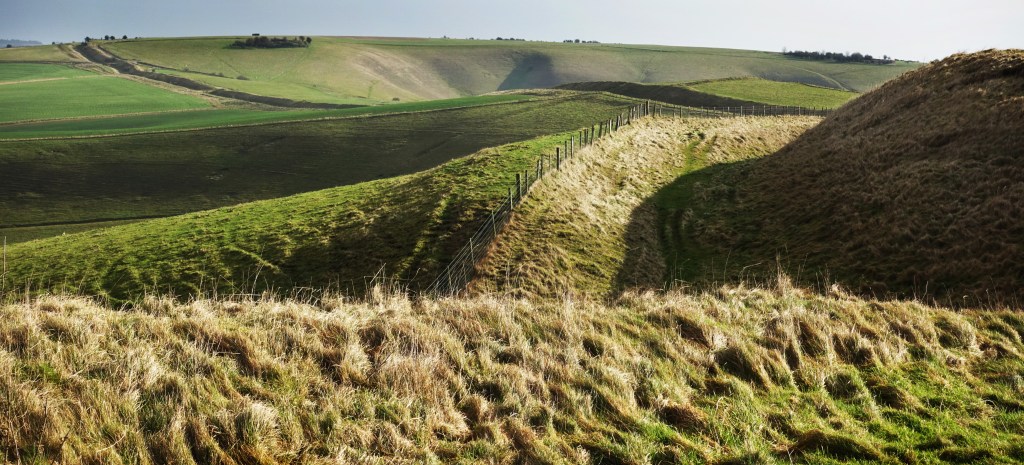
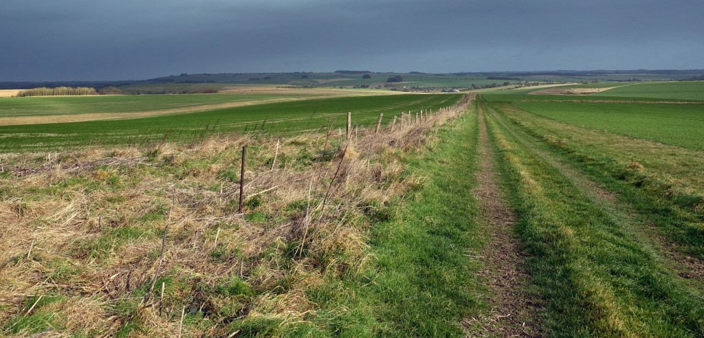
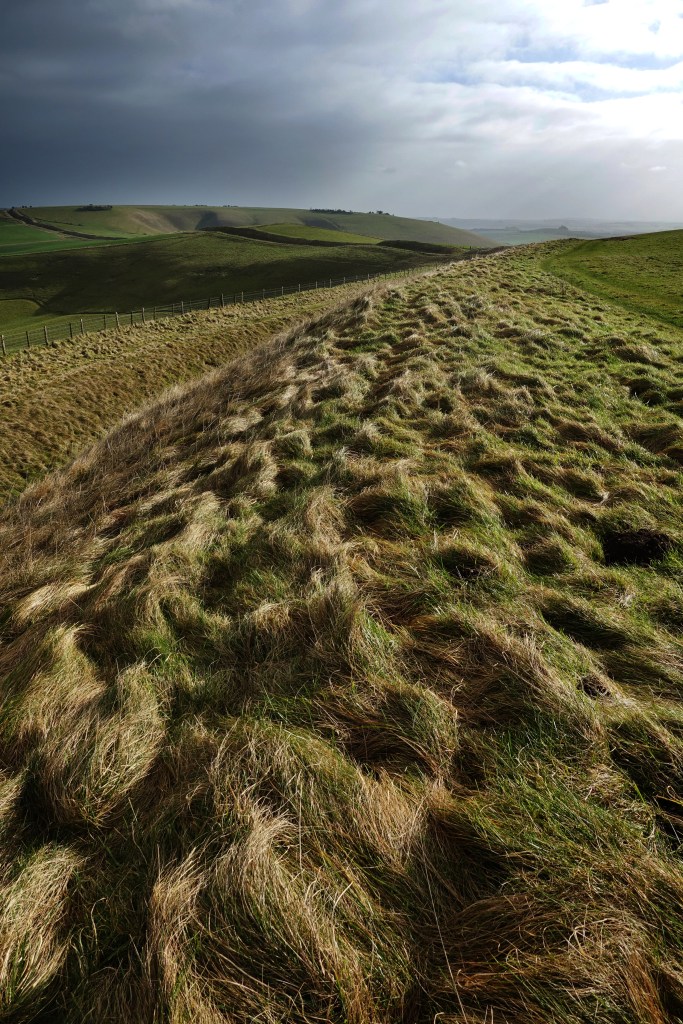
A little after crossing the A4 the route then heads E until it meets a metalled road where it turns S again as the route begins to rise, passing the West Kennet Long Barrow on the right, a neolithic burial chamber. At the 1.5 mile mark the route becomes a bridleway heading SW as the broad sweep of big skies, flint-strewn farmland and downs begin to fill the view. The views improve as the route continues its gentle ascent for the next 2 miles, the swelling downs and its features coming into focus until at 4 miles you meet the amazing Wansdyke which can be walked in its own right. Originally a 35 mile long defensive earthwork of large dyke and parapet form running east to west that snaked through Wiltshire and Somerset, it was probably constructed after the Romans left Britain as a defence against invaders from the north, possibly the Saxons. Being high on the ridge and spared the plough, this stretch of the dyke remains quite intact.
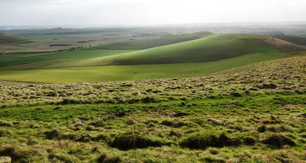
Top: Wansdyke, looking SE over the Vale of Pewsey and the Pewsey Downs.
Bottom: Looking South from the ridge over the hill fort of Rybury and the Vale of Pewsey.
The route climbs Tan hill where there are excellent views to the S across the Vale of Pewsey towards Salisbury Plain and Rybury hill fort, before cutting back roughly E, joining the dyke and ditch for the next half mile. The dyke made a decent wind shadow giving us a chance to have a break on the grassy slope to take in the scene out of the hoolie at the halfway point. At 5 miles there are options, with routes to the W along the dyke and S towards Milk Hill picking up the Ridgeway LDP – both of which link up with paths heading back to Avebury. Our route joined the White Horse Trail heading NE for the next 2.5 miles on a long descent; Skylarks, Yellowhammers and deer logging our progress through the the ancient, flinty landscape, the sound of the A4 growing as it follows the Kennet river valley.
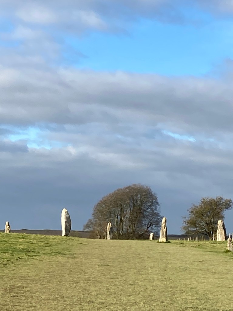
At nearly 8 miles the path meets the small metalled road used earlier and turns right to the N before reaching the A4 where the the route turns right E, there are decent verges to walk on for the short stretch before crossing the road to join a small B road heading NW before entering the amazing neolithic Stone Avenue, via a gate into the site. Originally there were around 100 pairs of sarsen stones creating a 1.5 mile long avenue leading to the massive stone circle of Avebury but only 27 remain, most having been torn down and broken into fragments for building material.
At 9 miles the route reaches the unique village of Avebury, a World Heritage Site, much of which is built within the most complex of Britain’s surviving neolithic henge monuments, the banks of which were once 55 feet in height, a third of their height today, above what was originally a 30-foot ditch. The massive stones form the largest stone circle in the world, measuring 330m across, originally comprised of around 100 huge standing stones, of similar age to Stonehenge, the bright white chalk sides of this immense surrounding structure (and the other large earthworks in the area) would have made it a luminous beacon in the landscape. Within the picturesque complex of barns of Avebury Manor and gardens there is a National Trust cafe (open Wed-Sun, 11.00am-4.00pm) and small museum. The barn is a grade I listed marvel. From here you can walk through the churchyard back to the high street where there is a cut through to the car park and a little further along a small village shop.
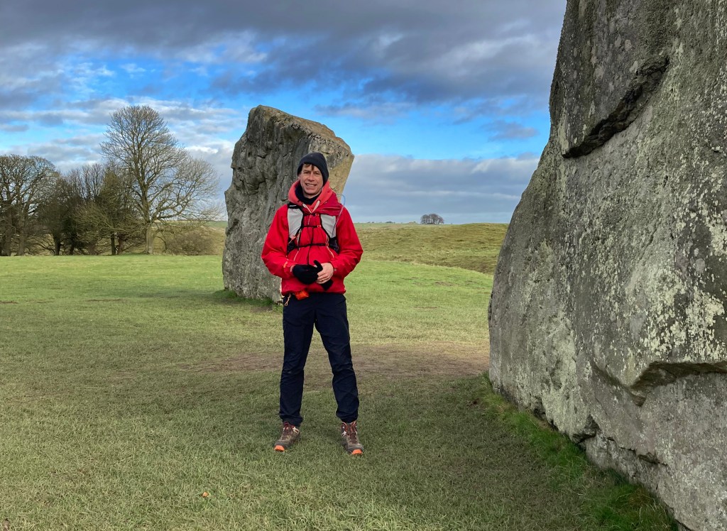
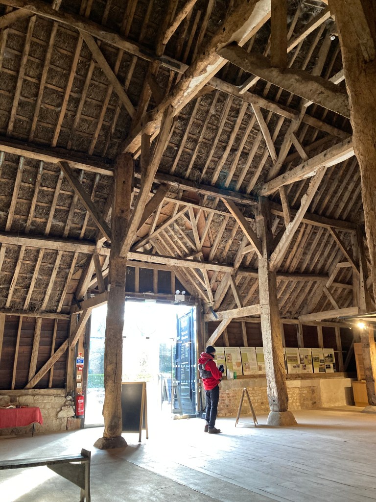
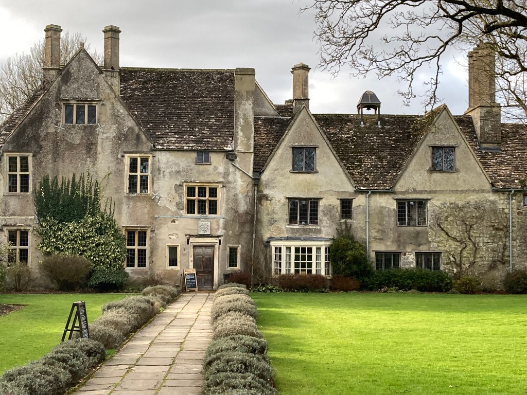
Clockwise: Dom, my walking mate, in the stone circle at Avebury – The Stone Avenue – Manor Barn -Avebury Manor.
The pleasure of this area is the excellent network of footpaths and byways enabling exploration of this dramatic downland scenery and the physical evidence of the neolithic world. We spent about four hours walking the route but there is so much history to explore the unique historic monuments in the landscape while walking through one of the country’s most magical landscapes.
It is less than ideal that agriculture abuts many of these important sites leaving little space to walk freely – access understandably confined to linear routes through the landscape given current land use. While the intense agriculture provides pattern to the landscape, some years ago a pesticide spillage possibly as run-off, into the river Kennet had a drastic effect on its biodiversity. One can hope that with a change in our attitude to the grass chalkland landscape, agriculture and biodiversity, not just here but in Sussex, Dorset and elsewhere, we can return the landscape to a more sustainable and hospitable environment for flora and fauna with less intensive farming and more wild space of chalk grassland where native species can be given the opportunity to thrive and users can develop a better appreciation of our natural world.
Farming practices can have an almost immediate impact. To quote the RSPB: “In the UK, the Skylark population halved during the 1990s, and is still declining. In the preferred habitat of farmland, skylarks declined by 75% between 1972 and 1996. The main cause of this decline is considered to be the widespread switch from spring to autumn-sown cereals, which has resulted in a dramatic reduction in the number of chicks raised each year.”
The 2019 State of Nature Report also provides cause for concern: “Since the 1970s, it has been shown that 41% of all UK species studied have declined. Some groups are faring worse than others. For example, 26% of the UK’s mammals are at a very real risk of becoming extinct, while 22% of seabird species studied have declined in the last five decades. On a species level, the figures are even more shocking. Since the 1950s the number of hedgehogs have declined by 95%, while turtle doves have crashed by 98% and even numbers of the common toad have fallen by 68%.”
There is some hope and transformation is possible. The RSPB have reverted 24 hectares of arable farmland to Chalk Grassland at Manor Farm in Wiltshire while The University of Manchester is researching how best to regenerate our chalk grasslands, 80 percent of which have been lost since 1945. At the same time the National Trust has said it wants to address the “dramatic slump” in wildlife by creating and restoring 25,000ha of habitats – equivalent to 10% of its land. It’s a start.
The Marlborough Downs Nature Enhancement Partnership is a farming led group “Making Space for Nature on the Marlborough Downs”. Clearly there needs to be a collaborative approach to the issues impacting the natural world and where farmers and landowners are working towards a reversal to species decline there is a model that can be applied elsewhere in the UK.
Links to conservation info and a few of the organizations helping to preserve, maintain and reinstate chalk grassland:
Plantlife
Magnificent Meadows
Royal Society for the Protection of Birds
The National Trust (Wiltshire)
The National Trust (What’s so special about chalk grasslands)
The Wildlife Trust (Wiltshire)
Pewsey Downs National Nature Reserve

One thought on “‘Avebury circuit’ – walk, Wessex Downs, Wiltshire”