Reflections on backpacking, walking, places and gear
Author: SLondon
I rediscovered the joy of walking in my early 50s having done little execise of any note since my early 20s. I have been lucky to be able to find insights, help, tips, opinion and reviews online and I also want to share my thoughts on places I have been and kit both good and bad.
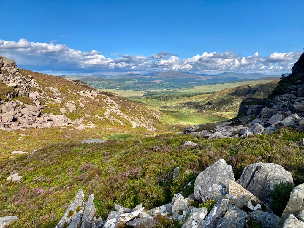
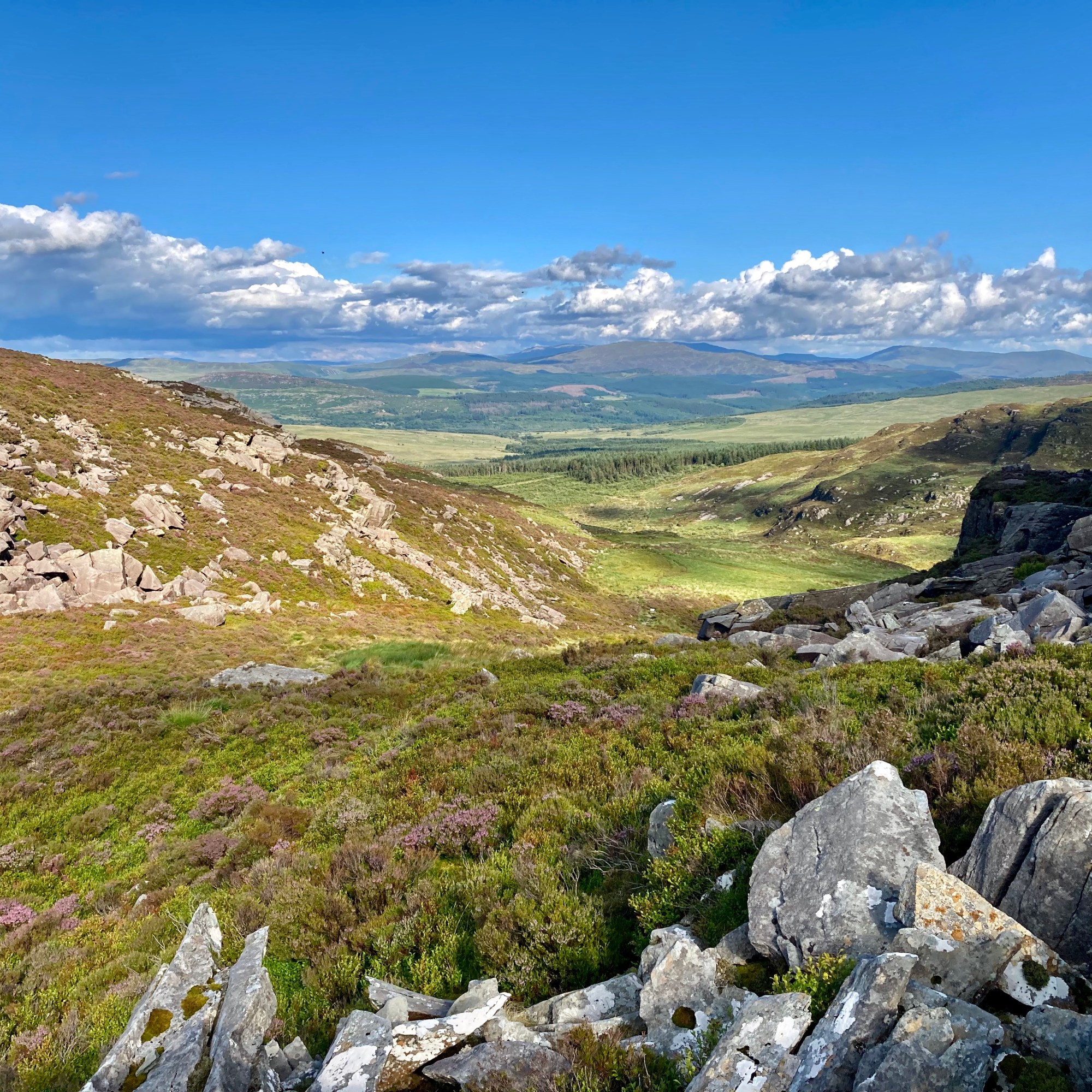
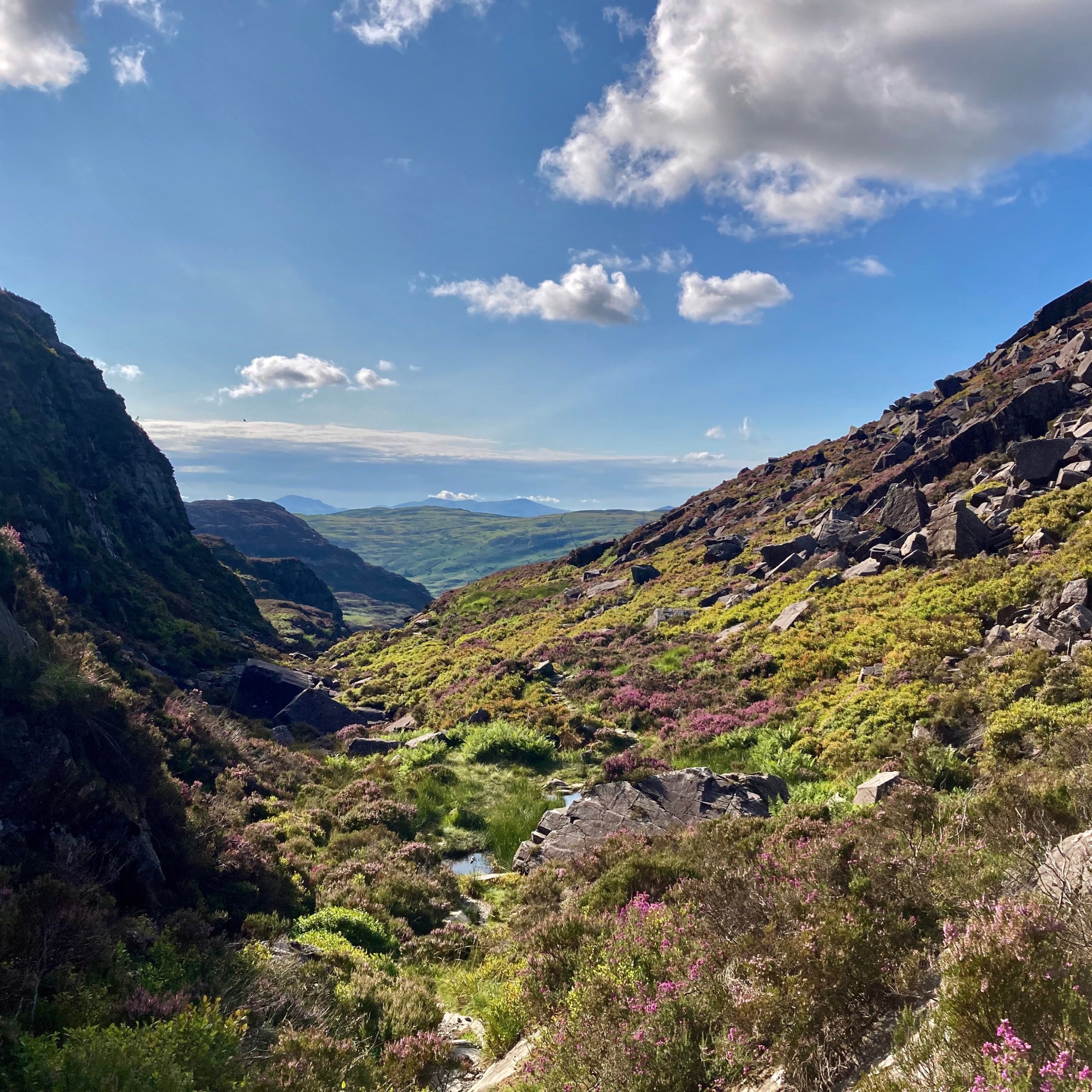
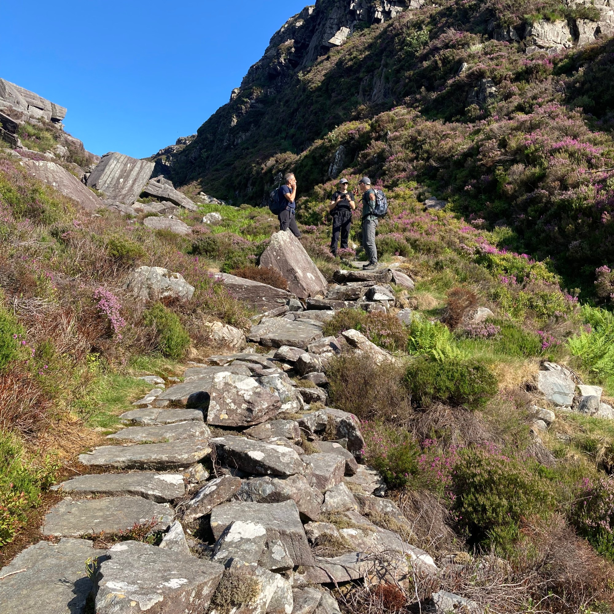
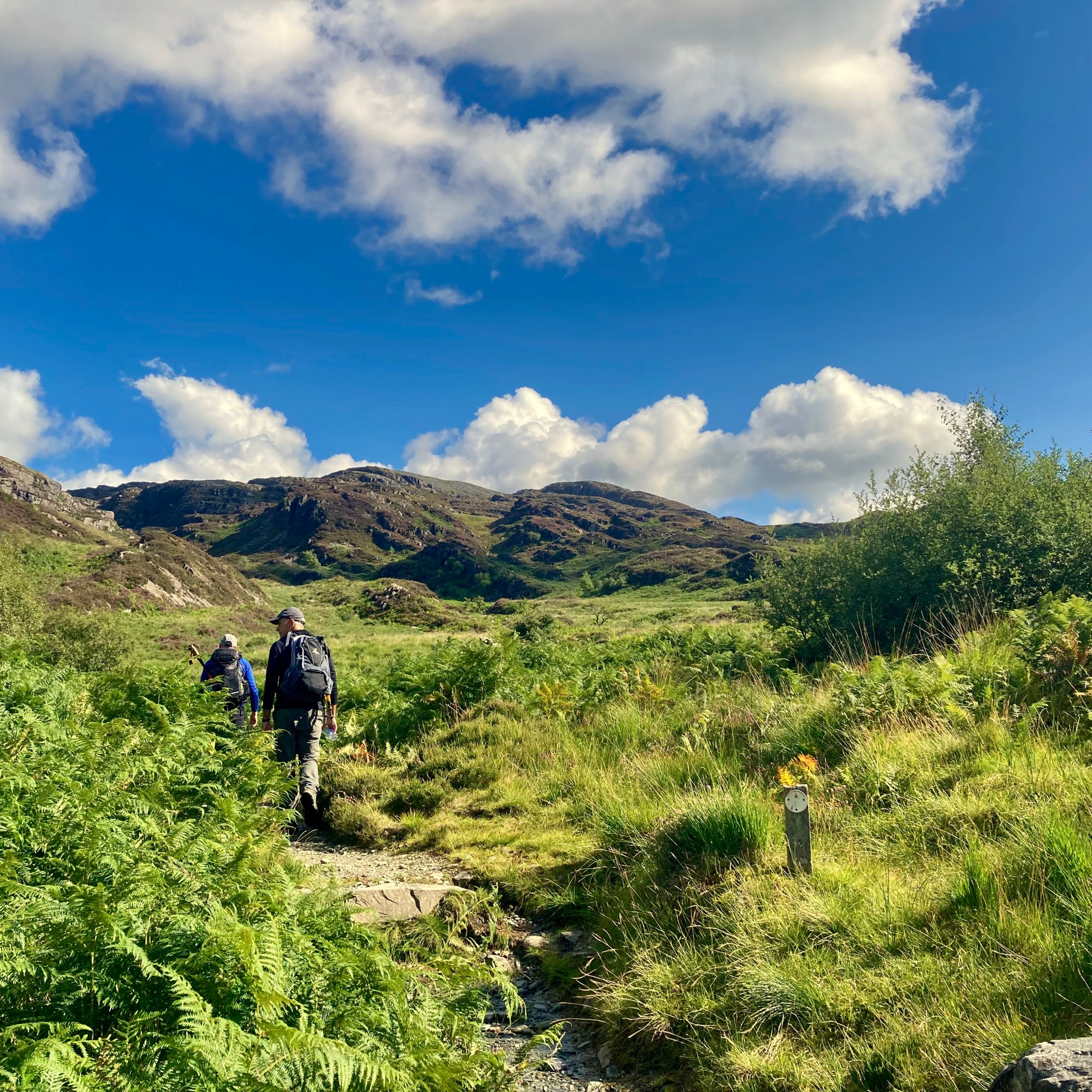
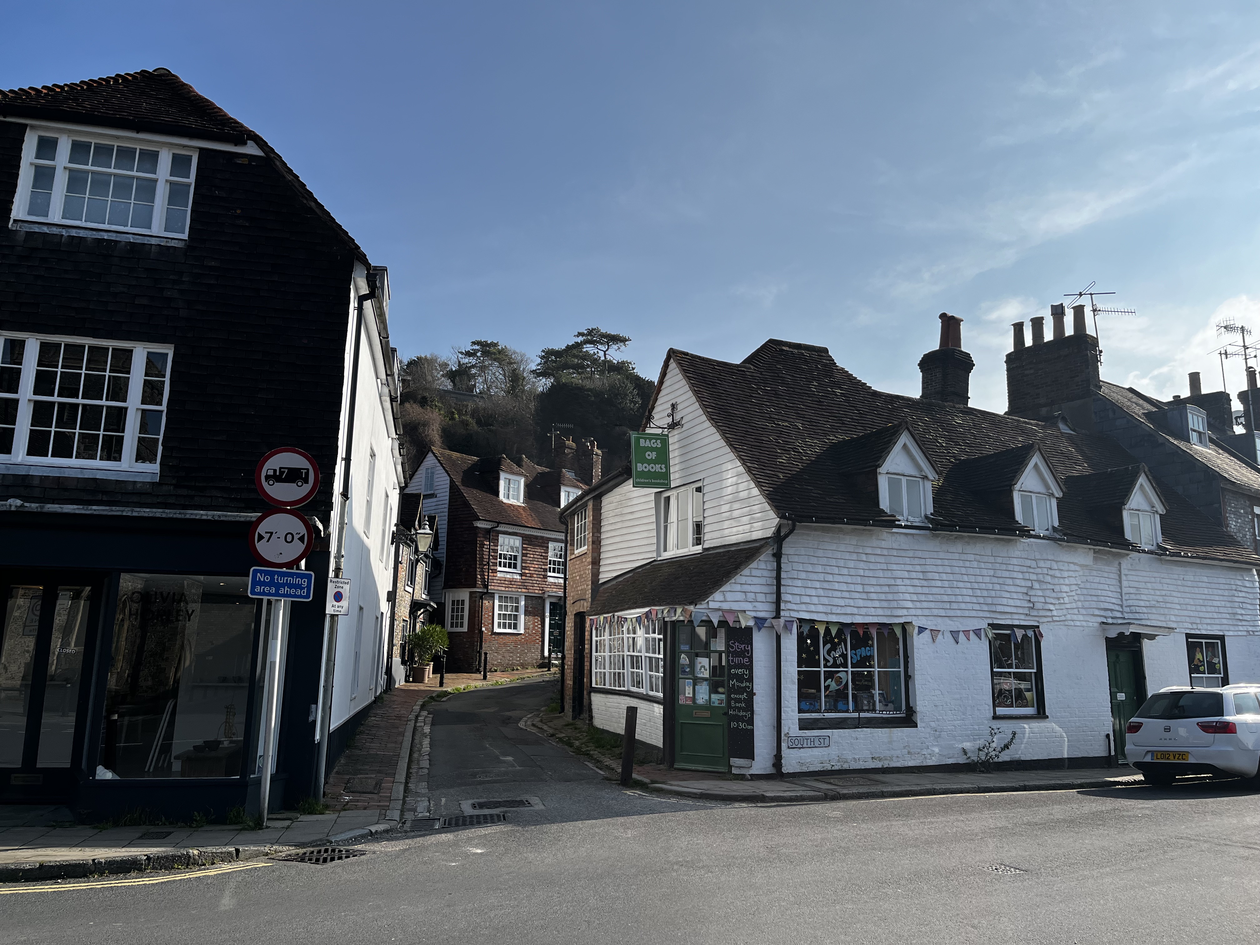
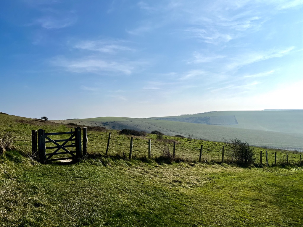
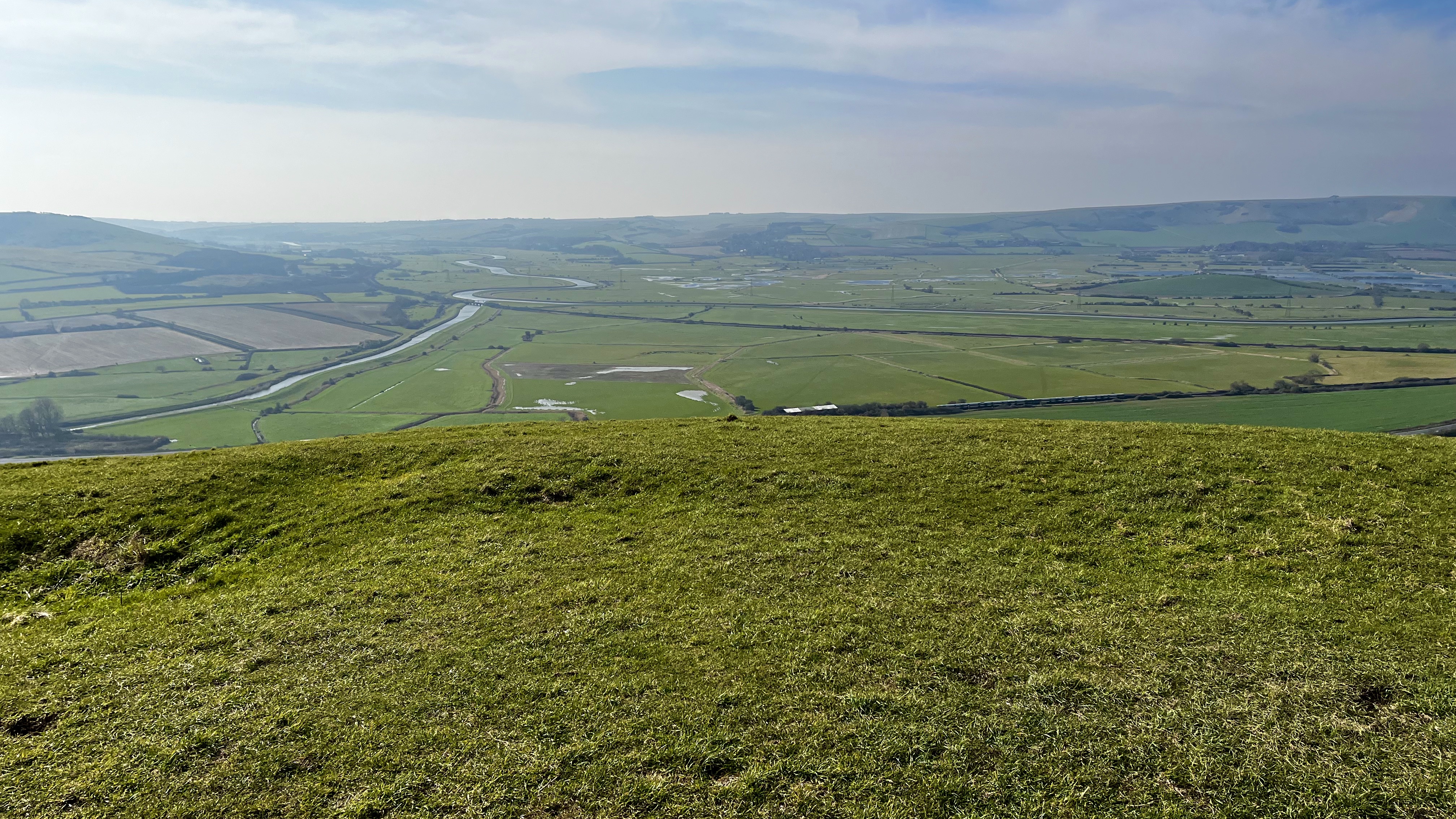
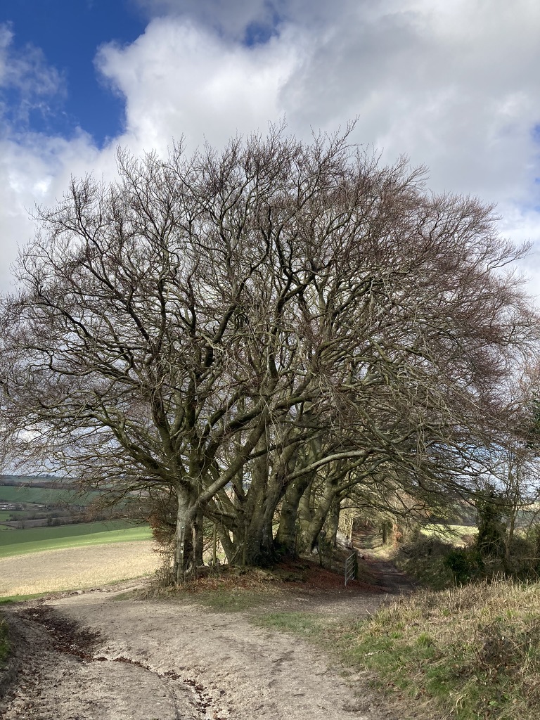
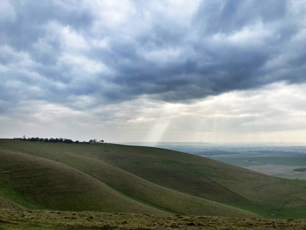
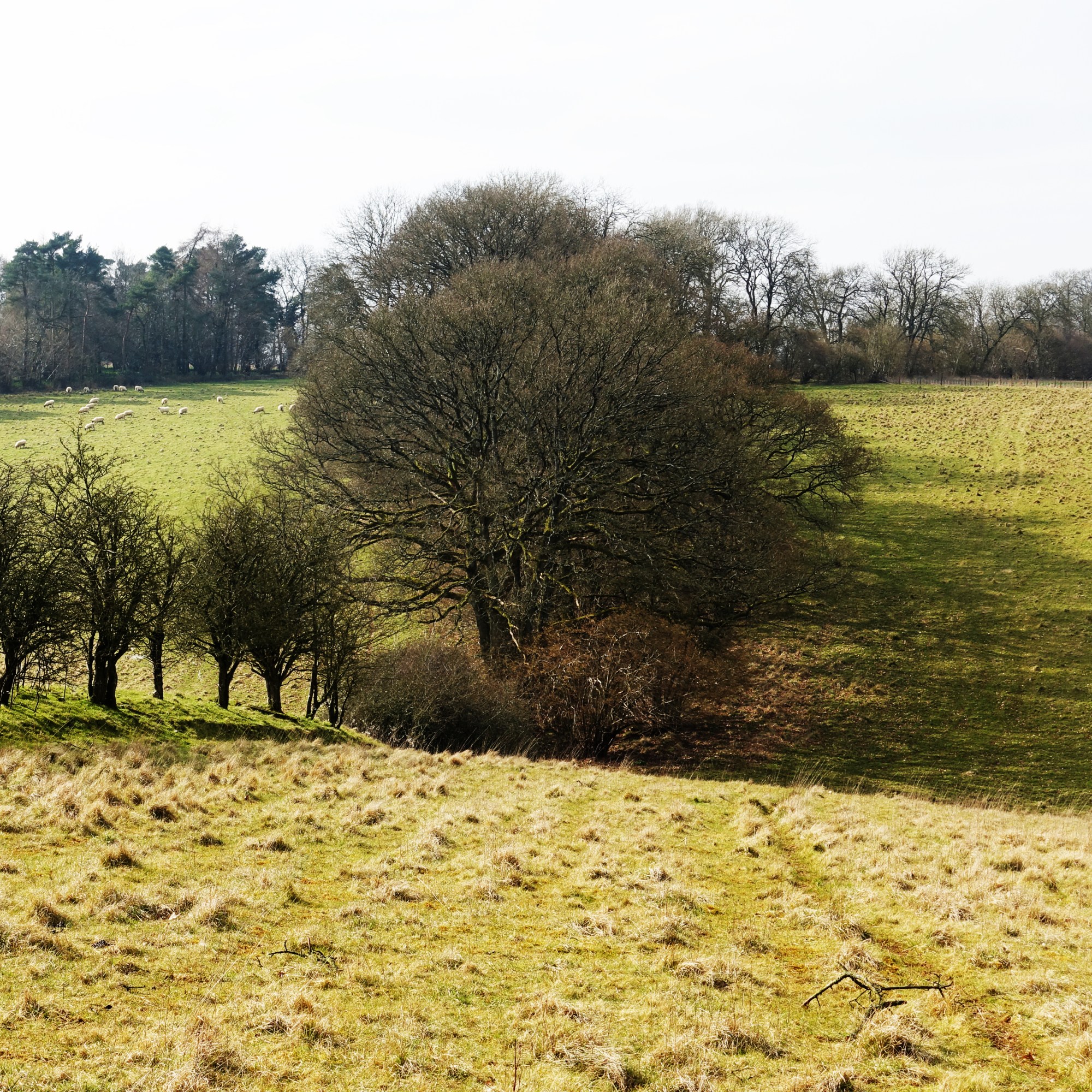
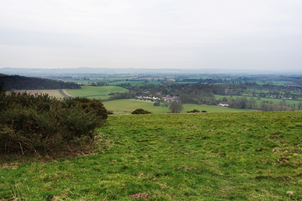
On arrival for our short trip to Snowdonia for our walk up Cadair Idris, we dumped our gear at our accommodation and given the perfect weather, decided on an early evening walk into the Rhinogydd mountains via the ‘Roman Steps’, remnants of a medieval structure built as a packhorse route through Rhinogydd. In all a 4 mile in/out trip, a steady climb of 1000 ft from parking at Cwm Bychan (£3) overlooking Llyn Cwm Bychan (map at bottom), a large lake with an area of grass and spartan campsite (£5 pp per night) and a truly beautiful setting. The journey from Barmouth took about forty minutes, the last leg on ever smaller single track roads through stunning country.
Starting at the southeast corner of the field through woods following the Cambrian Way, southward ish towards the Roman Steps. The views open up as you leave the light wood as the path rises over a packhorse bridge up the steps towards the head of the pass. We all agreed this was the most beautiful country for walking, more verdant than we had expected and visually stunning. The route is simple and quite easy. Sadly we only had enough time for a short sprint up to the head of the valley with astounding views to the east across the national park where we lingered for a while then back to the car. We agreed this would be a dream to come back to camping by the lake below. To quote W. Shakespeare: ‘I like this place and could willingly waste my time in it.’ We can’t think of a better place to do just that.
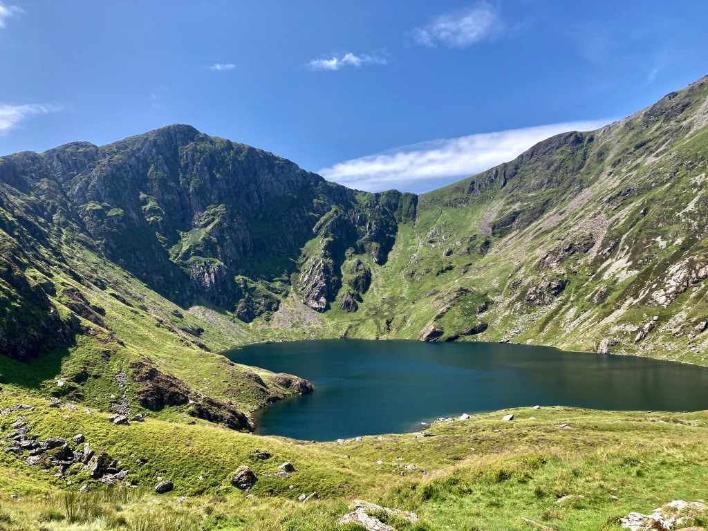
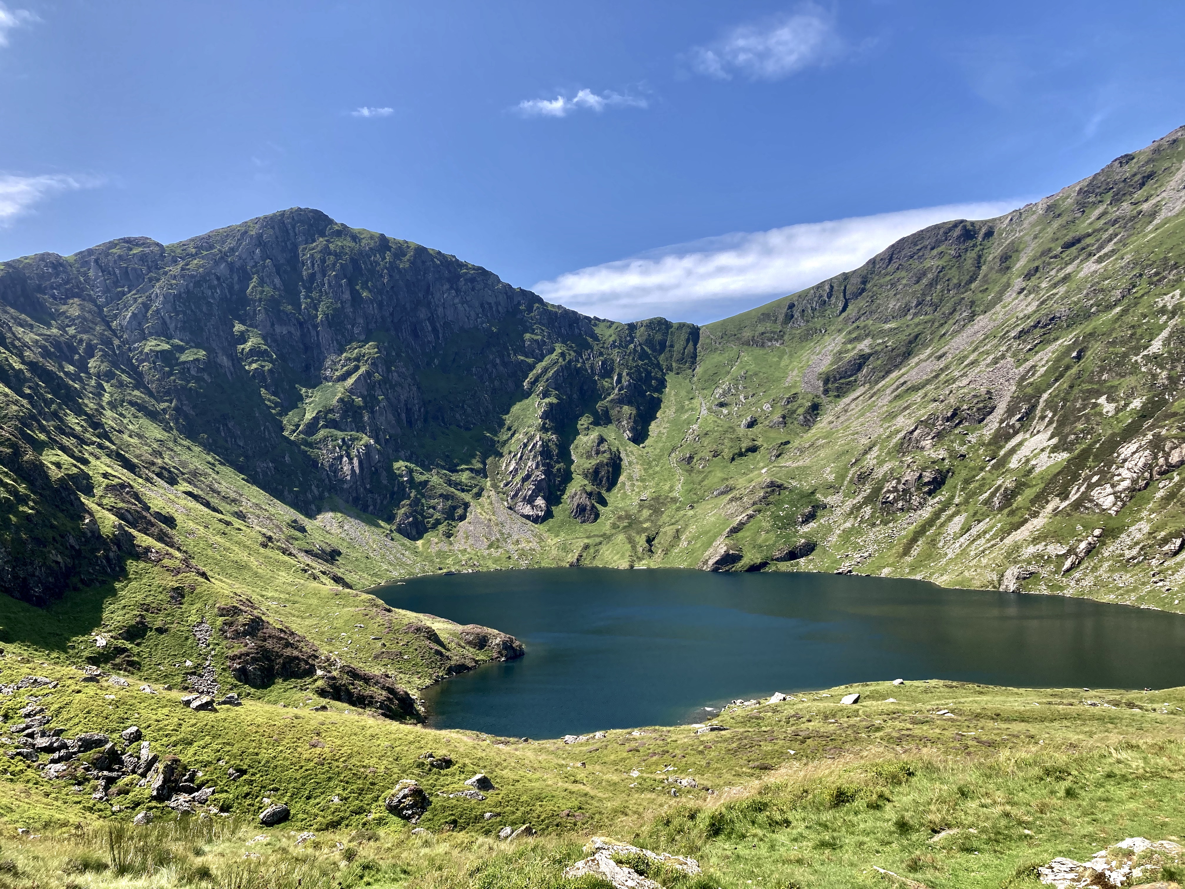
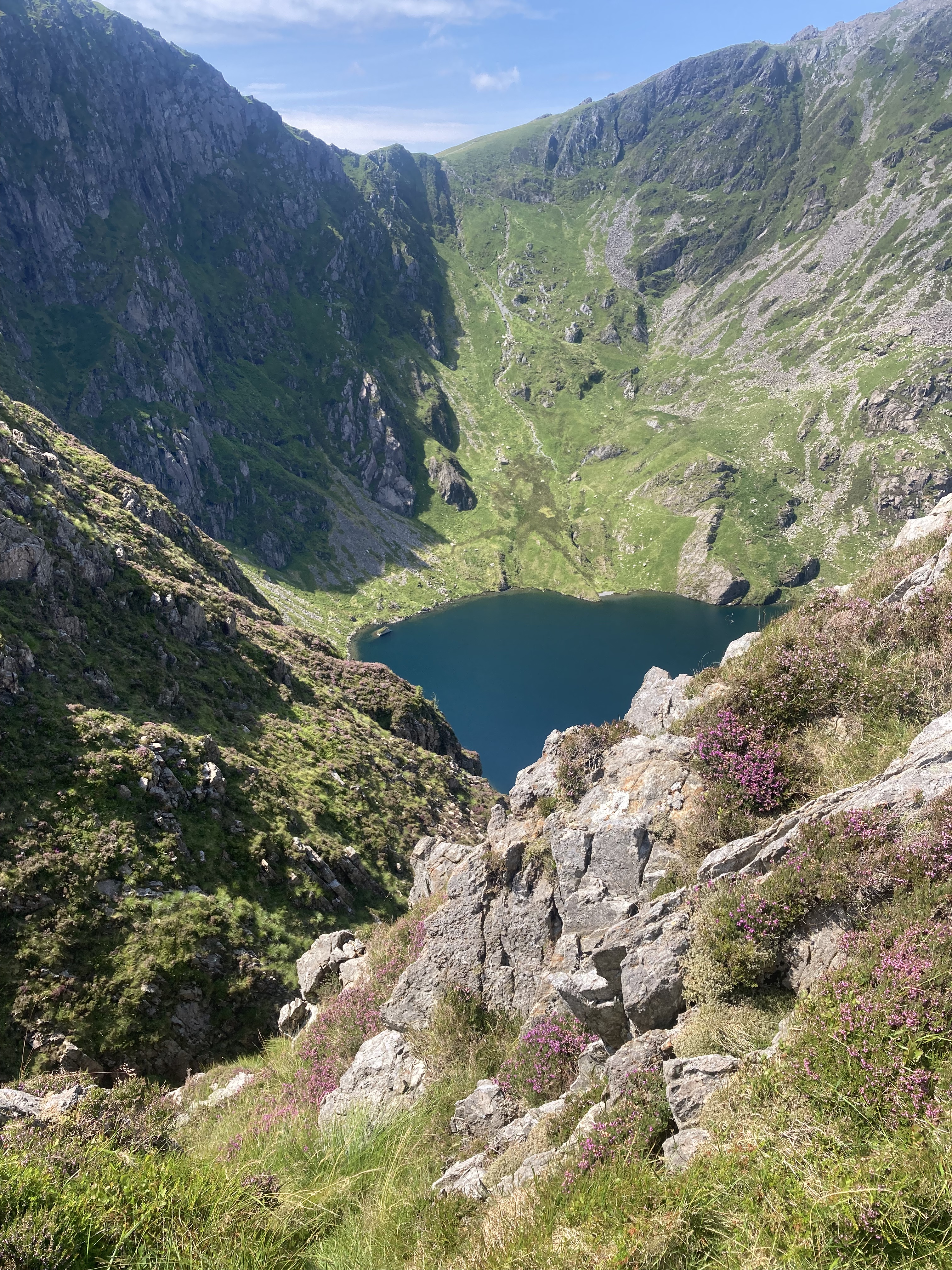
LLyn Cau as the path heads south and climbs around the corrie
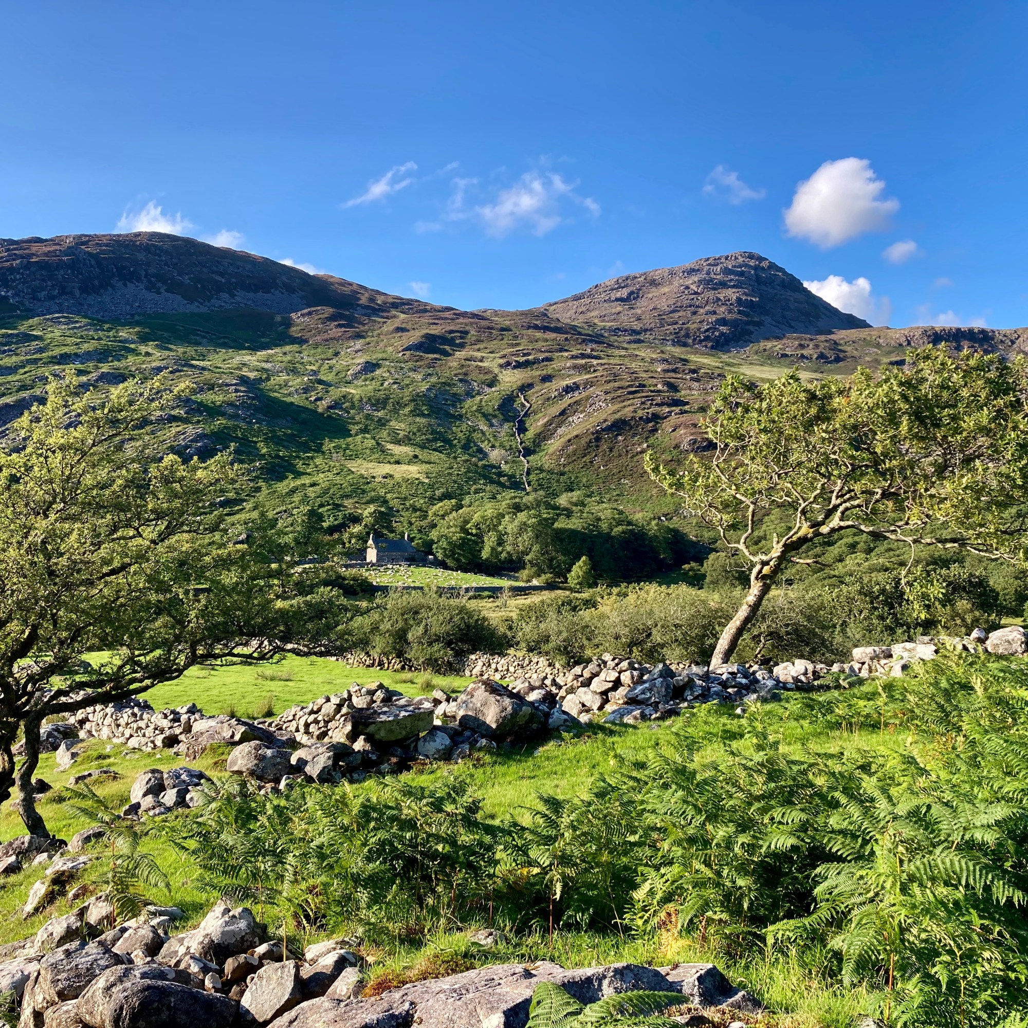
My walking friends and I talked about climbing another big mountain having walked Pen y Fan some years ago. I’m less keen as I’m the oldest, least fit and as the one who has planned most of our trips across the relative gentility and safety of Dartmoor, the Black Mountains or South Downs, so the prospect of a major hill was a little daunting – particularly given the vagaries of UK weather. But the consensus was for a weekend in July for the best likelihood of a sunny, dry trip and Snowdonia in North Wales as our playground for the weekend, specifically with our sights on Cadair Idris/Penygadair as it’s quieter than Mount Snowdon. We based ourselves in the seaside town of Barmouth which has a great coastline, views of the looming mountains, pubs, supermarket and fish and chips. On arrival we had a late afternoon stroll in the Rhinogs, which gave us a taster of the wonderful walking in Snowdonia.
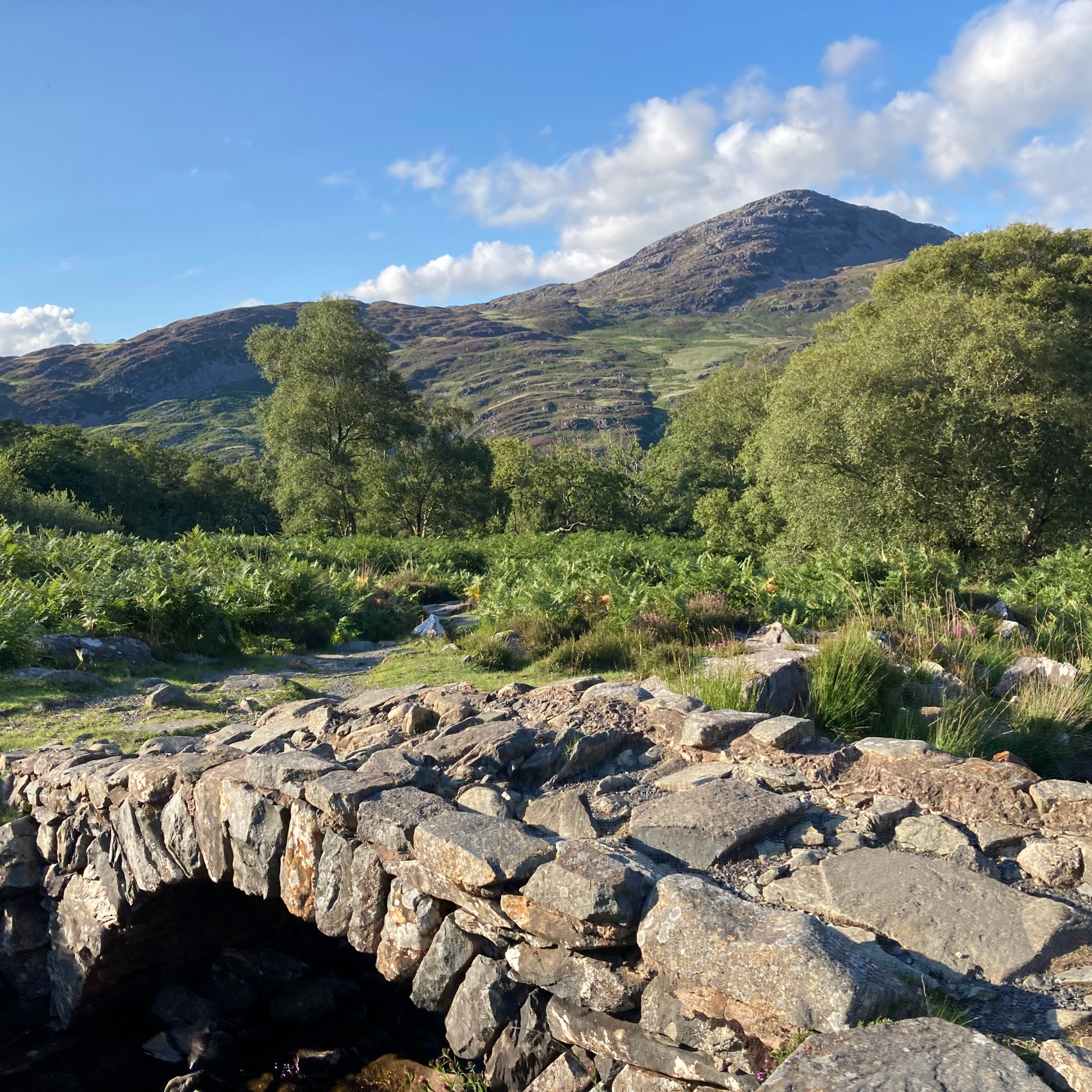
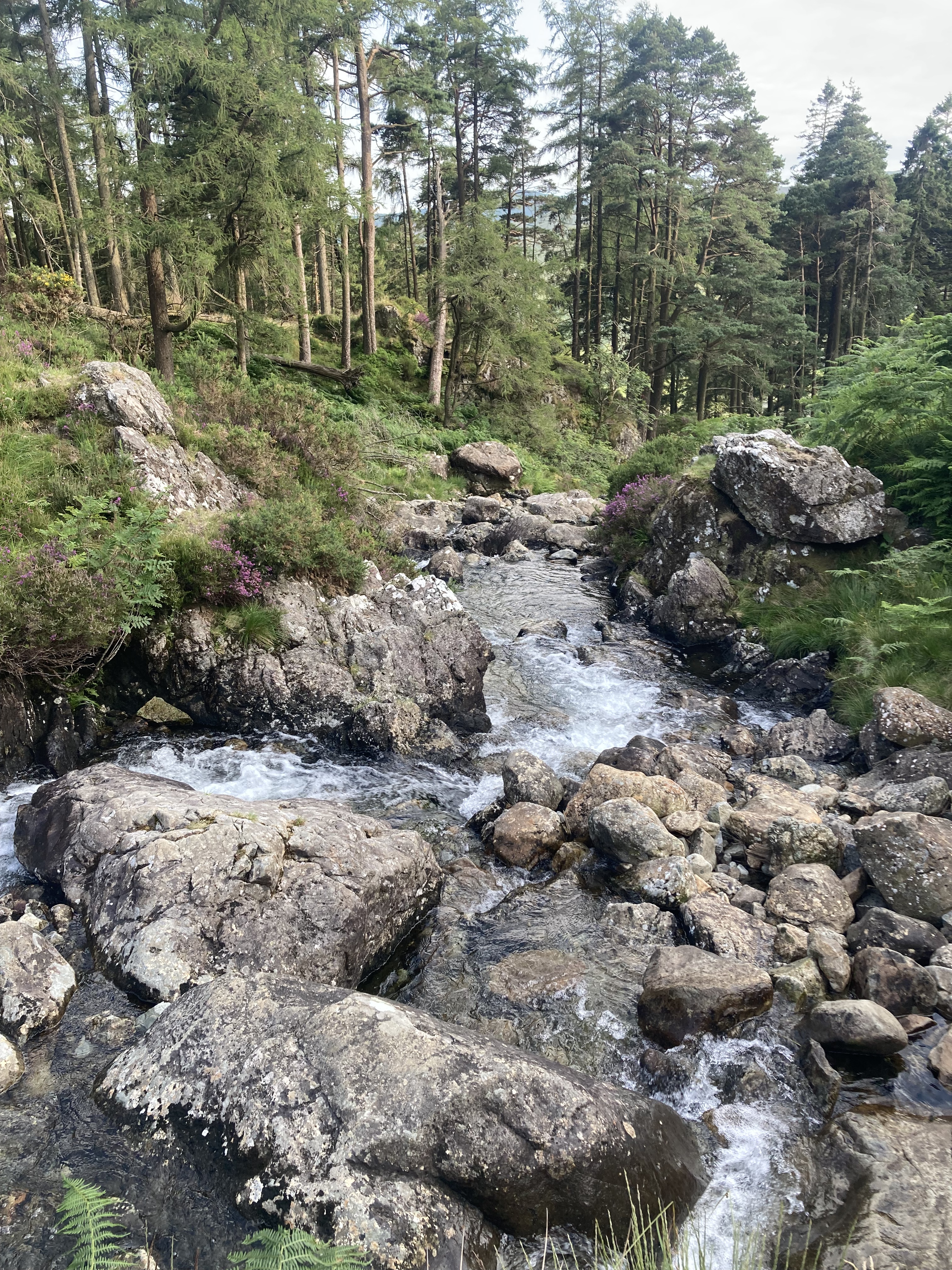
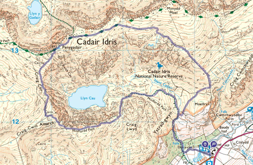
The forecast was for perfect weather as we left Barmouth after breakfast next day with packs as light as possible, intending to park in the Lay by east of the walk on the on the A487 but this was populated by a gaggle of oversized camper vans who saw this as their domain for a few days and together with early arrivals there was no parking, so we headed for the capacious Visitor Centre car park (with loos) at the foot of the mountain (map below) and revisited our route, on reflection, a good option as it is from here that the iconic Minffordd Path starts, which follows the course of a tumbling mountain stream through stunning pine woods up a great many steps before the open uplands below the summit.
Clockwise from top left: Looking back down the stream. LLyn Cau as the path climbs to the south. Looking east from the grit path above LLyn Cau. The trig point at the summit with Barmouth Estuary in the background. LLyn Cau seen through gaps in the cliffs as you climb around the corrie.
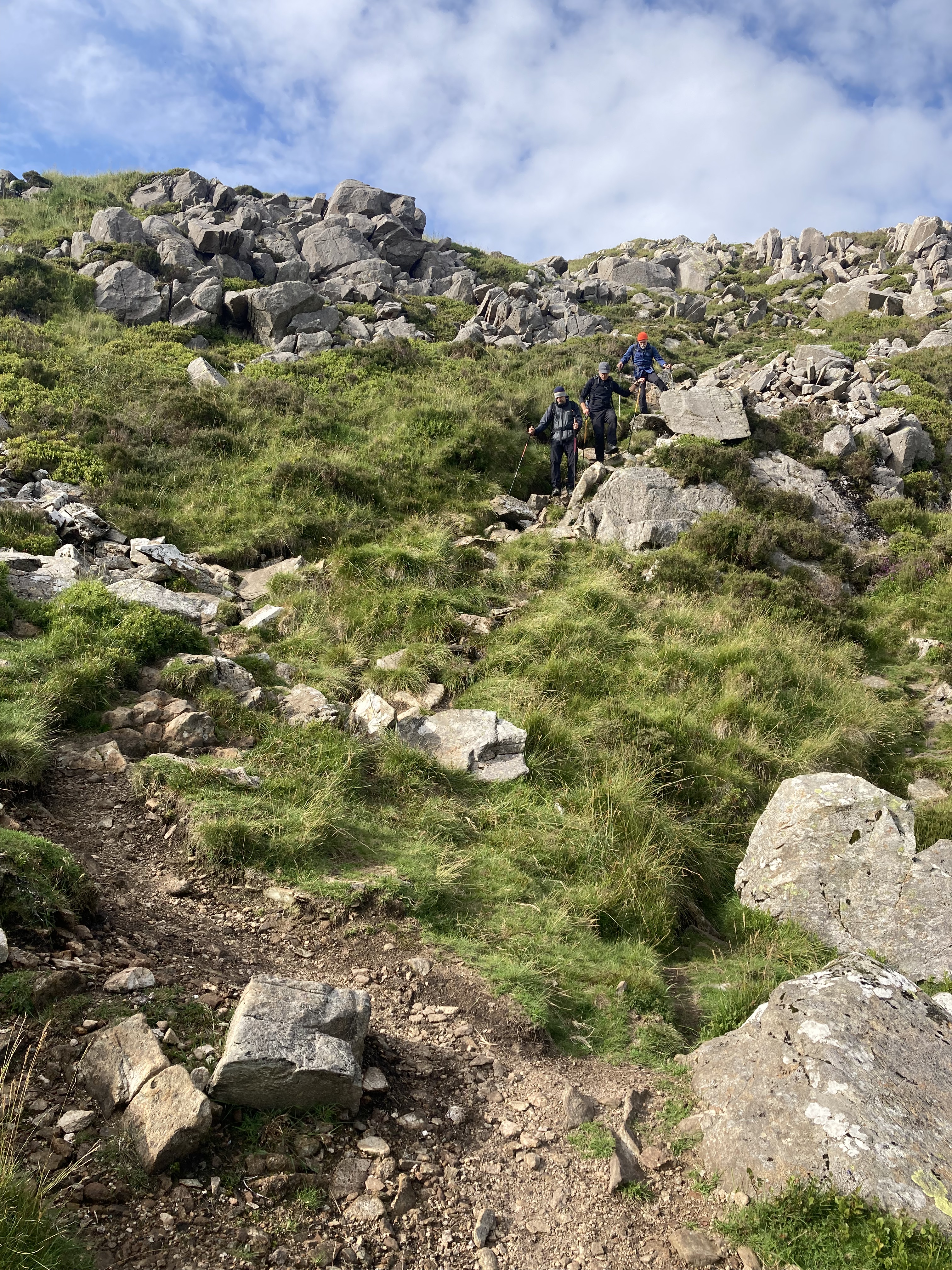
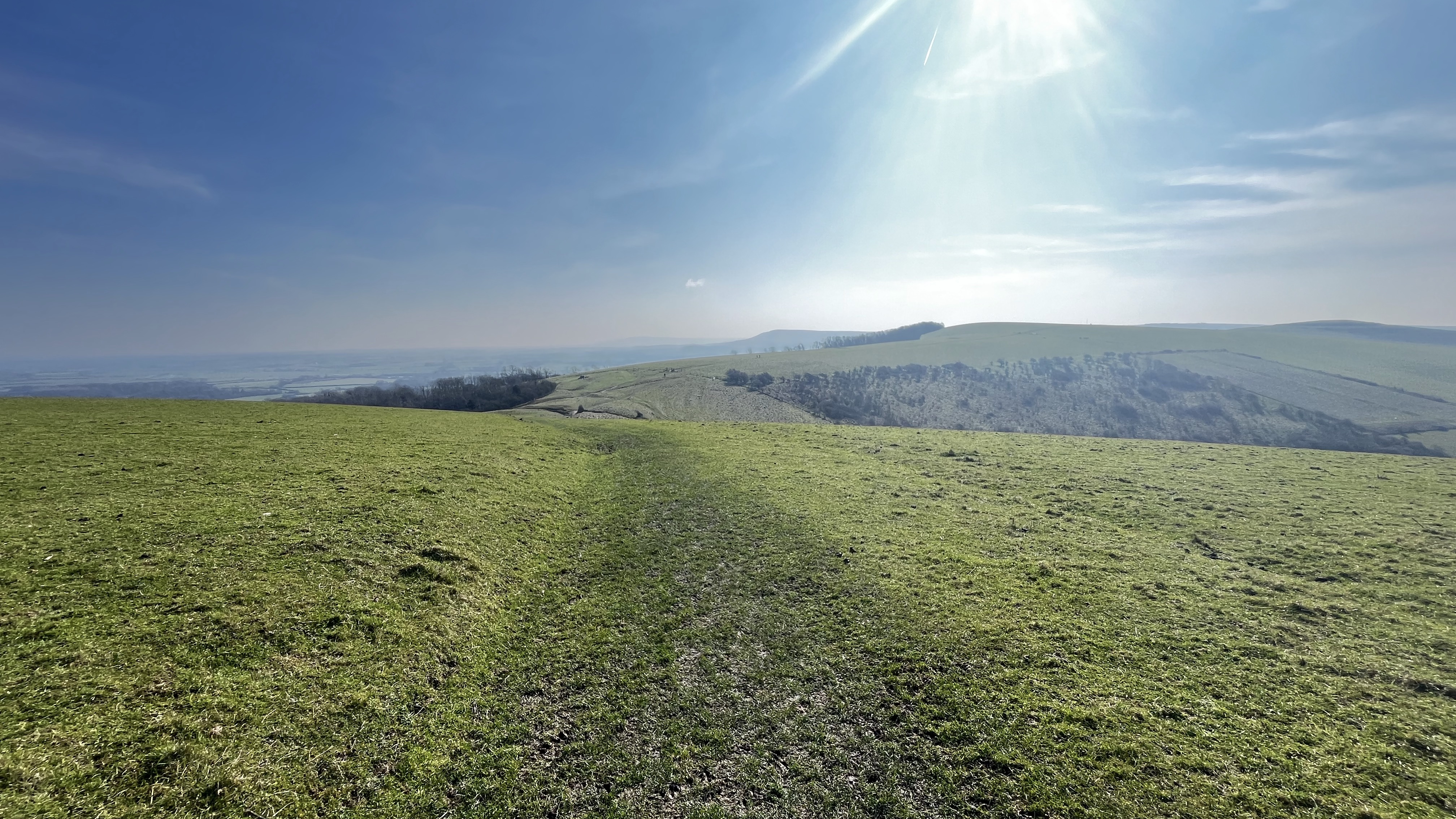
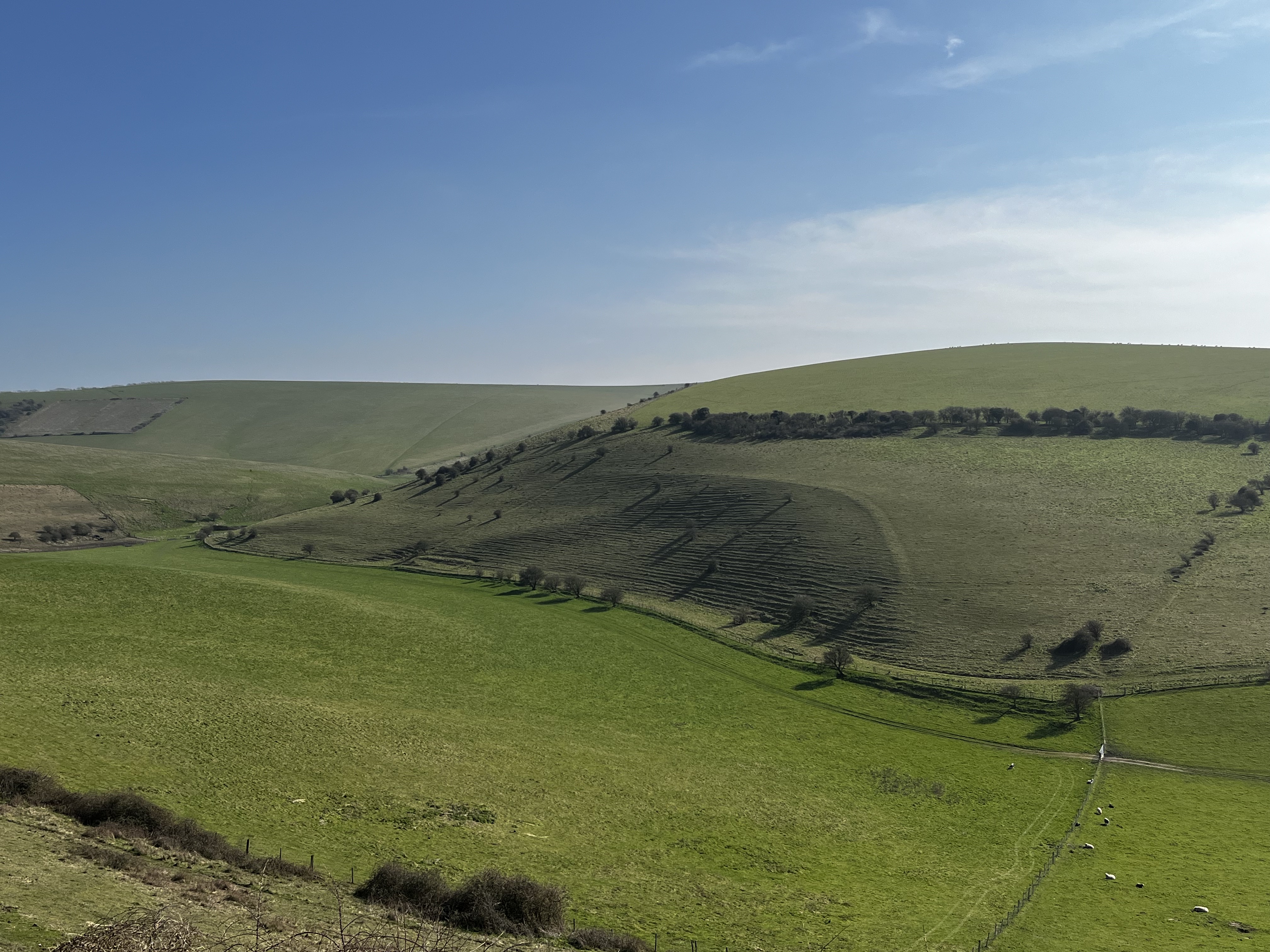
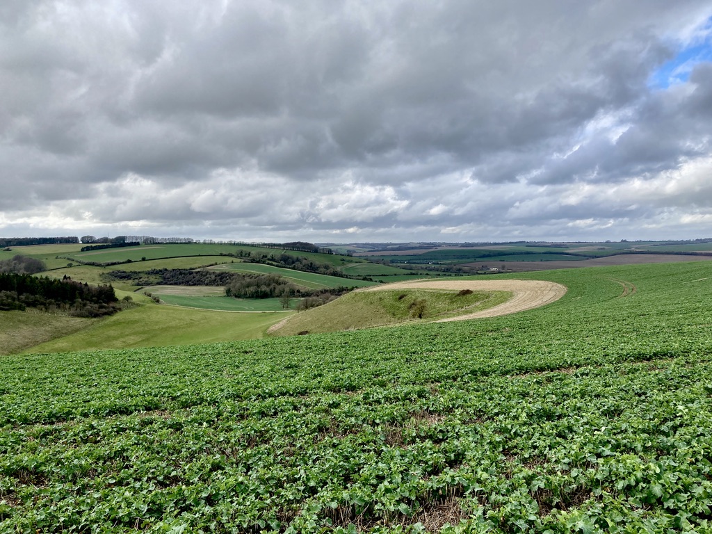
It’s a 700ft climb heading north before view opens up and the route leaves the stream, the path relatively easy grit/grass as you head west toward LLyn Cau, a water filled corrie under the looming flanks of the mountain’s peak. The path climbs to the south and up, then to the west, ever climbing at the same rate, round LLyn Cau as fabulous views to the south and east are revealed. We took a break here and had tea as, while we had only travelled about a mile and a half, we had climbed 1500 ft, half the overall height of the mountain. RAF jets cruised below us practicing their low-level skills through the valleys – amazing to see. Besides, we had all day and wanted to enjoy the views at leisure.
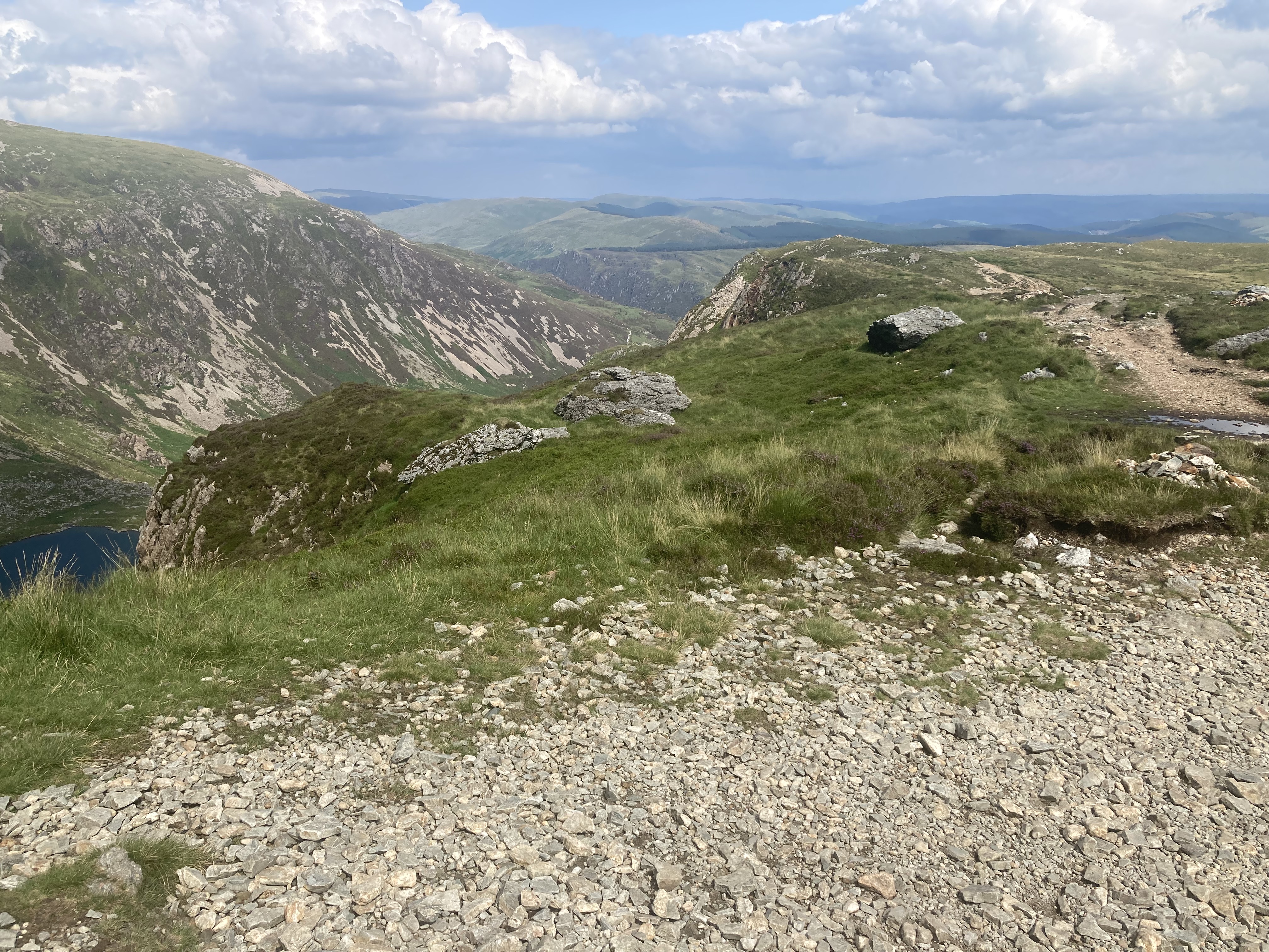
At Cwm Amarch the path climbs northward along the well defined route until the path becomes a lot rockier as you approach the summit. A last push and you reach the trig point from where the views are just pectacular. North you can sea the Barmouth estuary round to the tip of the LLeyn Peninsular, Snowdon and countless other peaks of mountains in the National Park. To the South all of Mid Wales is at your feet. There is a hut just below the summit which made for a pleasant break from the strong wind. We took in the sights, took photos, had lunch then headed east as we decided to make our route circular rather than retrace our steps. It was invigorating to be striding west across the level, grassy plateau, peak bagged, toward Mynydd Moel before bearing right along a small track heading south east which hugged the contours before descending a steep set of steps/path about a mile from the summit which was really hard going for about half a mile as you descend about a thousand feet. The path then takes a right south west along a fence/wall line heading back to the wooded stream and the steps back to the visitor centre and car park.
Clockwise from top left: The plateau looking east from the summit towards Mynydd Moel, our path bearing to the right. The steps on the descent which must have taken an immense effort to put in place. The steep track from the plateau to the steps. A break to absorb the views to the south before bearing right back into the valley, stream and steps. Looking back towards Cadair Idris from the descent.
Cadair Idris and a short walk in the the remote Rhinogs the day before made this one of our favourite trips. This is an iconic walk and we were really lucky to get the weather for the entire day. We were all kitted out but saw families making the climb with the bare minimum but even in July it was a hat and coat experience in the cool wind at the top. We agreed we wouldn’t consider attempting this in anything other than good dry, warm summer conditions with a long day key to the enjoyment, kit apart, particularly as the steep descent from the plateau as the steps/path would be treacherous in the wet. We would like to climb Cadair Idris again using the Pony Path to the North. All in all a fabulous day. Diolch/Thank you Cymru.
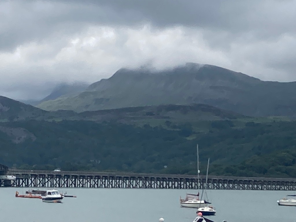
Cadair Idris from Barmouth the morning after our walk
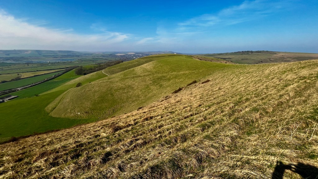
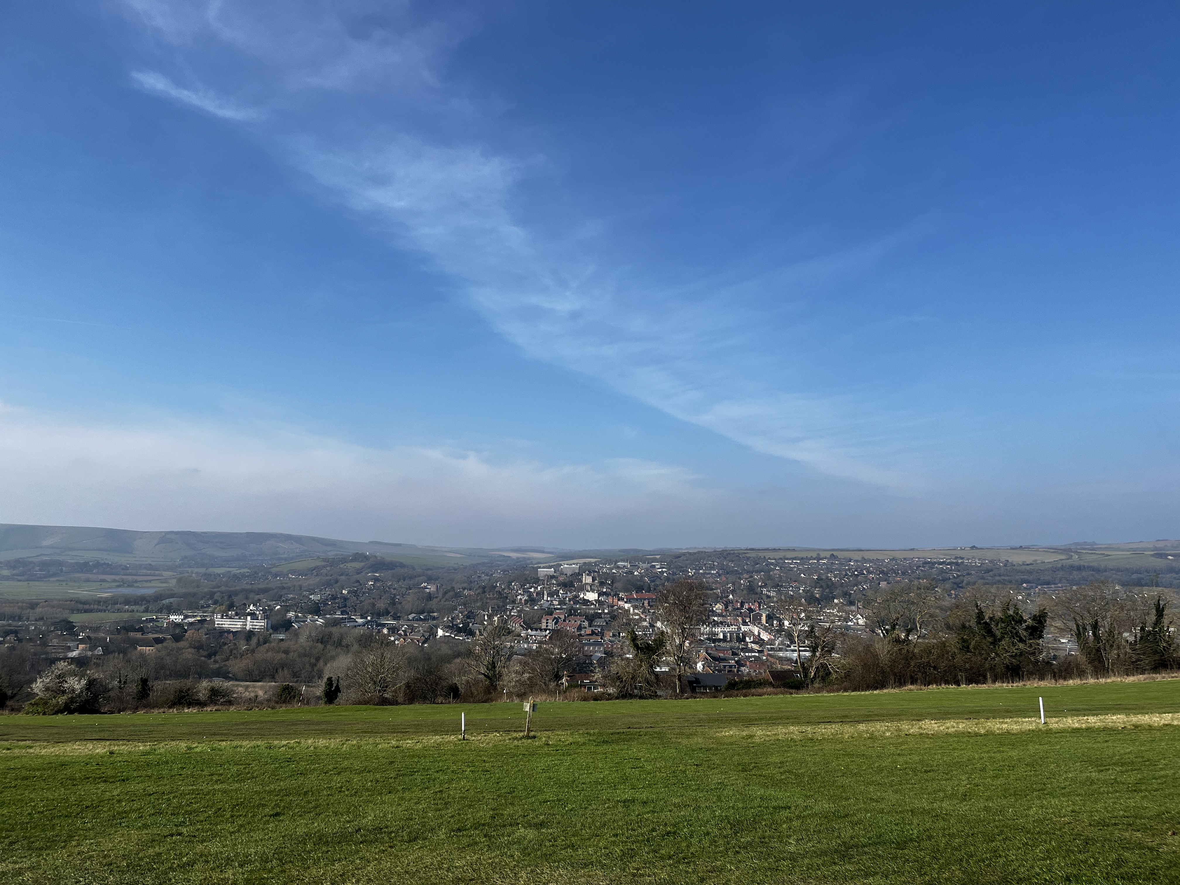
Looking south west acroos the Lewes Downs from Mount Caburn
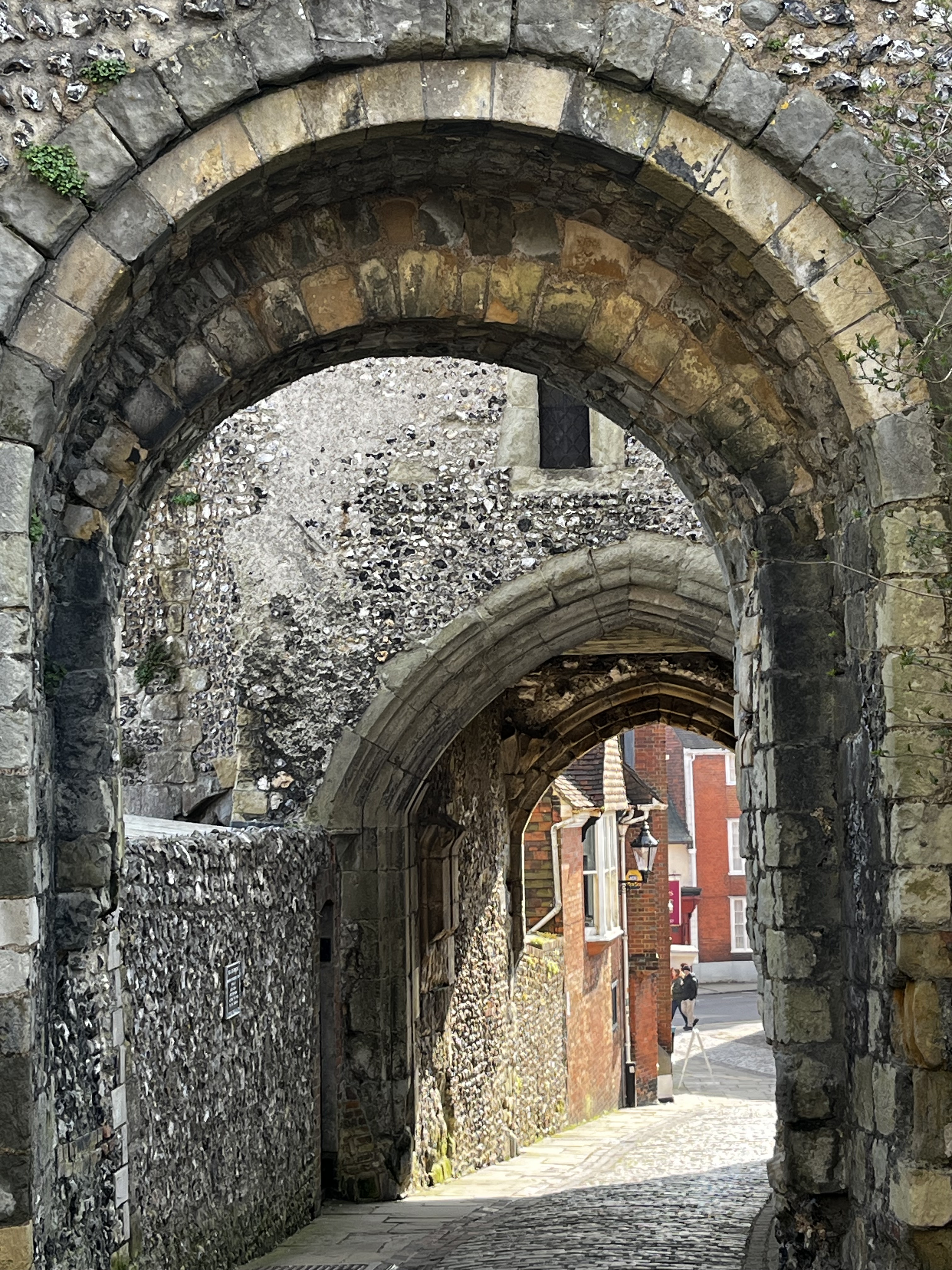
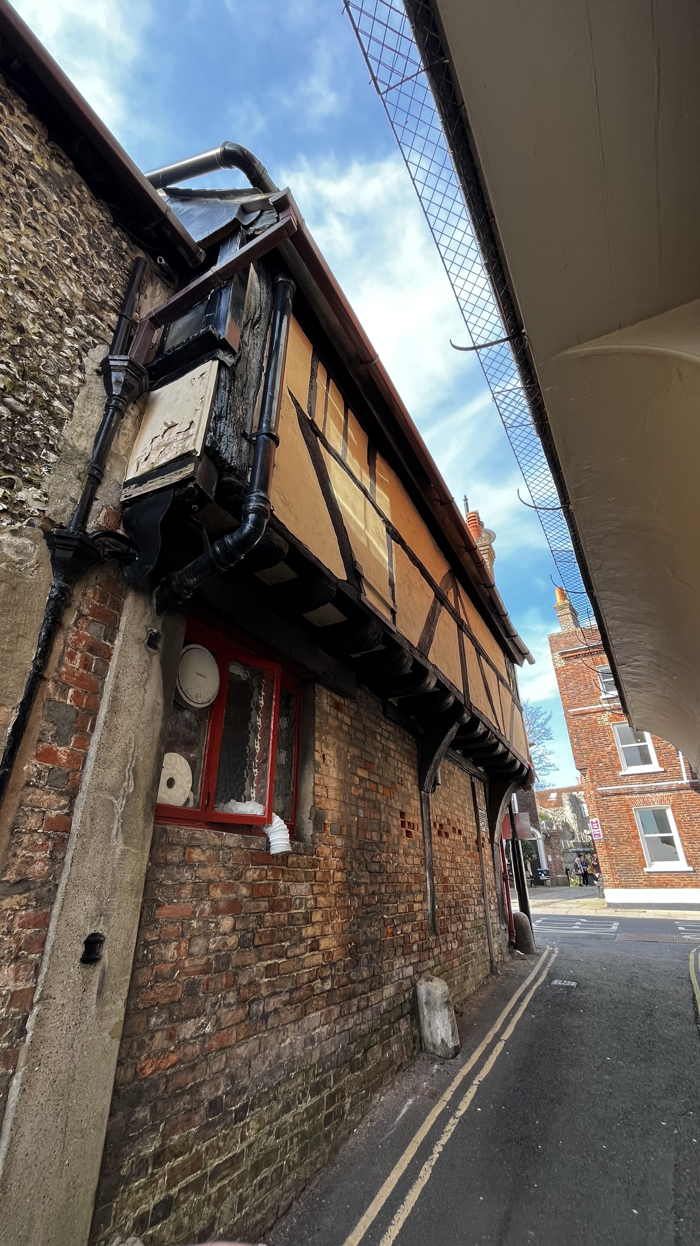
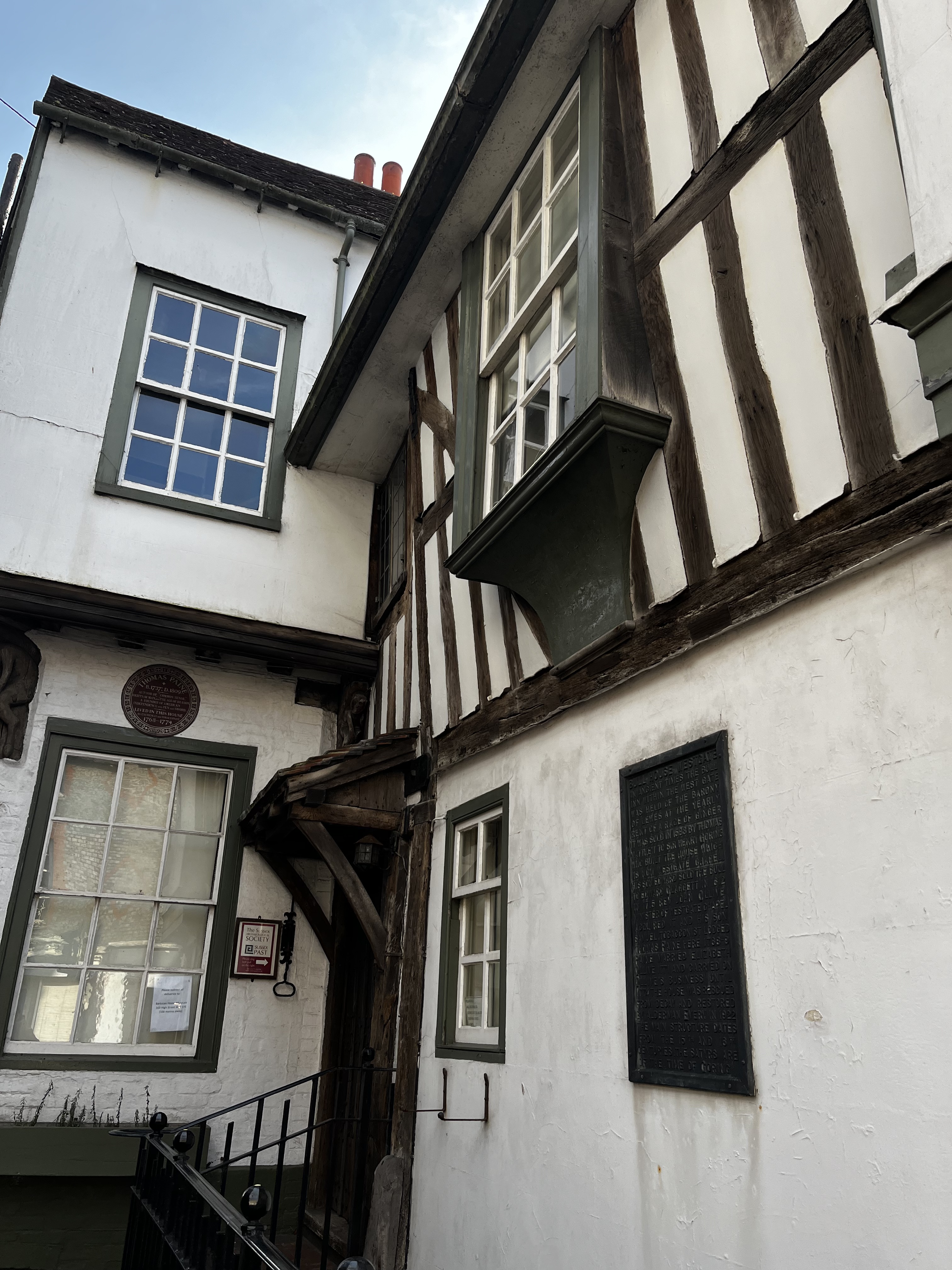
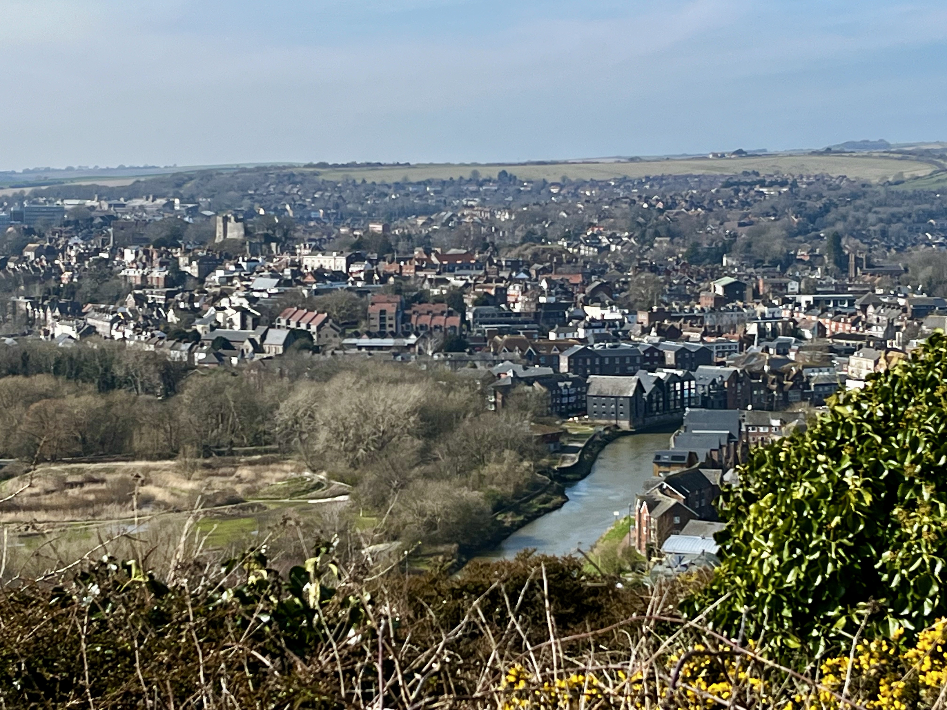
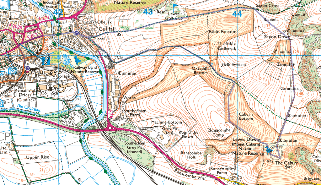
After the wettest February on record, early March promised something a little better with a few days without rain for the ground to dry out (February walking was a mud-fest) and the promise of a sunny Friday. So I decided on a trip to Lewes and a 5.5 mile circular walk from Lewes station town into the hills east of town. It takes in classic downs above a dry valley to the high point of Mount Caburn, the remains of an Iron Age hill fort, then back via the valley floor (map at end). I also wanted to spend some time in the vibrant town taking in the history and architecture for a couple of hours.
It isn’t a long walk, the first half mile via the town centre with, for me, a stop off on Station Street at ‘Carafe’ for a cup of tea. The route from the station is north up to High Street and from here you can see the downs you’ll be climbing, towering above the lower town. Walk east down high street and cross the bridge over the River Ouse by the Harveys brewery continuing on the level to the end of the street. Cross South Street and make your way up Chapel Hill, a steep, narrow road between beautiful cottages. At .75 miles take the small lane to the left, then through the gate onto a footpath and steps. This is the hardest part of the walk as it’s a short sharp climb to a golf course from which there are views of the town as a reward for the effort.
Clockwise from top left: Chapel Hill, view from High Street east to the downs, the downs as you leave the golf course, the path from Chapel Lane to the golf course, the view of the town from the golf course
Continue across the course roughly east between the tees. The walk continues to climb and is signposted in places. The views begin to become wider until at the 1.4 mile mark you leave the golf course and the path becomes a little wilder and level. At 2.4 miles there is a stile (or gate, can’t remember), then head south east towards the 135m high point and tumuli. The path descends a little, crosses some deep tracks then climbs up to another and stile. Head roughly south along the fence line to the highpoint at 148m as ‘The Caburn’ begins to take shape – follow your nose.
Views en route to the fort, the bottom two from Mount Caburn. The walk offers a pleasant mix of downland wildness and pasture.
The views from the fort are amazing, the steep scarp plunging into the sweep of the flooded Ouse valley, the views of the downs, Lewes and weald explain the fort’s important position in the landscape. Despite the strong sun, a brisk easterly wind made it a fresh day so the lee of the forts ramparts made a great place to sit and enjoy an early lunch in the sun out of the wind. I was in no great rush and the opportunity to simply sit on my warm, dry foam mat and take in the vast scene in the noonday sun was relaxing. It’s a good spot.
From the fort walk northwest towards the stile into the rough slope above Caburn Bottom, turn left and walk northwest keeping the fence line to your left (there is another stile into the field adjacent, ignore this) and follow the rough path as it tracks the dry valley below before veering to the right – northward and down to the bottom of the valley and a gate which takes you through the valley floor for a half mile or so heading northwest, past a dew pond and another gate before taking the path rising up the ridge flank to your right and heading west with great views of the valley until the path meets the top of Chapel lane by the golf course Clubhouse. Walk down the lane and you reach South Street at the 5 mile mark into town.
Pics of the town and its medieval architecture: dew pond in the dry valley and two of the town from the top of Chapel Lane as you come off the downs.
5.5 miles from the Lewes station and back, 850 ft of ascent.
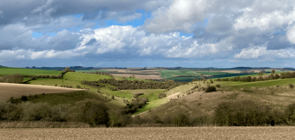
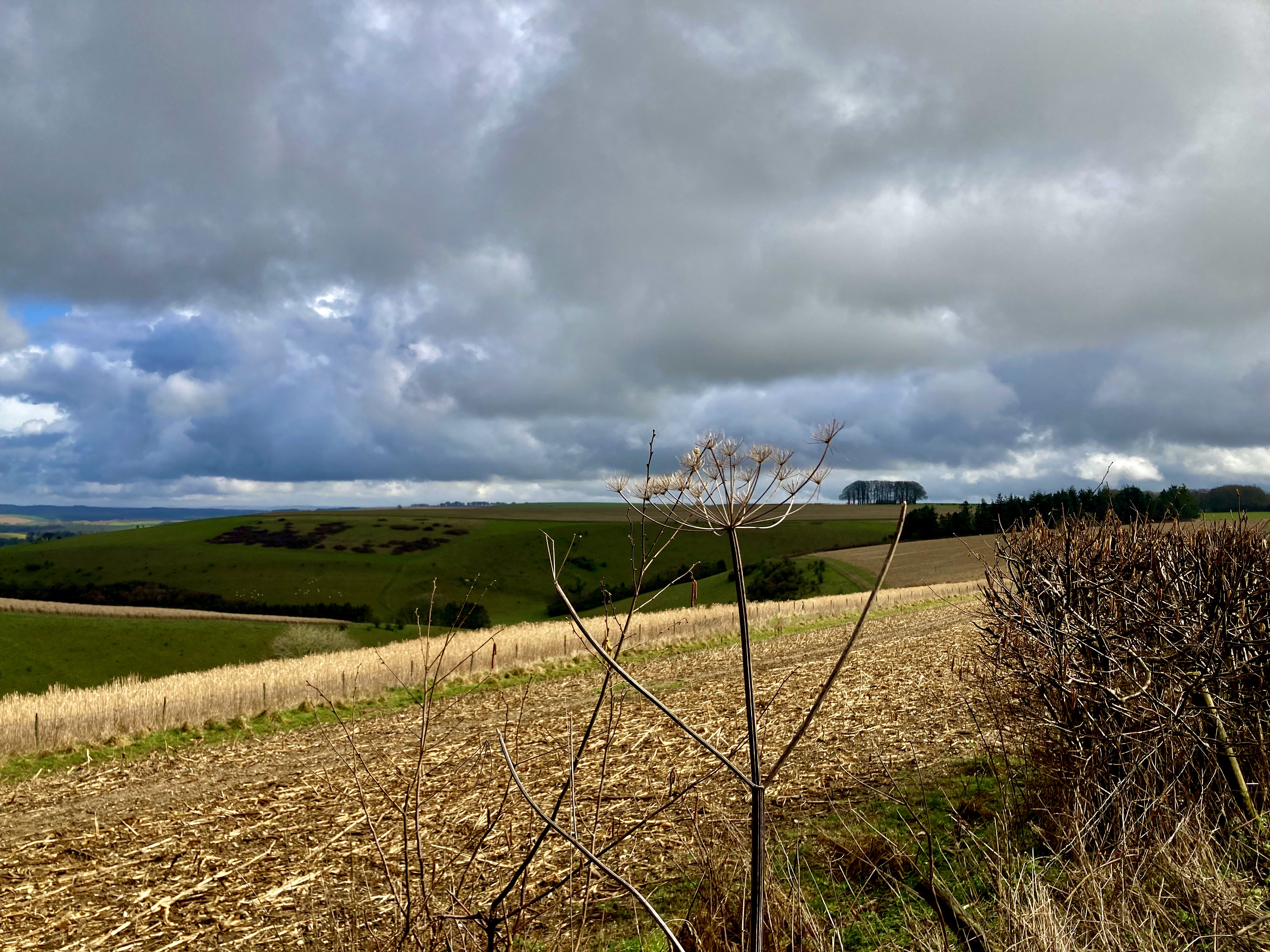
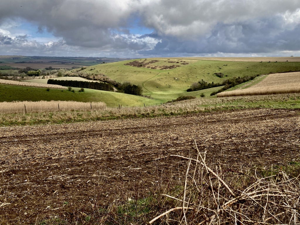
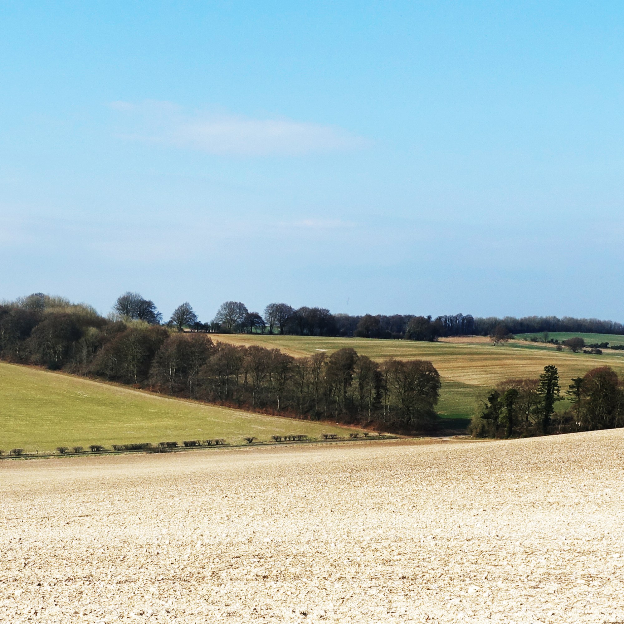
A few weeks ago I was inspired by seeing a forty year old film made by the legend who was Jack Hargreaves about the area southwest of Salisbury (starts 4 minutes in), to take a look as there are some decent length walks in downland country surrounding the chalk stream fed Ebble River Valley which is lined with small villages and hamlets, cottages, churches and pubs dressed in limestone and flint. It looked stunning (or did in 1983) with classic ridges and views, wide spaces, prehistoric features and the ancient ox droves themselves running east-west along the top of the hills to the north and south of the valley which connect the the Cranborne Chase, Shaftesbury and Salisbury.
So I was walked 14 miles of the north drove but found it a little underwhelming. As well as the evidence of weighty farm traffic and agri detritus, there was litter and occasional fly tipping among the tall hedged edges that formed a dismal tunnel, the drove heading arrow straight between. It just seemed unloved. But as I walked westward, the walk improved immeasurably, the views opening up, the walking perfect on a chalky, grassy drove and the five miles before reaching Berwick St John (where I caught the bus to Salisbury the 29 route – reliable and regular in the afternoon after a little refreshment in the Talbot pub) were a joy. At the same time my eye was drawn to the ridge above the Ebble river to the south on which a second parallel ox drove tracks the skyline. Tantalising. Subsequent research suggested this the better, more scenic drove with better walking.
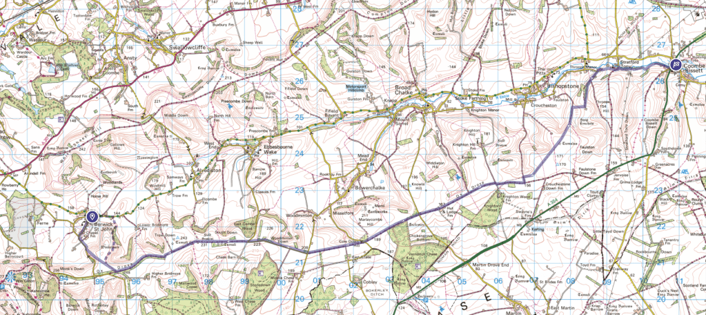
So I met up at 8.30 am with my friend Dom at the Fox and Goose pub in Coombe Bissett (they allowed us to park all day as we were going to have a late lunch there on our return) in order to get the 29 bus to our start point in Berwick St John (bus stop in a laybay on the Stratford Tony Road, the turning to the west 100m north of the pub), from where we would climb 350 feet up to the ridge then walk 9 miles of the drove, then back down to track the Ebble for a mile or so back to the pub (map at the foot). Just less than 13 miles in total.
The 29 bus passes through some stunning little settlements. It’s a community bus so takes its time, meandering the minor roads between manor house, farms and small cottages through villages with fabulous names like Broadchalke, Bowerchalke and Ebbesbourne Wake, there because of the crystal clear chalk stream that nourishes the valley as it runs east to join the Avon below Salisbury. Our jump off point in Berwick St John is another delightful setting with a pub, the Talbot, the ridge to the South filling the view as we made our way on paths across farmland towards the ridge. On reflection, I think we would have been better walking back through the village and taking the path south to the east, around Winklebury Hill and prehistoric enclosure (map below). Our route relied on a small footpath that we couldn’t find so we had to traverse a fence where a tree had collapsed on it. Annoying. But soon enough we were on the ridge approaching the ox drove which is marked on the map as the ‘Cranborne Droves Way’ (CDW).
The view West from Winklebury Hill above Berwick St John
The weather was dank but the going was easy on the drove, the route of which is known to be prehistoric, it forming a small part of the Great Chalk Way: the Wessex Ridgeway, Cranborne Droves Way, Sarsen Way, Ridgeway, Icknield Way and Peddars Way, part of this East West route linking Dorset and Norfolk for milennia.
It’s not easy to get lost on this walk once on the drove. Head East and keep your map to hand. I use the OS app on my phone. In places the drove joins sections of minor road but primarily its a track with the occasional deep rutted puddles the width of the path. We went after a few days of rain so these were rather full and not always easy to avoid. As the morning wore on the weather just improved and by noon it was warm, the sun positively beamed. From the log we were sat on for lunch we saw hare and a herd of deer perhaps thirty strong, the soundtrack; birdlife claiming space and mates, Skylarks the constant. The downland favourites were present – Sloe, Holly, Hazel, Yew, travellers joy, snow drops, celandines, primroses and stately Beech trees forming cool grey avenues and stark rounded copses between the bald flint and chalk speckled fields. Nearly Spring but not quite.
The drove is wide and ideal for a proper chat as you eat up the miles with views to the left and right
The scenery improves as you walk east with excellent views of the Dorset hills to the South beyond the woods of the Cranborne Chase while to the North the valley opens up as it widens. At the 8.75 mile mark the walk leaves the drove to head northeast into the valley, gently descending along green roads and long obliterated Roman road across farmland following the CDW.
Coming off the drove towards the valley bottom
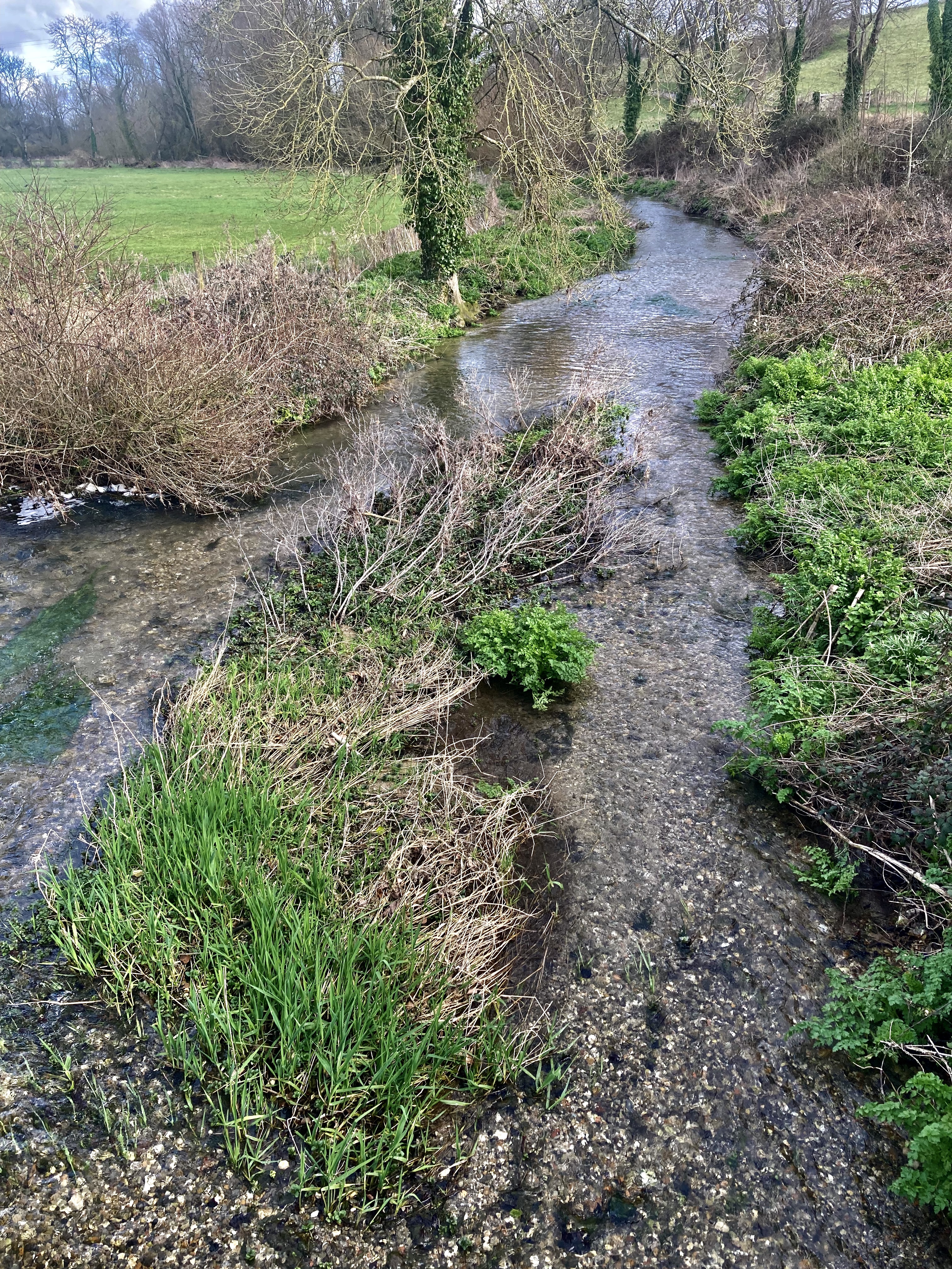
At about the 10.3 mile mark the walk, still on the CDW, heads east down a grassy incline towards some old flint farm buildings then turns North into a stretch of wooded path then East through fields and houses before reaching Stratford Tony where you can really appreciate the River’s beauty at a small ford and bridge. From here the route leaves the CDW and heads up a private farm road (it isn’t, the public footpath is marked on the gate) East along the valley with the river to your left until it reaches Coombe Bissett and the warmth of the Fox and Goose, its excellent menu and Butcombe on tap.
The River Ebble at Stratford Tony and green lane
We really enjoyed this walk. Being mostly along the ridge it was easy going and excellent for for a chat along the route. The real joy is that you can come off the route at any point and head into the valley to catch the 29 bus back to Salisbury or your start point. My first trip here was by train from London to Salisbury then the 29 from central Salisbury. It’s easy to do. The added joy are the many lanes and tracks into the valley as these are clearly less used, less busy and those we saw quite beautiful. It’s on these valley sides that I think you get a real sense of place pondering the Prehistoric, Roman and Saxon history of the area under a blue sky, breathing England’s cleanest air (it’s true!) the wide valley before you in true Wessex glory. It is one to revisit and modify as the weather improves. Thank you Ebble Valley.
Just under 13 miles, suggested route at the start as a dashed rule. Pubs in Coombe Bissett, Bishopstone, Broad Chalke, Ebbesbourne Wake, Alvediston and Berwick St John, all served by the 29 bus.
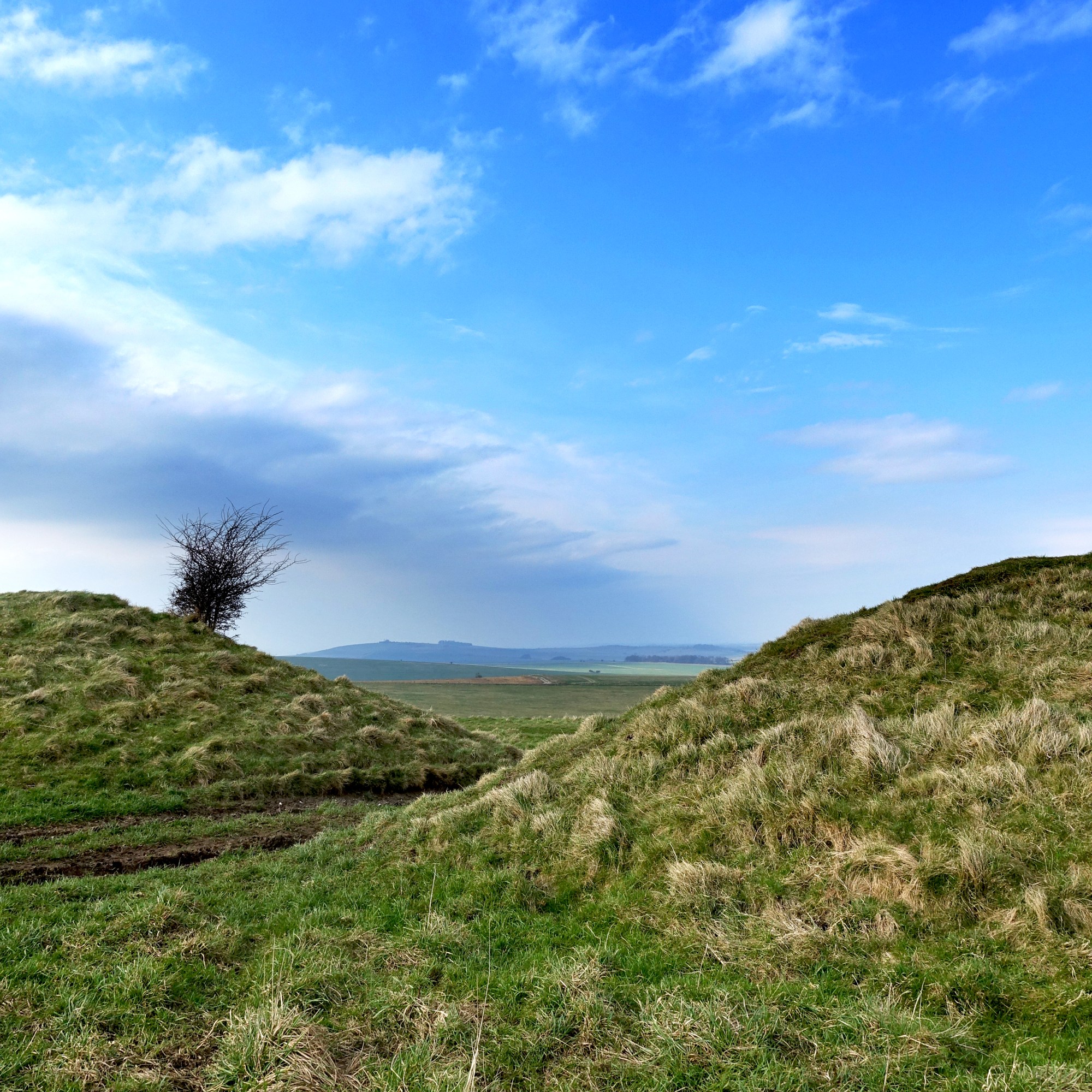
Prehistoric earth works on Windover Hill above the ‘Long Man’a mile and a half from Alfriston
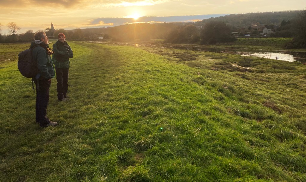
Early December and after a spell of heavy rain, a lovely period of fair weather, the ground drying out and a yearly pilgrimage to Sussex for a small, group of us to get together and enjoy a short and sweet walk and chat for a few hours in a pub or two for pre-Christmas festivities in lovely Lewes.
The usual format meant meeting at Clapham Junction, getting a train to Sussex and given the short day, walking the northern spur of the SDW from the Downs above Eastbourne for a little over 6 miles to the village of Alfriston where we would get the last afternoon bus to Lewes, returning to London from there in the evening (Lewes is on the same line as Eastbourne). We bought our tickets on http://www.trainline.com and as we were travelling after 9.30 am and had booked a few weeks in advance the cost was £15.00 there and back – pretty good value.
Arriving in Eastbourne a little after 11am we stopped off at Poppy Seed Bakery on Gildredge Road around the corner from the station to buy pasties and rolls for lunch before getting one of the many buses from the bus stop on the same road that takes you east to the ‘South Downs Way’ bus stop, for us the 12 Coaster service. It’s a ten minute ride up hill before topping the downs – the view wide and open and with a wintery sun sparkling on the Channel. This felt like the beginning of a good walk.
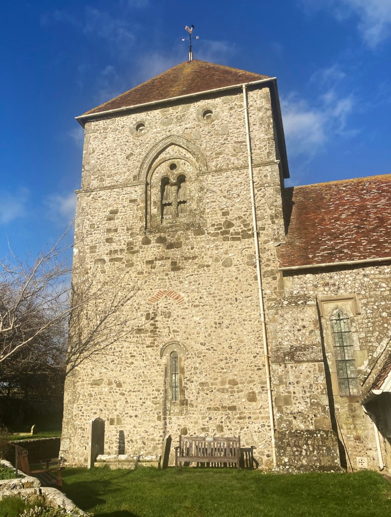
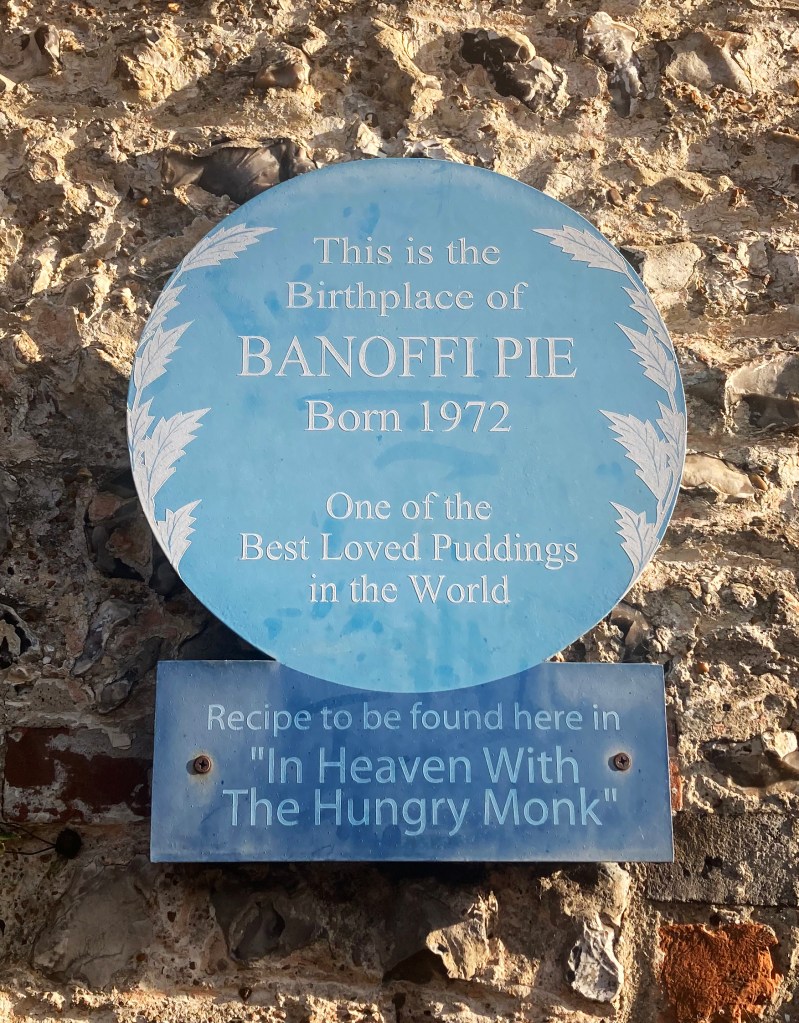
The route is quite simple (map at bottom). Cross the road and walk north with the golf course to your left and the ridge above Eastbourne to the right and follow the SDW signs. I always use the OS app. and take a paper map – this more for the enjoyment of reading the landscape and identifying distant features and landmarks – it’s a map thing. For the first 1.5 miles the level path begins to reveal the Downs to the West and the Weald to the north before descending westward by 400 ft to the small village of Jevington (home of the Banoffi pie – who knew?) at the 2.5 mile mark with its wonderful church and 11th century tower beside which is a bench facing south – convenient as a stop for lunch.
The path as it begins to descend to JevingtonJevington Church
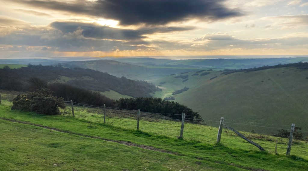
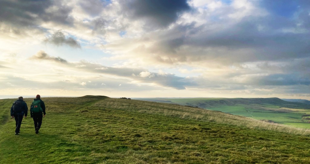
From Jevington the SDW works it way up from the valley for a long 400ft pull to the NW as the views become ever better. To the south – dry valleys, Friston Forest, the Cuckmere valley and the Seven Sisters, to the north the Weald and west the downs rolling away with Chanctonbury Ring in the far distance. The path rises till at the 4.5 mile point it reaches the small plateau of Wilmington and Windover Hills, a fabulous place with an 5000 year old Long Barrow above the famous Long Man.
View to the south as you approach Windover Hill, the sun glinting on the sea Windover Hill; the South Downs stretching westward.
We stopped for a while here to take in the magic of place and time before following the looping path down hill SE towards the fields above Alfriston until the path crosses a small road onto the sodden floodplain (where I found out my boots leak) of the River Cuckmere where thankfully the path follows the top of a dryish Levee; turn left in the direction of the church spire and cross the first bridge over the river into the village.
On the Levee with Alfriston church in the distance
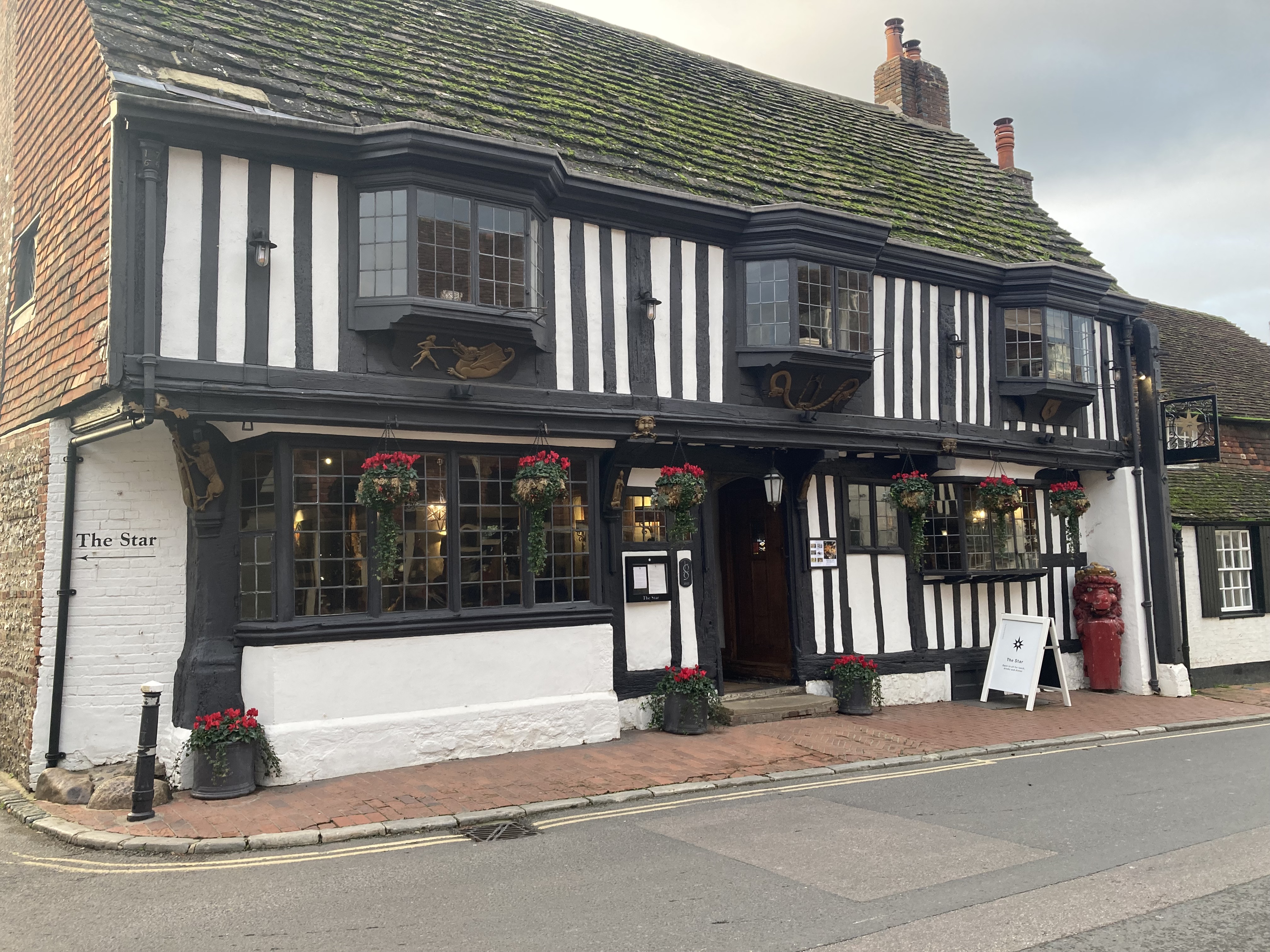
I have said it before but Alfriston is tiny but wonderful. Worth a visit in its own right. We made for the lovely George pub and enjoyed the warmth of the open fire and local beer then made our way down the road to the coach park north of the village to get the last bus at 4pm for the 20 minute journey to Lewes.
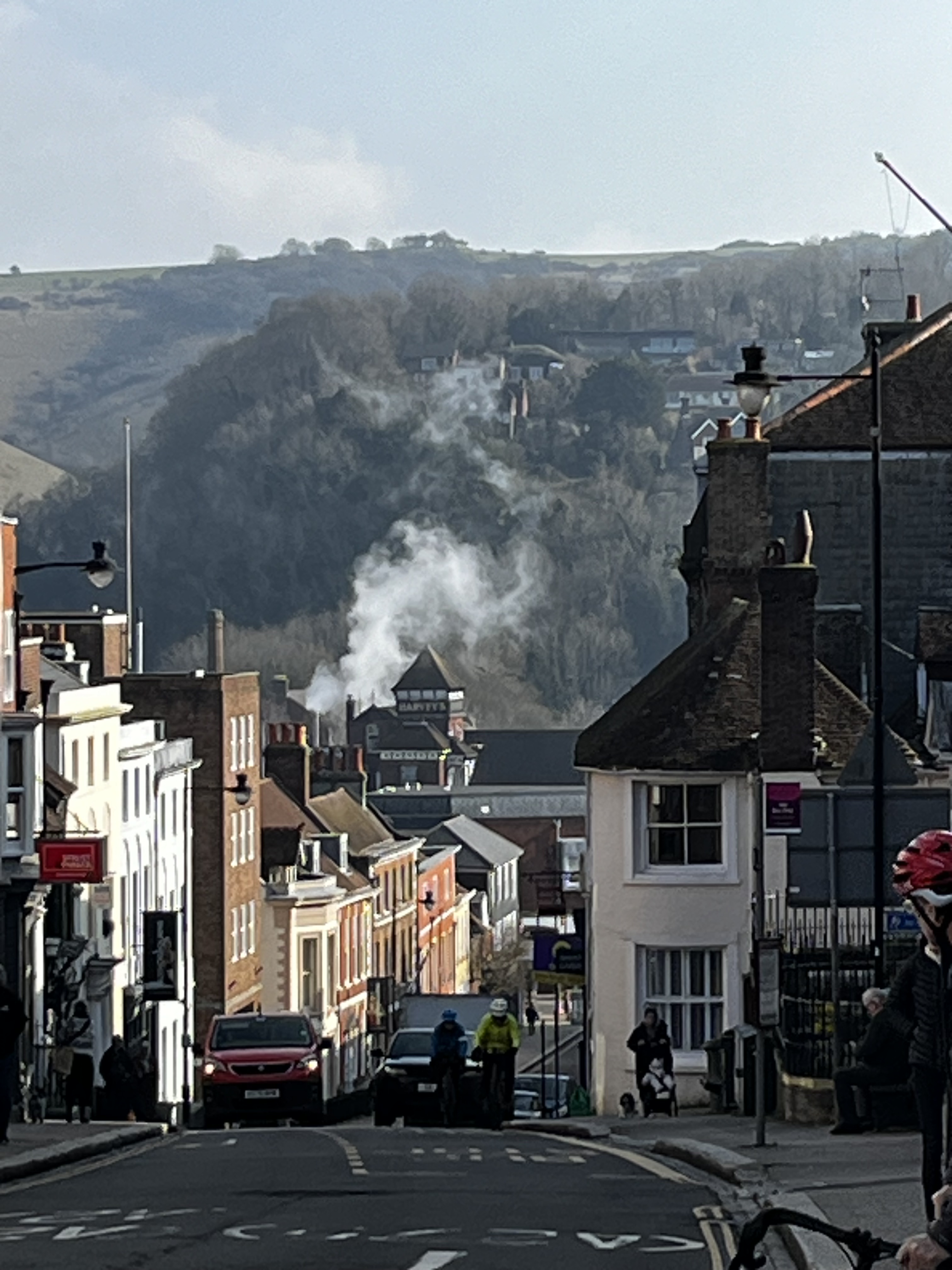
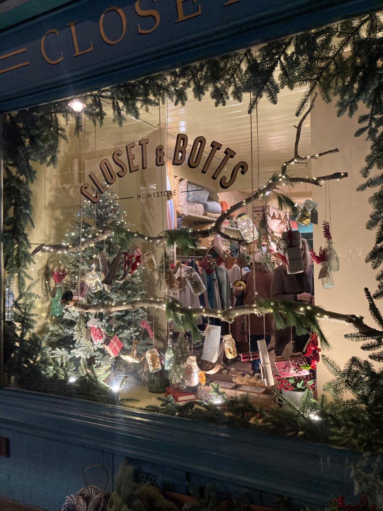
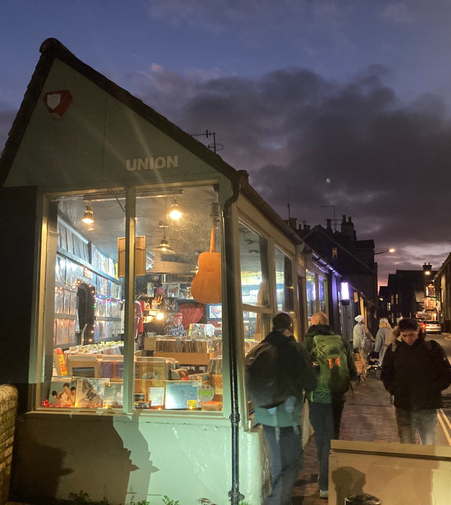
Lewes was gearing up for Christmas and we made our way to the cinema cafe for a hot chocolate then shops for a bit of Christmas shopping and quick record hunt in the used vinyl shop. We had booked dinner at the Rights of Man pub which was just as well as it was late shopping evening with attendant crowds, brass band and Morris Dancers. The atmosphere in the pub and town was fabulous. The delightful Victorian station is a few hundred yards from the main Street and we left Lewes at just before 8pm getting back to London an hour later.
Lewes on a festive evening
This is a walk that we had never done always taking the southerly SDW to take on the rollercoaster of the Seven Sisters. It is easy to do from London with decent connections and low carbon footprint! so will be a much repeated day out, solo or otherwise. A joy for us on a Winter’s day, it would be equally enjoyable at any time. We had pondered extending the walk by adding another 7 miles and walking the SDW from Alfriston to Southease station which has an hourly service to Lewes but with our late start, the light wasn’t with us. One for a longer day in May I’m thinking.
A couple of walks in the Black Mountains in wonderful Spring sunshine
Looking southwest along the northern scarp slope of the Black Mountain range
For years the Black Mountains in Wales have been a fabulous place to appreciate vast open skies with height, dozens of mountain walks and interesting weather, all accessible from Southern England and close to friends in the West of England. Having visited before in October and experienced the hill fog and rain associated with with dark Autumn afternoons, my three walking partners and I thought it about time we saw the views at their best and relax into a couple of long possibly warm days on the hills without worrying about getting off them into civilisation before nightfall at five in the afternoon. So we chose late May this year which didn’t disappoint.
In previous years we have stayed in Hay-on-Wye but there wasn’t the availability so made our home the Harp Inn in Glasbury, for a couple of nights which is an excellent local with great pub food, good value and excellent atmosphere just three miles from Hay. We were hoping to use cabs to get to and from our start and finish points of our expeditions but here we failed. There simply weren’t cabs available to drop us off and pick us up at the start and end of the day. We would have needed to pre-book several days in advance to make sure we had transport to and from our base as the buses are also few and far between. So were were resigned to walks from and back to our one car – maps below. But this did give us the freedom to know we didn’t have a deadline to meet so could stop and enjoy the scene as we saw fit.
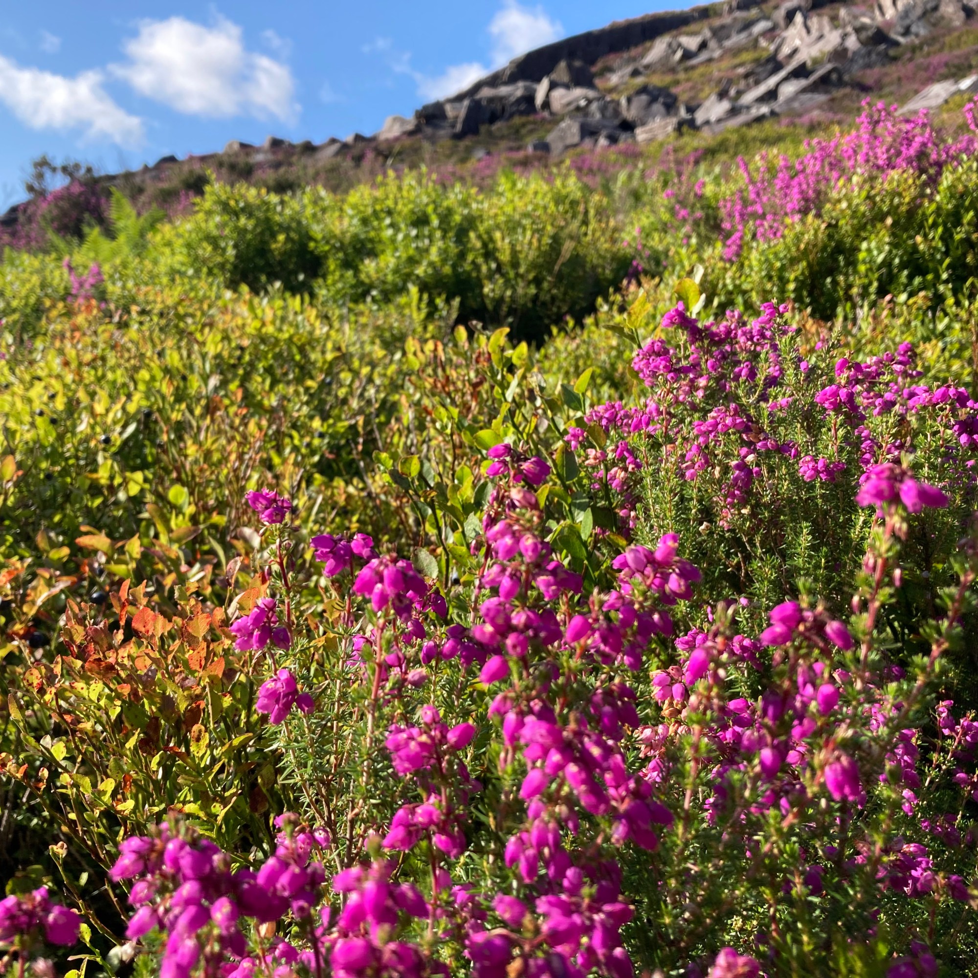
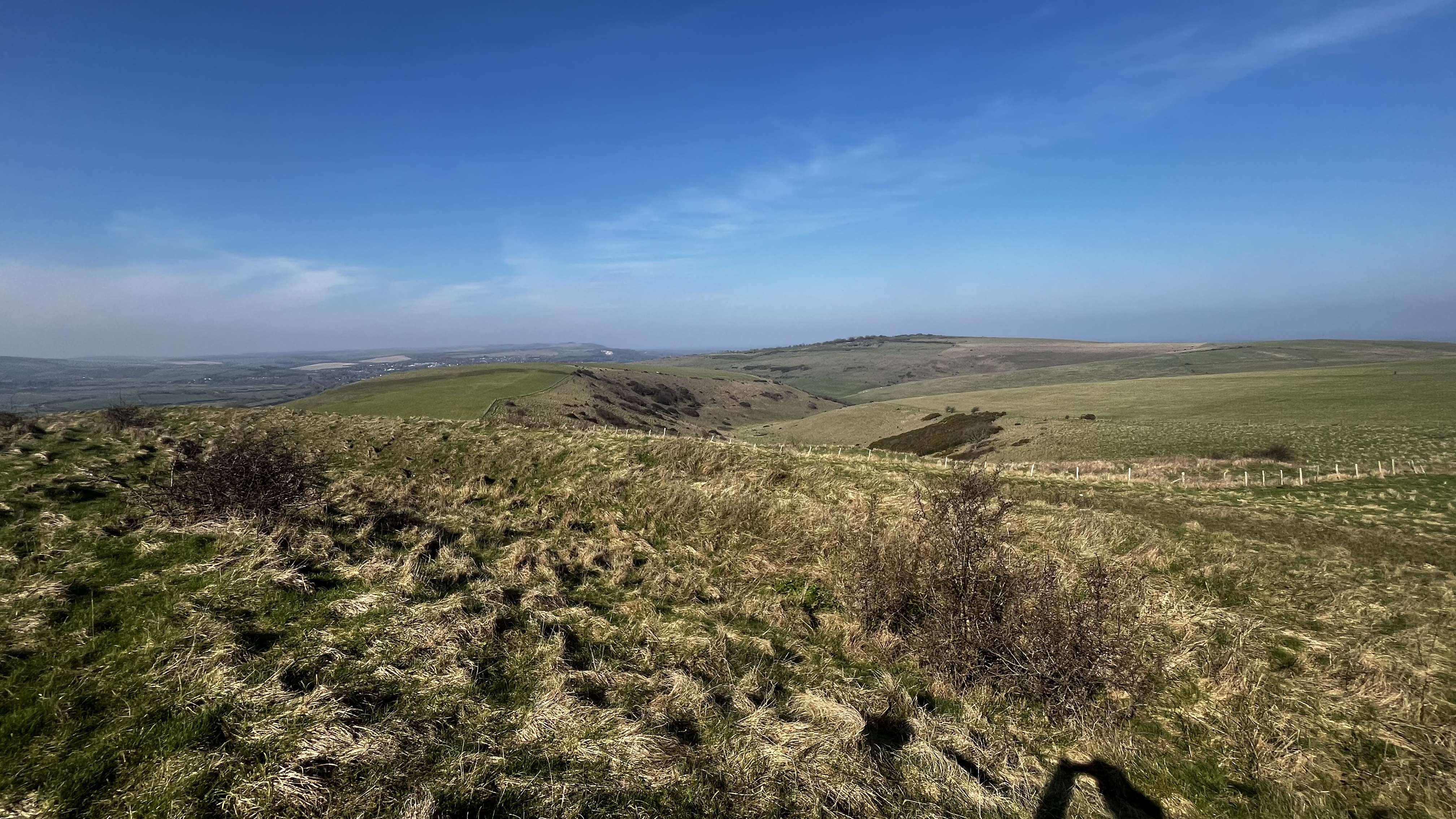
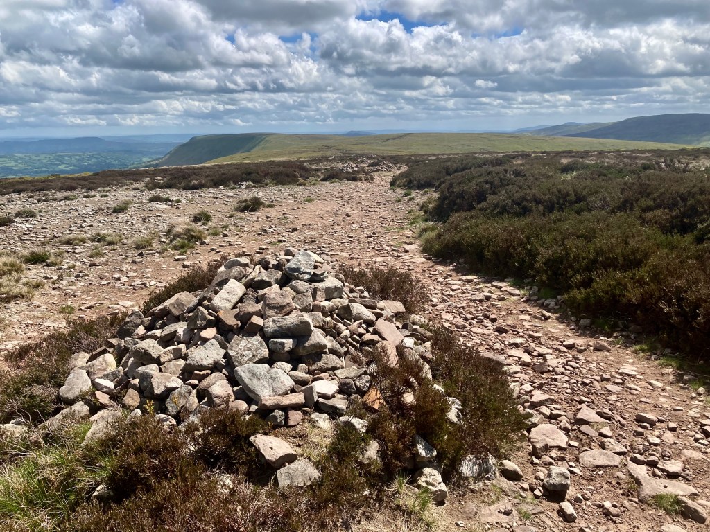
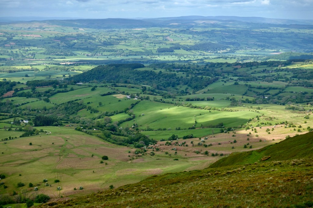
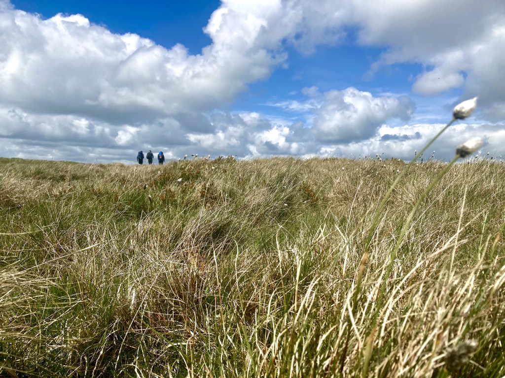
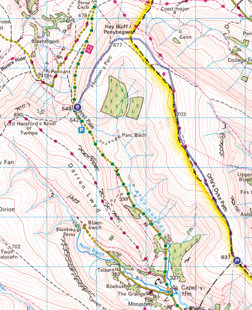
Arriving on Friday morning, we took the car to Gospel Pass car park which at over 500m altitude is an excellent starting point for the various options available for walking. We took the route to the NE for the first mile or so along the ridge to the trig point of Hay Bluff which is a nice initial climb to the ridge then a long easy pull up to the 677m mark. We then walked SE picking up the route of the Offa’s Dyke Path with England to our left and Wales to our right. This is quite easy walking along the backbone of one of the Black Mountain ‘fingers’ that lead off the Northern scarp with deep valleys between. After three miles there is an eroded area where the peat appears to have been washed away which is a real contrast to the heather, Bilberry and Hare’s Tail Cotton Grass which is more abundant where the ground is damper. The path is excellent. The interventions, large flat rock pavings and grit surface, make the going easy and the views – North over the Olchon Valley to Black Hill and South along the Vale of Ewyas – can be fully taken in. At about 4.5 miles we reached the 637m point on the map where we had lunch before heading back to the car. In previous years we have continued SE meeting the A465 at the 13 mile mark from where we caught a cab back to Hay.
Offa’s Dyke Path looking SouthThe Vale of Ewyas
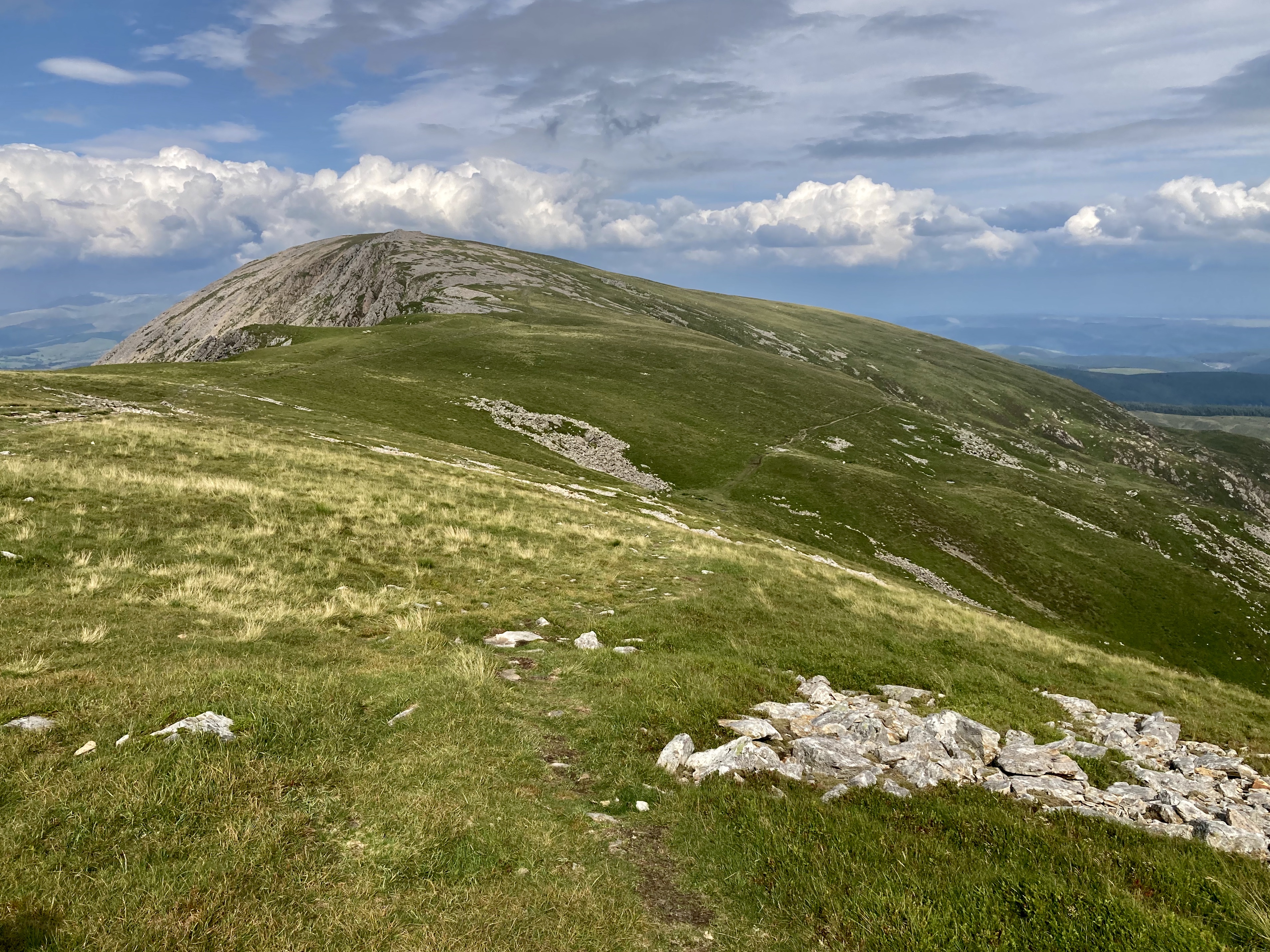
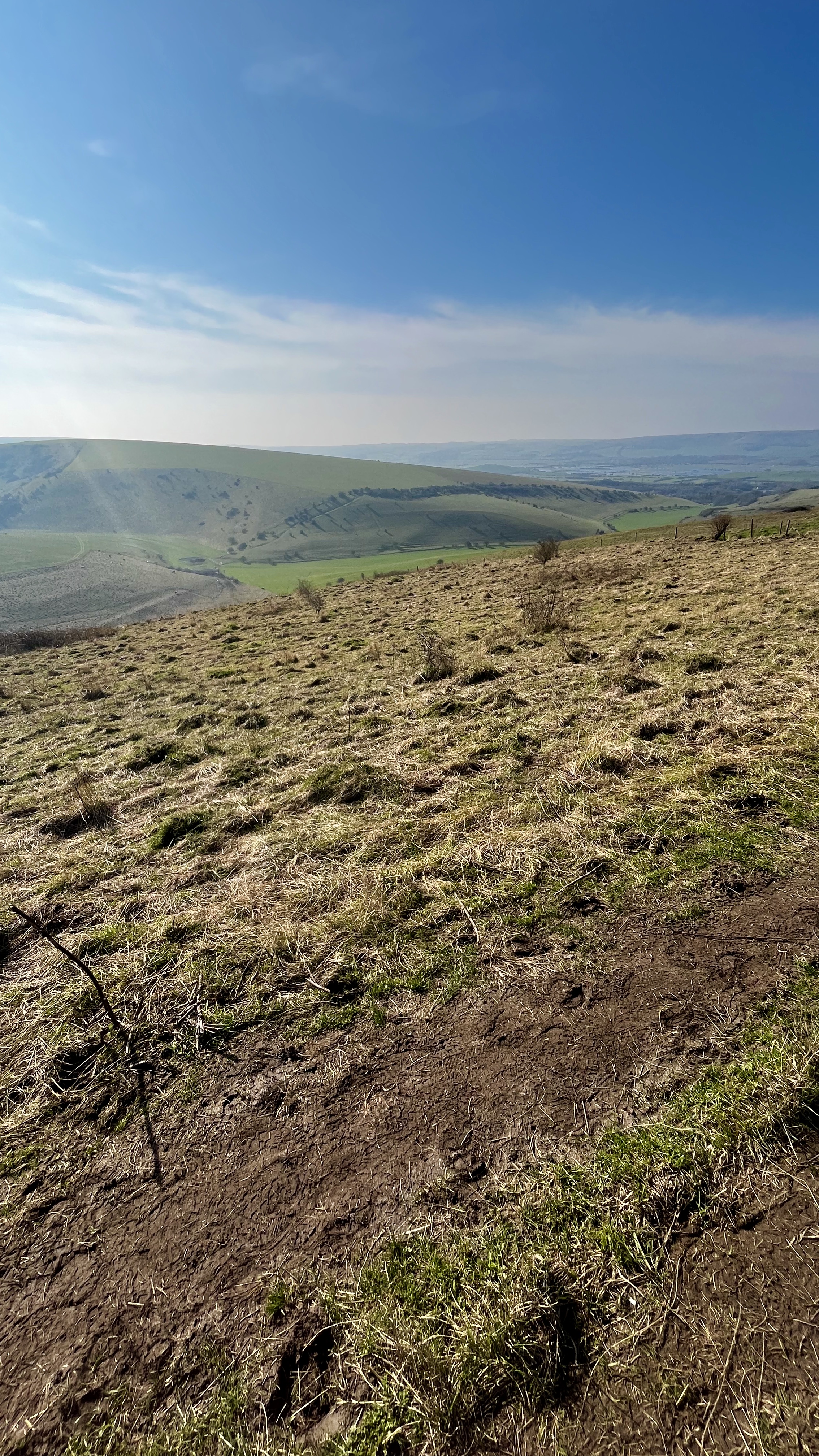
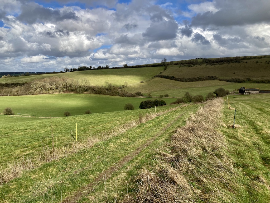
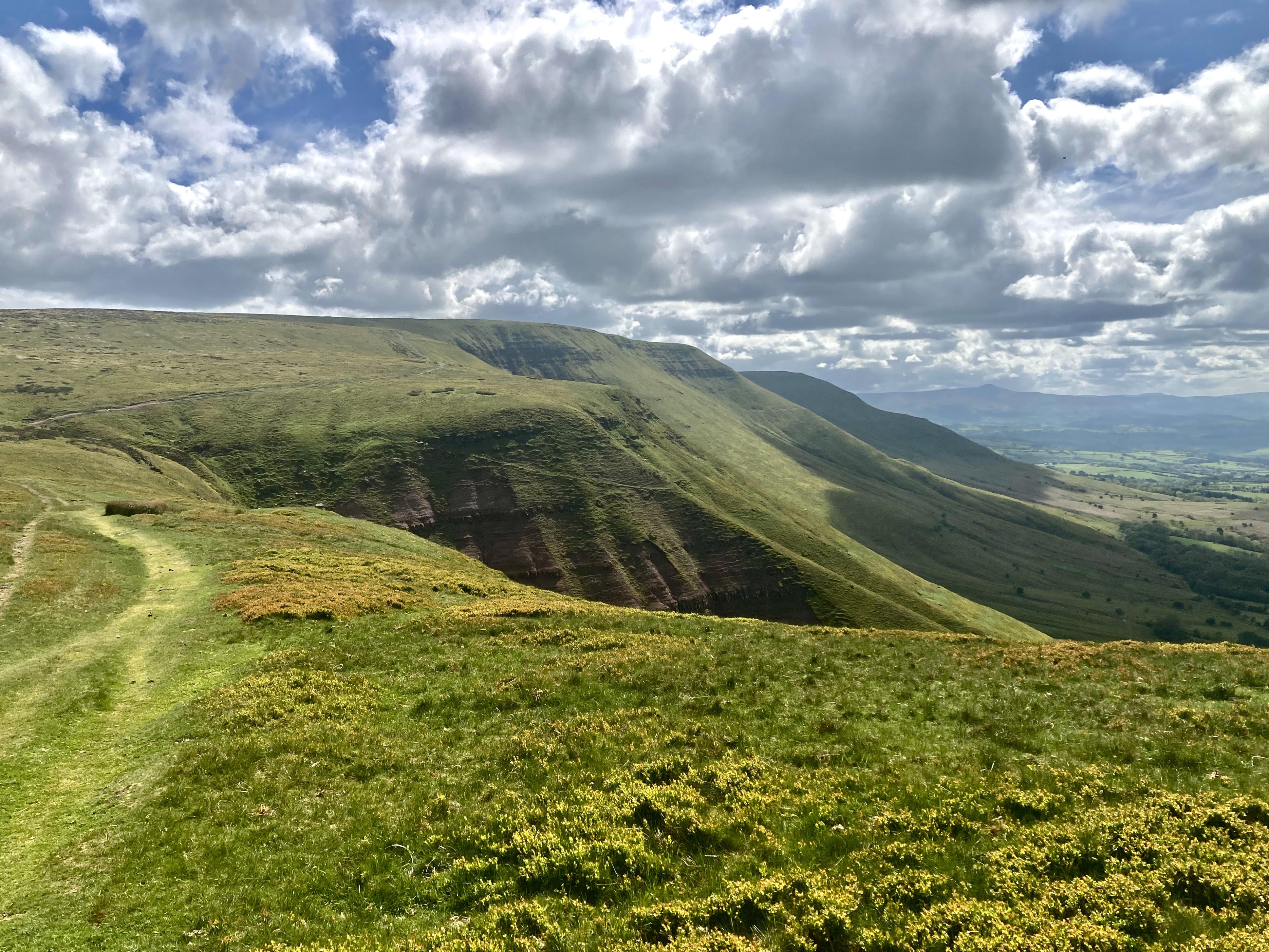
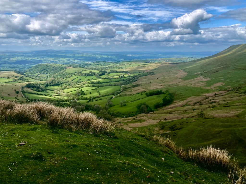
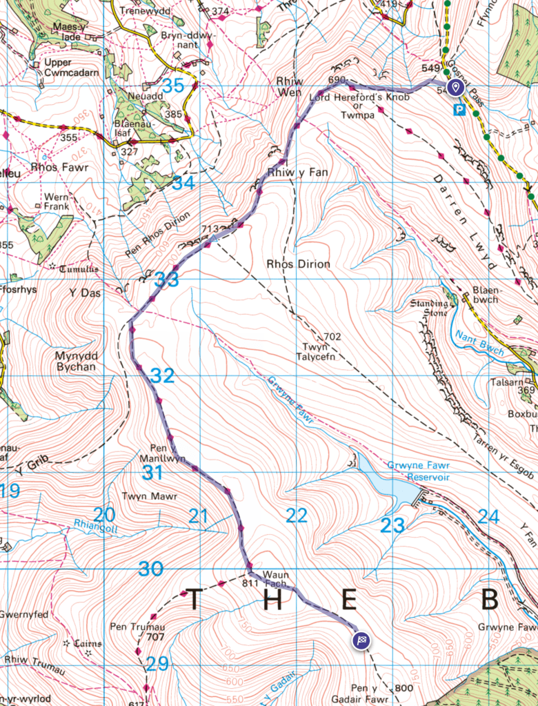
On day two we again parked at Gospel Pass car park. It being a Saturday we were fortunate to get a space at 10am. For this 11 mile walk we took the route along the scarp to the SW with amazing views to the North into the heart of Wales and West to the Brecon Beacons, the flat peak of Pen y Fan on the horizon. The route is simple and popular, keeping the edge on your right, it heads SW before turning with the ridge to the SE towards Waun Fach where, rather than following the Western path, we headed south towards the highpoint at 800m. We stopped at the 5.5 mile point for lunch and basked in the May sun, finding a spot for lunch out of the breeze with Skylarks the soundtrack. Heading back the weather just got better and the greens and bright blues of the scene made it a fabulous return leg.
Looking North from the scarp ridge of the Black Mountains
Had we been able to get a cab back we would have continued to Crickhowell – about 13 miles in total heading South along the Cambrian Way. There are a couple of good pubs in Crickhowell and the cab ride back to Hay takes about 30 minutes.
The view from Twmpa looking N East towards Hay-on-Wye
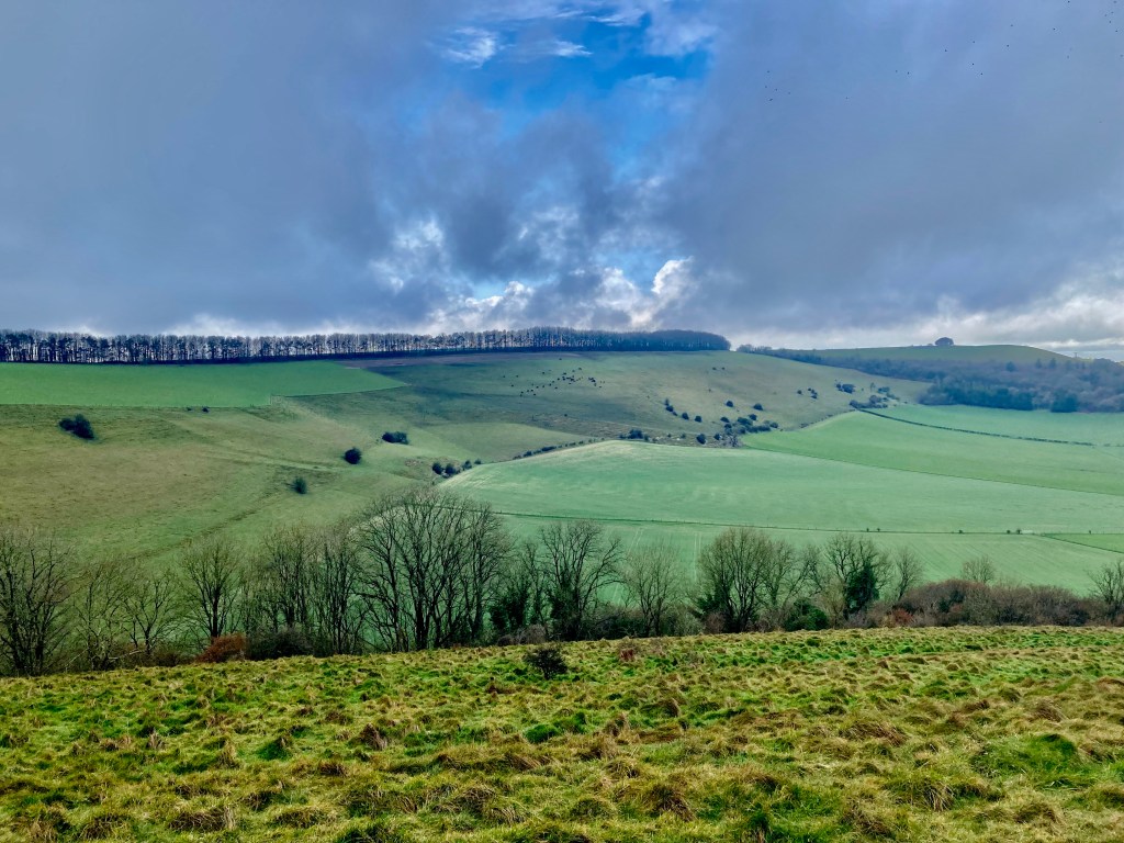
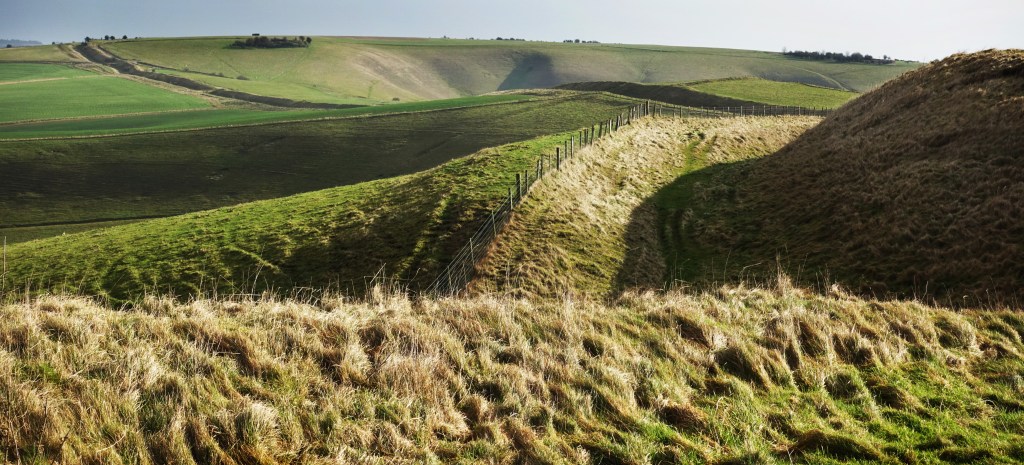
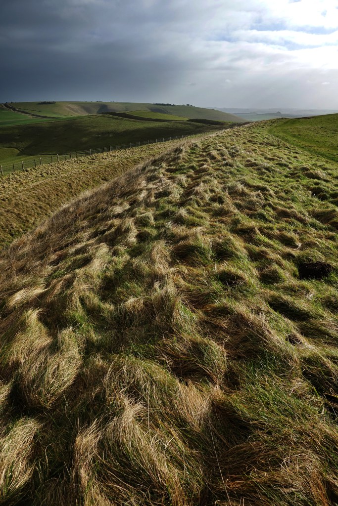
I first saw the Wansdyke a few weeks ago when I took a day out around Avebury with a friend on a nine mile walk which took in the Wiltshire downs and Avebury Village. I was struck by the scale of the enterprise, a 35 mile long defensive dyke and rampart earthwork running east to west – snaking through Wiltshire and Somerset, probably constructed after the Romans left Britain as a defence against invaders from the north, possibly the West Saxons encroaching from the upper Thames Valley. With a bit of reading I decided to walk a longer stretch of the ‘Wansdyke’ (the name comes from from ‘Woden’s Dyke’) and also take in a section of the folded Pewsey Downs which we had seen disappearing invitingly to the East.
This walk is a ten and a half mile circuit through contrasting woodland and downland with magnificent views to the north and south with short bus journeys from and back to Pewsey village and train station (map below). There is a car park at Clatford Bottom to the E of the Woods.
I took the 9.30 train from London Paddington to Pewsey station, the journey taking an hour. I had booked ahead and bought a cheap return ticket so I could travel on any train out of peak times. It’s the best approach in case you miss a specific train. In Pewsey I had time to kill as my bus, the X5 northbound, was due at 10.29. So I wandered into Pewsey, a small village/town with a useful high street and found Snoopers Bazaar for a cup of tea and listen to village talk. I give myself a day for these trips and try to roll with the vagueries of connections and delays. The bus leaves from the village centre, trundles through the thatched village of Oare before wheezing up the steep hill to the stop at Clench Common, the nearest stop to the start of the route.
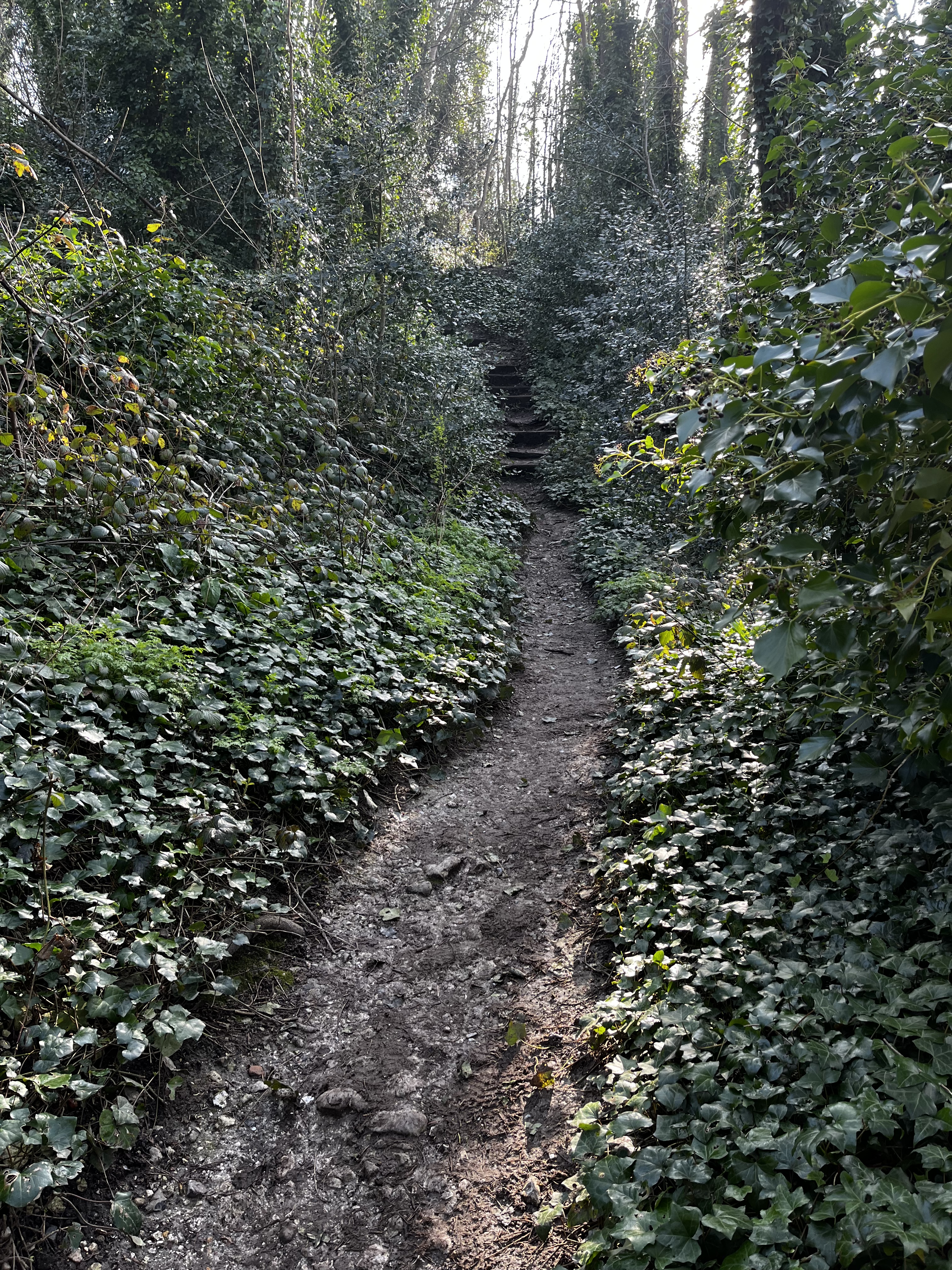
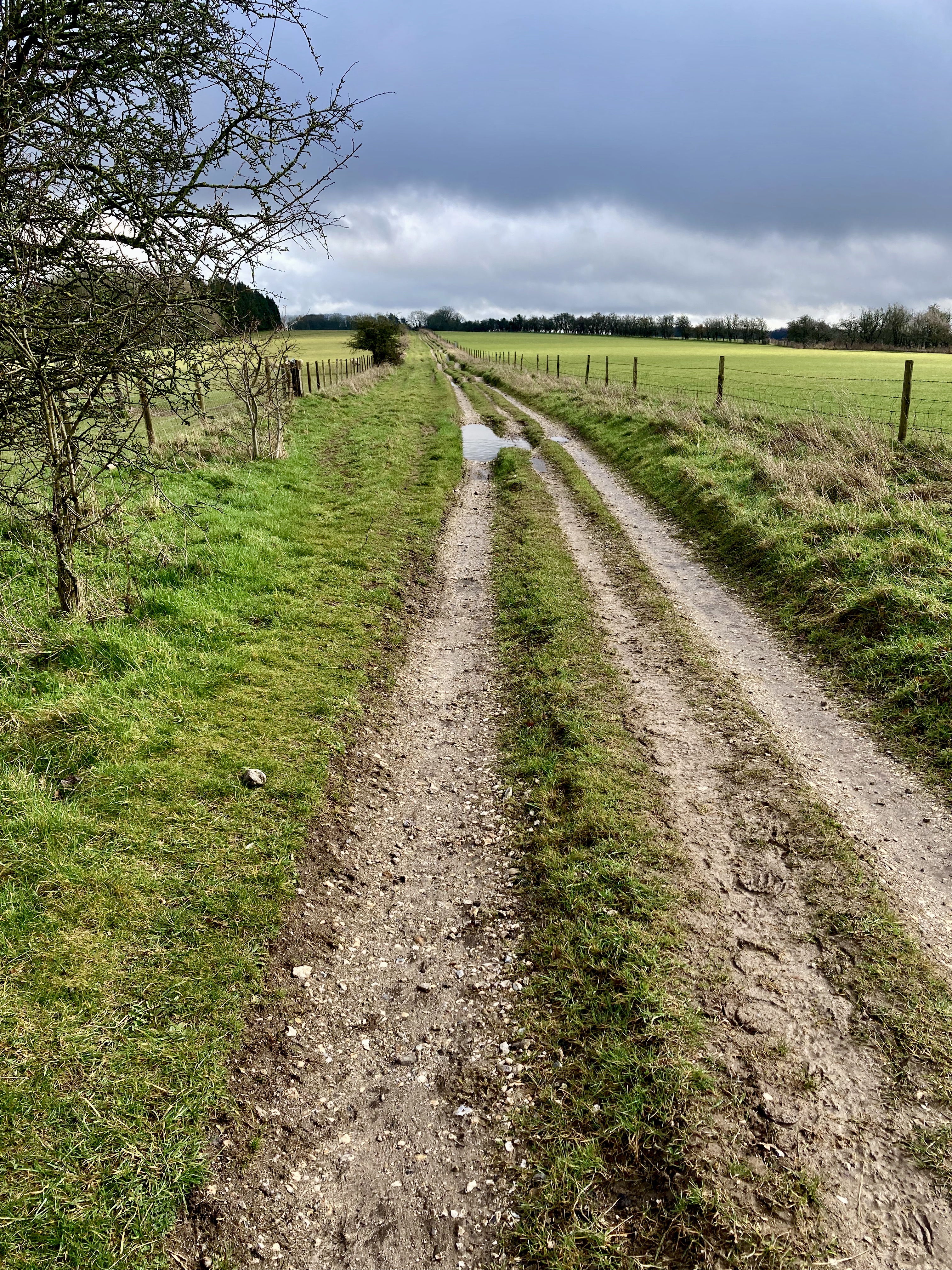
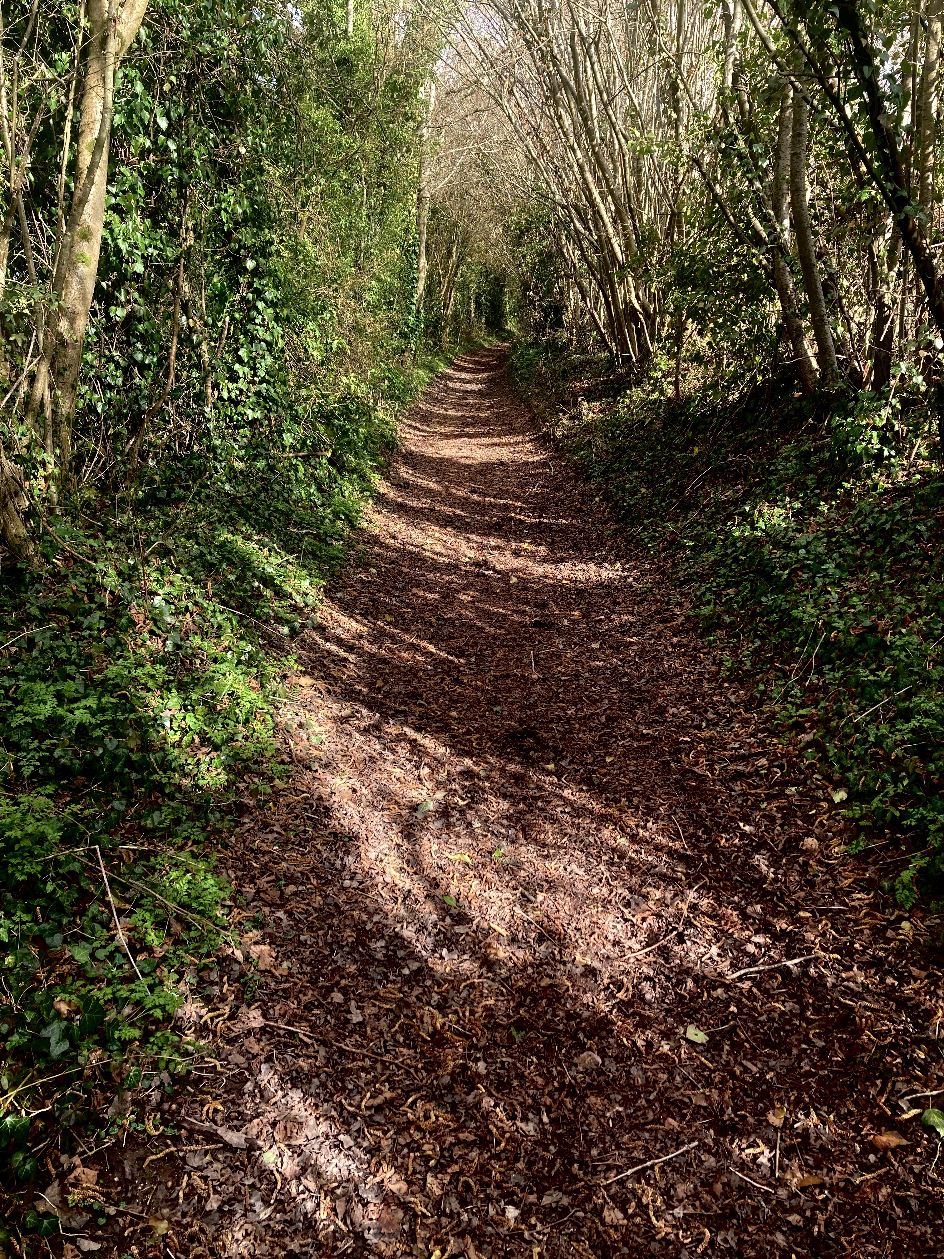
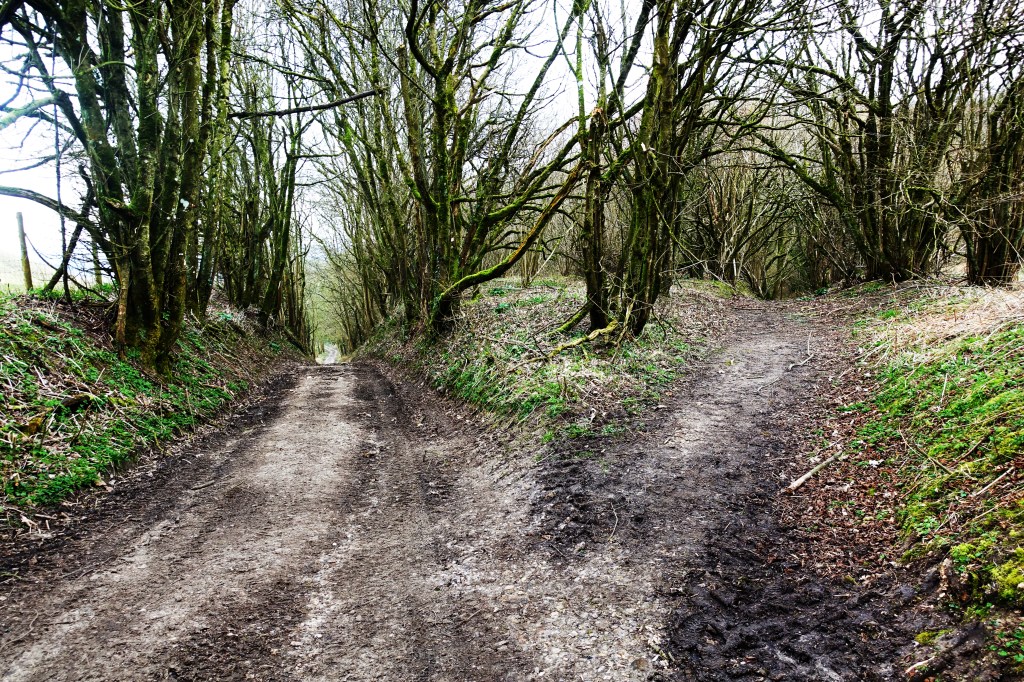
From the bus stop it’s a two minute walk along the busy main road before finding the footpath heading roughly N alongside the farm yard of Wellsummers Farm. The walking is immediately easy along a broad ride before entering Short Oak Copse where you meet the ditch and earthwork of Wansdyke running E/W. Turning left to the W, the path runs alongside the dyke on a narrow path which descends to meet a small road. Crossing this the signposted path climbs N away from the dyke through a mixed plantation of hard and softwoods before meeting a ride where the route takes a right right onto this N. After a couple of minutes the path splits, the path goes to the left, then after another minute or so another left heading W through a wood of tall broad leaf trees, the dyke appearing on the left running alongside the path. The going on this stretch was muddy, the rutted path doubling up as an access road for large forestry vehicles. My mind was planning to return in warmer, dryer months when this woodland must be a delight, stunning in late spring given the mass of emerging bluebells.
For the first couple of miles the route passes through woodland
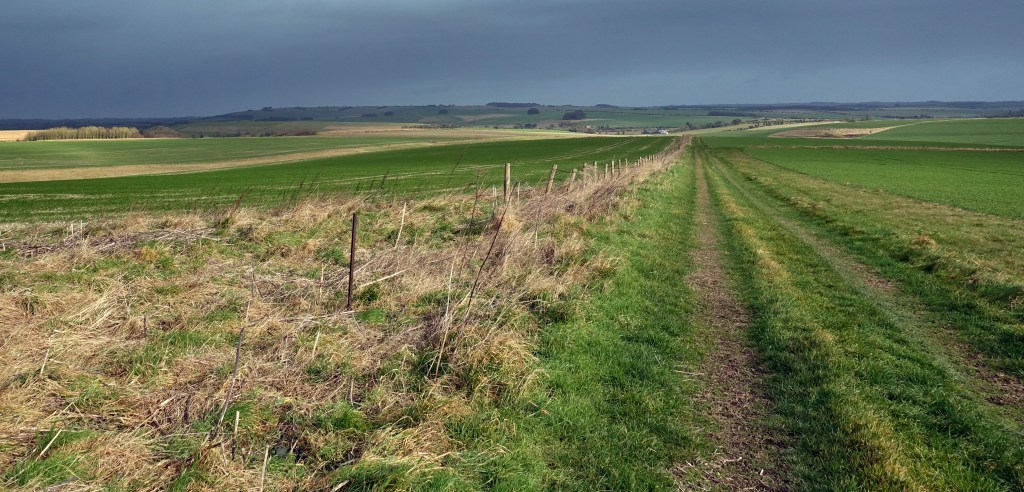
The next 1.5 miles is easy going – following or crossing the route of the dyke through the wood. The ground opens up on the left at about the two mile mark before descending to a cross road of tracks. Take the access track heading W up the hill and as it levels out the path takes a left before emerging into farmland above a deep valley. The path follows the dyke down then up and look out for the occasional oddly placed large stone, some scored and deposited by glaciers. At the top of the rise the path leaves the dyke as it hits a fence and is indistinct but turn left SE and there are a couple of stiles which take you into an open area of rough ground, this being the site of medieval Shaw village. Beyond this there is a band of tall scrub after which the path enters a field. You can go left or right here around the field margins in order to pick up the Wansdyke path as it comes into a stretch of chalky farmland with fabulous walking, the views opening up to reveal the downs and hills which form part of the later route as you descend to cross a small road at about mile four. The path rises to rejoin the Wansdyke which is now a well preserved feature in the landscape, the increasingly open, high ground offering vistas to the North, Silbury Hill, Avebury and the Marlborough Downs.
Clockwise from top: The path as it emerges from the woodland.The Wansdyke with the Marlborough Downs in the gap. The classic flinty chalk fields of the downs. the path opens up into wonderful downland walking.
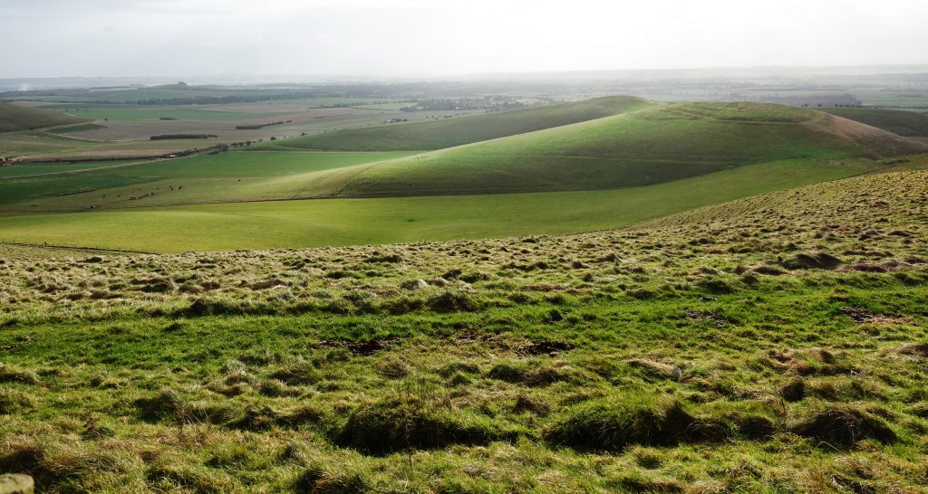
With the deep dyke to the left, the route continues W until a fence and stile at about mile five as it turns left to the S crossing the Wansdyke onto the signed path as it circuits Milk Hill, this being the return leg of the walk, picking up the route of the Mid Wilts Way. After a couple of hundred metres at about mile six, the view to the N opens up dramatically, the ground falling away steeply as the Pewsey Downs come into view stretching away to the E above the Vale of Pewsey, the occasional boom of artillery on Salisbury Plain spooking the pheasants.
The Wansdyke stretching Westward from the five mile point where the path turns S
Below, from left: The Vale of Pewsey. Old roads. The view over Oare village.
The path continues E along the scarp edge passing one of the White Horse chalk figures. It’s a proper downland setting here with stunted trees, gorse and few fences. The path descends slowly past Walkers Hill before crossing a small road at a car park. It then climbs past Knapp Hill and the path levels out continuing E. Just after mile 8 the path circuits Gopher Wood before climbing again towards Huish Hill where the path runs N to circuit Huish Hill House before continuing S down a precipitous hill towards the Village of Oare where the X5 bus takes you back to Pewsey and my train home. You can add a couple of miles and walk to Pewsey from here on the White Horse Trail. There is a good pub in Pewsey, The Royal Oak. With three fireplaces, beer and food it’s a good place to wait for the train.
January has been really dry, a blessing for walkers. The usual clag and boginess of Winter walking can be a real pain. So it was with keen anticipation that I met up with an old friend to walk among the extraordinary landscape and features around Avebury.
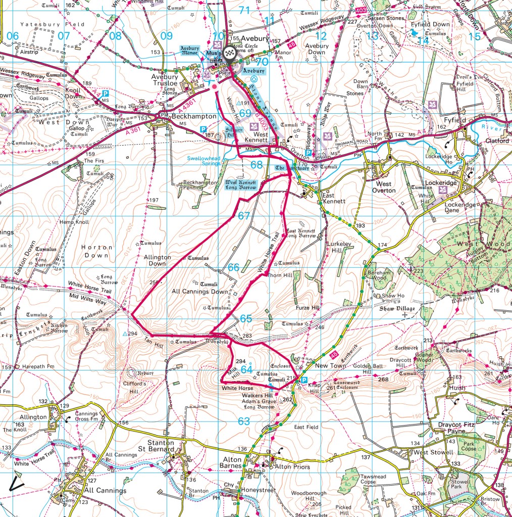
Storm Corrie made its blustery presence felt with a strong Northwesterly wind and a few spots of rain as we set off from the National Trust car park in the village of Avebury. Parking for a day is £7 unless you are a NT member. Our route was a 9.8 mile circuit (map below) starting low then heading gently up to the downs with a short ridge walk and views at nearly 1000 ft then back to Avebury taking in some of the historic features in this magical place.
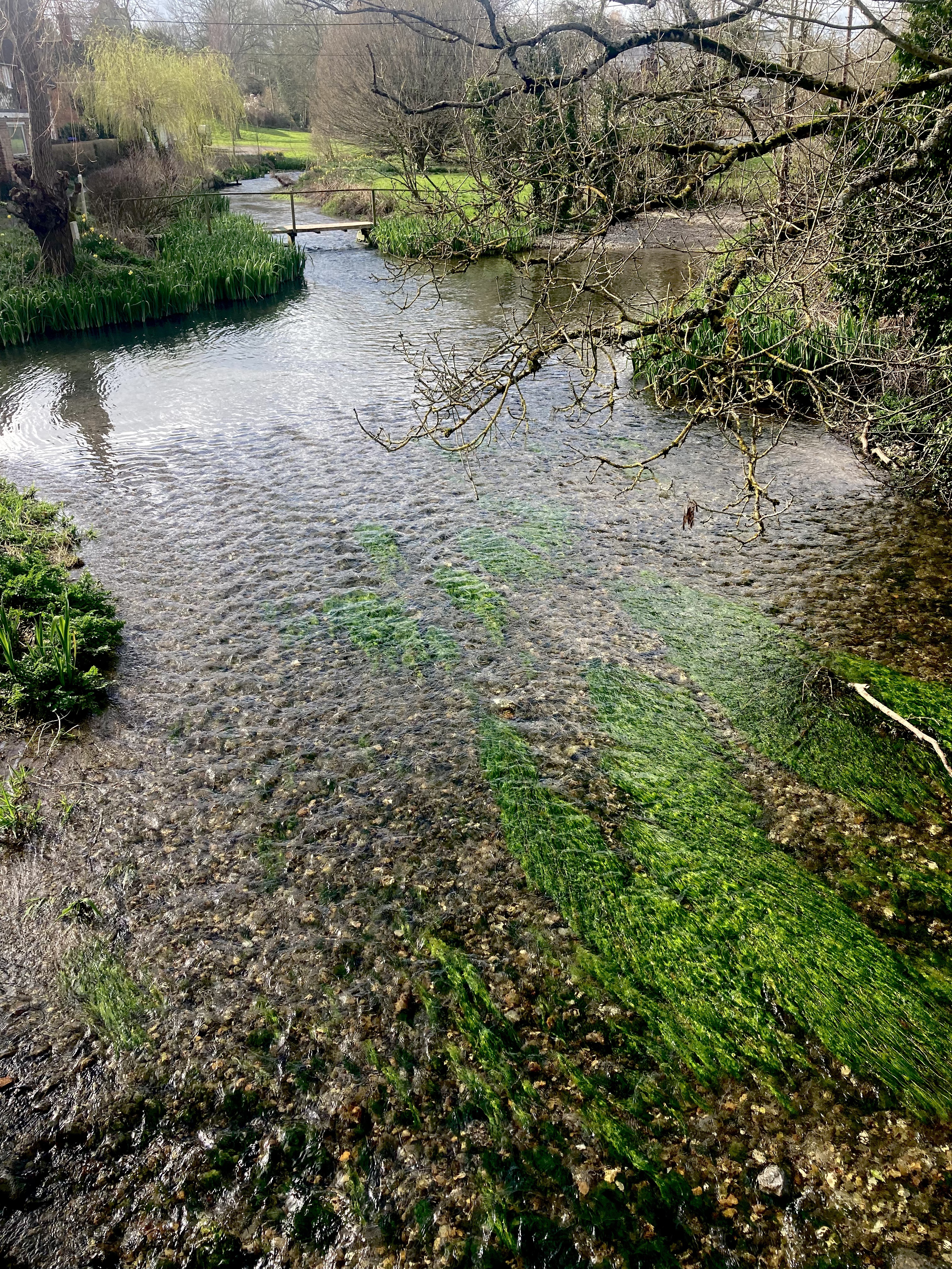
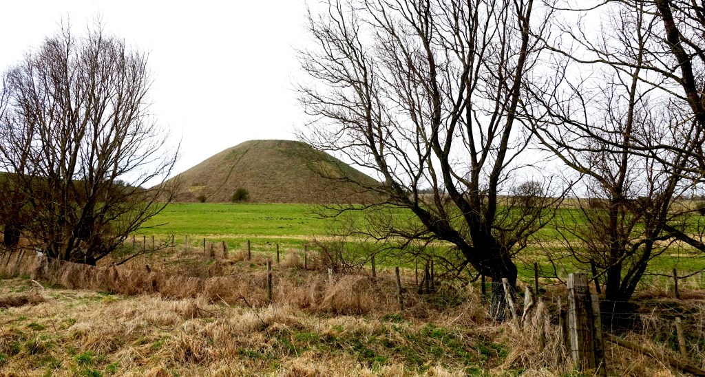
From the car park the route heads S, crossing the A4361, following a level footpath next to the infant River Kennet, a chalk stream, crystalline water running over the white chalk riverbed, before passing Silbury Hill on the right, the largest artificial prehistoric mound in Europe at 30m in height and some 4,500 year in age.
Top: Silbury Hill. Bottom: Looking back towards Avebury
A little after crossing the A4 the route then heads E until it meets a metalled road where it turns S again as the route begins to rise, passing the West Kennet Long Barrow on the right, a neolithic burial chamber. At the 1.5 mile mark the route becomes a bridleway heading SW as the broad sweep of big skies, flint-strewn farmland and downs begin to fill the view. The views improve as the route continues its gentle ascent for the next 2 miles, the swelling downs and its features coming into focus until at 4 miles you meet the amazing Wansdykewhich can be walked in its own right. Originally a 35 mile long defensive earthwork of large dyke and parapet form running east to west that snaked through Wiltshire and Somerset, it was probably constructed after the Romans left Britain as a defence against invaders from the north, possibly the Saxons. Being high on the ridge and spared the plough, this stretch of the dyke remains quite intact.
Top: Wansdyke, looking SE over the Vale of Pewsey and the Pewsey Downs. Bottom: Looking South from the ridge over the hill fort of Rybury and the Vale of Pewsey.
The route climbs Tan hill where there are excellent views to the S across the Vale of Pewsey towards Salisbury Plain and Rybury hill fort, before cutting back roughly E, joining the dyke and ditch for the next half mile. The dyke made a decent wind shadow giving us a chance to have a break on the grassy slope to take in the scene out of the hoolie at the halfway point. At 5 miles there are options, with routes to the W along the dyke and S towards Milk Hill picking up the Ridgeway LDP– both of which link up with paths heading back to Avebury. Our route joined the White Horse Trail heading NE for the next 2.5 miles on a long descent; Skylarks, Yellowhammers and deer logging our progress through the the ancient, flinty landscape, the sound of the A4 growing as it follows the Kennet river valley.
At nearly 8 miles the path meets the small metalled road used earlier and turns right to the N before reaching the A4 where the the route turns right E, there are decent verges to walk on for the short stretch before crossing the road to join a small B road heading NW before entering the amazing neolithic Stone Avenue, via a gate into the site. Originally there were around 100 pairs of sarsen stones creating a 1.5 mile long avenue leading to the massive stone circle of Avebury but only 27 remain, most having been torn down and broken into fragments for building material.
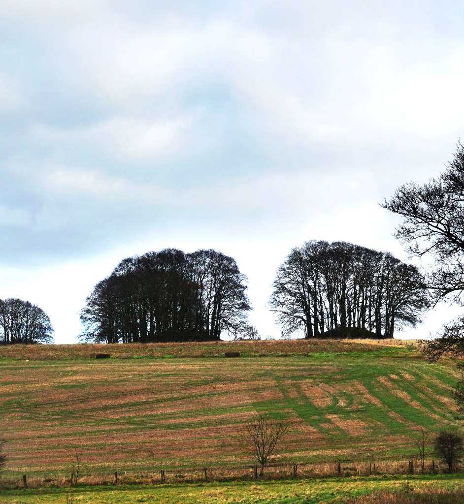
Tree covered tumuli overlooking the Stone Avenue
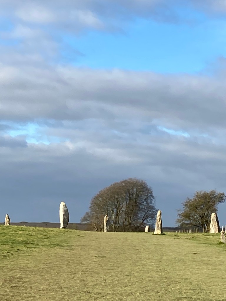
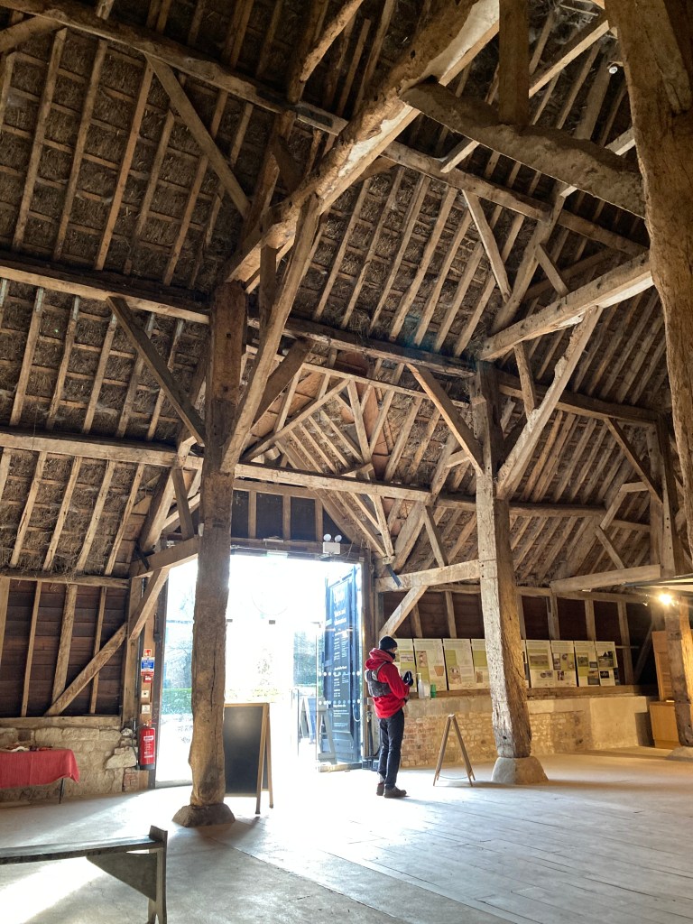
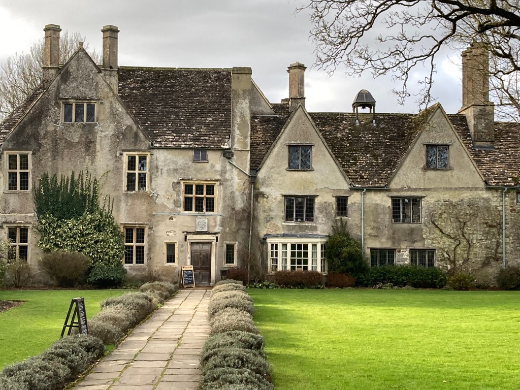
At 9 miles the route reaches the unique village of Avebury, a World Heritage Site, much of which is built within the most complex of Britain’s surviving neolithic henge monuments, the banks of which were once 55 feet in height, a third of their height today, above what was originally a 30-foot ditch. The massive stones form the largest stone circle in the world, measuring 330m across, originally comprised of around 100 huge standing stones, of similar age to Stonehenge, the bright white chalk sides of this immense surrounding structure (and the other large earthworks in the area) would have made it a luminous beacon in the landscape. Within the picturesque complex of barns of Avebury Manor and gardens there is a National Trust cafe (open Wed-Sun, 11.00am-4.00pm) and small museum. The barn is a grade I listed marvel. From here you can walk through the churchyard back to the high street where there is a cut through to the car park and a little further along a small village shop.
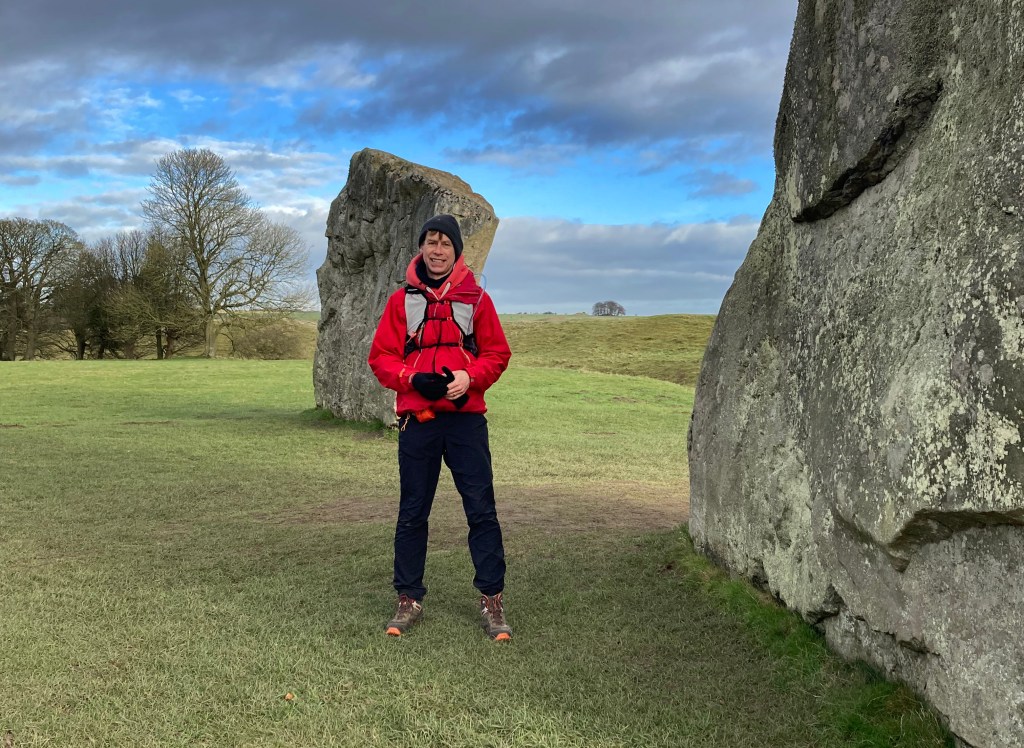
Clockwise: Dom, my walking mate, in the stone circle at Avebury – The Stone Avenue – Manor Barn -Avebury Manor.
The pleasure of this area is the excellent network of footpaths and byways enabling exploration of this dramatic downland scenery and the physical evidence of the neolithic world. We spent about four hours walking the route but there is so much history to explore the unique historic monuments in the landscape while walking through one of the country’s most magical landscapes.
It is less than ideal that agriculture abuts many of these important sites leaving little space to walk freely – access understandably confined to linear routes through the landscape given current land use. While the intense agriculture provides pattern to the landscape, some years ago a pesticide spillage possibly as run-off, into the river Kennet had a drastic effect on its biodiversity. One can hope that with a change in our attitude to the grass chalkland landscape, agriculture and biodiversity, not just here but in Sussex, Dorset and elsewhere, we can return the landscape to a more sustainable and hospitable environment for flora and fauna with less intensive farming and more wild space of chalk grassland where native species can be given the opportunity to thrive and users can develop a better appreciation of our natural world.
Farming practices can have an almost immediate impact. To quote the RSPB: “In the UK, the Skylark population halved during the 1990s, and is still declining. In the preferred habitat of farmland, skylarks declined by 75% between 1972 and 1996. The main cause of this decline is considered to be the widespread switch from spring to autumn-sown cereals, which has resulted in a dramatic reduction in the number of chicks raised each year.”
The 2019 State of Nature Report also provides cause for concern: “Since the 1970s, it has been shown that 41% of all UK species studied have declined. Some groups are faring worse than others. For example, 26% of the UK’s mammals are at a very real risk of becoming extinct, while 22% of seabird species studied have declined in the last five decades. On a species level, the figures are even more shocking. Since the 1950s the number of hedgehogs have declined by 95%, while turtle doves have crashed by 98% and even numbers of the common toad have fallen by 68%.”
There is some hope and transformation is possible. The RSPB have reverted 24 hectares of arable farmland to Chalk Grassland at Manor Farm in Wiltshire while The University of Manchester is researching how best to regenerate our chalk grasslands, 80 percent of which have been lost since 1945. At the same time the National Trust has said it wants to address the “dramatic slump” in wildlife by creating and restoring 25,000ha of habitats – equivalent to 10% of its land. It’s a start.
The Marlborough Downs Nature Enhancement Partnership is a farming led group “Making Space for Nature on the Marlborough Downs”. Clearly there needs to be a collaborative approach to the issues impacting the natural world and where farmers and landowners are working towards a reversal to species decline there is a model that can be applied elsewhere in the UK.
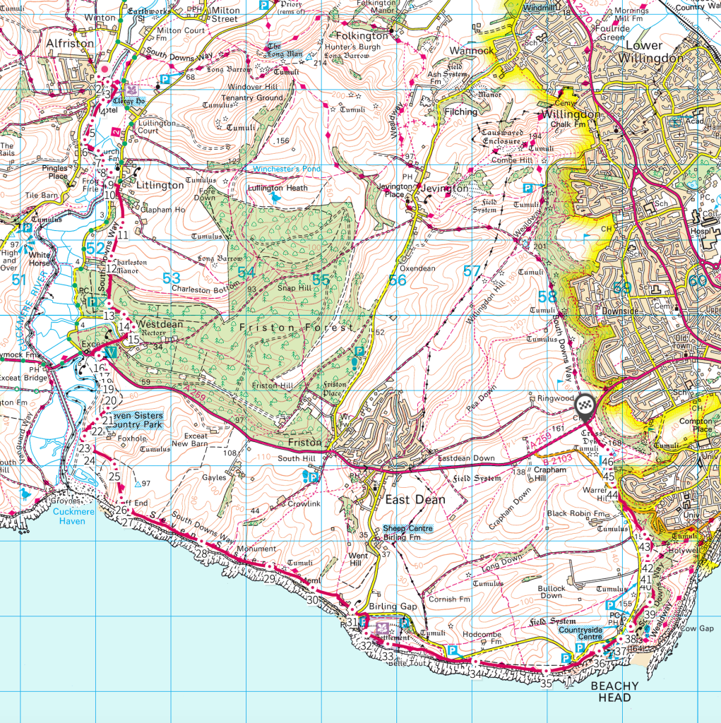
A dingy December day, a milky sky hanging over London, time on my hands. No reason not to hop on a train to Eastbourne and a bus up the hill and take in the rolling Seven Sisters cliffs, Beachy Head, some river views, wonderful downland and a village pub in Alfriston before a quick bus ride to festive Lewes to take in the atmosphere before catching the London train home.
I took an early train to Eastbourne from Clapham Junction in order to make the most of the short Winter day, this being a 11.5 mile walk taking about six hours with 2,500 ft of ascent – so a decent stretch (map at foot). Arriving at Eastbourne I took the 12 ‘Coaster’ bus which leaves from Gildredge Road (stop G1) around the corner from the station and heads uphill and westward to the point where the South Downs Way (SDW) crosses the A259 at the conveniently named ‘South Downs Way’ bus stop. I opted for the longer southern SDW route but there is also the northern route from this point which takes in the Long Man of Wilmington and offers a shorter 7 mile walk to Alfriston. I have yet to walk this (have done so now and it’s a great walk: link to same) but it looks like a great option (you could also add another 7 miles of the SDW to this and make this a long 14 mile walk to Southease station).
I have tried for most of my walks around London to use public transport where I can. I recommend it. It’s quite easy and with a little planning is cheap, environmentally sound and far more relaxing than sitting in a car for hours. With a rail pass my return fare using trainline.com and a bus fare cost £22 in total.
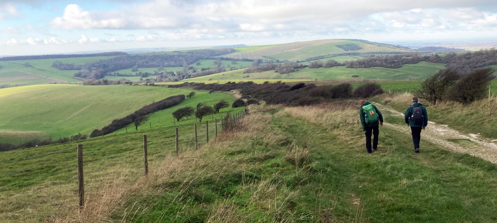
Arriving on top of the downs it had a moorland feel – dank and breezy in the low morning cloud/mist; cold and murky. The level route heads roughly S/SE for a couple of miles accompanied by roads along the edge of the hills overlooking Eastbourne (when it’s clear). I started walking in a base layer and lightly insulated jacket and as I got going I warmed up quite quickly.
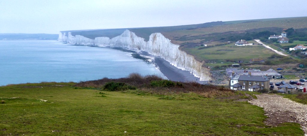
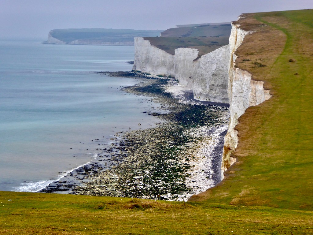
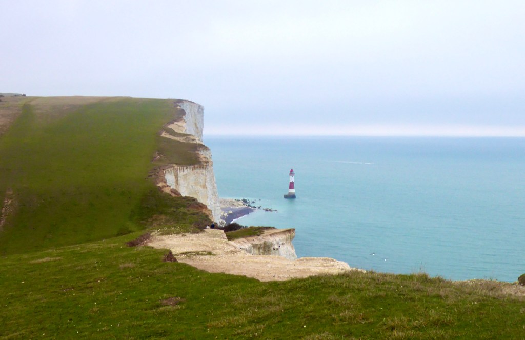
As the sea came into view, merged with the grey sky, a pink tinge on the horizon, the route heads SW, still following the curve of the road before meeting the cliff top at Beachy Head (you can take a lower hilly route but I wanted to stay high to get some decent walking in). From here, a great deal of the first half of the walk is on view. The precariously perched lighthouse of Belle Tout, Birling Gap beyond, then the rollercoaster, chalk-faced ‘Seven Sisters’ undulating westward towards a hint of the river Cuckmere. The walking is lovely here, it’s a 500 ft downhill with a couple of climbs before arriving at Birling Gap where there is a cafe and toilets. Past this point the coast road thankfully heads N and leaves you in a more peaceful setting as you walk westward over the Seven Sisters cliffs and dry valleys which form its rollercoaster contours. It’s hard work as the ascents and descents are quite steep and seven of them make it a workout. There is a small monument with a seat at the 6 mile mark where I stopped for lunch, the masonry providing a kind wind shelter while I rested at this halfway point of the walk.
Looking West across the Seven Sisters a mile or so West of Birling Gap, monument with seating in the distance.
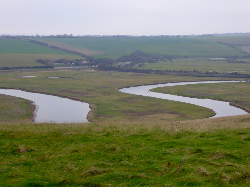
Having climbed ‘Cliff End’ the torture eases and the route descends towards the river Cuckmere where the path turns roughly N back up into the hills before crossing the busy A259 and climbing up to the Edge of Friston Forest with views of the Cuckmere and coast below. The path descends steep steps to the hamlet of Westdean before continuing NE upward through the woodland and turning NW before another climb into open farm land beyond Charleston Manor.
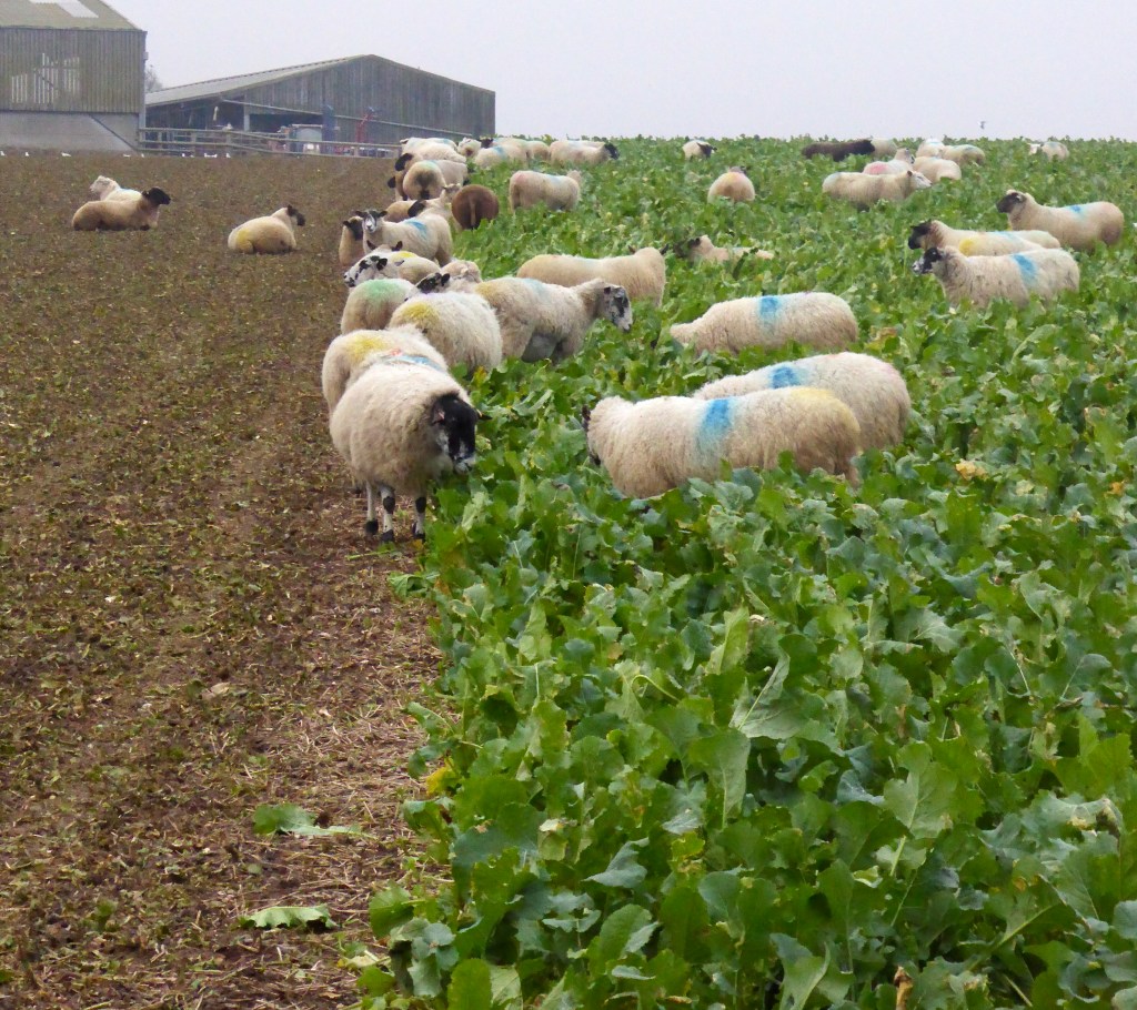
The Cuckmere ValleyThe Star in AlfristonSheep may grazeThe iconic Beachy Head lighthouse
From here it all goes downhill in a good way. The last couple of miles are almost at sea level and flat. Passing through the hamlet of Litlington on the road for a hundred metres or so, the path takes a sharp left towards the river. It can be really claggy here and was the least pleasant stretch of the walk but after a hundred metres or so the path follows the raised levee which is drier and easier going into Alfriston. The village is a joy. Several pubs, a 14th c. church, large green, a few of shops and masses of character. I was here in 1975 when I walked the SDW as a teen and can clearly remember drinking Guinness in the evening in Ye Olde Smugglers Inn with my two mates having nearly completed the length of the walk.
The bus to Lewes (for me to pick up the Eastbourne train back to London) left at just after 4pm so I had nearly an hour to sit by the open fire of the medieval George Inn and relax over a pint. The bus leaves from the village car park two minutes from the village centre and takes about 20 minutes or so to reach Lewes. Another hour or so before my train departure gave me time to have a wander around this lovely town and visit another lovely pub.
This is a great walk. Hard work – and I think a breezy warm day of blue skies and clear views would make it better still and more worthwhile in terms of views, nature and simply soaking up the atmosphere. I’ll come back in late Spring to do this again with a longer day to linger in a few of the amazing landscapes it offers.
One bonus of having walked this before is to see how footwear and clothes compare. The last time I made this walk a couple of years ago W to E, my feet really suffered – though I was on tarmac for the last couple of miles trudging through Eastbourne. I have recently started using Footactive Sports Innersoles which can be picked up for half price at about £14.00. The difference (compared with using Salomon’s branded insole in my X-Utras) has been amazing, the same boot but the forefoot and heel are just better protected from impact and a gnarly surface underoot. Innersoles in general (I used to use Superfeet Green but found them too rigid) and these in particular, have had the most beneficial impact on my enjoyment and comfort on longer walks.