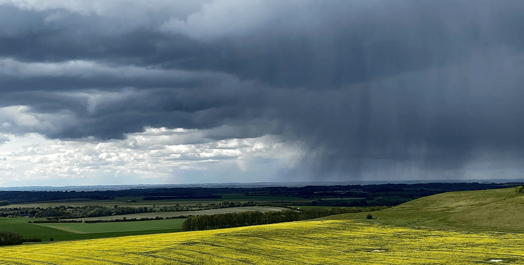
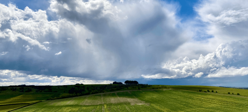
The Marlborough Downs is one of the most fascinating places in the UK, steeped in early history which remains etched in the ground. The walking is enjoyable, the far reaching views, sights and sounds really special, even on a day of wintry showers.
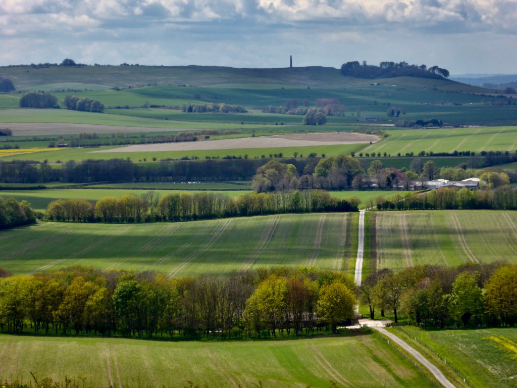
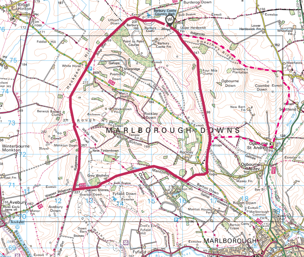
Meeting up with friends after the long lockdown, we chose a circular route taking in the distant views offered by this ridge walk of 11 miles. Our walk began at the free car park (part of the Barbury Castle Country Park, about four miles South of the M4 and Swindon – map below) on a day of sunshine and showers of May hale, heading first E past an ultra-modern house then farm buildings. You can take a more easterly, longer option along lovely Smeathe’s Ridge or the more southerly route along a well defined track bordered by Hawthorn trees and a deep green verges. We chose the latter option as it stays higher for a few miles, whereas the other route descends into the villages of Ogbourne St Andrew (pub) and Ogbourne Maizey (see map).
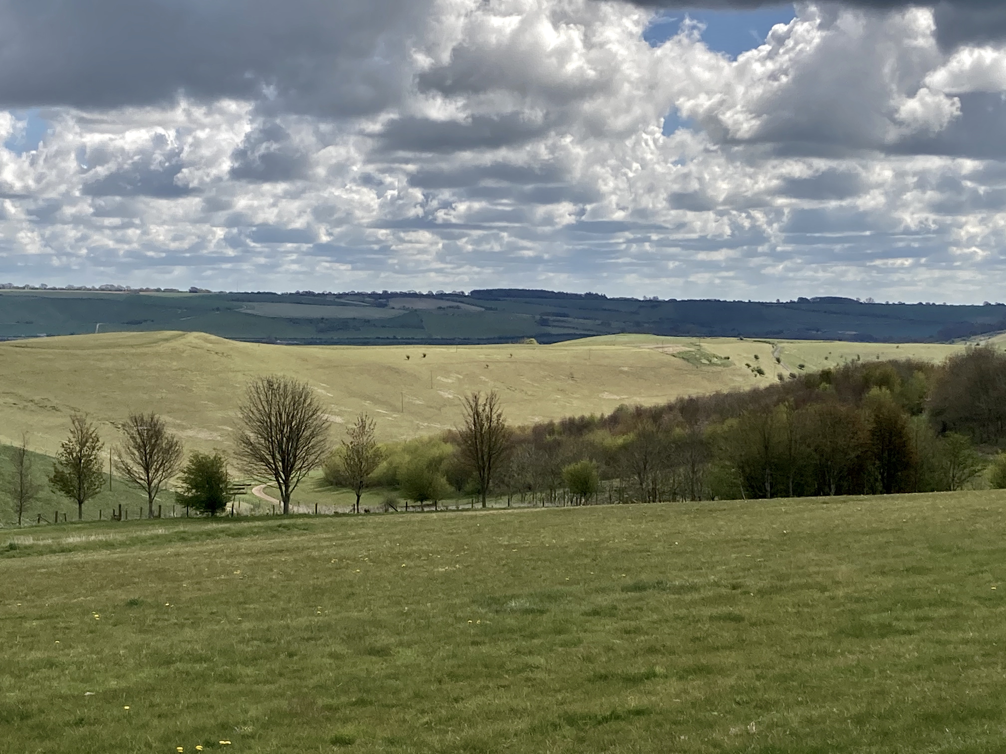
In a matter of a few yards our path opened up to wide views on either side with views of Smeathe’s Ridge, the white of the chalk and flint path wending southward alongside the gallops for race horses trained and stabled locally. From the ridge, the path descends gently to a minor road at the 3 mile mark. Walk past a few houses on your left, cross the road about 100 yds further on and join a small footpath which heads uphill heading W. Once you reach the well maintained track and gallops at the top, turn right to the NW and follow this to the 4.3 mile mark then bear left SW and follow the track uphill for half a mile mile through a gate onto Fyfield Down.

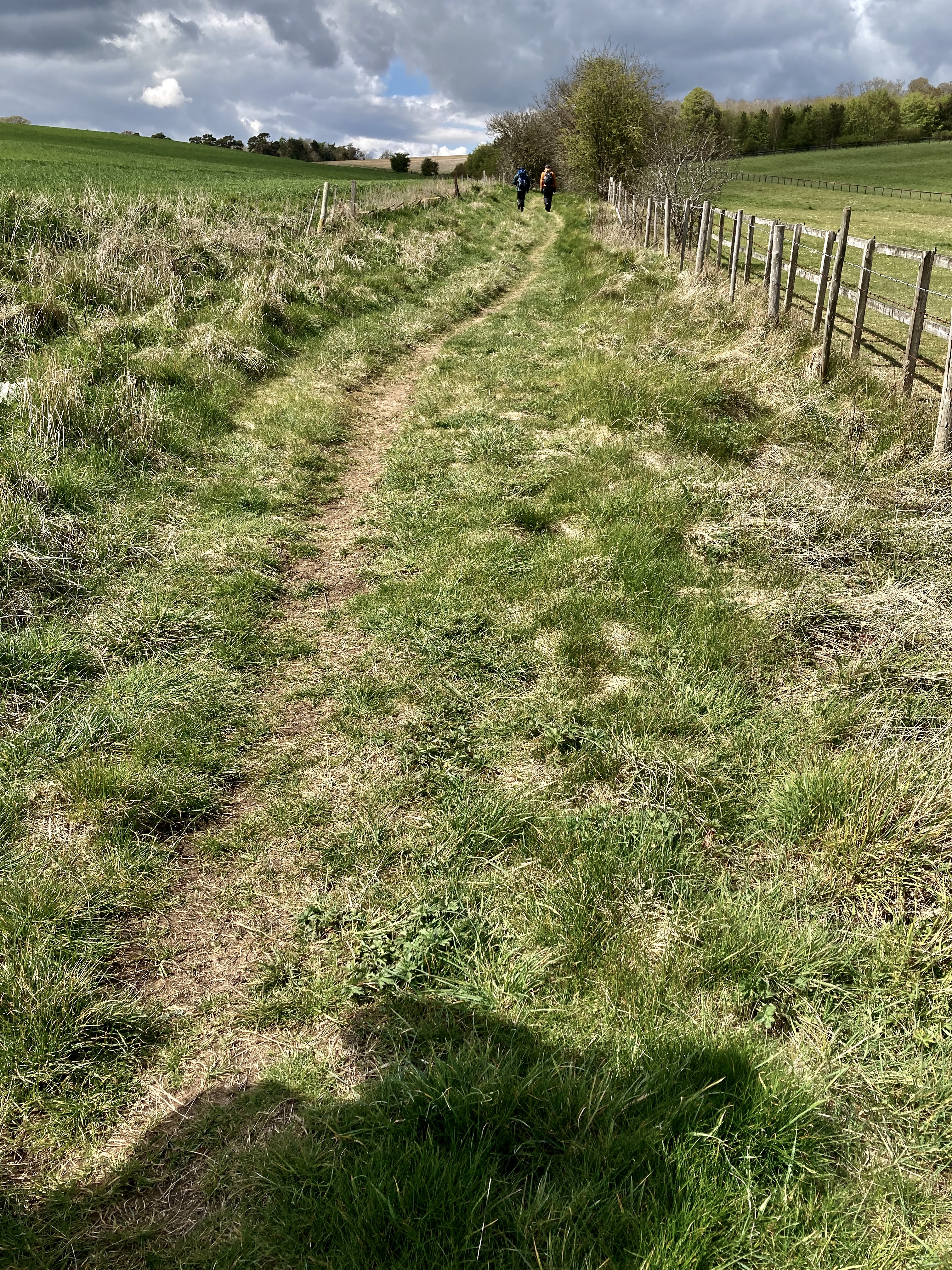
Left. the track heading South. Centre. View of Smeathe’s Ridge. Right: the path uphill from the road
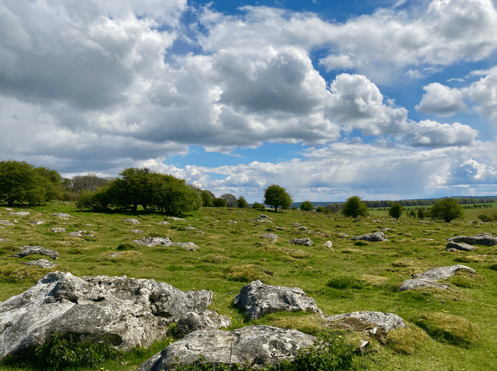
Fyfield Down has to be one of the most engaging landscapes in Britain. The Sarsen stones for Stonehenge came from West Woods a few miles south of here and the large sandstone blocks still bear the marks of use for sharpening neolithic stone tools. Called ‘Grey Wethers’ as they could be confused with the shape of sheep, the name Sarsen possibly stems from the Anglo Saxon ‘sar stan’, meaning ‘troublesome stone’. This is a great place for an early lunch or simply to sit and ponder on the place, soaking up the ancient atmosphere amid the sound of skylarks while taking in the views to the South from a choice of stone seating.
Keep heading SW through a gate and at the 6 mile mark, the route meets the ‘Ridge way’ scarp slope, part of a prehistoric road system used for at least 5,000 years by travellers, drovers and armies needing a reasonably passable means by which to traverse the country for 85 miles from the World Heritage site at Avebury to Ivinghoe Beacon. A national trail, the Ridgeway is a charming long distance footpath. Turning right to the north the path is a broad bridleway with expansive views to the South West towards Avebury and the more westerly stretch of the Downs and Ridgeway. The route follows the Ridgeway for another four miles before nearly completing the circle and reaching Barbury Castle which dates back 2,500 years. On a sunny day, this is a perfect place to lie on the accommodating grassy slopes of its long low amphitheatre and soak up the afternoon sun before the short stroll back to the less scenic carpark.
This part of the West Country deserves a visit. The history under your feet, the artefacts and monuments and vistas in amazing countryside make any walk here truly enjoyable.

One thought on “‘Ridgeway Round’ – walk, Marlborough Downs, Wiltshire”