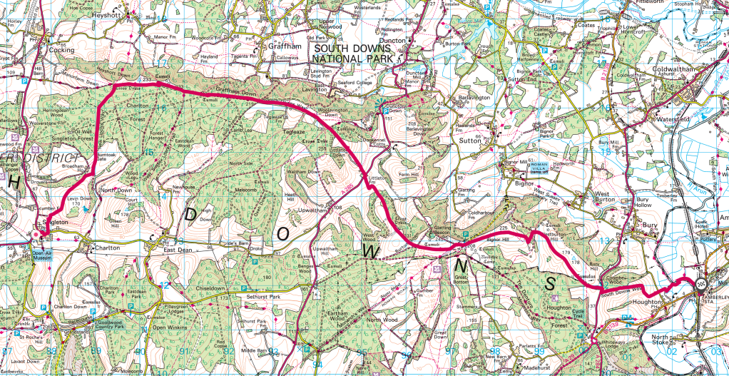
The weather for mid May looked disappointing – a cool mix of rain showers, occasional intense sunshine and, on the one day I could get away, cloud with the added interest of a twelve percent chance of rain but forty mph plus winds. Lovely. Keen to get into the countryside using public transport from London, wherever possible, to complete sections of the South Downs Way (SDW) as day hikes, I left Clapham Junction bound for Chichester on my delayed 9.42 am train. In this instance my 13 mile route (map at foot of page) started in the charming village of Singleton (a twenty minute journey N of Chichester using the thankfully frequent route 60 bus given my delay) ending in Amberley, a village with station which sits in the valley of the River Arun.
Lapwings mobbed seagulls and crows in the in the fields under the leaden sky as the train passed Arundel between the long sculpted valleys of the Downs dip-slope and with twenty minutes of the train journey left I reviewed my options and finalised my route. Rather than taking the Bus to Cocking, half a mile N of the SDW, I wanted to walk the New Lipchis Way from Singleton heading NE for about 2.5 miles to meet the SDW, up the sloping downs and through the large forest of mixed woodland which stretches for miles to the S of the SDW.
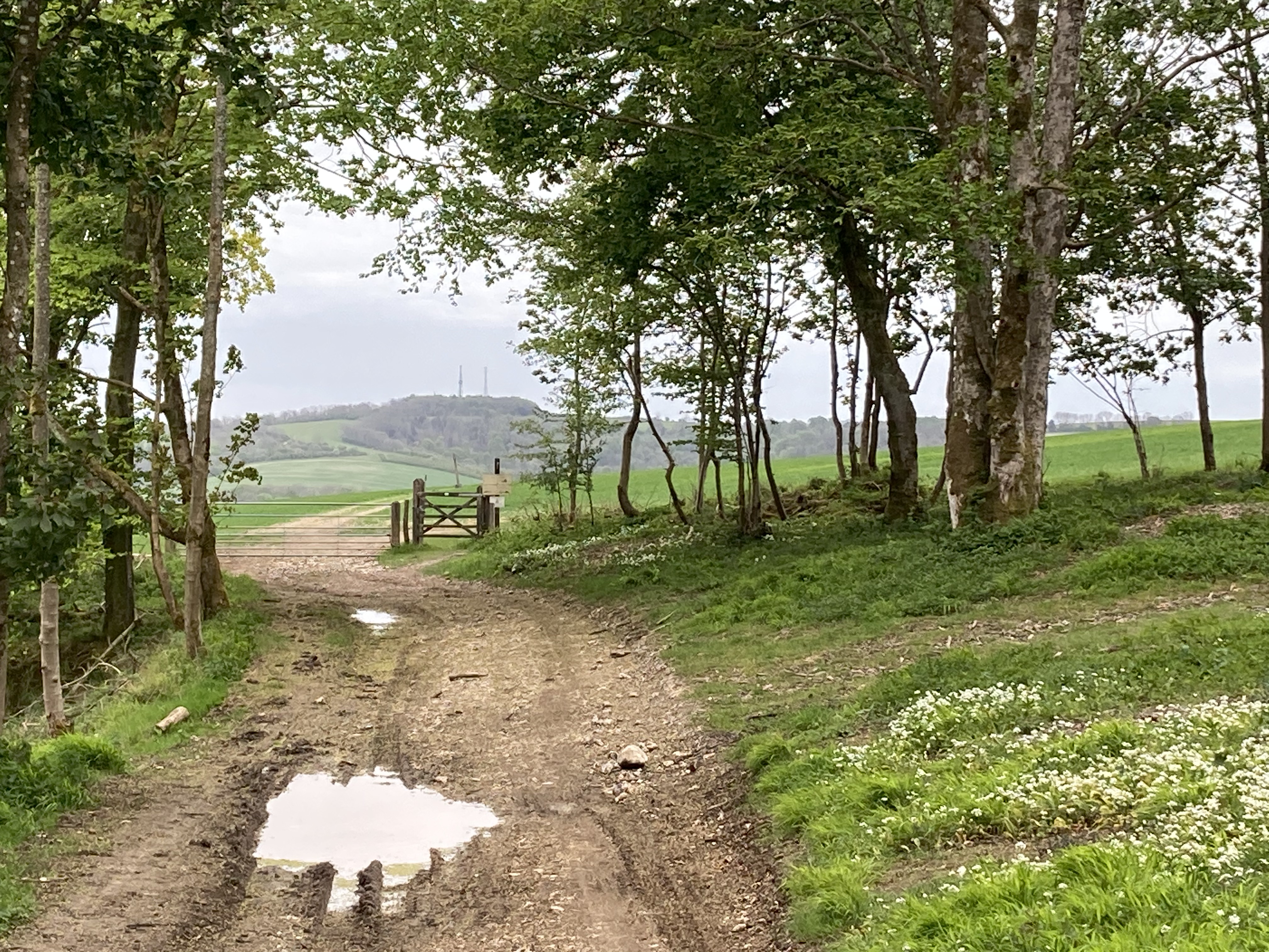
The bus trip from Chichester (two minutes from the train station) took twenty minutes to my stop in Singleton, the walk proper starting from a small footpath adjacent the village school. This heads up Levin Down which is a beautiful stretch of wide country which I enjoyed on my own, with views to the W. the walk continues over lovely undulating ground, the forest ahead dominating the skyline. A pair of Yellowhammer took to the air in the stiffening breeze as I reached more open fields and headed towards Burnt Oak Gate at the edge of the wild woods of Singleton Forest via a narrow bridleway.
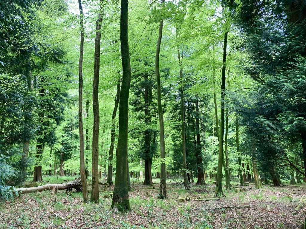
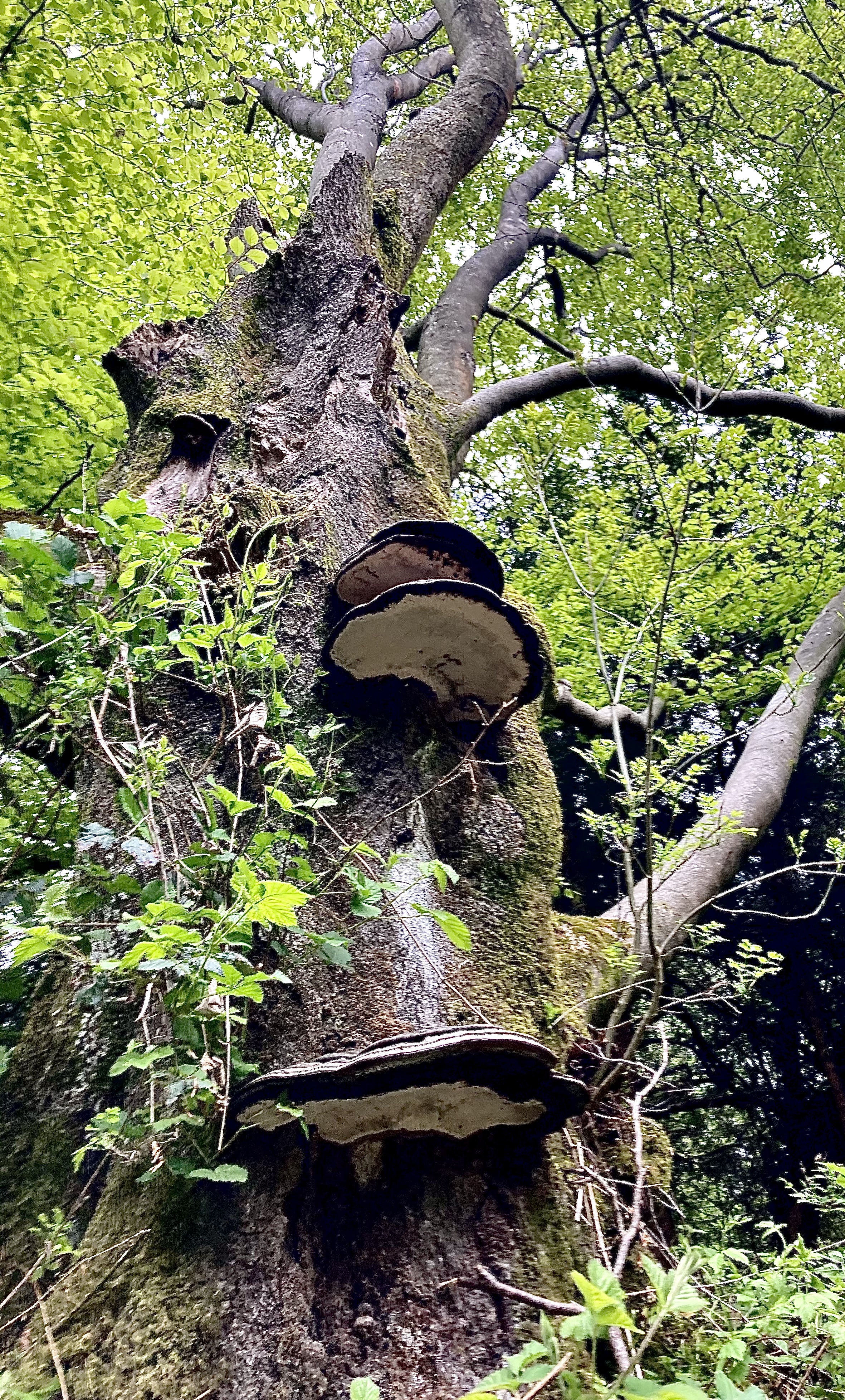
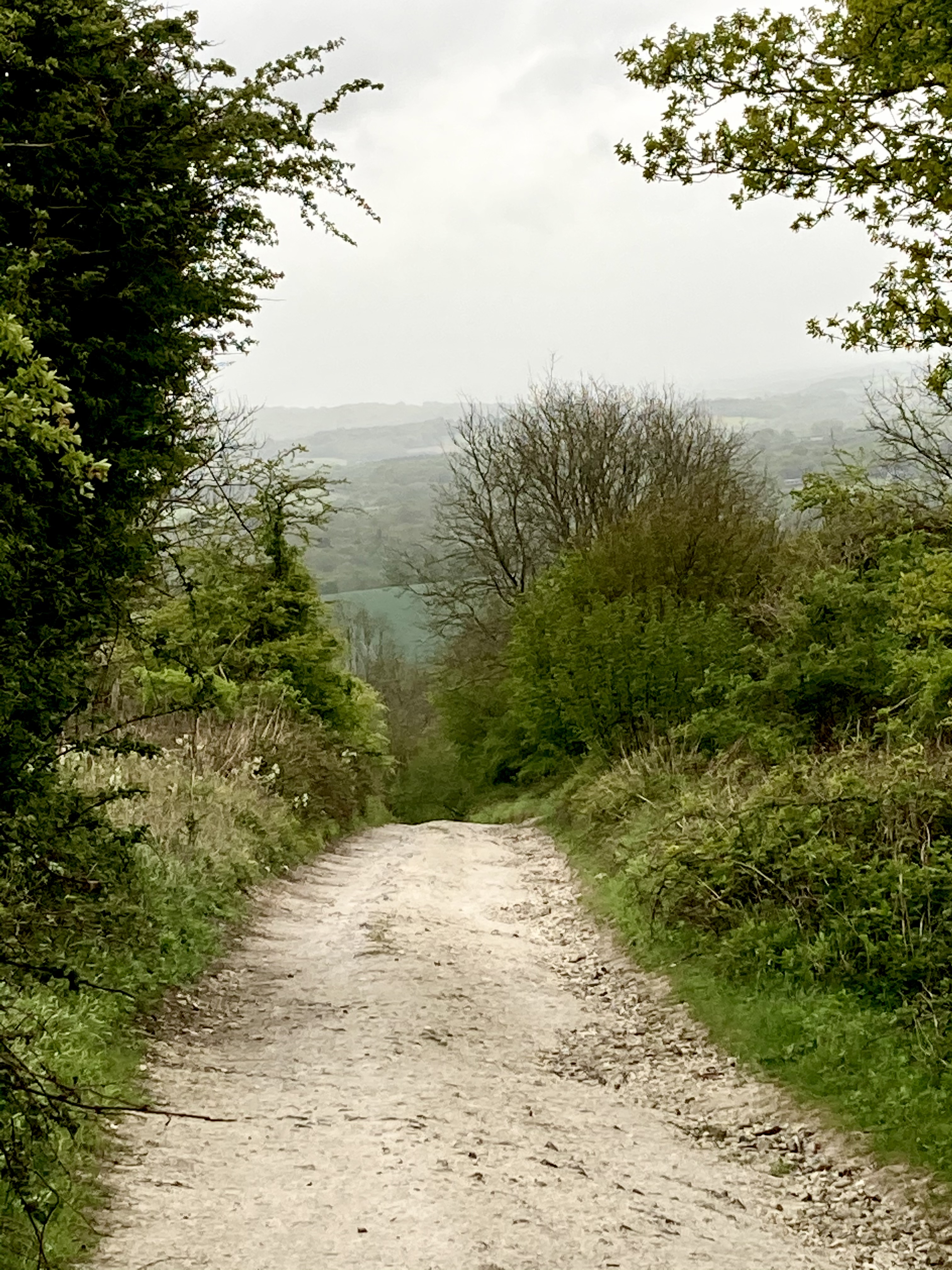
The forest is a stunning contrast to the open downland; a mixture of large Beech, conifer and smaller coppiced species inc. hazel, the paths well defined straight avenues. The wind was booming above the tree canopy and the shelter of the forest was welcome. The gently sloping route continues NE for just over a mile crossing rides and tracks before meeting the SDW at the 2.5 mile mark of the walk. Taking a right, the familiar views of the Weald to the N can just be seen through the dense Yew, Sorbus and thorn, adorned with the vines of Traveller’s Joy, all of which have remained pretty untroubled on the high, steep scarp slope where cultivation has never been a real possibility. This was a welcome level stretch after the climb and a chance to stretch the legs on a good surface, a wide track. A few bikes passed by, wearing the tell-tale badge of their tribe, a long, white chevron stripe of chalk mud starting at their ar$e and ending on their similarly coated back packs. I felt a little jealous of the miles, they would cover, I love bikes and as the SDW is a bridleway it’s a possible trip for the future.
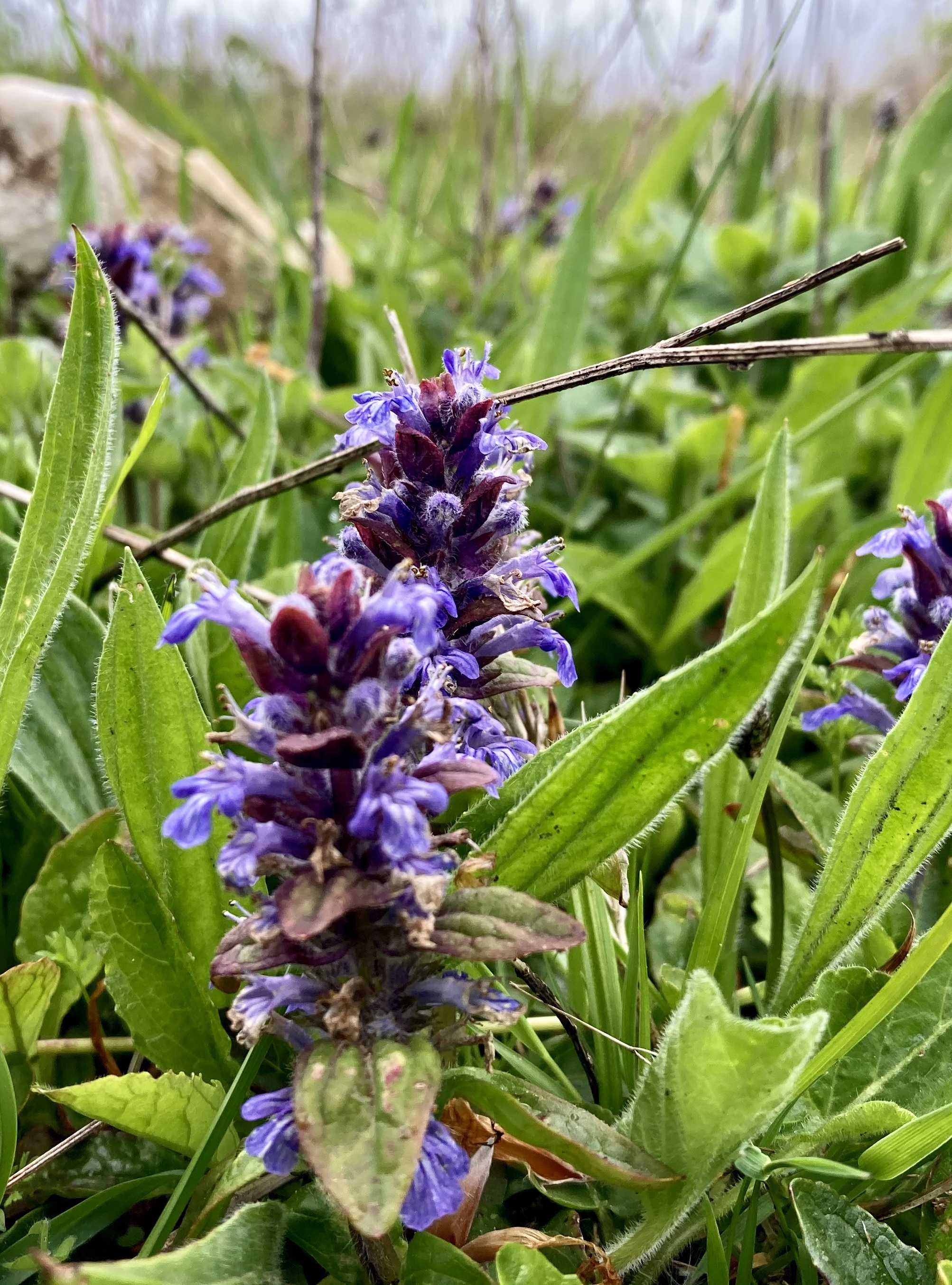

With the forest to the right and scarp the the left, the path continues past a 233m trig point (within a small gated meadow, ideal for a stop off) then through a wide cropped meadow of Cowslips peppered with Early Purple Orchid and Self-Heal (pics above) and one of a series bronze age ‘cross-dykes’ thought to have been built as boundary markers. This meadow leads to a series of nature reserves, which the Graffham Down Trust have developed over nearly forty years to to improve the biodiversity of the downs by creating an accessible mixed wildlife corridor a couple of miles in length. The reserves are home to an improving variety of species and exemplify how effort and the cooperation of landowners with a local community can make a real difference to the ecology of an area.
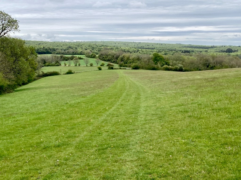
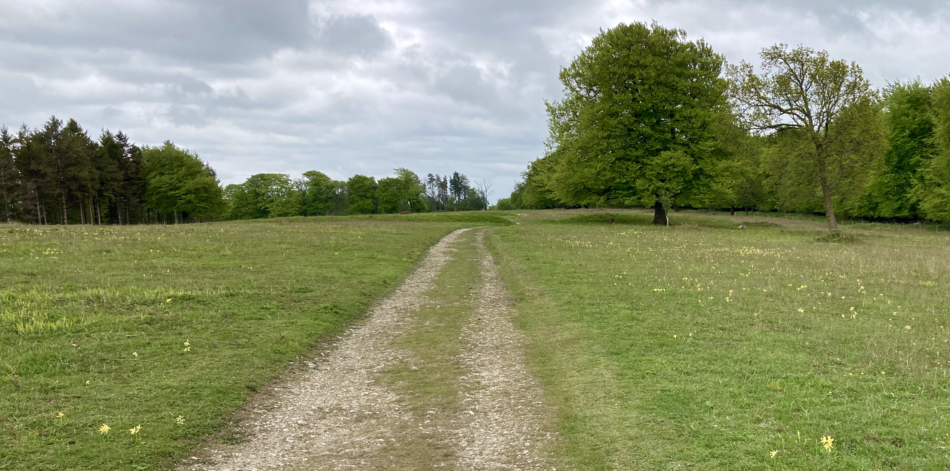
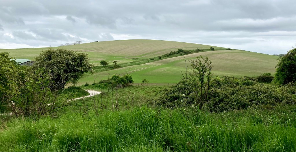
Just above Graffham Down itself, the path opens up and at about the 5.8 mile mark and enters open farmland of Littleton Down with wide views to the radio masts on Glatting Beacon to the E and lane to the N (pics above) before descending to cross the A258 road and rising to Sutton Down where I felt the full effect of the strengthening wind. It also began to rain, to rain horizontally and at speed. I was the winner of the one in five lottery for bad weather that day and I hadn’t brought over trousers. Instead I had a light silnylon poncho, bought as a tarp for quick overnighters but seldom used as I like tents. On a previous walk in Wiltshire, the rotation of cold rain/hot sun all day, had made putting on and taking off waterproofs a pain so I thought the poncho might make a quick to deploy rain cover given the remote forecast possibility of a shower but in the ever increasing squally rain, it was like wearing a large green kite which thankfully stayed grounded. It was hopeless, so I hid in the wind shadow of a clump of trees till the worst had passed over, stowed the poncho, donned a waterproof jacket which I had brought as a back-up and strode into the remnants of the hooley. My legs were wet in no time but on one side only, which was weird. Thankfully the rain subsided further and became a horizontal minor shower. I have made a promise to myself to always, always bring over-trousers.
A few of notes on kit. My rain jacket is the Arcteryx Beta SL Hybrid reviewed here. It’s made with two kinds of Gore-tex ‘Pac-lite PLUS’ with the tougher of the two used for high wear/stress points and it features ever useful pit zips. At 360g it’s packable but hardy. I have a few waterproofs but saw this on sale before the pandemic and read the glowing reviews which made it an easy choice to add to the stable. In the few hours I have worn it, in both strong wind and rain, it performed really well. The hood is excellent, the length great as is the overall fit.
In addition I was using Superfeet Green insoles for the second outing of twelve miles or more and I am impressed. They offer the arch support I clearly need, a decent level of comfort for the forefoot, which is good as the SDW can be flinty and my boots, Salomon X Ultras, are beginning to wear flat on the ball of my foot where I normally feel the road. The heel is also protected and cupped really well. Overall these insoles really do make for a much more comfortable, and therefore potentially, longer walk. The testament to this is the condition of my feet next day. No problems at all. No sore spots or tenderness. Having struggled some time ago for nearly a year with dreaded plantar fasciitis (the walker’s curse), I can absolutely recommend these. I initially read a brief review from what I consider one of the very best and impartial reviewers of outdoor gear: Section Hiker, who gives honest, no-nonsense (no advertisers) assessments of a plethora of lightweight kit. There is also a Lengthy review here of the insoles. At sale times they can be as little as £17.00.
I have also found what I think is my favourite all-round pair of socks, the ‘Darn Tough Light Hiker Micro Crew Light Cushion sock‘. Long name but really comfortable with some padding, which suits most of my footwear. Toes, heel, sole and achilles enjoy light cushioning while the lighter top allows the foot to breathe adding additional comfort in most temperatures. The height is also good for me – not too long. They are durable and while they cost about £19.00 they’ll give reliable and long service. If you are on the cusp of sizes, go up rather than down. It has taken me years to find my favourite fit, finish and functionality in my outdoor gear and family run Darn Tough is up there. In addition, they offer a lifetime guarantee even in the UK. What’s not to like.
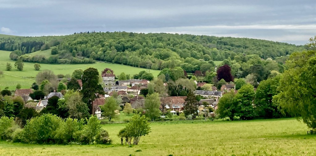
I had to get going as my delayed train in the morning had put me back by thirty minutes and my cheapo ticket obly applied to a single train, the 17.17 to Victoria. At about 8.5 miles, the route crosses a road end and carpark and climbs to Bignor Hill then descends before climbing Wesburton Hill which in turn becomes a pleasing downhill walk to cross the busy A29 Road at about the 11 mile mark. Having crossed this, the route is a gentle descent into the slopes of the river Arun valley with views of Amberley which hugs the eastern bank of the river under the large scar of an old chalk quarry which, for for more than a hundred years, produced hydrated lime for construction. It’s easy to get wrapped up in the bucolic, forgetting that nearly ever manageable inch of the entire, useable landscape we now enjoy has, at some point in time, been a place of work and industry. For the last mile or so the path dog-legs between fields then crosses the river Arun over a foot bridge, at which point the path to Amberley station (tea rooms and pub) follows the river to the right into town while the SDW is signposted North.

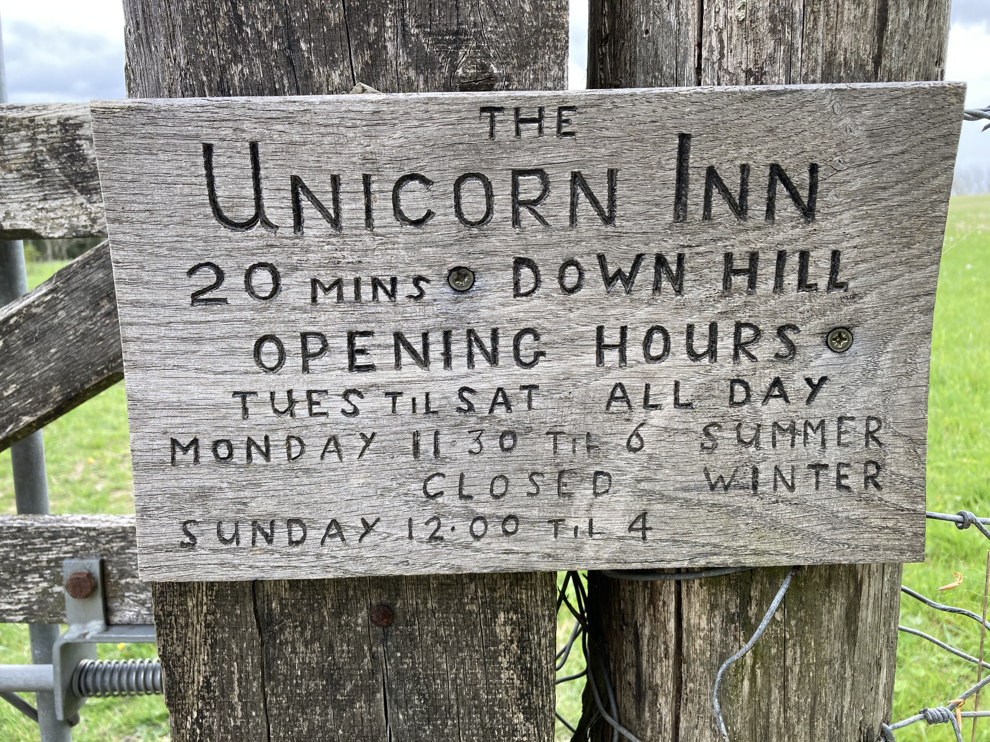
The delays leaving London meant I had barely enough time to meet my train. I had allowed for some leisurely idling on the downs which didn’t happen as the weather constantly threatened (and delivered) so I kept up a moderate pace and walked the 13 miles and 1600 ft of ascent in five hours. With better weather, lazy breaks for lunch and just sitting to take in the scene and sounds, I would make it a day of it and allow eight hours with the added benefit of an early dinner in Amberley at the ‘Bridge Inn’ which reviews really well, before a contentedly dozy train ride back to London. With my discount card, I managed to get to and From Sussex for under £14.00. With the bus the return trip to London cost less than £19.00. The route works equally well in reverse with the destination being Chichester, an amazing city with masses of history and watering holes for the weary traveller