‘Petersfield to West Meon’ – walk, South Downs Way

Old Winchester Hill and fort above the Meon Valley

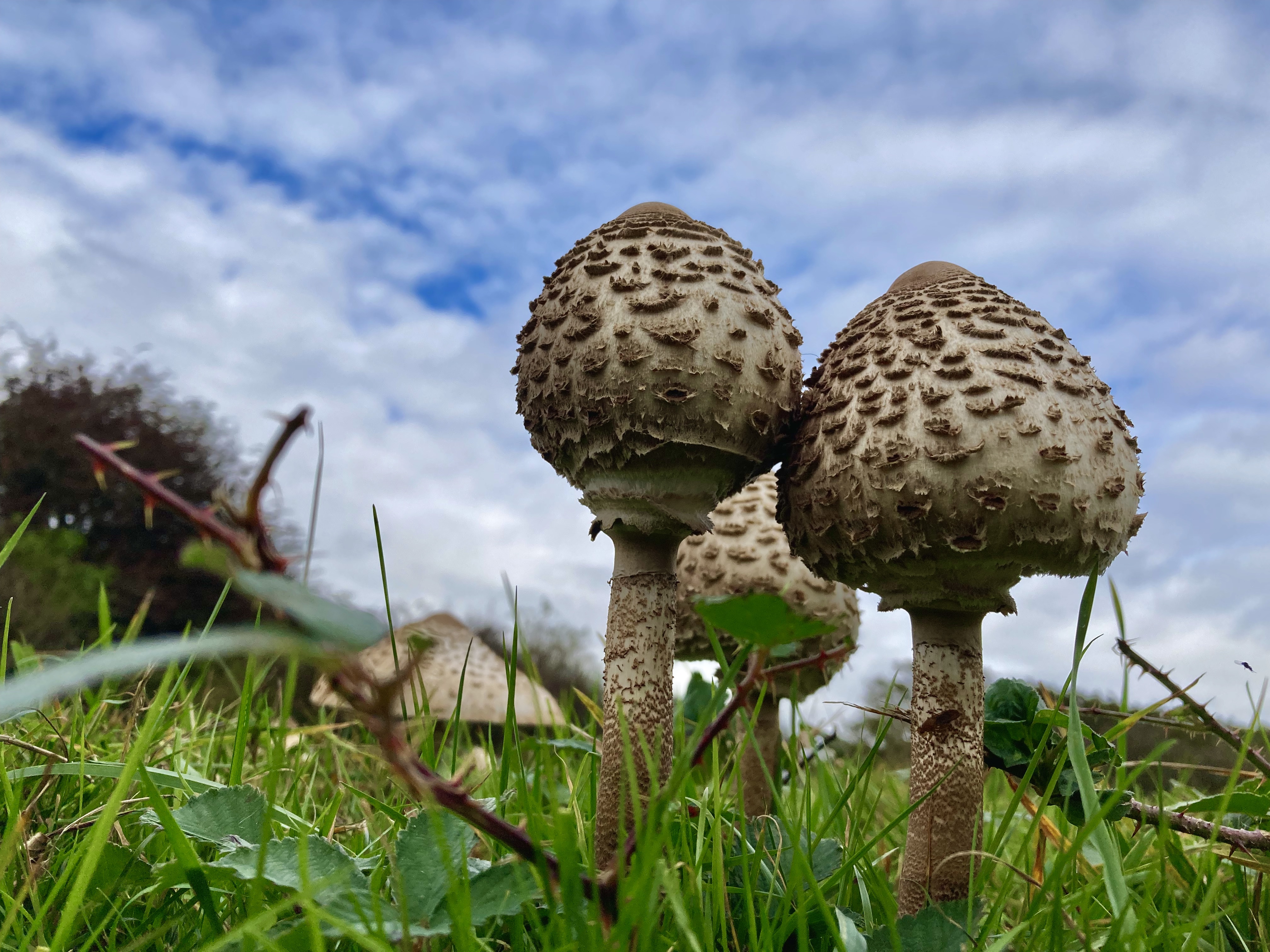
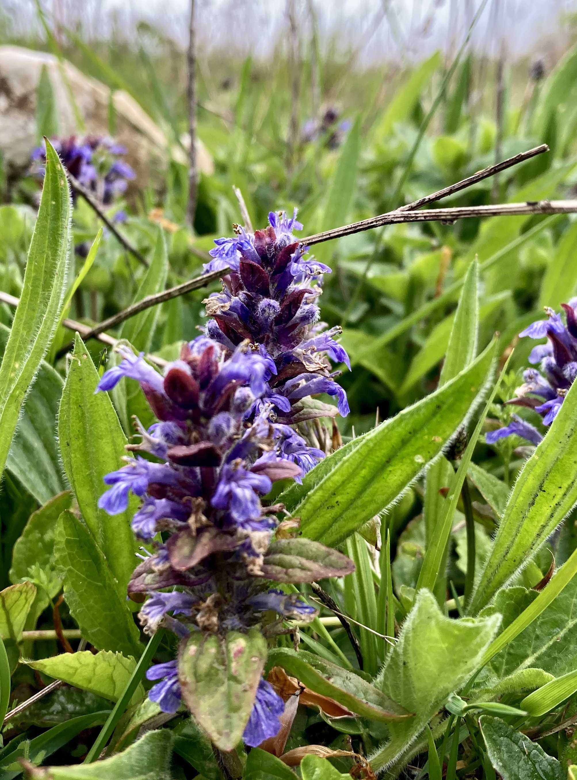
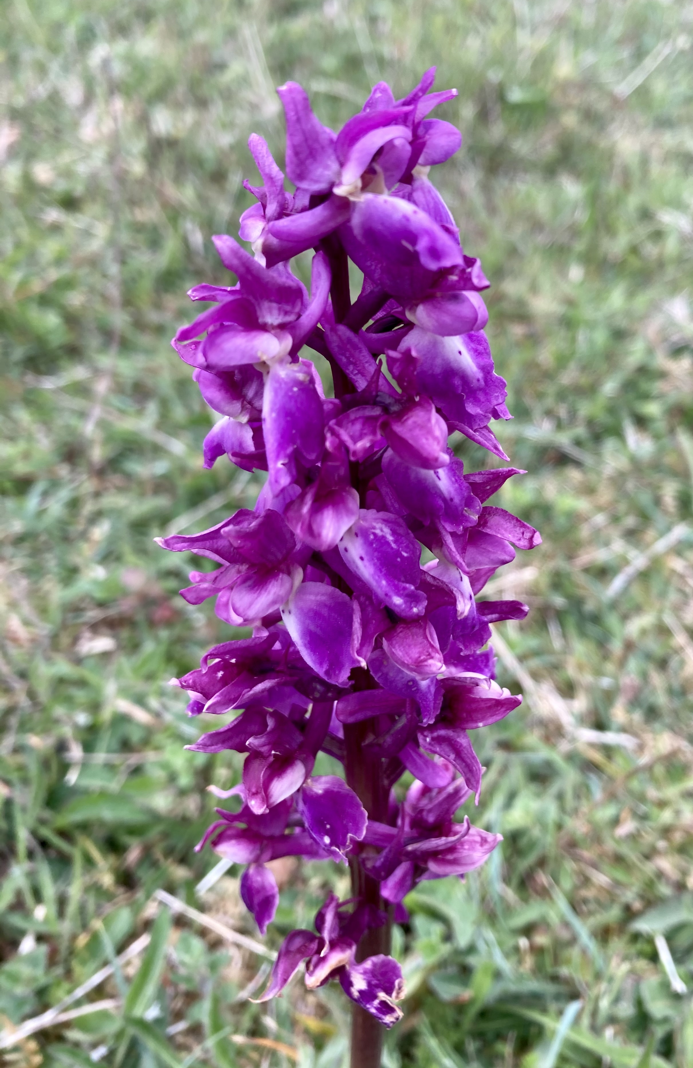
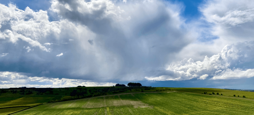
2021’s Autumn has been colourful, dry and warm in Southern England; excellent weather for getting out. It is a luxury to be able to walk on a surface that doesn’t attempt to suck your boot off or entice you to slip and land on your coccyx. Yes the daylight disappears early in the evening but the peace of the gloaming is another another facet of the pleasure of being outside.

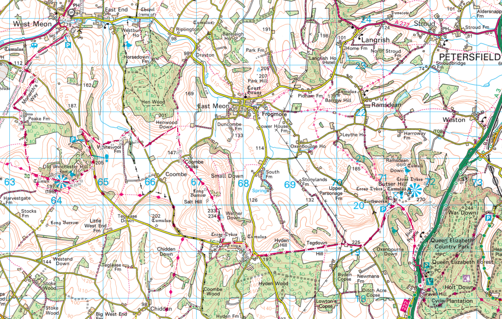
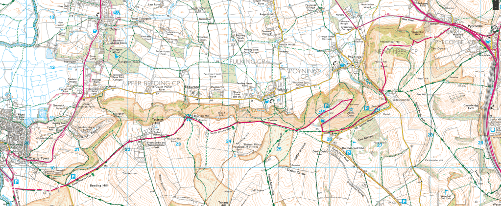
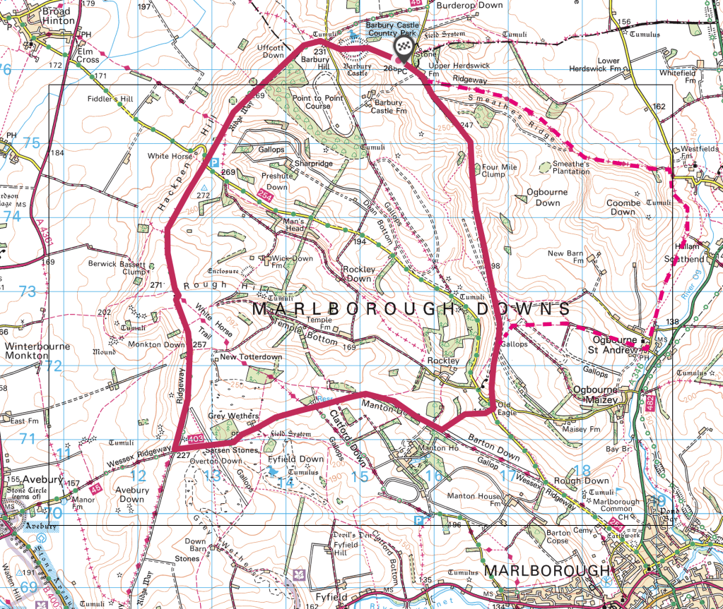
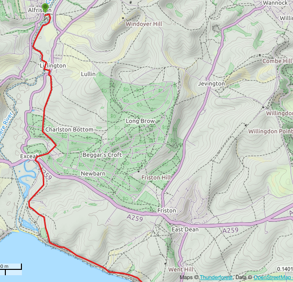
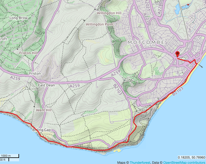
This walk is just over 12 miles in length, an undulating route taking 4.5 hours or more, along the ridges and downs and woods of the rolling Hampshire countryside. It takes in a couple of hill forts and some delightful stretches of enveloped path with a Hobbity quality to them. It also does have stretches that feel a little suburban but for the most part it is a not too strenuous route which can be shortened to suit in lovely countryside with excellent views and good paths. Link to route on OS website here, map at the foot of the page.

I have never walked the western end of the South Downs Way (SDW), it having the start/finish point of ‘Buriton’ when I walked it first as a teen. But with two legs remaining in order to complete my more recent walk of the SDW, I wanted to see why it had been extended, other than for the obvious spectacle of Winchester itself. It also reminds me of the inspirational rolling countryside I used to hitch around when at art college in Surrey which found its way into my sketchbooks.

I have tried to complete each leg using public transport wherever I can which has been largely successful. A cab or two has been necessary when buses or services have been cancelled but otherwise, I have found local buses to be excellent to get me to and from railway stations and trains to and from London. It takes a bit of planning and a bit of waiting sometimes but there are a lot of pubs near a lot of bus stops and more importantly I don’t use a car to get some fresh air in the countryside I value.

From home in North London I took the Overground to Clapham Junction to connect with my train to Petersfield. For tickets I use Trainline.com which I think is the best discount online seller with a good app and cheap fairs, particularly with a railcard that reduces the fares by a third. A little over an hour later I arrived in Petersfield and fifteen minutes later having bought lunch, caught the bus for the ten minute ride to the Queen Elizabeth Country Park which lies on the SDW to the southwest of Petersfield. It went wrong here. What I thought was a tunnel wasn’t so I chose to cross the A3 dual carriageway, not knowing that by walking down into the park to the E there is a service road that runs parallel to the A3 that has a perfectly safe underpass half a mile N of the bus stop. In my nominal defence, there was no useful signage to be seen near the bus stop to help.

The slope up to Butser Hill

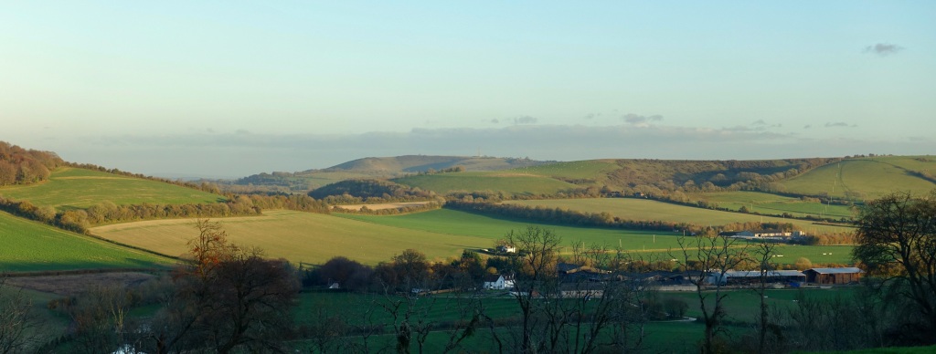
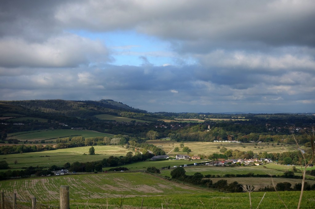
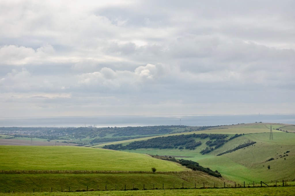
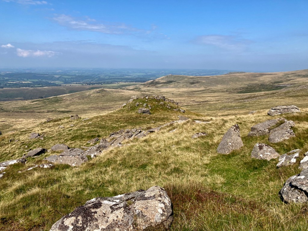
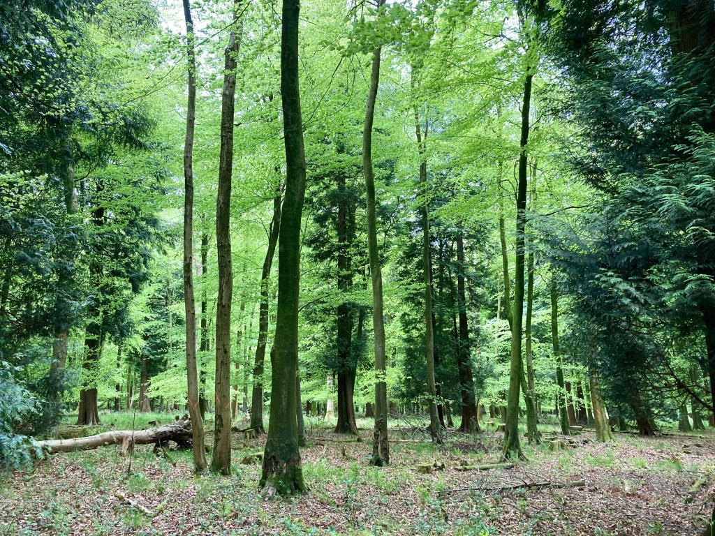
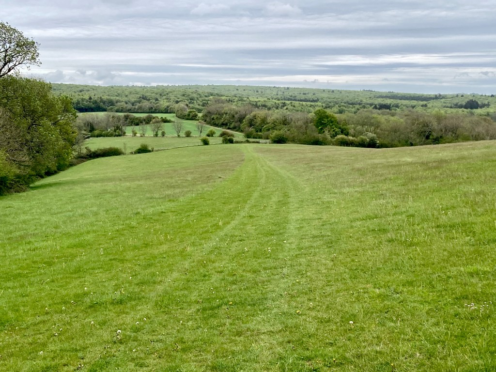
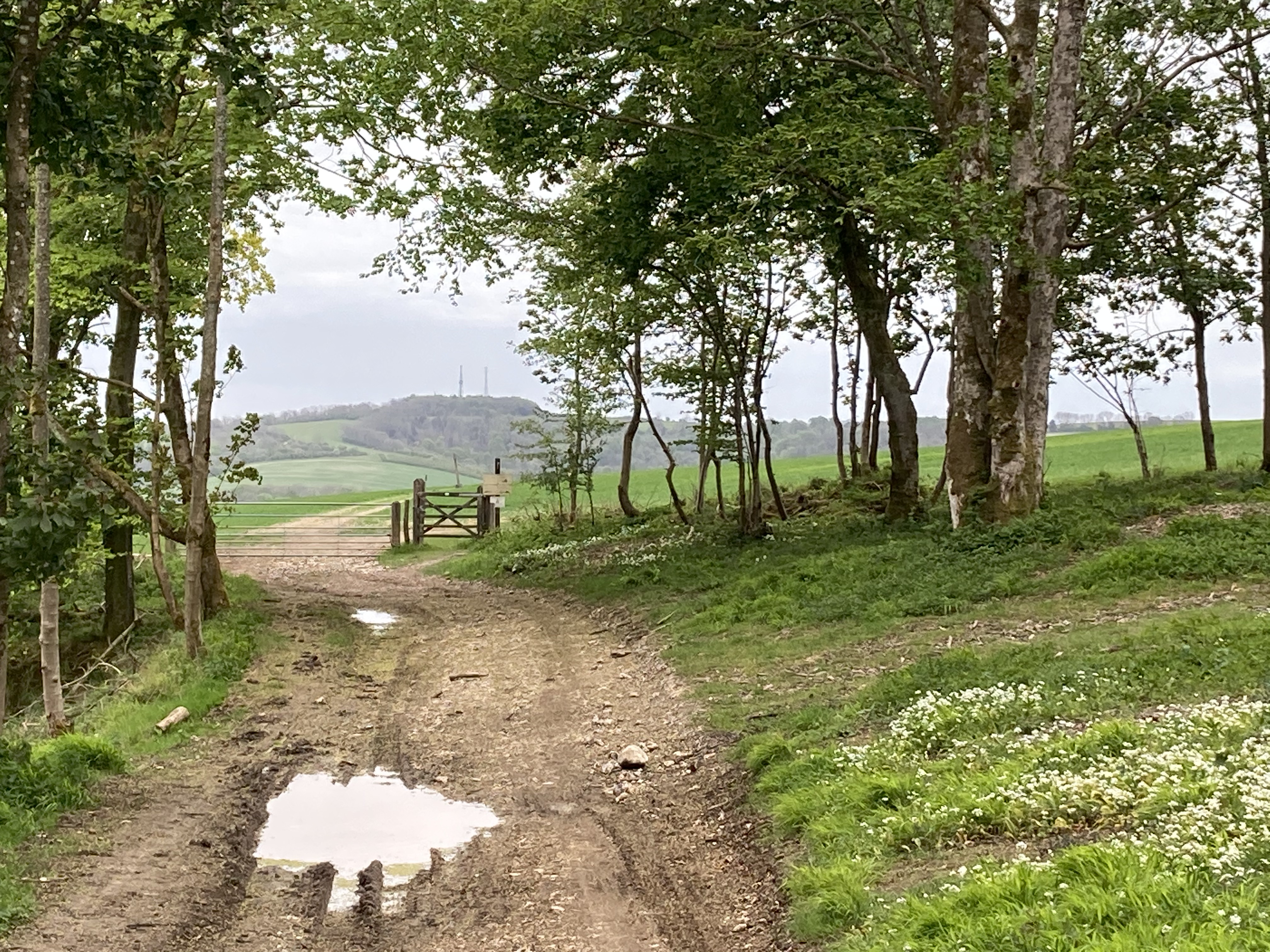
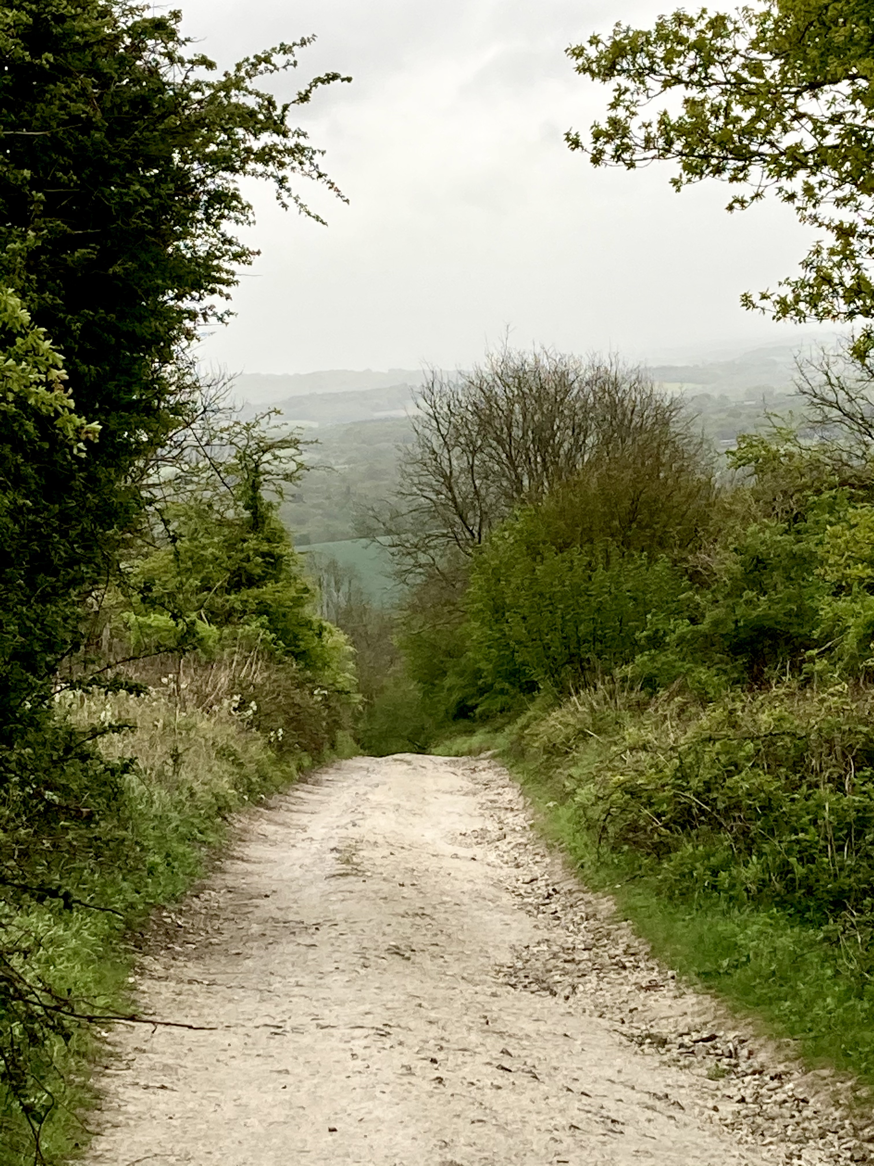
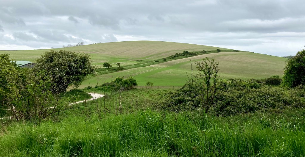
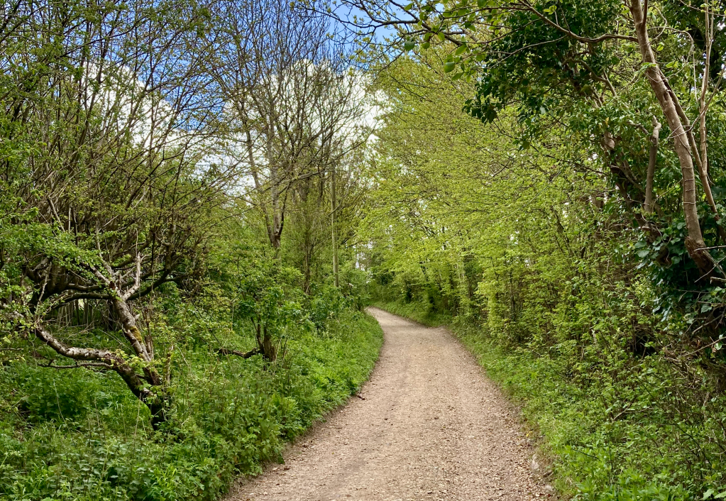
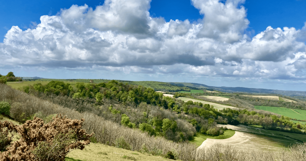
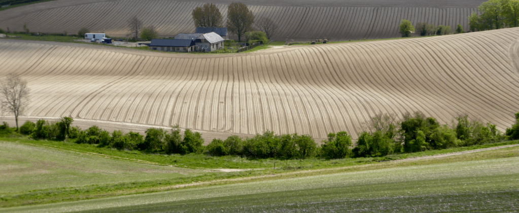
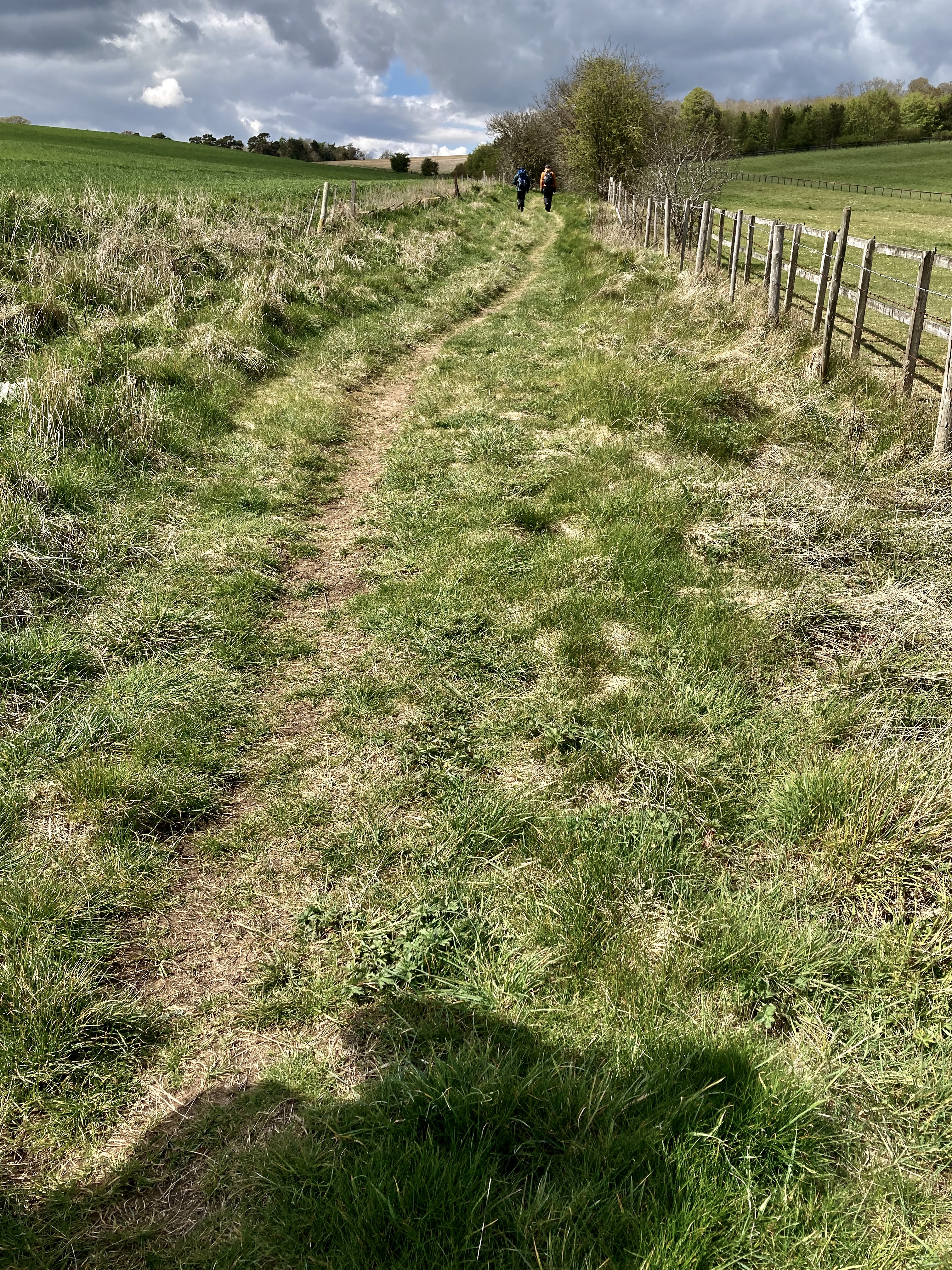
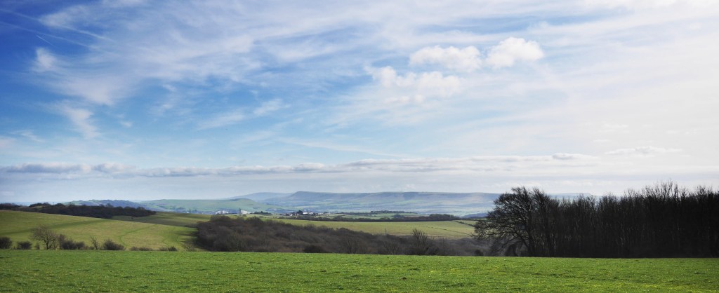
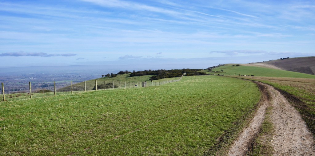
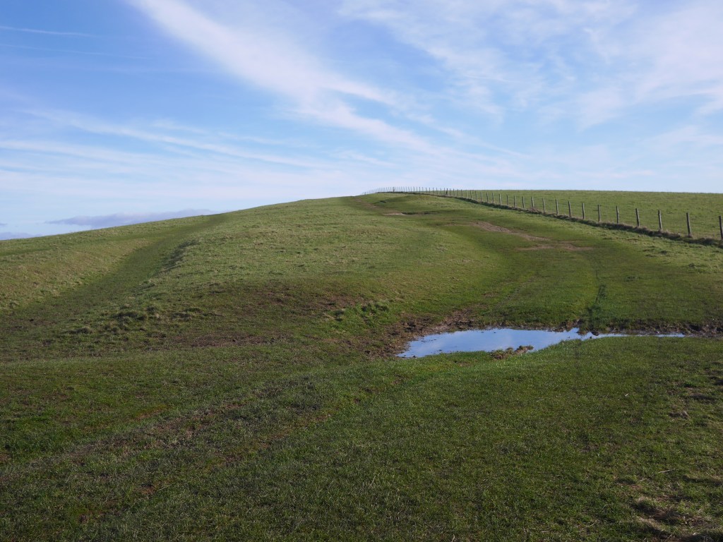
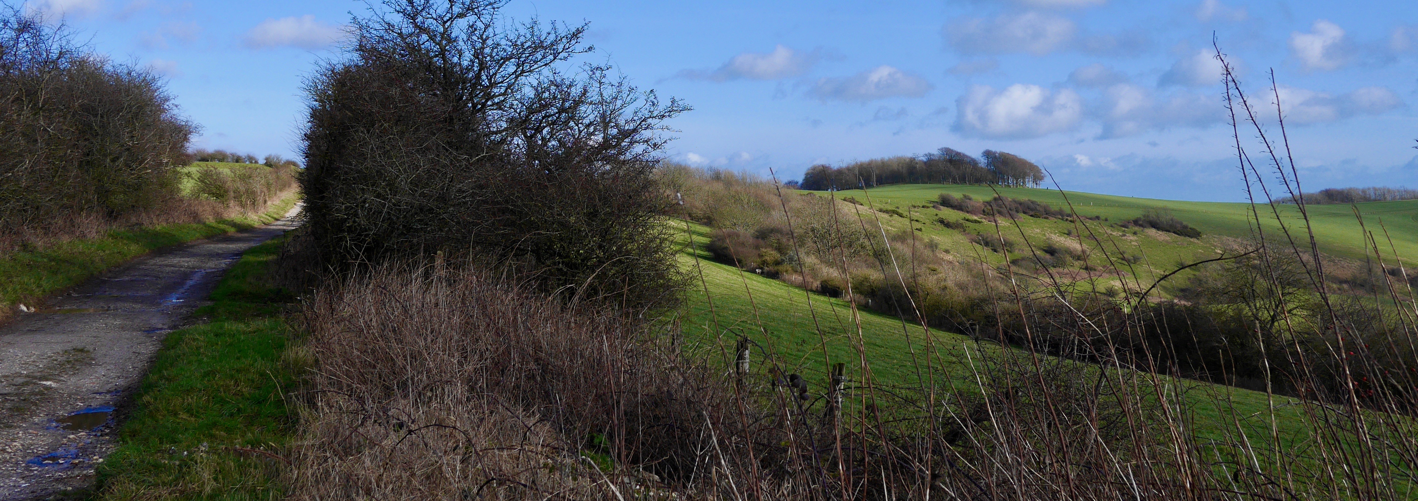
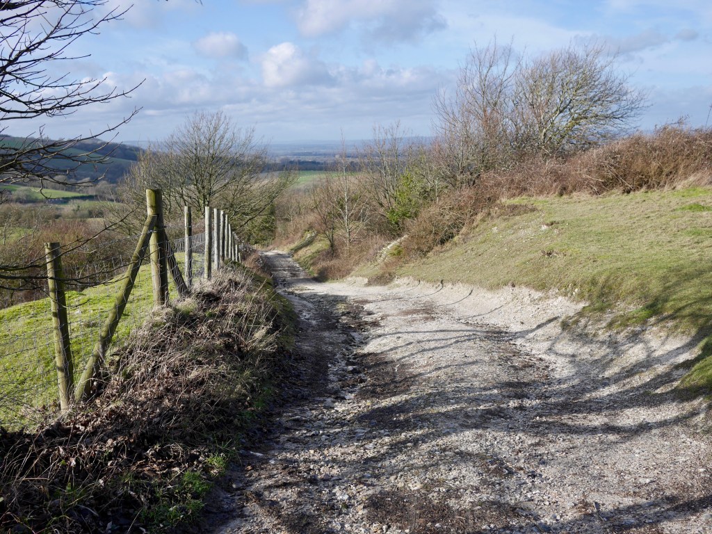
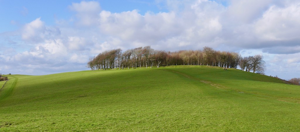
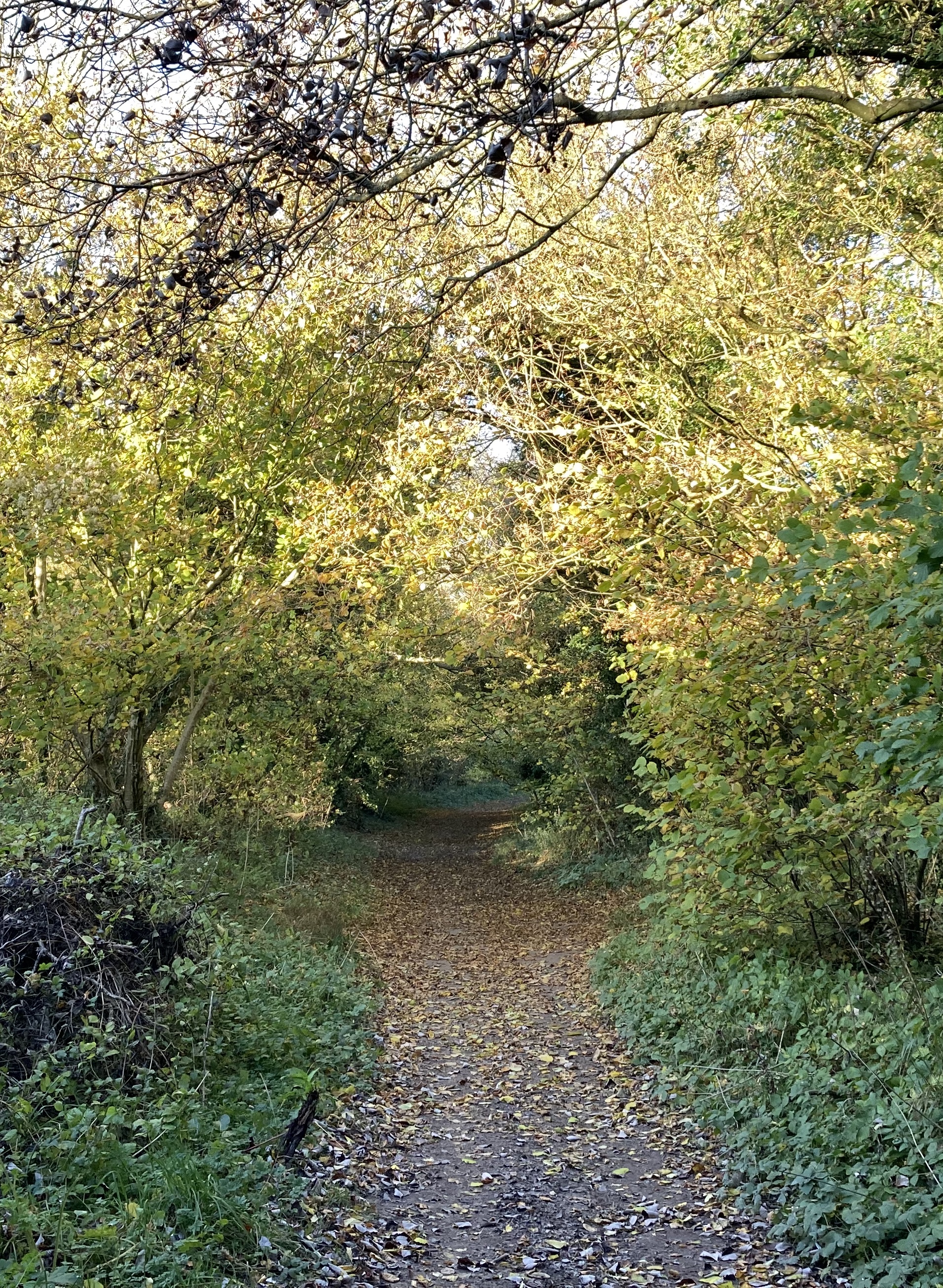
The route proper begins (having used the safe and convenient underpass) in the fields at Hilhampton Bottom under a Yew clad amphitheatre up the long slope to Butser Hill. A lung buster with which to start the walk but as temperatures were in the single digits and a strong, cold wind was blasting the hills from the N, it was a great way to get warm. by the time you reach the top you’ve gained 400 ft and far-reaching views to the shipping in the Solent to the S. On a warmer day there is a viewpoint which would be a great place to spend a few minutes but I was keen to crack on given my short day. Frustratingly the route now uses the road for the next half mile before thankfully turning onto a drive at the end of which the stony chalk footpath begins. The overall feeling I get from this route is primarily one of being cozily wrapped by hedgerows and arching trees of Hazel, Field Maple, Beech and the occasional Yew festooned in lengthy strands Travellers Joy.

Travellers Joy seed heads and setting Sun

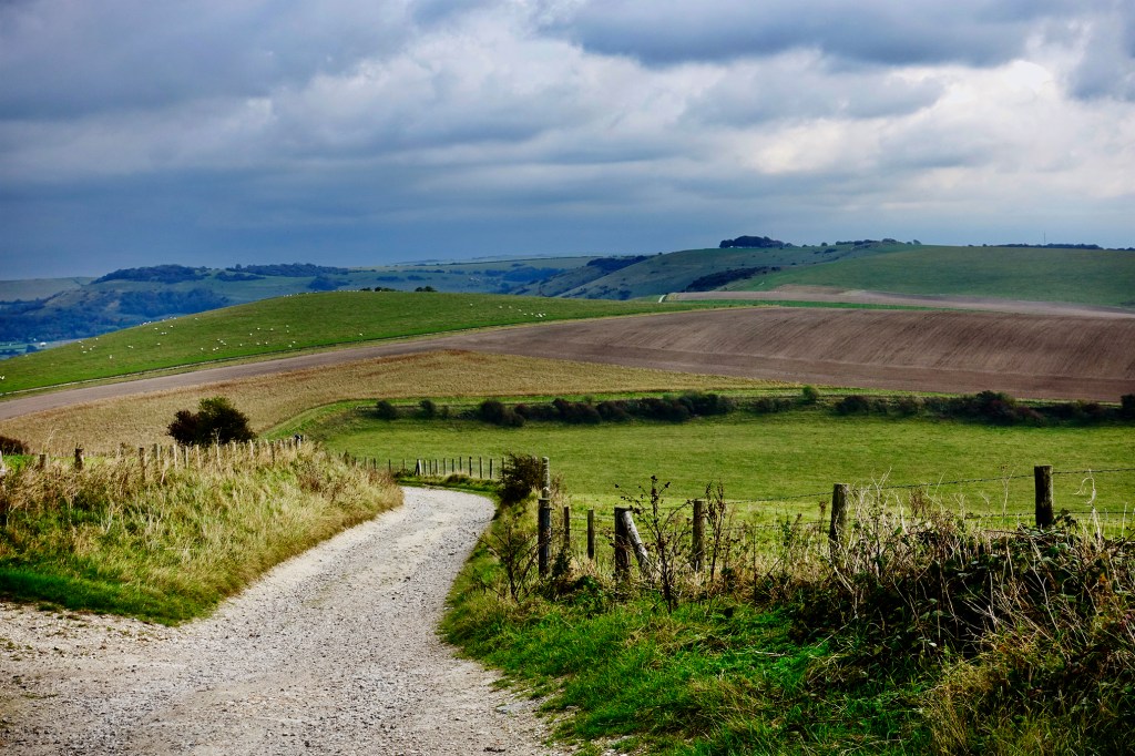
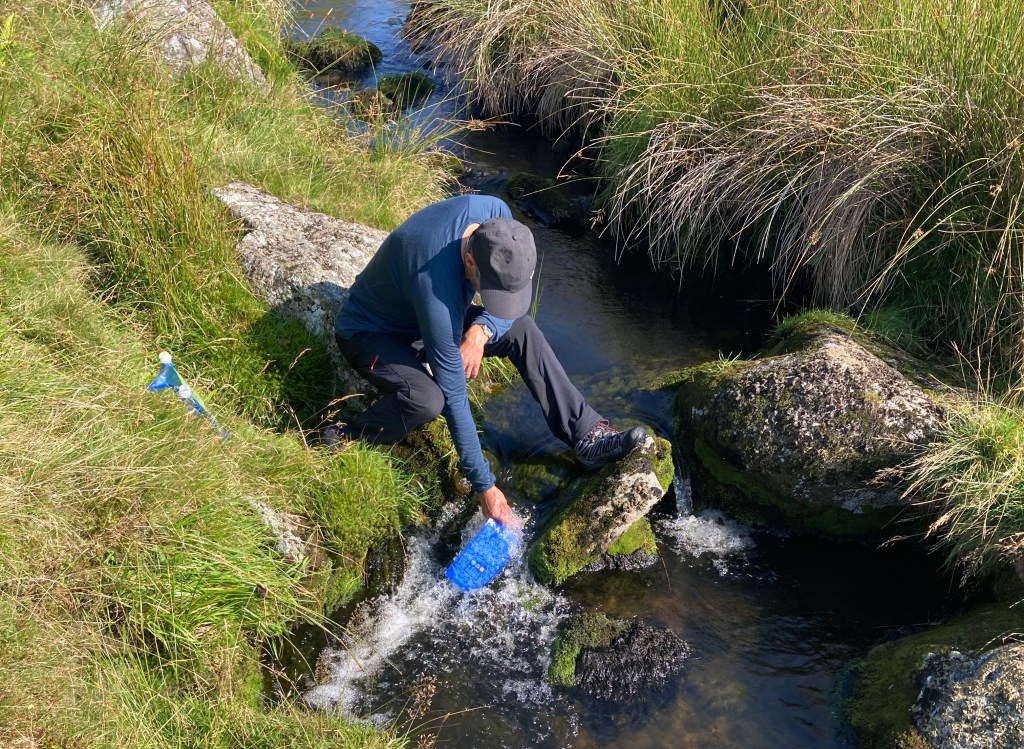
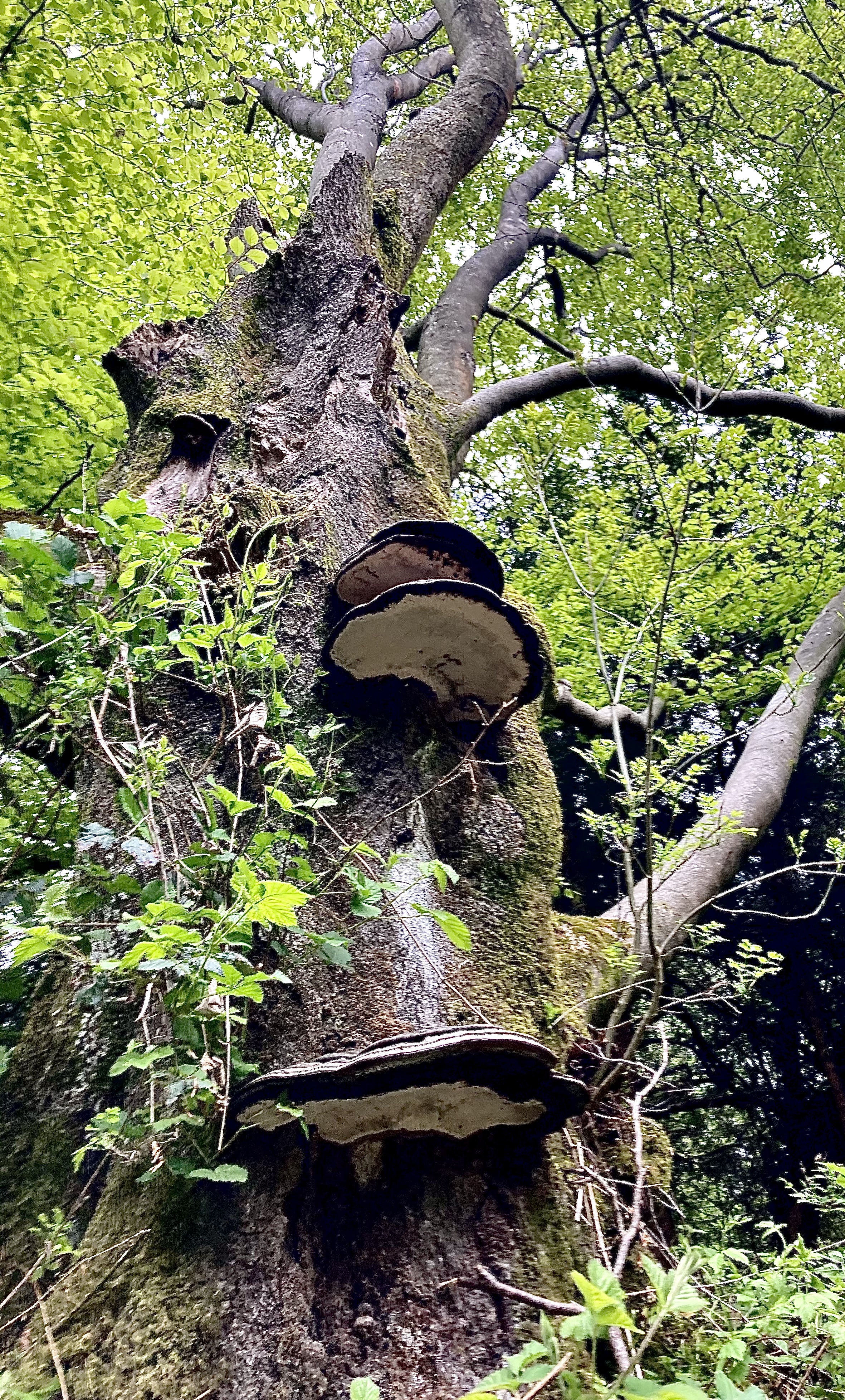
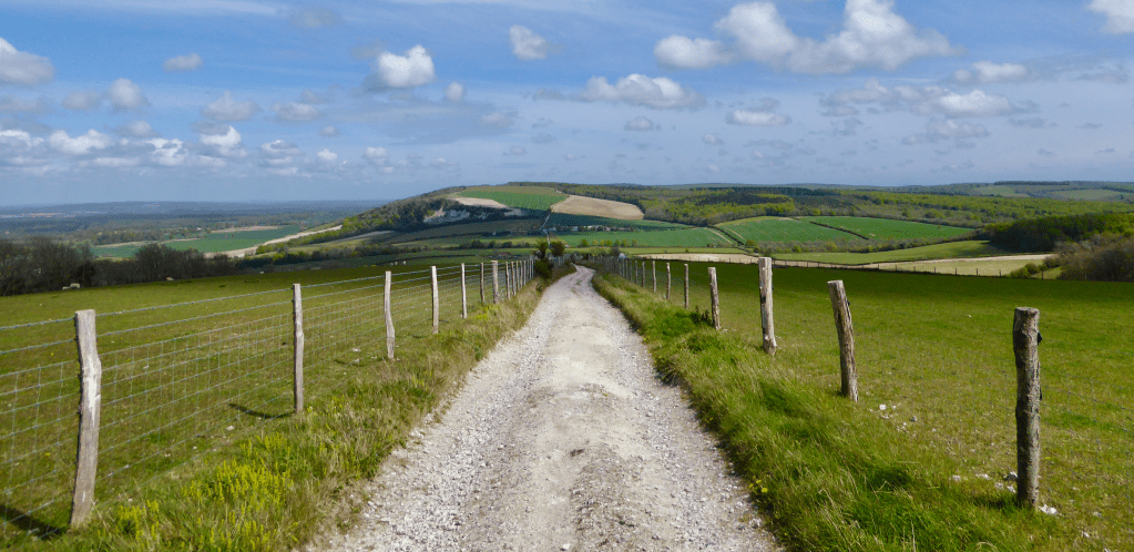
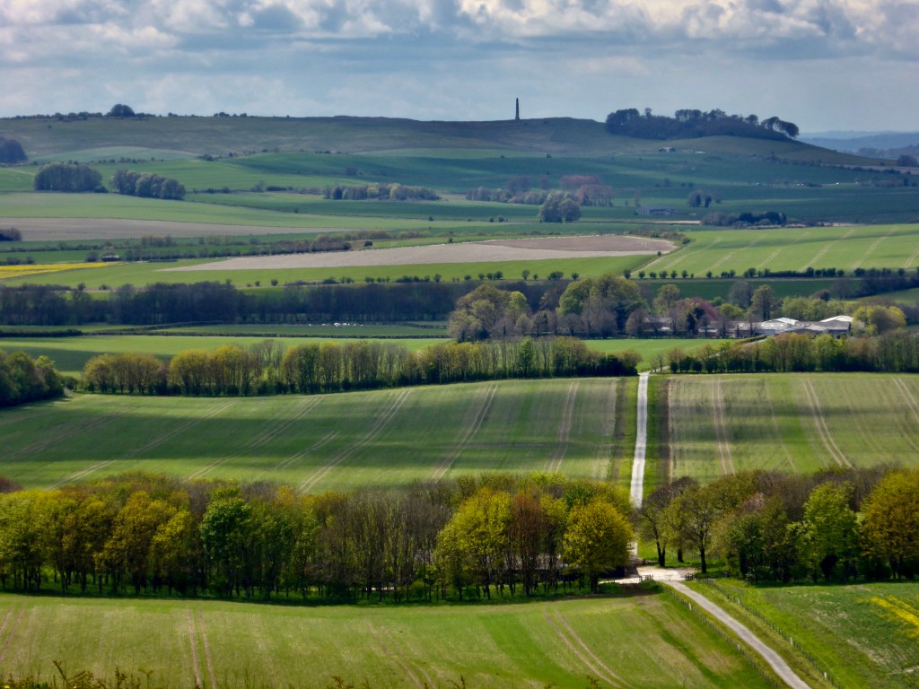
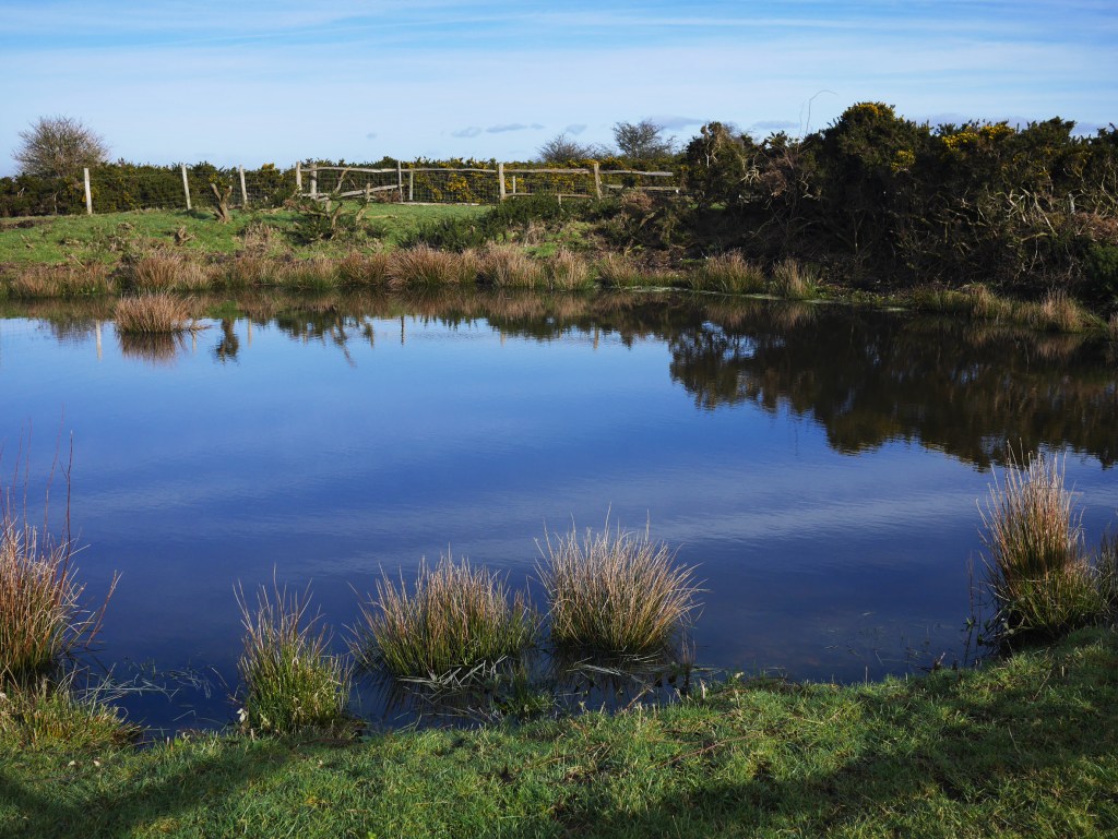
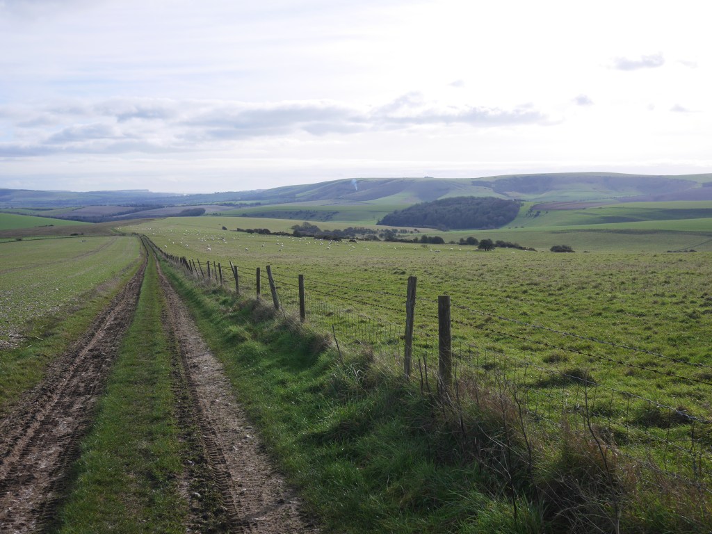
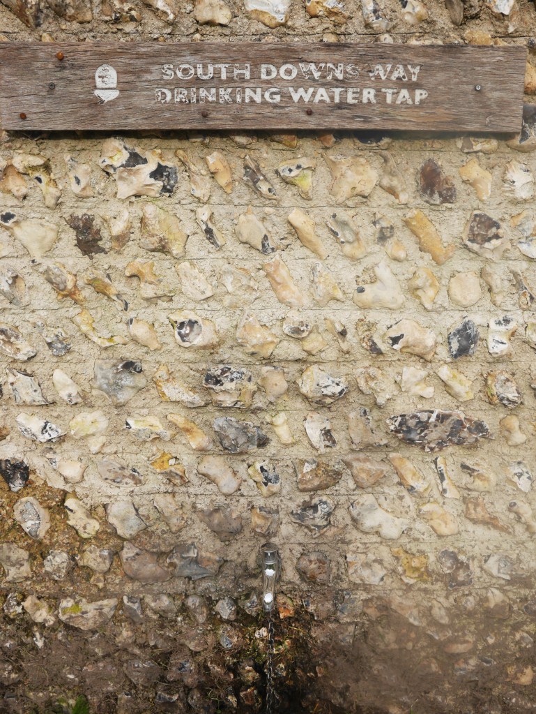
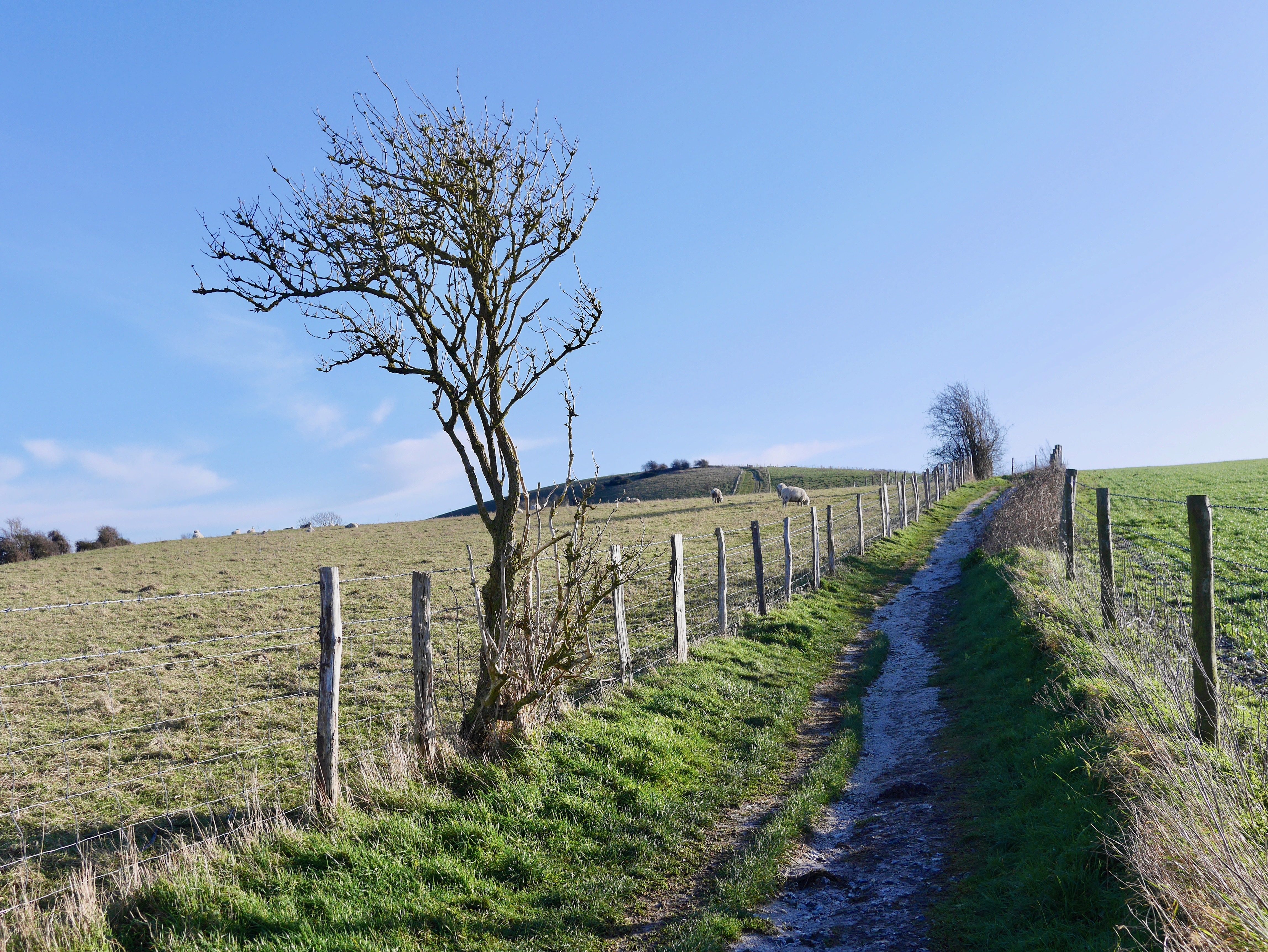
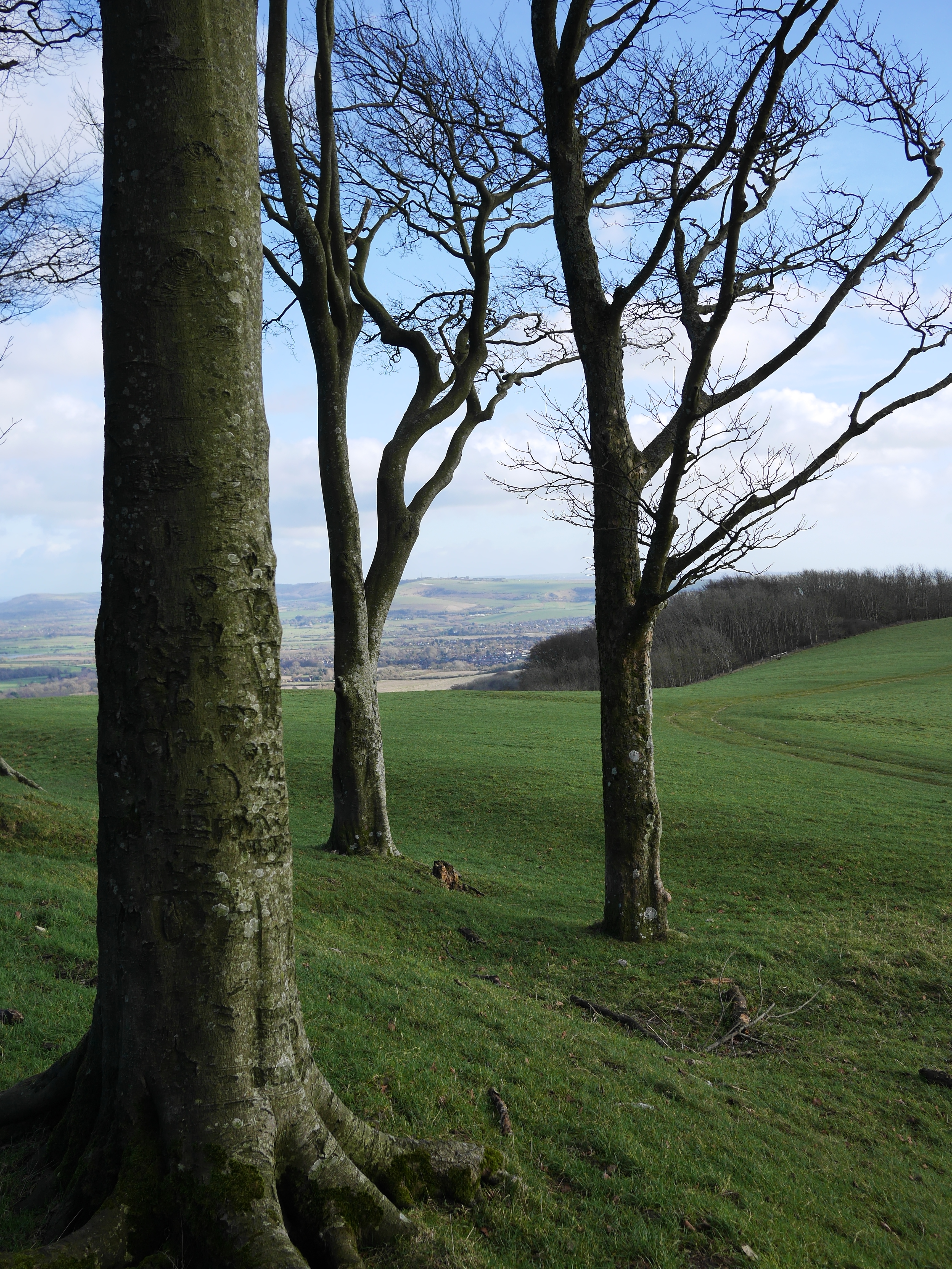
The going is easy with the occasional glimpse to the N across the Hampshire countryside as the route continues to the W. At about 3.5 miles you cross a couple of roads and pass by a number of houses and a cafe, as part of a sustainability learning centre, until the path strikes N along a rising ridge with rewarding views then more enclosed tunnels of Autumn colour. At mile 6 the route turns to the SW and descends along a roadway to Whitewool Farm. They have kindly provided a drinking tap by their car park at the point where the path turns and crosses their beautifully clear chalk spring fed Trout ponds in which the fish can clearly be seen. The route circuits the farmyard and rises to a chalk pit then heads NW up a broad path until it meets a road at the top of the ridge where the path doubles back to the S.

Beech hanger above Whitewool farm

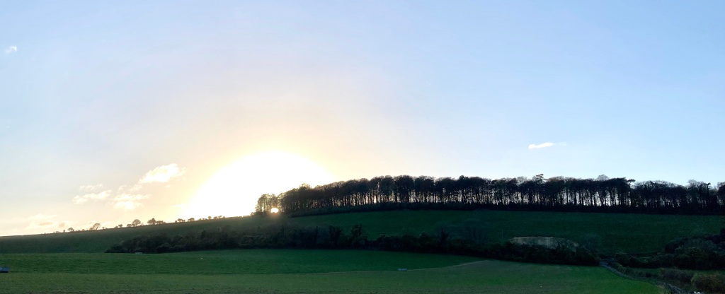
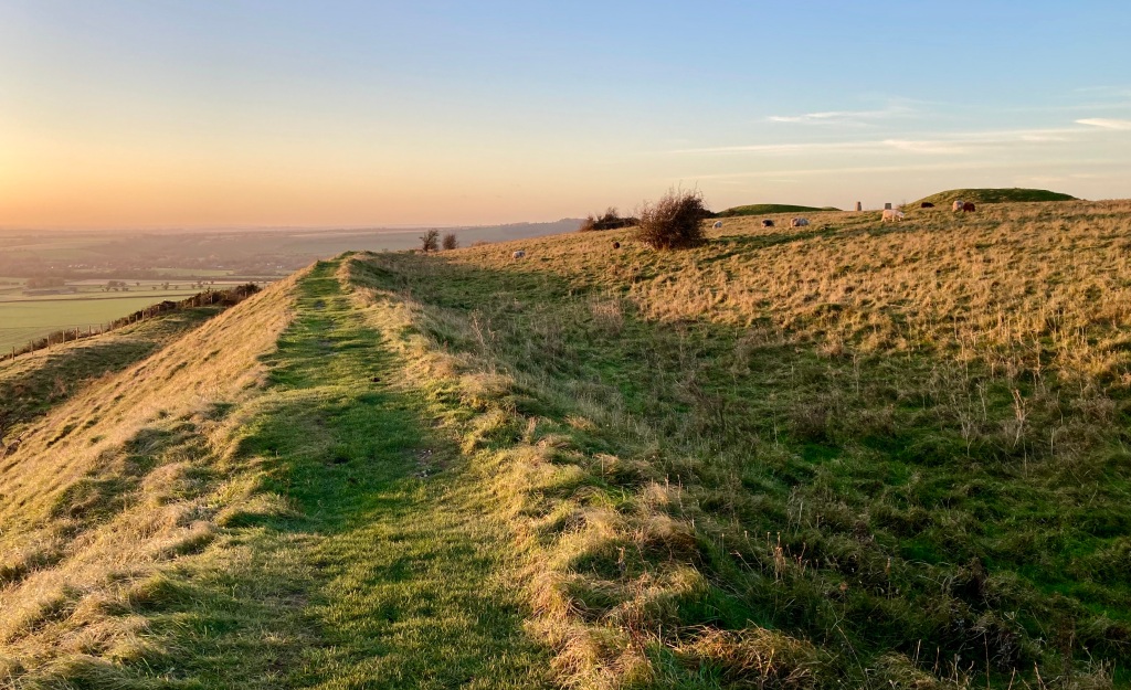
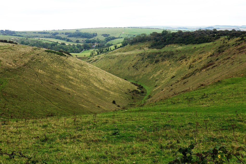
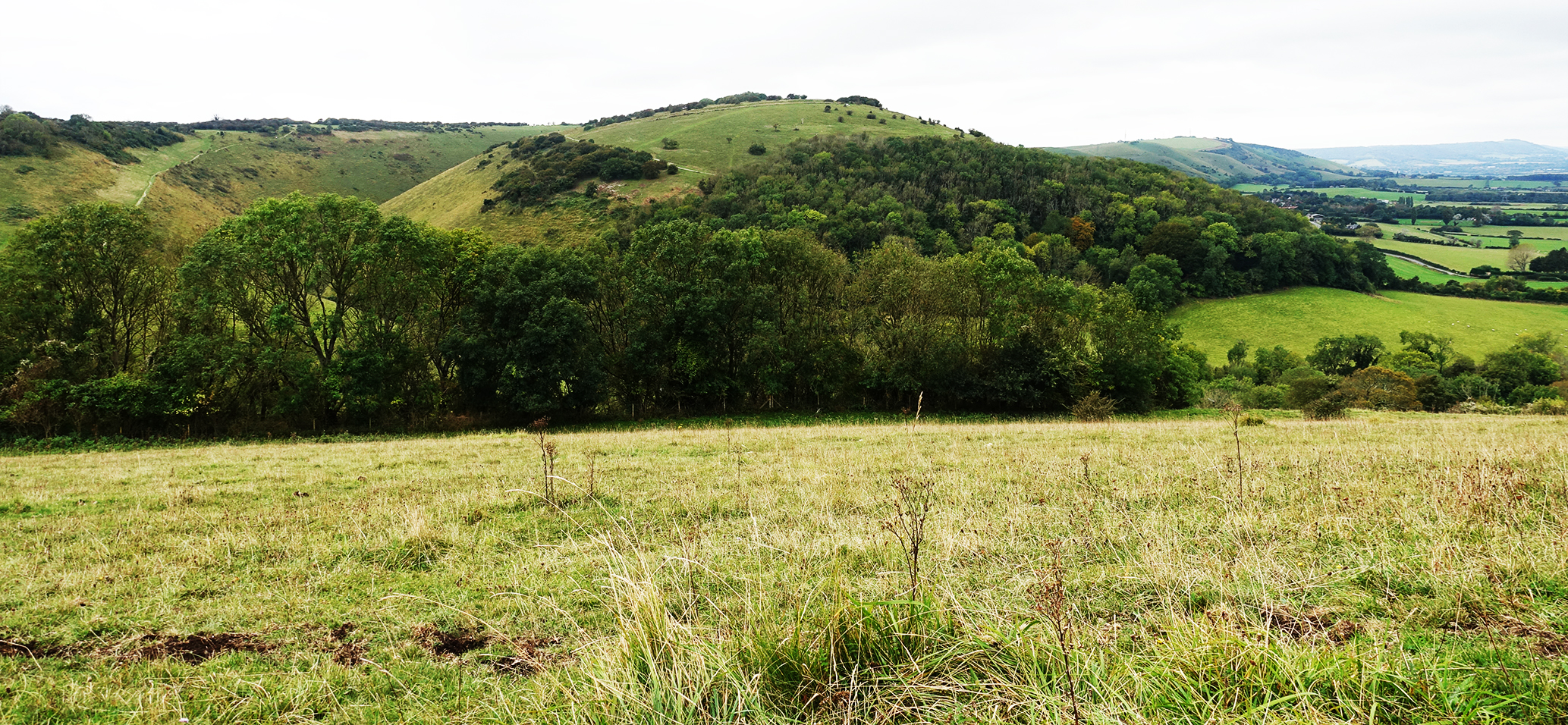
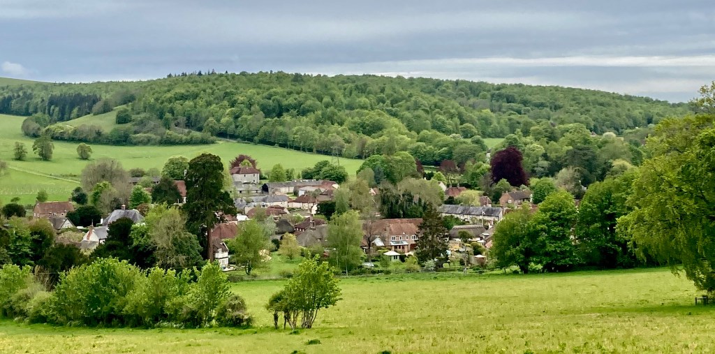
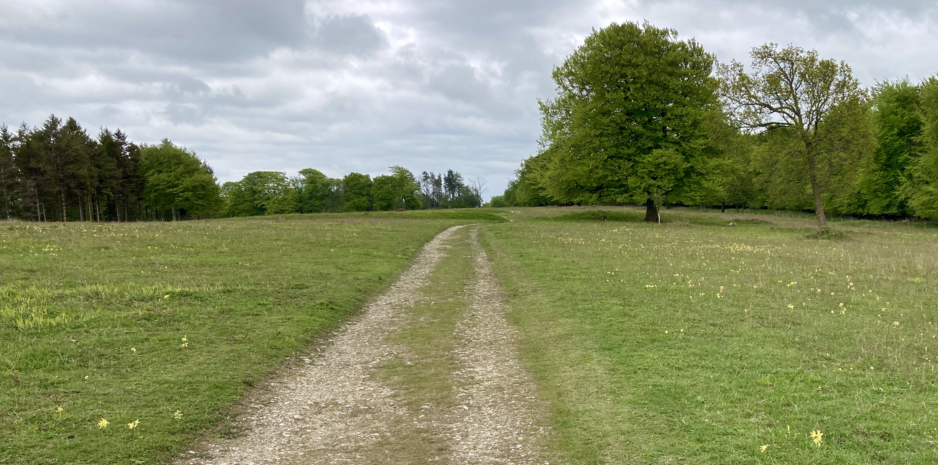
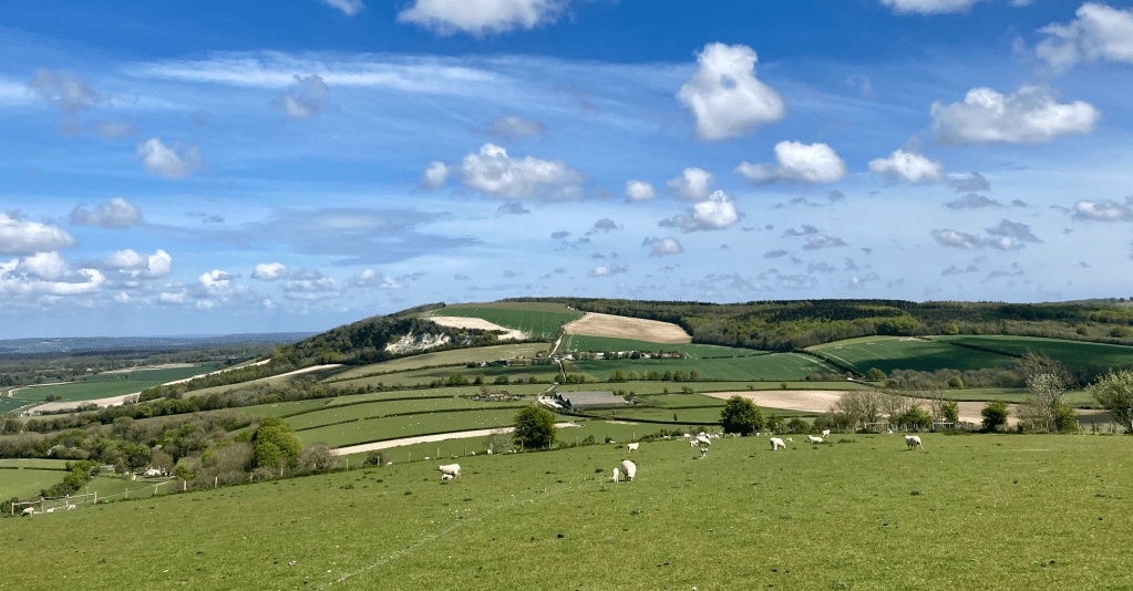
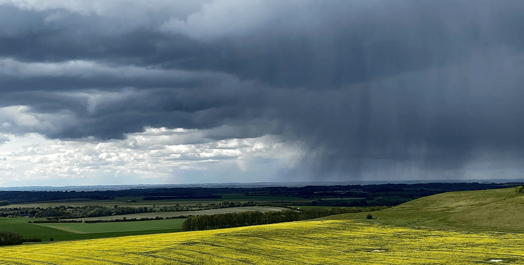
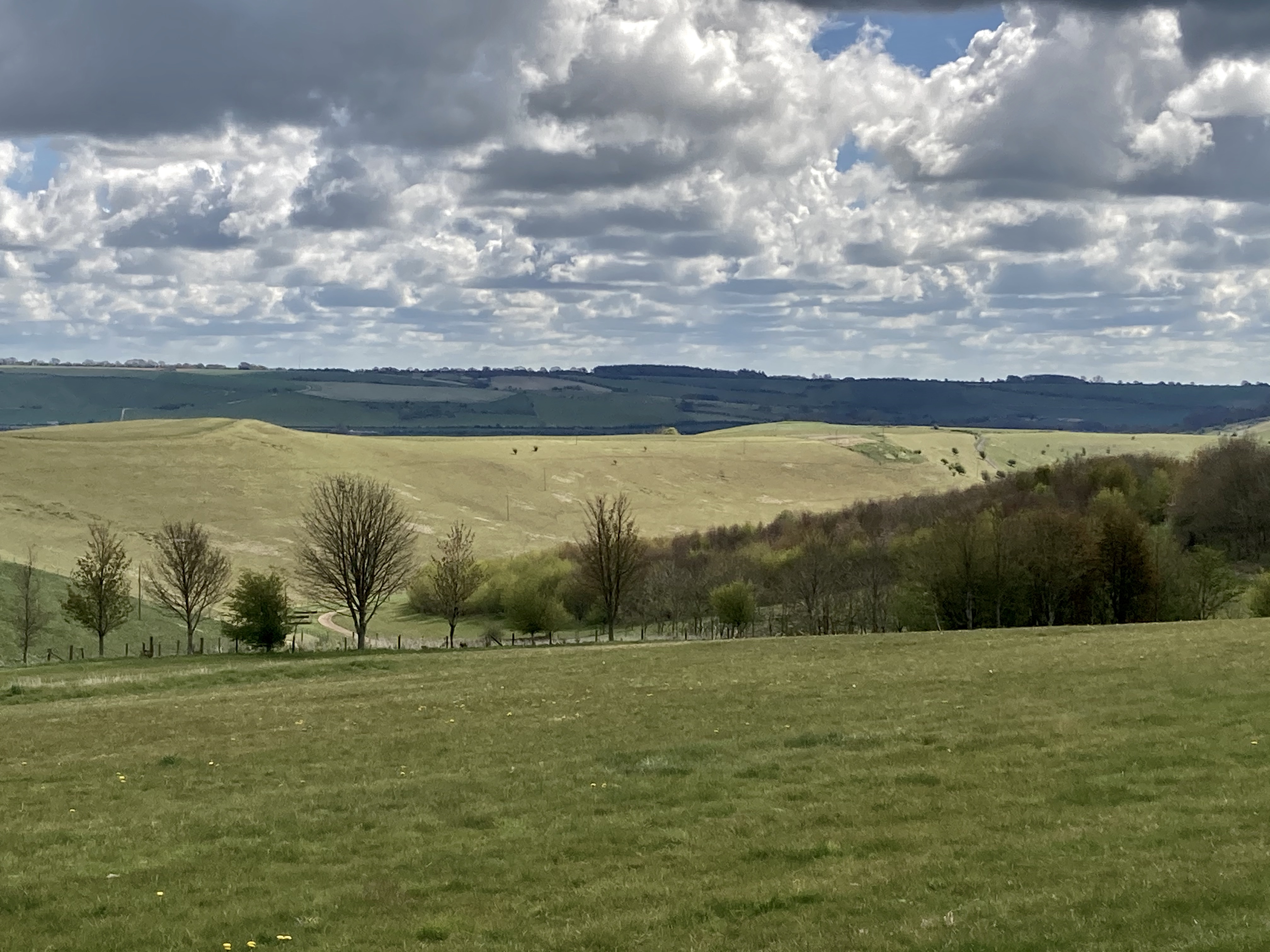
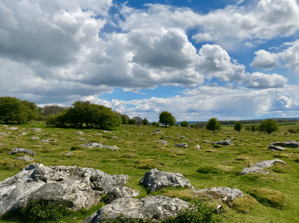
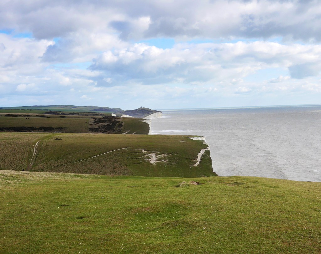
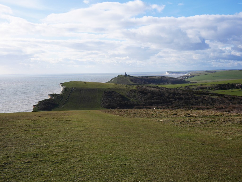
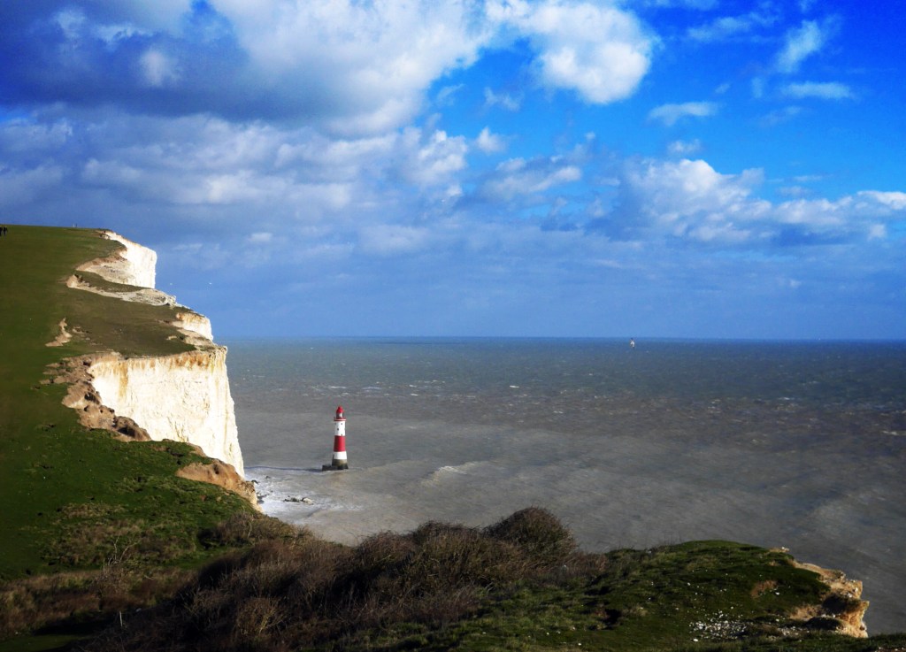
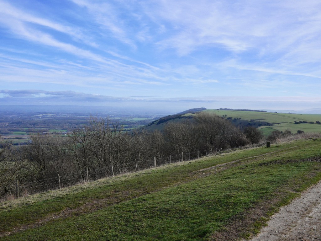
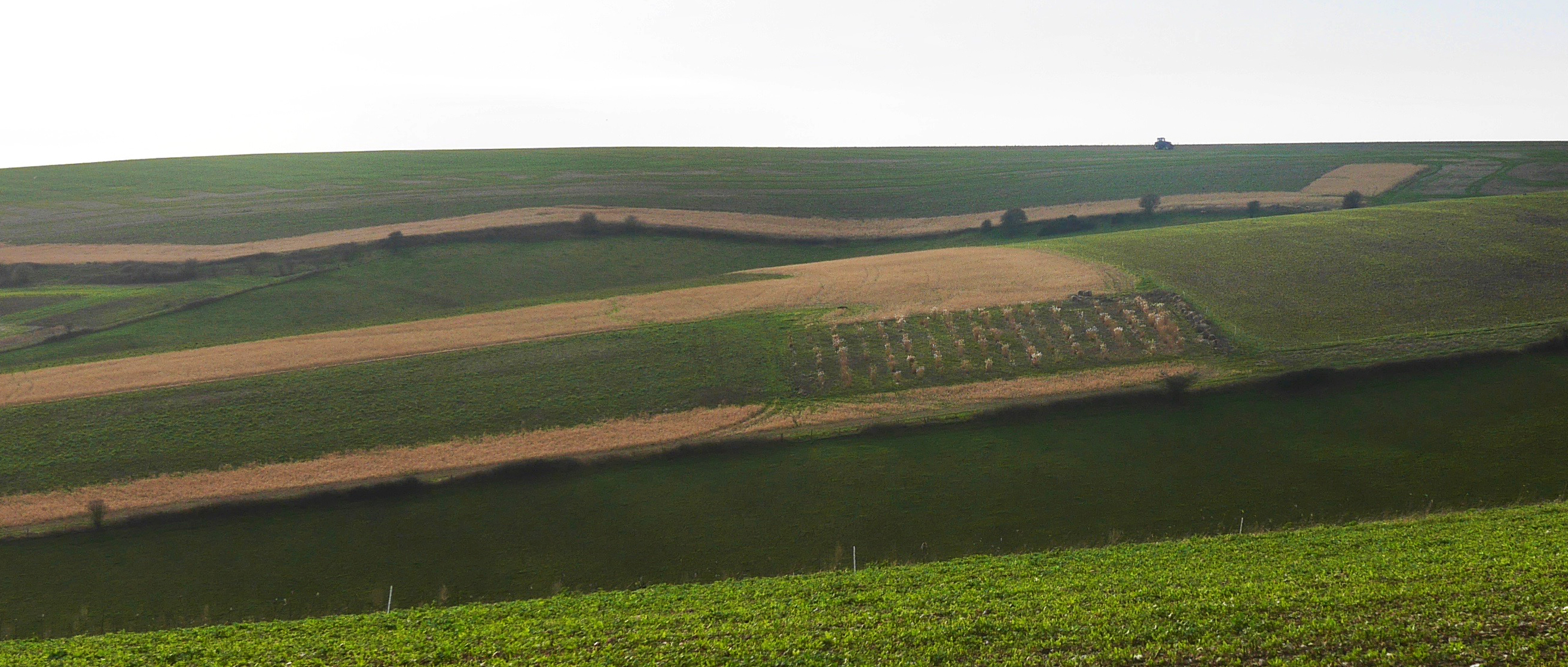
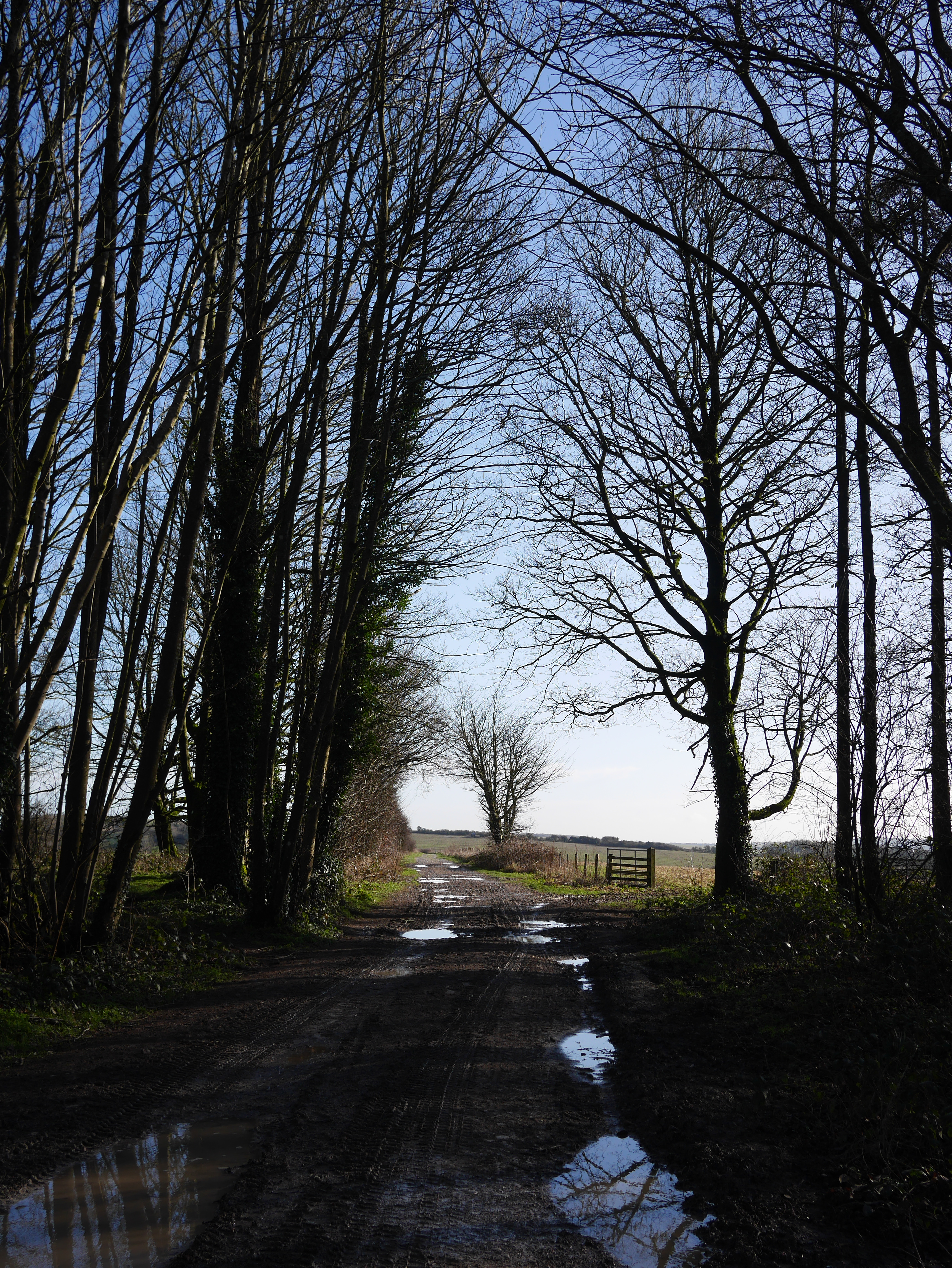
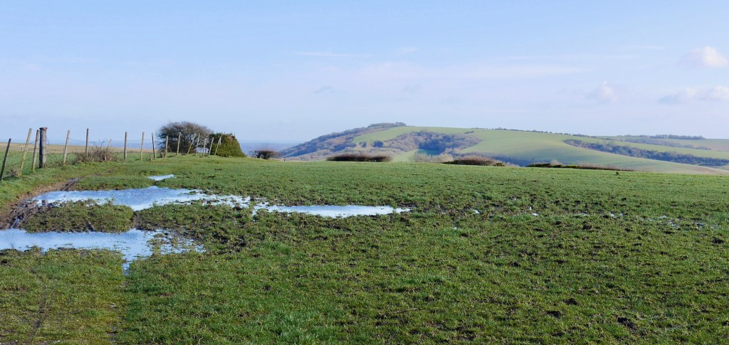
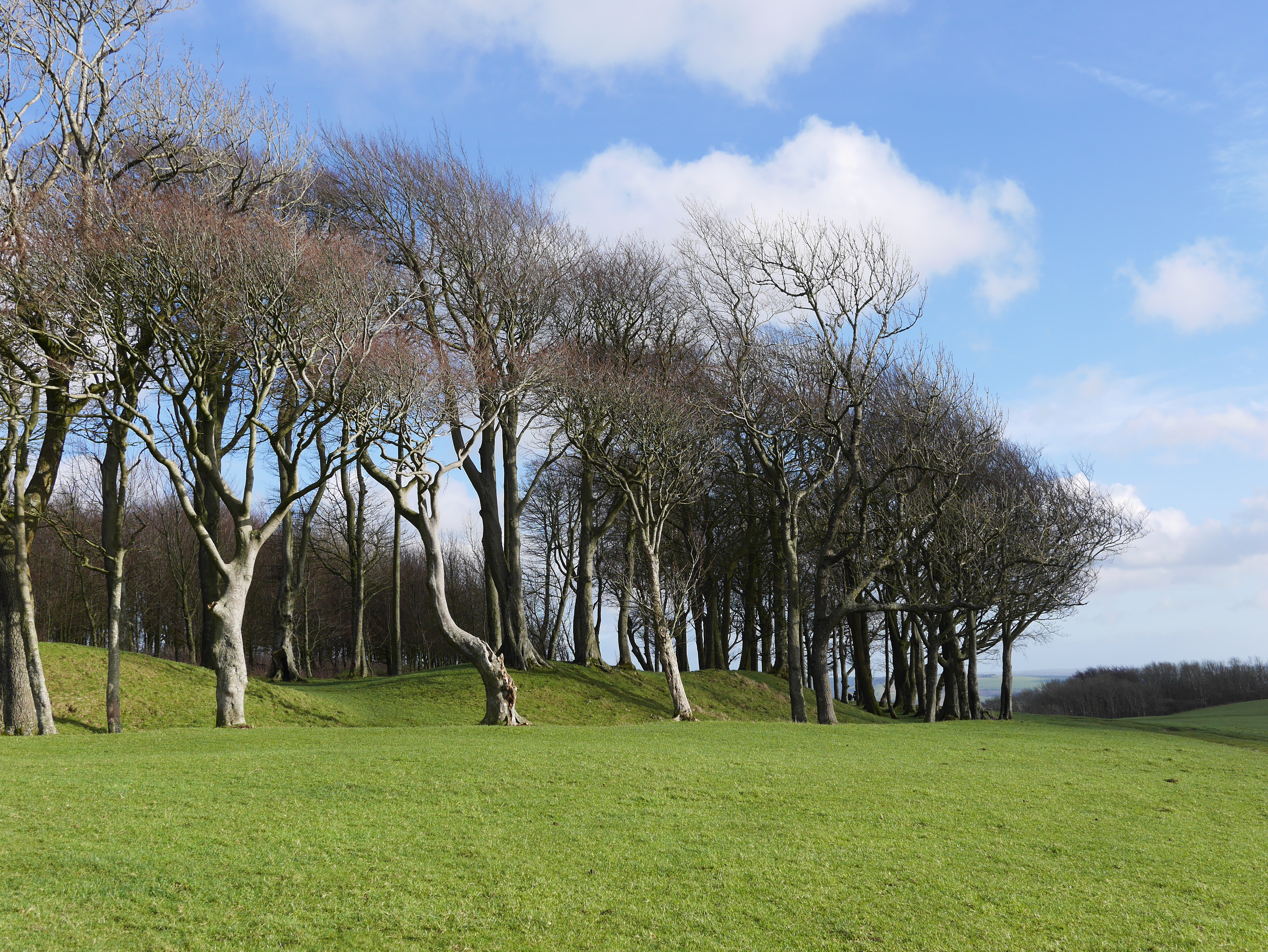
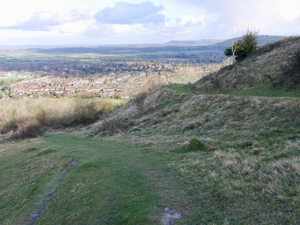
At about mile 8 the path heads W again and circuits the Old Winchester Hill nature reserve. The fort is amazing, with earth ramparts above the hillside and commanding views to three sides. The route then heads W. across the fort and descends through woods and farmland. At mile 9 my route leaves the SDC and picks up the Monarchs Way heading N towards Peake Farm and cottages (in order for me to get my bust at West Meon). Beyond these the route rises until meeting a minor road. Turning left heading NW past Hayden’s Farm the path then takes a right into a disused railway cutting below a bridge. By this time there was little light left and the silence was punctuated by a lone owl and the mad flapping of wings in the branches above as I disturbed piogeons roosting above and headed NW towards a small road into the village of West Meon, following the increased sound of traffic and the occasional light in the village. There is a footpath on the right of this minor road that avoids the main road and brings you closer to the bus stop to Pertersfield (on the same side of the road and next to the ‘Thomas Lord‘ pub which has accommodation), but I didn’t know where the stop was so followed the main road. Blissfully, I had 45 minutes before my bus was due so warmed up in the lovely pub, the bus ride returning me to Petersfield Station in about 15 minutes for my journey back to London.

I wore my Salomon X Ultra 3 boots as my go to for routes on decent paths. These with an insole from Footactive. Their UltraLite Innersole works well for me as the forefoot is padded but isn’t too thick, so doesn’t impact on the volume of the toe box. I need some padding on the heel as well which this offers. It can be bought at a discounted price (as at November 2021) from Sportpursuit.com. My Darn tough Light Hiker Micro Crew Hiking Socks are my go to for a long walk and they performed well as always. I have yet to put a hole in one of their socks, just buy a size up. My Marmot Alpha 60 Jacket/hoody worked brilliantly in the cold, dry windy conditions over a winter weight base layer. It isn’t totally windproof but the open weave of the pile lining creates a wind cheating layer of warm air while remaining really breathable. It’s brilliant technology. The lining is everywhere so no cold spots and when the hood isn’t used it makes for a great neck warmer. It’s light and packs small so unconsciously I keep choosing it for trips and end up relying on it for the cosy warmth it offers – review here. I dispensed with a waterproof layer as rain wasn’t remotely possible but took my Montane wind jacket as a further, but unnecessary, layer. With Merino beanies and rab powerstretch gloves, Bergan’s Torfinnstind Pants completed my clobber – ultralight softshell but wind cutting and stretchy. Sadly no longer made but testimony to the qualities of the brand. Poles – carbon three part by Leki which pack away when travelling, my backpack – the trusty Osprey Talon 22.

‘Upper Beeding to Pycombe’ – walk, South Downs Way

Looking East from Edburton Hill towards the high point above tree topped Devils Dyke and Newtimber Hill to the far left.

This is a short stretch of the South Downs Way (SDW) which includes some classic downland country and views. Buses are easy at either to rail connections to make this a simple circular hike of 8.5 miles that can be completed in a short day (map at foot).

I travelled by rail and bus on a weekday from Clapham Junction to Shoreham-By-Sea buying my rail tickets on Trainline.com which cost £10.00 for a return on specific trains (I would be returning from Hassocks, which is on the Shoreham line so a loop). I like to ensure I build in time at the end of my day so I have plenty of time for connections. This can often result in an hour in a pub or sitting on a village green till the bus comes but it’s no hardship. The train takes just over an hour to get to Shoreham-By-Sea which is a fabulous historic village on the Adur river with a great atmosphere and beautiful church. A 15 minute wait for the No 2 bus towards Upper Beeding meant I had time to buy lunch and very good coffee at a deli on Brunswick Street then stroll to the riverside bus stop.

The bus took about 10 minutes to get to the stop called ‘South Downs way’ on the busy A road. A couple of minutes into the walk up a long hill and the skylark song became audible. I love this sound, it is the Downs for me. Having climbed the hill the path meets a minor road and follows this with views West, climbing steadily for another mile or so until the Youth Hostel below Truleigh Hill. It’s all a bit suburban imo, unlike the more majestic open range further East on the SDW.

Looking West from the initial climb up to the Downs towards Chanctonbury Ring.

Beyond the Hostel and houses the path does open up a bit with more of the sweeping, pillowed hills that the SDW is known for and the walking is pleasant for the next couple of miles with views to the sea down the dry valleys before the trees above Devils Dyke come into view (pics below). Sometimes, a place to stop for r&r is a welcome sight but it just seemed that as soon as I had got into my stride, the town was here to meet me again as the numbers of walkers and dogs increased. Love dogs but my ideal walk is one on which I meet few people.

Looking South towards the coast
Looking northeast down Devils Dyke. The route descends a path among the trees on the ridge to the right.

Devils Dyke has a pub and a car park and marks the 4 mile point of the route. A quick stroll around the edge of this Iron Age hill fort makes it clear why it was chosen, the steep sides making any attack a difficult task. Leaving the pub and car park behind and a short walk along the minor road, the route enters the National Trust land to the southeast of the Dyke and heads northeast. This is a descending ridge through pleasant scrub and trees full ogf Goldfinches while I was there, till it meets a road by a car park in the valley at about mile six of the walk. Crossing the road and entering a gate to the National Trust’s Saddlescombe Farm which includes Newtimber Hill, turn immediately left up the gentle slope of the hill. The path rises steadily with views back to the Dyke and the Downs to the West. This is a much quieter stretch of the walk and Newtimber Hill has a good atmosphere about it (road noise apart) dotted with veteran Oaks and open meadowland and some gorgeous funghi.

The route loops across the top of the hill before hitting a hedge line and descending a narrow, green-lane through scrubby farmland for the next half mile until it leaves the Downs next to a farm shop. It is then a three quarter of a mile along roads, crossing the A road to the village of Pyecombe (follow the cycle-route signs) which has a wonderful Norman church and pub. I was catching the bus to Hassocks station in order to travel back to London but buses also go South Brighton. My stop was on the main road near the garage. Buses are frequent but the pub is temptingly open all day and was a pleasant place to spend an hour.

Not my favourite stretch of the Downs. Maybe on a hard Winter’s day it might take on a little of the wildness I enjoy. But I have now nearly completed my South Downs Way using public transport from London so am happy the penultimate stretch is completed.

Reviewing the route in the Plough pub in Pyecombe
Country bus stop covered in ‘travellers joy’.

‘Belstone to Lanehead’ – walk and camp, North Dartmoor

With last years plans for a get-together in the hills cancelled, it was good to put a trip together for four of us and enjoy the unexpected early September sunshine after a dismal summer. We wanted a decent length of day as we would be taking in nine Tors and be camping on the moor for a night, splitting our 17 mile trip across North Dartmoor into two (map at the foot).

We parked one car in Belstone on Friday morning (on Saturday we would be hard pushed to find a spot as when the weather is good as Belstone enables you to be on the moor in moments) and headed for Oke Tor. It has been a while since I have carried a full pack and the meagre 9kg we each carried seemed ridiculously heavy. I was using a Gregory Paragon 48 pack which worked well, with good ventilation and adjustable sizing in order to refine the fit. Our first day would be primarily a slow climb to High Willhays before a short stretch to our proposed overnight stop on Lints Tor.

Our route from Belstone headed roughly S, 2 miles towards Oke Tor on the decent, undulating paths of grit and grass. We stopped at Oke Tor for a break and take in the views, then after another mile S we headed W on a small path next to a wall towards High Willhays and Yes Tor. The path became an easy military road for while still heading W crossing two good streams before we headed N at about 4.5 miles then crossed rough ground to meet the wide path up to Yes Tor.

High Willhays in the distance from Yes Tor

We had been on North Dartmoor a few years ago for an October trip in order to take in the tors and views but the weather comprised mist, cloud and cold, horizontal rain. The marked contrast with this year was amazing. Where I was expecting mud and bog, the peaty soil was dry making for generally easy walking. We were also relying on the moor for our water. We brought a Sawyer Squeeze and half a dozen compatible pouches as our filter system and this did the job though we were reliant on the larger more established streams and rivers as a lot of the smaller water sources we were expecting to use were bone dry. If possible we tried to find a fast flowing cascade for water, A, because the pouches were easier to fill if the water was tap like and B, because the risks of nasties from livestock or otherwise were reduced given the greater flow.

Getting water from Rattle Brook below Hare Tor

The route from Yes Tor turns S towards High Willhays on decent ground before heading SE towards Dinger Tor over rougher ground, then with our overnight pitch in site, working round the contour to Lints Tor at the 8.5 mile. The NE breeze had kept us cool all day but the rough ground, full on sun and temperatures in the mid twenties C had taken their toll, so arriving at our overnight stop was welcome.

Lints Tor from Dinger Tor
Approaching Lints Tor from the SE

Lints Tor offers a few decent places to pitch a tent in and among the clitter of rocks that surround the tor. We took four solo shelters, a Durston x-mid, Tarptent Notch Li, Tarptent Aeon Li which use trekking poles for support, and an OEX Phoxx 1 Tent which comes with poles. We were pleased that there was no litter or scorch marks on the tor, LNT working well in the middle of the moor despite there being an easier and popular route to this vantage point from the Meldon Reservoir carpark.

We arrived at about 6pm and as the sun was setting got the tents up quickly in order that two of our group with remaining energy could make the trip to the West Okement River for the 10 litres of water we thought we would need overnight. We had hoped to come across a stream before getting to our pitch but hadn’t seen a decent stream en route for miles so there was no option other than the 200 ft descent and the climb back. With hindsight we could have detoured to Brim Brook S of Dinger Tor before getting to Lints Tor, as the ground, though rough, is level and the stream a decent size.

Pitched on Lints Tor – looking NW up the West Okement River
Tarptent Aeon Li pitched below Lints Tor

The Tor provided us with a decent area sheltered from the strong breeze and a large flat rock made a perfect table and seat as we boiled water for our dehydrated meals. At about 100 gms each, these seemed the best bet for keeping weight to a minimum, particularly as we had a wine box was in tow to help us mellow out in the evening glow.

Our dining table and all round flat surface, X-Mid the overall preferred non-scientifically tested shelter

The evening got better as the Milky Way began to take shape and we spent time lying on the flat rocks on top of the tor satellite spotting and finding the occasional shooting star. As we turned in the wind began to drop and the only sound was the river half a mile below us and the sheep grazing and coughing.

We woke to a breezy misty morning and bit of condensation in the tents. For me, in the single skin Aeon Li, a few sheets of ‘Plenty’ kitchen roll (it’s brilliant, doesn’t break up and can be used again and again) was enough to dry off the inside of the shelter. I like the Aeon but my spot wasn’t flat so I wasn’t able to get my sleeping bag foot box into the higher ‘pitchlock’ corner, so there was a bit of transferred condensation onto it though the semi waterproof outer seemed to handle it OK. Of the four shelters, the X-Mid seemed to be the favourite for space, comfort and ease of pitch, it taking a couple of minutes. For me it’s a toss up between that and the Notch Li which with a semi-solid inner which has a well deserved reputation for robustness and build, is only a little heavier than the Aeon Li and few oz lighter than the X-Mid. The Phoxx 1 was the least favourite with its bivy shape allowing for little movement once inside. It also weighs about 1.5 kg but it is also exceptional value for money.

The view northward in the morning from Lints Tor towards Black-a-Tor Copse and Black Tor

Packing up didn’t take long, we packed the last of our rubbish and checked for rogue tent pegs before making our way cross country, crossing the shimmering Brim Brook in order to cross the watershed/saddle between the heads of the West Okement River and Amicombe Brook, this being the driest means of getting onto Amicombe Hill. This start to the day was the hardest work of the weekend. With no discernible tracks it was a tough few miles before reaching the easier ground on the West side of the Hill with Green Tor on our right and Great Links Tor ahead and Hare Tor in the distance to the left. But we did feel we got the real terrain experience.

Hare Tor from Green Tor

Getting to Rattle Brook at the 3 mile mark, we filtered water and took a break by this little gem before crossing the stream and heading SW up the side of Rattlebrook Hill to Chat Tor. We followed the rough path marked by red and white poles that mark the edge of the military ranges. From Chat Tor it was another ten minutes before reaching Hare Tor at around 4.5 miles in from our morning start. The tor has amazing views to the S and W.

Looking westward from Hare Tor

From Hare Tor we followed the rough path to Ger Tor from which we could see the car park at ‘Lanehead’ which is at the six mile mark. From there we had another two miles to walk on minor roads to get to our B&B in Horndon, The Elephant’s Nest which is a great B&B in a fabulous location and excellent food. They have a great garden and bar which opens when dinner is served. They don’t do lunch so we drove our second car to the excellent Castle Inn in Lydford which we had booked for lunch and also serves excellent food and has rooms. We then drove to Belstone to collect our other car and returned to the B&B for a snooze before dinner.

Over the entire route the ground varied immensely, from made paths, rough roads, easy grassy sections, boggy stretches (thankfully passable given the dry conditions) or difficult tussocky ground which created deep gaps to lose your foot in. Walking poles proved invaluable, not just for testing the ground ahead when needed but primarily for helping with balance over rougher ground while carrying a pack. As they were also going to hold up our shelters, they more than earned top spot on the kit list. I used Black Diamond Distance Plus FLZ Poles which are robust and dependable.

We were very lucky with the weather. Better hot and dry with water to hand than wet and cold. I don’t think some of the route we took would be passable in a full-on wet Winter. Visibility was great which made navigation a doddle as phones can’t be relied upon for navigation as there is no service on parts of the moor. We also took a ‘Satmap’ satellite mapping device as well as maps and compass.

We felt we had ‘crossed’ the moor but we just clipped the top corner. Dartmoor has so much to offer with the benefit of near uninhibited freedom to camp in the middle of the moor (we checked to make sure there were no military training restrictions where and when we were walking), there is a lot to go back and see another time on another trip. Can’t wait.

Day 1 route – Belstone to Lints Tor

Day 2 route – Lints Tor to Lanehead car park (Horndon in our case)

‘Singleton to Amberley’ – walk, South Downs Way

The weather for mid May looked disappointing – a cool mix of rain showers, occasional intense sunshine and, on the one day I could get away, cloud with the added interest of a twelve percent chance of rain but forty mph plus winds. Lovely. Keen to get into the countryside using public transport from London, wherever possible, to complete sections of the South Downs Way (SDW) as day hikes, I left Clapham Junction bound for Chichester on my delayed 9.42 am train. In this instance my 13 mile route (map at foot of page) started in the charming village of Singleton (a twenty minute journey N of Chichester using the thankfully frequent route 60 bus given my delay) ending in Amberley, a village with station which sits in the valley of the River Arun.

Lapwings mobbed seagulls and crows in the in the fields under the leaden sky as the train passed Arundel between the long sculpted valleys of the Downs dip-slope and with twenty minutes of the train journey left I reviewed my options and finalised my route. Rather than taking the Bus to Cocking, half a mile N of the SDW, I wanted to walk the New Lipchis Way from Singleton heading NE for about 2.5 miles to meet the SDW, up the sloping downs and through the large forest of mixed woodland which stretches for miles to the S of the SDW.

The bus trip from Chichester (two minutes from the train station) took twenty minutes to my stop in Singleton, the walk proper starting from a small footpath adjacent the village school. This heads up Levin Down which is a beautiful stretch of wide country which I enjoyed on my own, with views to the W. the walk continues over lovely undulating ground, the forest ahead dominating the skyline. A pair of Yellowhammer took to the air in the stiffening breeze as I reached more open fields and headed towards Burnt Oak Gate at the edge of the wild woods of Singleton Forest via a narrow bridleway.

Looking Back towards Singleton from Levin Down
Looking NE from Levin Down towards Singleton Forest

The forest is a stunning contrast to the open downland; a mixture of large Beech, conifer and smaller coppiced species inc. hazel, the paths well defined straight avenues. The wind was booming above the tree canopy and the shelter of the forest was welcome. The gently sloping route continues NE for just over a mile crossing rides and tracks before meeting the SDW at the 2.5 mile mark of the walk. Taking a right, the familiar views of the Weald to the N can just be seen through the dense Yew, Sorbus and thorn, adorned with the vines of Traveller’s Joy, all of which have remained pretty untroubled on the high, steep scarp slope where cultivation has never been a real possibility. This was a welcome level stretch after the climb and a chance to stretch the legs on a good surface, a wide track. A few bikes passed by, wearing the tell-tale badge of their tribe, a long, white chevron stripe of chalk mud starting at their ar$e and ending on their similarly coated back packs. I felt a little jealous of the miles, they would cover, I love bikes and as the SDW is a bridleway it’s a possible trip for the future.

With the forest to the right and scarp the the left, the path continues past a 233m trig point (within a small gated meadow, ideal for a stop off) then through a wide cropped meadow of Cowslips peppered with Early Purple Orchid and Self-Heal (pics above) and one of a series bronze age ‘cross-dykes’ thought to have been built as boundary markers. This meadow leads to a series of nature reserves, which the Graffham Down Trust have developed over nearly forty years to to improve the biodiversity of the downs by creating an accessible mixed wildlife corridor a couple of miles in length. The reserves are home to an improving variety of species and exemplify how effort and the cooperation of landowners with a local community can make a real difference to the ecology of an area.

Just above Graffham Down itself, the path opens up and at about the 5.8 mile mark and enters open farmland of Littleton Down with wide views to the radio masts on Glatting Beacon to the E and lane to the N (pics above) before descending to cross the A258 road and rising to Sutton Down where I felt the full effect of the strengthening wind. It also began to rain, to rain horizontally and at speed. I was the winner of the one in five lottery for bad weather that day and I hadn’t brought over trousers. Instead I had a light silnylon poncho, bought as a tarp for quick overnighters but seldom used as I like tents. On a previous walk in Wiltshire, the rotation of cold rain/hot sun all day, had made putting on and taking off waterproofs a pain so I thought the poncho might make a quick to deploy rain cover given the remote forecast possibility of a shower but in the ever increasing squally rain, it was like wearing a large green kite which thankfully stayed grounded. It was hopeless, so I hid in the wind shadow of a clump of trees till the worst had passed over, stowed the poncho, donned a waterproof jacket which I had brought as a back-up and strode into the remnants of the hooley. My legs were wet in no time but on one side only, which was weird. Thankfully the rain subsided further and became a horizontal minor shower. I have made a promise to myself to always, always bring over-trousers.

A few of notes on kit. My rain jacket is the Arcteryx Beta SL Hybrid reviewed here. It’s made with two kinds of Gore-tex ‘Pac-lite PLUS’ with the tougher of the two used for high wear/stress points and it features ever useful pit zips. At 360g it’s packable but hardy. I have a few waterproofs but saw this on sale before the pandemic and read the glowing reviews which made it an easy choice to add to the stable. In the few hours I have worn it, in both strong wind and rain, it performed really well. The hood is excellent, the length great as is the overall fit.

In addition I was using Superfeet Green insoles for the second outing of twelve miles or more and I am impressed. They offer the arch support I clearly need, a decent level of comfort for the forefoot, which is good as the SDW can be flinty and my boots, Salomon X Ultras, are beginning to wear flat on the ball of my foot where I normally feel the road. The heel is also protected and cupped really well. Overall these insoles really do make for a much more comfortable, and therefore potentially, longer walk. The testament to this is the condition of my feet next day. No problems at all. No sore spots or tenderness. Having struggled some time ago for nearly a year with dreaded plantar fasciitis (the walker’s curse), I can absolutely recommend these. I initially read a brief review from what I consider one of the very best and impartial reviewers of outdoor gear: Section Hiker, who gives honest, no-nonsense (no advertisers) assessments of a plethora of lightweight kit. There is also a Lengthy review here of the insoles. At sale times they can be as little as £17.00.

I have also found what I think is my favourite all-round pair of socks, the ‘Darn Tough Light Hiker Micro Crew Light Cushion sock‘. Long name but really comfortable with some padding, which suits most of my footwear. Toes, heel, sole and achilles enjoy light cushioning while the lighter top allows the foot to breathe adding additional comfort in most temperatures. The height is also good for me – not too long. They are durable and while they cost about £19.00 they’ll give reliable and long service. If you are on the cusp of sizes, go up rather than down. It has taken me years to find my favourite fit, finish and functionality in my outdoor gear and family run Darn Tough is up there. In addition, they offer a lifetime guarantee even in the UK. What’s not to like.

Westburton Hill

I had to get going as my delayed train in the morning had put me back by thirty minutes and my cheapo ticket obly applied to a single train, the 17.17 to Victoria. At about 8.5 miles, the route crosses a road end and carpark and climbs to Bignor Hill then descends before climbing Wesburton Hill which in turn becomes a pleasing downhill walk to cross the busy A29 Road at about the 11 mile mark. Having crossed this, the route is a gentle descent into the slopes of the river Arun valley with views of Amberley which hugs the eastern bank of the river under the large scar of an old chalk quarry which, for for more than a hundred years, produced hydrated lime for construction. It’s easy to get wrapped up in the bucolic, forgetting that nearly ever manageable inch of the entire, useable landscape we now enjoy has, at some point in time, been a place of work and industry. For the last mile or so the path dog-legs between fields then crosses the river Arun over a foot bridge, at which point the path to Amberley station (tea rooms and pub) follows the river to the right into town while the SDW is signposted North.

Amberley, in the middle, nestled under the chalk quarry on the River Arun

The delays leaving London meant I had barely enough time to meet my train. I had allowed for some leisurely idling on the downs which didn’t happen as the weather constantly threatened (and delivered) so I kept up a moderate pace and walked the 13 miles and 1600 ft of ascent in five hours. With better weather, lazy breaks for lunch and just sitting to take in the scene and sounds, I would make it a day of it and allow eight hours with the added benefit of an early dinner in Amberley at the ‘Bridge Inn’ which reviews really well, before a contentedly dozy train ride back to London. With my discount card, I managed to get to and From Sussex for under £14.00. With the bus the return trip to London cost less than £19.00. The route works equally well in reverse with the destination being Chichester, an amazing city with masses of history and watering holes for the weary traveller

‘Buriton to Cocking’ – walk, South Downs Way

The South Downs in all their Spring glory – looking East from Cocking Down

It is a delight to leave London and get walking on the South Downs. Early May, mixed weather, hot sun one minute, showers the next, the new green of the woods, Beech hangers, complex bird song in the hedgerows, wild flowers in the verges, wide skies with views to match from the top of the downs, Skylarks the soundtrack.

This 11.5 mile walk West to East (map at foot) is another stretch of this national trail completed, wherever possible, with the use of public transport, leaving and returning to London in a day. In this instance train to Petersfield from Waterloo, a short cab ride, then, having completed the walk, local bus to Chichester, train to London with one short change at Havant. It sounds involved but the connections are all regular and easy.

I took the train from Waterloo to Petersfield arriving an hour or so later. There isn’t a bus to Buriton (Buriton Village used to be the start of the South Downs Way (SDW) when I first walked it in 1976; now it stretches to Winchester. Another walk for another day) so I took a 10 minute cab ride to the car park SW of Buriton at grid ref. SU 73325 19821 which sits on the SDW. The sound of lambs bleating greeted me as I got myself together and began the walk, the last remnants of a shower glistening in the immediate change to strong mid-morning sunshine. The SDW is well signposted and its route is generally W to E and while there are some deviations, signs are frequent so map reading is not a requirement.

The route heads roughly E along a minor road before hitting a track, which in turn becomes another minor road. This mix of small road and track is repeated for nearly two miles through fields and a patch of woodland but is easy going and a chance to get into your stride with tantalising views through the hedges either side of Field Maple, Hazel and Traveller’s Joy to the Surrey Hills to the N and chalk tinted dry river valley fields stretching to the S. Wild flowers: Greater Stitchwort, Bluebell, Yellow Rattle, and many others are abundant.

The walking at the Western end of this route is easy on tracks between hedging and trees.
Red Campion
Cowslip
Speedwell

Walking through Sunwood Farm the route becomes exclusively track/footpath as you cross from Hampshire into W. Sussex, the path rising and falling through beautiful countryside. At 2.5 miles you cross a track and rise to Main Down which gives great views over the downland to come to the E. Crossing the B road at 3.4 miles you enter a delightful Beech hanger and for about half a mile the path overlooks a road below a steep scarp with views to the N. you come to another road and cross this onto Harting Down and classic downland. If the weather is with you the views have to be taken in for a while from this well preserved chalk grassland dotted with wild flowers, scrub and small trees.

There seems to be a real commitment to returning areas of the downs to chalk upland on many stretches of the Downs and elsewhere with great results. Whatever the argument that no one aspect of our landscape is ‘wild’, the fact remains that where the number and variety of species fall due to damaging practices, farming or otherwise, there is an issue to address. Efforts at Harting Down are working towards resolving the decline in species and increasing the extent of biodiverse grassland. There are fewer fences on this short stretch of the route and you do get a sense of the space and open, wilder landscape being a possibility elsewhere on the Downs. This contrasts with the other parts of the SDW which have been intensively cultivated (markedly since WW2) leaving little space for the path which is fenced in and eroded badly with constant footfall. Just four percent of ancient chalk upland intact across the whole National Park but with increased awareness of the plight of bio and geo diversity it may be possible to rewild and recover some of the land put to the plough in the past 100 years and give our flora and fauna a chance.

Looking East from Harting Down

Harting Down provides some lovely walking as it leads to the foot of Beacon Hill at about the 5 mile mark. The SDW avoids the steep climb up the hill by skirting Beacon hill, cutting S then back N. I followed the SDW but on reflection I wish I had just climbed the hill. It offers more amazing views and a good place for an early lunch. Having walked around Beacon Hill, the path ascends Pen Hill, the west side of which, at about halfway, the 6 mile mark, is also a great place for a break with excellent views to the E and S before descending into chalky farmland. The path then meanders through a stretch of wood before opening up onto Didling Hill then Linch Ball, at 248 m (813 ft), the highest part of the walk.

Chalk farmland below Pen Hill

The path continues East until approx. 10.3 miles where it leaves the SDW and heads down towards Cocking through fields and several gates. It enters a small stretch of wood then passes Crypt Farm on the left and follows the made road to the left through an old railway bridge into the small village of Cocking which has a pub opposite the sheltered bus stop at its centre. Total mileage 11.4 miles.

Looking East before the path left to Cocking

The weekday buses to Chichester run approx. every half hour and the ticket is £4.90. The journey to Chichester is about 30 minutes. Chichester offers hours of fabulous history with its cathedral and beautiful architecture and the station is close to the centre so easy an easy walk. The return journey to London took 1 hour 50 mins. including a change and short wait at Havant. The cost of my discounted return rail ticket was £22.00. With the cab ride and bus, I spent £38.00 on all transport excluding the cost of shoe leather.

‘Ridgeway Round’ – walk, Marlborough Downs, Wiltshire

Looking West from the Ridgeway – hale incoming

The Marlborough Downs is one of the most fascinating places in the UK, steeped in early history which remains etched in the ground. The walking is enjoyable, the far reaching views, sights and sounds really special, even on a day of wintry showers.

Meeting up with friends after the long lockdown, we chose a circular route taking in the distant views offered by this ridge walk of 11 miles. Our walk began at the free car park (part of the Barbury Castle Country Park, about four miles South of the M4 and Swindon – map below) on a day of sunshine and showers of May hale, heading first E past an ultra-modern house then farm buildings. You can take a more easterly, longer option along lovely Smeathe’s Ridge or the more southerly route along a well defined track bordered by Hawthorn trees and a deep green verges. We chose the latter option as it stays higher for a few miles, whereas the other route descends into the villages of Ogbourne St Andrew (pub) and Ogbourne Maizey (see map).

In a matter of a few yards our path opened up to wide views on either side with views of Smeathe’s Ridge, the white of the chalk and flint path wending southward alongside the gallops for race horses trained and stabled locally. From the ridge, the path descends gently to a minor road at the 3 mile mark. Walk past a few houses on your left, cross the road about 100 yds further on and join a small footpath which heads uphill heading W. Once you reach the well maintained track and gallops at the top, turn right to the NW and follow this to the 4.3 mile mark then bear left SW and follow the track uphill for half a mile mile through a gate onto Fyfield Down.

Left. the track heading South. Centre. View of Smeathe’s Ridge. Right: the path uphill from the road

Fyfield Down has to be one of the most engaging landscapes in Britain. The Sarsen stones for Stonehenge came from West Woods a few miles south of here and the large sandstone blocks still bear the marks of use for sharpening neolithic stone tools. Called ‘Grey Wethers’ as they could be confused with the shape of sheep, the name Sarsen possibly stems from the Anglo Saxon ‘sar stan’, meaning ‘troublesome stone’. This is a great place for an early lunch or simply to sit and ponder on the place, soaking up the ancient atmosphere amid the sound of skylarks while taking in the views to the South from a choice of stone seating.

Looking South on Fyfield Down

Keep heading SW through a gate and at the 6 mile mark, the route meets the ‘Ridge way’ scarp slope, part of a prehistoric road system used for at least 5,000 years by travellers, drovers and armies needing a reasonably passable means by which to traverse the country for 85 miles from the World Heritage site at Avebury to Ivinghoe Beacon. A national trail, the Ridgeway is a charming long distance footpath. Turning right to the north the path is a broad bridleway with expansive views to the South West towards Avebury and the more westerly stretch of the Downs and Ridgeway. The route follows the Ridgeway for another four miles before nearly completing the circle and reaching Barbury Castle which dates back 2,500 years. On a sunny day, this is a perfect place to lie on the accommodating grassy slopes of its long low amphitheatre and soak up the afternoon sun before the short stroll back to the less scenic carpark.

Looking west from the Ridgeway, the 120 foot monument to Sir William Petty, built in 1845 as an ‘eye-catcher’ atop the skyline of the ridges west of Avebury.
Looking back along the Ridgeway from Barbury Castle.

This part of the West Country deserves a visit. The history under your feet, the artefacts and monuments and vistas in amazing countryside make any walk here truly enjoyable.

Our walk – 11 miles of reasonably easy paths, bridleways and tracks. Longer alternative shown as dotted rule.

‘Alfriston to Eastbourne’ – walk, South Downs Way

Looking E towards the Birling Gap having left Cuckmere Haven

Another trip to Sussex on a bright, cold blustery day to complete another section of the South Downs Way (SDW), an accidental inspiration borne of having completed a couple of sections in the last few months. The object is to use public transport where I can to get there and back (home in London) in a day and complete a decent walk in between. This walk is the last leg of the South Downs Way (SDW) heading West to East.

The walk is 13 miles in length with nearly 3000 ft of ascent so allow 5.5 hours plus to complete it, particularly in the Winter when the going can be muddy and slow in places. The train to Lewes takes about an hour from Clapham Junction followed by a 40 minute bus ride leaving Lewes either at 09.30 or 12.30 to Alfriston Village. At the end of the walk from Eastbourne Station there is a direct 1.5 hour service back to London via Lewes, which is worth a visit if you have time to break your journey.
I use Trainline.com for my tickets. If I book well ahead and am sure I will be able to catch specific trains outside of rush hour this return train journey can cost as little as £10.00 or if you have a rail card £7.00. Potluck with the weather but as we get in to Spring it can only improve. Nothing can compare with the muddy wet of this Winter.

Alfriston Church and flooded meadows from the E bank of the Cuckmere

The walk (map below) begins by crossing the river Cuckmere over a footbridge to the left of Alfriston Church. Having crossed this join the river bank following the yellow sign for the SDW heading S. The path follows the raised levee and is muddy but manageable. After about a mile the path leaves the river and head into the village of Litlington which has another beautiful downland church of flint and stone, a white painted weather-boarded wooden belfry tower which supports a broach spire covered with wooden shingles. The path crosses the minor road 100 yds S then branches at 45 degrees up through a small field. Look for the small concrete waysign.

The path gains height until the view opens up back to Alfriston and beyond. Continuing up the hill to the S, Friston Forest fills the view with Charleston Manor in the fold of the valley you walk into. The path then rises up a flight of steps into the wood which in turn becomes a ride with pleasant walking through the wood into the Hamlet of Westdean before climbing a hundred or so steps up to a hill overlooking The National Trust’s Cuckmere Valley, a salt marsh where the river meets the sea at Cuckmere Haven. Cuckmere Valley is a haven for wildlife, from over-wintering wildfowl to colourful wild flowers.

The Cuckmere Valley salt marshes

The path crosses the Busy A road then appears to join the valley walk before climbing the side of the hill before descending to the valley where the path then cuts back SE uphill some 270 ft to the amazing walk along the chalk cliffs. Once on the top the wind was bracing, out of the NW. The views are stupendous, from Cliff End you can see the major part of the cliff walk, to the lighthouse above the Birling Gap and beyond to the high point of Beachy Head at 538 ft. At this point a WW2 Spitfire, sporting D-Day black and white stripes on the underside of its wings, flew along the Cuckmere Valley before wheeling round the cliffs and heading inland. Quite a sight given where I was and an amazing sound from its Rolls Royce Merlin engine – unmistakeable.

The view looking across the Seven Sisters beyond Birling Gap from Cliff End

The ‘Seven Sisters’ cliff walk is a real roller coaster and forms the main part of the walk. It is a ‘Country Park’ managed by East Sussex Council and there is real effort to maintain habitat for wildlife, I saw a Rock Pipit and heard Skylark’s in the fields and scrub to the North. It’s a nice workout for the Quads having already put in 4 miles and the path is kind of obvious so you can enjoy the ever revealed cliff views – but don’t get too close to the edge. The chalk cliffs are eroding about 22 to 32cm a year but occasionally there is a big rock fall. However these falls do help to protect the base of the cliffs from further erosion.

Having climbed Went Hill, the last of the Seven Sisters, the path descends to the Birling Gap where there is a National Trust shop and cafe with toilets, drinks, hot and cold food. The walk continues to the Belle Tout Lighthouse described by the owners who run it as a B&B as ‘Built in 1832 and decommissioned in 1902, a tea-shop, a home, part-destroyed during the second world war and lovingly rebuilt in the 50’s’. After the lighthouse the walk becomes less roller coaster and rises steadily towards Beach Head passing the distinctive Beachy Head lighthouse.

Looking W back to the Belle Tout lighthouse and beyond
The Beachy Head lighthouse

The path winds round the point below the trig point and you get your first view of Eastbourne, beyond the wooded slope that sits above the lower cliffs. The walk continues through the woods on a narrow path until it enters a wide ride with the town below. The path becomes steeper heading down toward the road on the edge of town and finally picks up the coast road. It’s a 2 mile walk to the the Railway station via the pier which I chose as my end to the walk. You can use the path that runs next to the beach, there are various steps down.

Eastbourne from the edge of the wooded section of the path
The pier at Eastbourne. By 1914 more than 100 of these structure adorned Britain’s coastline

I have the SDW sections West of Amberley to look forward to in the coming months. It will be a relief to have drier, warmer, longer days to look forward to, particularly as the Western end is the muddier! My kit performed brilliantly. I think I have found the sweet spot for me in terms of footwear and the various crucial layers. It will be interesting to see how useful these layers remain as the weather improves.

‘Pyecombe to Southease’ – walk, South Downs Way

Looking E from Plumpton Plain towards the Ouse Valley and Downs beyond

The weather of early February 2020 has been so much better for getting out. It’s still quite gross underfoot in places but the ground has dried out enough to make a long walk less of an assault course. So with a weather forecast of sunshine, a light NE wind and single figures C, I wanted to get back to Sussex to complete another section of the South Downs Way (SDW), an accidental inspiration borne of having completed a couple of sections previously. The object is to use public transport where I can to get there and back (home in London) in a day and complete a decent walk in between. In this instance 15.5 miles from Pyecombe to Southease Station. From Clapham Junction I took the train to Hassocks Station then a quick 5 min walk to the A273 to catch a bus to Pyecombe. In just over an hour and I was at the foot of the Downs.

The walk (map below). You have to retrace back up the A273 for just over half a mile in order to pick up the SDW and the road is busy with no pavement so better to walk round through Pyecombe village and use the dedicated path to the W of the road until you cross E to start the walk. The first mile or so is steadily uphill through a manicured golf course before the path turns N through a stables then up to the scarp path where you can see the two ‘Clayton’ windmills. The path turns sharp right and continues E and opens up as do the magnificent views (weather permitting). There are Tumuli to the left and right and a couple of ‘dew ponds’ – man made pools, traditionally lined with straw, clay and Lime (to deter worms from perforating the lining) which date from medieval times, designed to harvest rainwater for livestock in an otherwise parched landscape.

Looking E when on the scarp path
Dew Pond near Ditchling Beacon
Gorse in flower

The path continues E towards Ditchling Beacon, one of the highest points of the Downs. Noticeable in the surroundings as an area of scrub which is being grazed back into chalk grassland. The Beacon was gifted to the National Trust by a local family in memory of their son, an RAF pilot lost in the English Channel during the Battle of Britain of 1940. I cycled (actually I pushed my bike) up here when taking part in the London to Brighton Bike Ride and remember it as the toughest part of the route before becoming a welcome downhill freewheel to the coast.

Looking East near Ditchling Beacon
The wide path

For a couple of miles beyond Ditchling Beacon the path retains a wide open feel, more ride than path and occasionally Skylarks can be heard as they hover above more hospitable areas of field stubble, in what incredibly has become an ever more unfriendly zone for them. Skylarks are on the Red List of threatened species, as changes in farming practices (including the use of herbicides to eliminate weeds which provided the Skylark with over-Wintering food) and the decline in habitat has led to a 90% decline in just 30 years. I find it incredible that we haven’t addressed this issue of erosion of habitat during an extended period of awareness of the problem. The British Trust for Ornithology has more information about the plight of the Skylark and has launched an appeal to help farmland birds. This helps explain why my memory of Skylark song as a constant backdrop when walking the Downs in the early 1970s isn’t fanciful nostalgia.

From Plumpton Plain views of the Ouse valley and coast, including the Seven Sisters cliffs, open up together with views of the Downs beyond the Ouse marching E towards Alfriston. The path soon turns right heading S away from the scarp slope into the rolling dip slope of the South Downs. The landscape becomes a patchwork of largely arable fields with some grazing and the path less busy as it heads away from the obvious route towards Lewes.

Wide open spaces looking SE on the Southern leg of the walk
Traveller’s Joy/Wild Clematis – indicative of a downland habitat

The path carries on roughly S before reaching the busy A27. There is free water by Housedean Farm (and a campsite) before the path crosses the bridge over the road then continues parallel to it, backtracking past a foot tunnel on the right before going under a second bridge/tunnel a few hundred yards further on. Thankfully once through this the sound of the road diminishes as you begin to climb past a stretch of wood to the left. The route emerges onto the edge of a large bowl, the edge of which you trace around – always climbing to nearly 600ft /190m. The views become expansive as you pass the Dew Pond at the top.

Free water by the A27
Looking NE rom Swanborough Hill – Lewes and the River Ouse

For the views alone this is a lovely and quiet stretch of the Downs as it heads SE but after a couple of turns the path becomes a mile long concrete road between ploughed fields running downhill and the going is tough on weary feet. Beyond this the path enters a field, then a short section of fenced path past houses* and enters another field above a farm, the path twists round the hill descending to join a farm track heading NE. *An option (though not following the SDW) would be to follow the sign to ‘the pub’ in Rodmell. Very tempting and you can follow the minor road from there and rejoin the SDW at Southease.

Big fields adjacent the concrete road
Near Fore Hill towards the end of the walk

After about half a mile the path leaves the scrappy track and climbs to the right, crossing a road entering Southease, a hamlet with a beautiful church with 12thc tower and small green with a couple of houses. From Southease the road heads E, crosses the River Ouse and reaches Southease Station from which you can get to Lewes in minutes or Brighton in under half an hour. Trains run every hour at about five past the hour until late evening. From here I caught the 16.05 to Lewes and was at Clapham junction in less than 90 minutes.

It’s a long walk with 1600 ft of ascent. I wore light boots (Salomon X Ultra 3 mids) which, paired with Darn Tough socks, perform brilliantly on fair paths. The weather was good and my Montane Power Up hoodie over a Lowe Dryflo base layer worked for most of the day until the afternoon when it cooled and I swapped the hoodie for a Marmot Alpha 60 jacket. As it wasn’t too cold I wore a pair of Bergans Torfinnstind softshell trousers which are surprisingly wind resistant for their light weight and have a close alpine cut at the ankle which stretches over the top of the boot. Outside of Winter these are an excellent, comfortable packable option which wick really well.

‘Amberley to Steyning’ – walk, South Downs Way

Another bright January day and the opportunity to get out of London by train and walk a section of the South Downs Way (SDW) National Route for just over 11 miles, from Amberley Station to the village of Steyning allowing about five hours with a stop for lunch en route.
My aim is to walk the entire length of the SDW in day sections of between 9 and 19 miles using public transport (whenever possible) with London as my base. In this instance returning by bus from Steyning to Pulborough station (on the Amberley line) thence home.

The forecast was for 5c with a cold SW wind and no rain. Perfect! The direct train from London takes just over an hour and a quarter. The walk (map below) starts by exiting the station and walking N up a busy road for a few hundred yards before turning E up a lane called ‘High Titten’. This is metalled for about a mile before the SDW takes a left and turns into a steep chalk and flint footpath. This path opens up (pic below) as it climbs between chalk grassland and I heard my first Skylark, for me the icon of the Downs. Being January and being wet chalk the path can be muddy and slippery and the path is restricted between fences (though there is a drier field to the left as an alternative, parallel path with stiles at each end – which I realised too late). The path runs past Rackham Hill (633 ft – 193m) before continuing through a spinney then between more fences and ploughed fields for another few miles.

For some of the first section the land is cultivated intensively leaving a mean, fenced, narrow strip for the SDW with no sense of it being a downland landscape other than the ploughed flint and chalk to left and right. Work is being done to help the Downs – since its having become a National Park in 2010 – but to quote the South Downs National Park website ‘much of the chalk grassland habitat in the National Park has been lost, and it now only makes up 4 percent of the National Park. During World War II many of the chalk grassland sites in the South Downs were ploughed and have since remained in cultivation.’ It’s tragic that in a National Park so little is being done to reinstate natural habitat in which threatened and native species can thrive. I understand that prior to going under the plough the land was still farmed but the cost of this has been the threat to a set of flora and fauna wholly reliant on chalk grassland. The South Downs aren’t unique as an area of grassland on chalk which has suffered badly from loss and fragmentation in the UK. As a national resource we must do more to return some of our most iconic and sensitive landscapes to a less intensively farmed, biodiverse, chemical free environment. There is work being done by National bodies and land owners who care such as the Knepp Estate owner Charle Burrell in a ground breaking rewilding project adjacent the SDW.

By Kithurst Hill the path opens up a little and is more more grassland and thorn and gorse as margins to the wider path. In a small area of heath I saw a pair of Stonechats and more Skylarks. The going is easy past the car park at the Chantry Post then uphill to wide open views. The path continues through farmland – a quagmire in places after the Winter’s rain, to Barnsfarm Hill, from which you can see ‘Black Down’, the highest point in the SD National Park some 13 m to the NW. It also offers a first glimpse of Chanctonbury Ring (pic below). The path descends towards a wood above the A24. The path turns into a lane (the signpost suggests going down a steep hill to the left to the N but I chose to stick to the metalled road (Glaseby Lane) given the conditions underfoot). There is also a welcome public water point on the lane opposite a few houses as you near the slip road to the A24.

Looking E to Chanctonbury Ring from the top of Barnsfarm Hill

Having crossed the busy A24, the path climbs and twists steeply past small quarries and spinneys of Sycamore, Hazel and thorn (pic below) before joining a path running NE which in turn opens out into lovely open walking as you approach Chanctonbury Ring.

Looking West back along the Downs from the approach to Chanctonbury Ring
Approaching Chanctonbury Ring looking East

I love this place having spent nights camping here in its spooky earthworks. Its prominent setting and form is just so pleasing. As an important point in the SD ridgeway the ring ditch was built in either the Bronze and Iron ages perhaps for defence or to coralle livestock and later hosted Romano-British temples. There are many associated structures such as barrows in the area suggesting the site was of ritual significance. The outer ring was planted with Beech trees in the mid 18c and the interior planted in the early 20c which by the mid 20c further enhanced the amazingly distinctive living mound which could be seen from miles around. The storm of 1987 destroyed many of the trees leaving an unrecognisable mess. Since then the Ring has been replanted and the canopy is already beginning to resemble its former self. You can just see Steyning in the river Adur valley below, about four miles distant, from the E end of the Ring (pics below).

The Ring from the East.

Leaving Chanctonbury Ring, the path is pleasant level, easy walking with great views, after a mile and a half there are options. Leave the SDW at the path signposted ‘Steyning 1.2m’ or continue on the SDW as it turns S then leave the SDW and double back NE towards the village (this option indicated on map). I took the former option and regretted it. This route follows the gnarly edge of the woodland hugging the scarp slope and the going was muddy, narrow and annoying. Better when dry I’m sure but not on a wet January afternoon. My route eventually joined the alternative route above the village. Then there is a steep descent into the streets leading to the centre of Steyning.

Steyning from ‘Steyning Round Hill’

Steyning is small but a really attractive destination with everything you need after an eleven mile walk. I took some cash out at the ATM in the Co-op and had a couple of pints of local Sussex bitter at the Chequer Inn (which has a Pool table). If going back to London, there is a bus service which takes you to Pulborough Station in about 35 minutes, leaving in late afternoon from the prominent clock tower in the High Street at 15 past the hour (last service 17.15) which connects with the London train with four minutes to spare (though the service is regular – approx. every 30 minutes) if delayed.

There is fabulous architecture in Steyning, half-timbered, clapperboard and brick & flint.

I loved parts of this walk particularly the wide spaces of Chanctonbury Ring but the going was nasty in places so suggest boots and poles (for balance) vital in the Winter. It was cold and windy but sunny and I found a base layer, decent mid layer, wind shirt and selection of hats and gloves worked well. I can’t wait to re-visit this walk on a dryer, warmer day.

Links to conservation info and a few of the organizations helping to preserve, maintain and reinstate chalk grassland:
Plantlife
Magnificent Meadows
Royal Society for the Protection of Birds
The National Trust (South Downs)
The National Trust (What’s so special about chalk grasslands)
The Wildlife Trust (Sussex)